County statistics of the United States
In 48 of the 50 states of the United States, the county is used for the level of local government immediately below the state itself. Louisiana uses parishes, and Alaska uses boroughs. In several states in New England, some or all counties within states have no governments of their own; the counties continue to exist as legal entities, however, and are used by states for some administrative functions and by the United States Census bureau for statistical analysis. There are 3,142 counties and county equivalent administrative units in total, including the District of Columbia.
There are 41 independent cities in the United States. In Virginia, any municipality that is incorporated as a city legally becomes independent of any county. Where indicated, the statistics below do not include Virginia's 38 independent cities.
In Alaska, most of the land area of the state has no county-level government. Those parts of the state are divided by the United States Census Bureau into census areas, which are not the same as boroughs. The state's largest statistical division by area is the Yukon–Koyukuk Census Area, which is larger than any of the state's boroughs. Although Anchorage is called a municipality, it is considered a consolidated city and borough.
Count

Lists of counties and county equivalents by number per political division:
- Total: 3,142 (3,007 counties and 135 county equivalents)
- Average county equivalents per state (not including D.C.): 62.84
Population
Nationwide population extremes
These rankings include county equivalents.
|
|
Population per state
| State | Least populous | Population | Most populous | Population |
|---|---|---|---|---|
| Alabama | Greene | 9,045 | Jefferson | 658,466 |
| Alaska | Yakutat | 662 | Anchorage | 291,826 |
| Arizona | Greenlee | 8,437 | Maricopa | 3,817,117 |
| Arkansas | Calhoun | 5,368 | Pulaski | 382,748 |
| California | Alpine | 1,175 | Los Angeles | 9,818,605 |
| Colorado | San Juan | 699 | Denver | 693,060 |
| Connecticut | Windham | 118,428 | Fairfield | 916,829 |
| Delaware | Kent | 162,310 | New Castle | 538,479 |
| Florida | Liberty | 8,365 | Miami-Dade | 2,496,435 |
| Georgia | Taliaferro | 1,717 | Fulton | 1,010,562 |
| Hawaii | Kalawao | 88 | Honolulu | 953,207 |
| Idaho | Clark | 982 | Ada | 392,365 |
| Illinois | Hardin | 4,320 | Cook | 5,194,675 |
| Indiana | Ohio | 6,128 | Marion | 903,393 |
| Iowa | Adams | 4,029 | Polk | 430,640 |
| Kansas | Greeley | 1,247 | Johnson | 544,179 |
| Kentucky | Robertson | 2,282 | Jefferson | 741,096 |
| Louisiana | Tensas | 5,252 | East Baton Rouge | 440,171 |
| Maine | Piscataquis | 17,535 | Cumberland | 281,674 |
| Maryland | Kent | 20,197 | Montgomery | 971,777 |
| Massachusetts | Nantucket | 10,172 | Middlesex | 1,503,085 |
| Michigan | Keweenaw | 2,156 | Wayne | 1,820,584 |
| Minnesota | Traverse | 3,558 | Hennepin | 1,152,425 |
| Mississippi | Issaquena | 1,406 | Hinds | 245,285 |
| Missouri | Worth | 2,171 | St. Louis | 998,954 |
| Montana | Petroleum | 494 | Yellowstone | 147,972 |
| Nebraska | Arthur | 460 | Douglas | 517,110 |
| Nevada | Esmeralda | 783 | Clark | 1,951,269 |
| New Hampshire | Coos | 33,055 | Hillsborough | 400,721 |
| New Jersey | Salem | 66,083 | Bergen | 905,116 |
| New Mexico | Harding | 695 | Bernalillo | 662,564 |
| New York | Hamilton | 4,836 | Kings | 2,504,700 |
| North Carolina | Tyrrell | 4,407 | Mecklenburg | 919,628 |
| North Dakota | Slope | 727 | Cass | 149,778 |
| Ohio | Vinton | 13,435 | Cuyahoga | 1,280,122 |
| Oklahoma | Cimarron | 2,475 | Oklahoma | 718,633 |
| Oregon | Wheeler | 1,441 | Multnomah | 735,334 |
| Pennsylvania | Cameron | 5,085 | Philadelphia | 1,526,006 |
| Rhode Island | Bristol | 49,875 | Providence | 626,667 |
| South Carolina | McCormick | 10,233 | Greenville | 451,225 |
| South Dakota | Jones | 1,006 | Minnehaha | 169,468 |
| Tennessee | Pickett | 5,077 | Shelby | 927,644 |
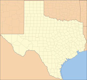
| Texas | Loving | 113 | Harris | 4,092,459 |
| Utah | Daggett | 1,059 | Salt Lake | 1,029,655 |
| Vermont | Essex | 6,306 | Chittenden | 156,545 |
| Virginia | Highland | 2,321 | Fairfax | 1,081,726 |
| Washington | Garfield | 2,266 | King | 1,931,249 |
| West Virginia | Wirt | 5,717 | Kanawha | 193,063 |
| Wisconsin | Menominee | 4,232 | Milwaukee | 947,735 |
| Wyoming | Niobrara | 2,484 | Laramie | 91,738 |
Area
Nationwide land area extremes
The following tables exclude county equivalents. The largest counties and county equivalents are organized boroughs and the census areas of Alaska with the top two being Yukon–Koyukuk Census Area (145,504.79 sq mi or 376,855.7 km2) and North Slope Borough (88,695.41 sq mi or 229,720.1 km2). The smallest counties and county equivalents are the independent cities of Virginia with the extreme being Falls Church (2.00 sq mi or 5.2 km2).[3]
| Rank | County | Land area (sq mi) |
Land area (km2) |
|---|---|---|---|
| 1 | San Bernardino County, California | 20,056.94 | 51,947.24 |
| 2 | Coconino County, Arizona | 18,618.89 | 48,222.70 |
| 3 | Nye County, Nevada | 18,181.92 | 47,090.96 |
| 4 | Elko County, Nevada | 17,169.83 | 44,469.66 |
| 5 | Mohave County, Arizona | 13,311.08 | 34,475.54 |
| 6 | Apache County, Arizona | 11,197.52 | 29,001.44 |
| 7 | Lincoln County, Nevada | 10,633.20 | 27,539.86 |
| 8 | Sweetwater County, Wyoming | 10,426.65 | 27,004.90 |
| 9 | Inyo County, California | 10,180.88 | 26,368.36 |
| 10 | Harney County, Oregon | 10,133.17 | 26,244.79 |
| Rank | County | Land area (sq mi) |
Land area (km2) |
|---|---|---|---|
| 1 | Kalawao County, Hawaii | 11.99 | 31.05 |
| 2 | New York County, New York | 22.83 | 59.13 |
| 3 | Bristol County, Rhode Island | 24.16 | 62.57 |
| 4 | Arlington County, Virginia | 25.97 | 67.26 |
| 5 | Broomfield County, Colorado | 33.03 | 85.55 |
| 6 | Bronx County, New York | 42.10 | 109.04 |
| 7 | Nantucket County, Massachusetts | 44.97 | 116.47 |
| 8 | Hudson County, New Jersey | 46.19 | 119.63 |
| 9 | San Francisco County, California | 46.87 | 121.39 |
| 10 | Suffolk County, Massachusetts | 58.15 | 150.61 |
Smallest, largest and average area per state
This list excludes Alaskan Census Areas, but includes other county equivalents. The North Slope Borough is the largest independently incorporated county equivalent. The Unorganized Borough is substantially larger, but is an extension of the State of Alaska government and not independently incorporated.A[›]
Also note that the smallest land area with county-level governance in the U.S. is Falls Church, Virginia, but it is an independent city and not a county or part of one. Kalawao County, Hawaii is the smallest true county by land area.
| State | Avg. county land area, sq. mi. (km2) | Smallest county | Area, sq. mi. (km2) | Largest county | area, sq. mi. (km2) |
|---|---|---|---|---|---|
| All States | 997.6 (2,584) | City of Falls Church, Virginia | 2.0 (5.2) | North Slope Borough, Alaska | 88,695.4 (229,720) |
| Alaska | 8,545.7 (22,133) | Skagway Municipality | 452.3 (1,171) | North Slope Borough | 88,695.4 (229,720) |
| Arizona | 7,572.9 (19,614) | Santa Cruz County | 1,236.9 (3,204) | Coconino County | 18,618.8 (48,222) |
| Nevada | 6,457.7 (16,725) | City of Carson City | 144.6 (375) | Nye County | 18,181.9 (47,091) |
| Wyoming | 4,221.4 (10,933) | Hot Springs County | 2,004.0 (5,190) | Sweetwater County | 10,426.6 (27,005) |
| New Mexico | 3,675.7 (9,520) | Los Alamos County | 109.1 (283) | Catron County | 6,923.6 (17,932) |
| Utah | 2,833.4 (7,338) | Davis County | 298.7 (774) | San Juan County | 7,819.9 (20,253) |
| California | 2,685.8 (6,956) | San Francisco County | 46.8 (121) | San Bernardino County | 20,056.9 (51,947) |
| Oregon | 2,666.3 (6,906) | Multnomah County | 431.3 (1,117) | Harney County | 10,133.1 (26,245) |
| Montana | 2,599.0 (6,731) | Silver Bow County | 718.4 (1,861) | Beaverhead County | 5,541.6 (14,353) |
| Maine | 1,927.7 (4,993) | Sagadahoc County | 253.6 (657) | Aroostook County | 6,671.3 (17,279) |
| Idaho | 1,878.3 (4,865) | Payette County | 406.8 (1,054) | Idaho County | 8,477.3 (21,956) |
| Washington | 1,704.0 (4,413) | San Juan County | 173.9 (450) | Okanogan County | 5,267.9 (13,644) |
| Colorado | 1,619.4 (4,194) | Broomfield County | 33.0 (85) | Las Animas County | 4,772.6 (12,361) |
| North Dakota | 1,301.9 (3,372) | Eddy County | 630.1 (1,632) | McKenzie County | 2,760.3 (7,149) |
| Hawaii | 1,284.5 (3,327) | Kalawao County | 11.9 (31) | Hawaii County | 4,028.4 (10,434) |
| South Dakota | 1,148.7 (2,975) | Clay County | 412.1 (1,067) | Meade County | 3,470.9 (8,990) |
| Texas | 1,028.5 (2,664) | Rockwall County | 127.0 (329) | Brewster County | 6,183.7 (16,016) |
| Minnesota | 915.2 (2,370) | Ramsey County | 152.2 (394) | St. Louis County | 6,247.4 (16,181) |
| New Hampshire | 895.3 (2,319) | Strafford County | 368.9 (955) | Coos County | 1,794.6 (4,648) |
| Oklahoma | 890.8 (2,307) | Marshall County | 371.0 (961) | Osage County | 2,246.3 (5,818) |
| Nebraska | 826.1 (2,140) | Sarpy County | 238.9 (619) | Cherry County | 5,960.4 (15,437) |
| Florida | 800.4 (2,073) | Union County | 243.5 (631) | Collier County | 1,998.3 (5,176) |
| Kansas | 778.7 (2,017) | Wyandotte County | 151.6 (393) | Butler County | 1,429.8 (3,703) |
| Alabama | 767.4 (1,988) | Etowah County | 534.9 (1,385) | Baldwin County | 1,589.7 (4,117) |
| New York | 760.1 (1,969) | New York County | 22.8 (59) | St. Lawrence County | 2,680.3 (6,942) |
| Wisconsin | 752.2 (1,948) | Pepin County | 231.9 (601) | Marathon County | 1,544.9 (4,001) |
| Arkansas | 693.8 (1,797) | Lafayette County | 528.2 (1,368) | Union County | 1,039.2 (2,692) |
| Michigan | 681.2 (1,764) | Benzie County | 319.7 (828) | Marquette County | 1,808.4 (4,684) |
| Louisiana | 675.1 (1,749) | Orleans Parish | 169.4 (439) | Vernon Parish | 1,327.9 (3,439) |
| Pennsylvania | 667.8 (1,730) | Montour County | 130.2 (337) | Lycoming County | 1,228.5 (3,182) |
| Vermont | 658.3 (1,705) | Grand Isle County | 81.8 (212) | Windsor County | 969.3 (2,510) |
| South Carolina | 653.5 (1,693) | McCormick County | 359.1 (930) | Horry County | 1,133.9 (2,937) |
| Delaware | 649.5 (1,682) | New Castle County | 426.2 (1,104) | Sussex County | 936.0 (2,424) |
| Connecticut | 605.3 (1,568) | Middlesex County | 369.3 (956) | Litchfield County | 920.5 (2,384) |
| Missouri | 597.8 (1,548) | City of St. Louis | 61.9 (160) | Texas County | 1,177.2 (3,049) |
| Mississippi | 572.2 (1,482) | Alcorn County | 400.0 (1,036) | Yazoo County | 922.9 (2,390) |
| Iowa | 564.2 (1,461) | Dickinson County | 380.6 (986) | Kossuth County | 972.7 (2,519) |
| Massachusetts | 557.1 (1,443) | Nantucket County | 44.9 (116) | Worcester County | 1,510.7 (3,913) |
| Illinois | 544.3 (1,410) | Putnam County | 160.1 (415) | McLean County | 1,183.3 (3,065) |
| North Carolina | 486.2 (1,259) | Chowan County | 172.4 (447) | Robeson County | 949.2 (2,458) |
| Ohio | 464.3 (1,203) | Lake County | 227.4 (589) | Ashtabula County | 701.9 (1,818) |
| West Virginia | 437.1 (1,132) | Hancock County | 82.6 (214) | Randolph County | 1,039.6 (2,693) |
| Tennessee | 434.1 (1,124) | Trousdale County | 114.1 (296) | Shelby County | 763.1 (1,976) |
| Maryland | 404.5 (1,048) | City of Baltimore | 80.9 (210) | Frederick County | 660.2 (1,710) |
| Indiana | 389.4 (1,009) | Ohio County | 86.1 (223) | Allen County | 657.3 (1,702) |
| Georgia | 361.7 (937) | Clarke County | 119.2 (309) | Ware County | 892.4 (2,311) |
| New Jersey | 350.2 (907) | Hudson County | 46.1 (119) | Burlington County | 798.5 (2,068) |
| Kentucky | 329.1 (852) | Robertson County | 99.9 (259) | Pike County | 786.8 (2,038) |
| Virginia | 294.7 (763) | City of Falls Church | 2.0 (5.2) | Pittsylvania County | 968.9 (2,509) |
| Rhode Island | 206.8 (536) | Bristol County | 24.1 (62) | Providence County | 409.5 (1,061) |
Population density
Most densely populated
Data presented below is based on U.S. Census department data from 2010.[4] Calculations are made by dividing the population by the land area. All county equivalents are included.
Least densely populated
This list generated by dividing the population by the land area. All county equivalents are included. The list is dominated by just a few states: Alaska, Montana, and Texas together comprise about two-thirds of the entries. The Unorganized Borough is not included here as a unit, but its census areas (non-governmental entities) are. If the census areas were removed from the list, the Unorganized Borough would rank fourteenth with a density of 0.38 per square mile (0.15/km2).
Population density per state
Data presented below is based on U.S. Census Bureau data from 2010.[4] Calculations are made by dividing the population by the land area. All county equivalents are included.
Excluding the census areas of Alaska, Lake and Peninsula Borough is the least densely populated county equivalent with 0.069/sq mi (0.027/km2).
| State | Least densely populated county | Population density | Most densely populated county | Population density |
|---|---|---|---|---|
| Alabama | Wilcox County | 13.13/sq mi (5.07/km2) | Jefferson County | 592.53/sq mi (228.78/km2) |
| Alaska | Lake and Peninsula Borough | 0.06/sq mi (0.023/km2) | Anchorage Municipality | 171.19/sq mi (66.10/km2) |
| Arizona | La Paz County | 4.55/sq mi (1.76/km2) | Maricopa County | 414.89/sq mi (160.19/km2) |
| Arkansas | Calhoun County | 8.53/sq mi (3.29/km2) | Pulaski County | 503.77/sq mi (194.51/km2) |
| California | Alpine County | 1.59/sq mi (0.61/km2) | San Francisco County | 17,179.15/sq mi (6,632.91/km2) |
| Colorado | Hinsdale County | 0.75/sq mi (0.29/km2) | Denver County | 3,922.59/sq mi (1,514.52/km2) |
| Connecticut | Litchfield County | 206.31/sq mi (79.66/km2) | Fairfield County | 1,467.18/sq mi (566.48/km2) |
| Delaware | Sussex County | 210.60/sq mi (81.31/km2) | New Castle County | 1,263.18/sq mi (487.72/km2) |
| District of Columbia | 9,857.20/sq mi (3,805.89/km2) | 9,857.20/sq mi (3,805.89/km2) | ||
| Florida | Liberty County | 10.01/sq mi (3.86/km2) | Pinellas County | 3,347.50/sq mi (1,292.48/km2) |
| Georgia | Clinch County | 8.49/sq mi (3.28/km2) | DeKalb County | 2,585.72/sq mi (998.35/km2) |
| Hawaii | Kalawao County | 7.50/sq mi (2.90/km2) | Honolulu County | 1,586.71/sq mi (612.63/km2) |
| Idaho | Clark County | 0.55/sq mi (0.21/km2) | Ada County | 372.76/sq mi (143.92/km2) |
| Illinois | Pope County | 12.12/sq mi (4.68/km2) | Cook County | 5,495.11/sq mi (2,121.67/km2) |
| Indiana | Benton County | 21.78/sq mi (8.41/km2) | Marion County | 2,279.57/sq mi (880.15/km2) |
| Iowa | Adams County | 9.51/sq mi (3.67/km2) | Polk County | 750.51/sq mi (289.77/km2) |
| Kansas | Greeley County | 1.60/sq mi (0.62/km2) | Johnson County | 1,149.57/sq mi (443.85/km2) |
| Kentucky | Hickman County | 20.23/sq mi (7.81/km2) | Jefferson County | 1,948.11/sq mi (752.17/km2) |
| Louisiana | Cameron Parish | 5.32/sq mi (2.05/km2) | Orleans Parish | 2,029.41/sq mi (783.56/km2) |
| Maine | Piscataquis County | 4.42/sq mi (1.71/km2) | Cumberland County | 337.23/sq mi (130.21/km2) |
| Maryland | Garrett County | 46.51/sq mi (17.96/km2) | City of Baltimore | 7,671.51/sq mi (2,961.99/km2) |
| Massachusetts | Franklin County | 102.05/sq mi (39.40/km2) | Suffolk County | 12,416.78/sq mi (4,794.15/km2) |
| Michigan | Keweenaw County | 3.99/sq mi (1.54/km2) | Wayne County | 2,974.42/sq mi (1,148.43/km2) |
| Minnesota | Lake of the Woods County | 3.11/sq mi (1.20/km2) | Ramsey County | 3,341.64/sq mi (1,290.21/km2) |
| Mississippi | Issaquena County | 3.40/sq mi (1.31/km2) | DeSoto County | 338.66/sq mi (130.76/km2) |
| Missouri | Worth County | 8.14/sq mi (3.14/km2) | St. Louis County | 5,157.48/sq mi (1,991.31/km2) |
| Montana | Garfield County | 0.25/sq mi (0.097/km2) | Yellowstone County | 56.19/sq mi (21.70/km2) |
| Nebraska | McPherson County | 0.63/sq mi (0.24/km2) | Douglas County | 1,574.37/sq mi (607.87/km2) |
| Nevada | Esmeralda County | 0.21/sq mi (0.081/km2) | Carson City | 382.09/sq mi (147.53/km2) |
| New Hampshire | Coos County | 18.41/sq mi (7.11/km2) | Hillsborough County | 457.37/sq mi (176.59/km2) |
| New Jersey | Salem County | 199.10/sq mi (76.87/km2) | Hudson County | 13,731.61/sq mi (5,301.80/km2) |
| New Mexico | Harding County | 0.32/sq mi (0.12/km2) | Bernalillo County | 570.76/sq mi (220.37/km2) |
| New York | Hamilton County | 2.81/sq mi (1.08/km2) | New York County | 69,468.42/sq mi (26,821.91/km2) |
| North Carolina | Hyde County | 9.48/sq mi (3.66/km2) | Mecklenburg County | 1,755.54/sq mi (677.82/km2) |
| North Dakota | Billings County | 0.68/sq mi (0.26/km2) | Cass County | 84.86/sq mi (32.76/km2) |
| Ohio | Monroe County | 32.12/sq mi (12.40/km2) | Cuyahoga County | 2,799.95/sq mi (1,081.07/km2) |
| Oklahoma | Cimarron County | 1.34/sq mi (0.52/km2) | Tulsa County | 1,058.14/sq mi (408.55/km2) |
| Oregon | Harney County | 0.73/sq mi (0.28/km2) | Multnomah County | 1,704.93/sq mi (658.28/km2) |
| Pennsylvania | Cameron County | 12.83/sq mi (4.95/km2) | Philadelphia County | 11,379.49/sq mi (4,393.65/km2) |
| Rhode Island | Washington County | 385.67/sq mi (148.91/km2) | Bristol County | 2,064.00/sq mi (796.91/km2) |
| South Carolina | Allendale County | 25.53/sq mi (9.86/km2) | Greenville County | 574.72/sq mi (221.90/km2) |
| South Dakota | Harding County | 0.47/sq mi (0.18/km2) | Minnehaha County | 209.95/sq mi (81.06/km2) |
| Tennessee | Perry County | 19.08/sq mi (7.37/km2) | Davidson County | 1,243.33/sq mi (480.05/km2) |
| Texas | Loving County | 0.12/sq mi (0.046/km2) | Dallas County | 2,718.00/sq mi (1,049.43/km2) |
| Utah | Garfield County | 0.99/sq mi (0.38/km2) | Salt Lake County | 1,387.14/sq mi (535.58/km2) |
| Vermont | Essex County | 9.50/sq mi (3.67/km2) | Chittenden County | 291.74/sq mi (112.64/km2) |
| Virginia | Highland County | 5.59/sq mi (2.16/km2) | Alexandria City | 9,314.30/sq mi (3,596.27/km2) |
| Washington | Garfield County | 3.18/sq mi (1.23/km2) | King County | 912.87/sq mi (352.46/km2) |
| West Virginia | Pocahontas County | 9.27/sq mi (3.58/km2) | Ohio County | 419.98/sq mi (162.16/km2) |
| Wisconsin | Iron County | 7.80/sq mi (3.01/km2) | Milwaukee County | 3,925.95/sq mi (1,515.82/km2) |
| Wyoming | Niobrara County | 0.94/sq mi (0.36/km2) | Laramie County | 34.15/sq mi (13.19/km2) |
See also
Notes
^ A: The Unorganized Borough, Alaska, formed by the Borough Act of 1961, is a legal entity, run by the Alaska state government as an extension of State government,[5] it and the independently incorporated Unified, Home Rule, First Class and Second Class boroughs roughly correspond to parishes in Louisiana and to counties in the other 48 states.[6]
References
- ↑ "Chapter 4: States, Counties, and Statistically Equivalent Entities". Geographic Areas Reference Manual (PDF). U.S. Department of Commerce. November 1994. p. 4-2.
- 1 2 "American FactFinder". U.S. Census Bureau.
- 1 2 3 4 "DataSet.txt". State & County QuickFacts. U.S. Census Bureau. Archived from the original on September 30, 2013. Retrieved November 16, 2012. (See "Download the Database" for an explanation of this data set.)
- 1 2 3 4 "2010 Census Summary File 1: GEOGRAPHIC IDENTIFIERS". American Factfinder. US Census. Retrieved 18 October 2013.
- ↑ "Alaska Statutes Title 29 Chapter 03. The Unorganized Borough". Local Government On-Line, Division of Community and Regional Affairs, Alaska Department of Commerce, Community and Economic Development. August 18, 1998. Retrieved 2008-07-17.
- ↑ "Local Government in Alaska" (PDF). Local Boundary Commission, Alaska Department of Commerce, Community and Economic Development. February 2001. Retrieved 2008-07-17.
General
- US Census Quick Facts
- For a state map showing the counties, select in http://quickfacts.census.gov/qfd/ the state and select "view map"; select a county to obtain data about it.*
- For a table of counties of a state, with areas, populations, densities and more (using miles), select the state in .
- Map of the US showing population density per county (pdf, see p. 6)
- 2002 Census of Governments; Volume 1, No. 1, Government Organization. U.S. Census Bureau. . Page 8 shows a chart of counties by population and by state.
External links
- Labor Statistics County Employment and Wages
| General | ||
|---|---|---|
| Demographics |
| |
| Economy | ||
| Geography | ||
| Name origins | ||
| See also | ||