Daggett County, Utah
| Daggett County, Utah | |
|---|---|
 Daggett County Courthouse in Manila, May 2008 | |
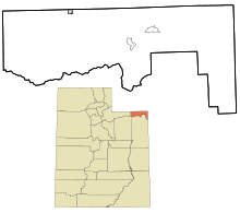
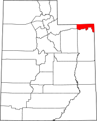 Location in the U.S. state of Utah | |
 Utah's location in the U.S. | |
| 40°53′N 109°31′W / 40.89°N 109.51°WCoordinates: 40°53′N 109°31′W / 40.89°N 109.51°W | |
| Founded | 1918 |
| Named for | Ellsworth Daggett |
| Seat | Manila |
| Largest town | Manila |
| Area | |
| • Total | 721 sq mi (1,867 km2) |
| • Land | 697 sq mi (1,805 km2) |
| • Water | 24 sq mi (62 km2), 3.3% |
| Population (est.) | |
| • (2015) | 1,109 |
| • Density | 1.5/sq mi (0.6/km2) |
| Congressional district | 1st |
| Time zone | Mountain: UTC−7/−6 |
| Website |
www |
Daggett County (/ˈdæɡət/ DAG-ət) is a county located in the northeastern corner of the U.S. state of Utah. As of the 2010 census, the population was 1,059,[1] making it the least populous county in Utah. Its county seat is Manila.[2] The county was named for Ellsworth Daggett, the first surveyor-general of Utah. The small community of Dutch John, located near the state line with Colorado and Wyoming, became an incorporated town in January 2016.
History
Due to dangerous roads, mountainous terrain, and frequent bad weather preventing travel via a direct route, 19th century residents in far northern Uintah County had to travel 400 to 800 miles (640 to 1,290 km) on both stagecoach and rail to conduct business in Vernal, the county seat, a mere 50 miles (80 km) away. (The long and arduous journey involved overland travel to a train station in Wyoming, where the person would take a train to either Mack, Colorado, Price, or Salt Lake City, and then take an uncomfortable and extended stagecoach trip to Vernal.) In 1917, all Uintah County residents voted to create Daggett County.[3] It received its name from Ellsworth Daggett, the state's first surveyor.
Geography
According to the U.S. Census Bureau, the county has a total area of 721 square miles (1,870 km2), of which 697 square miles (1,810 km2) is land and 24 square miles (62 km2) (3.3%) is water.[4] It is the fourth-smallest county in Utah by area. Over 90% of the land of Daggett County is under federal ownership.
Adjacent counties
- Summit County (west)
- Duchesne County (southwest)
- Uintah County (south)
- Moffat County, Colorado (east)
- Sweetwater County, Wyoming (north)
National protected areas
- Ashley National Forest (part)
- Flaming Gorge National Recreation Area (part)
Demographics
| Historical population | |||
|---|---|---|---|
| Census | Pop. | %± | |
| 1920 | 400 | — | |
| 1930 | 411 | 2.8% | |
| 1940 | 564 | 37.2% | |
| 1950 | 364 | −35.5% | |
| 1960 | 1,164 | 219.8% | |
| 1970 | 666 | −42.8% | |
| 1980 | 769 | 15.5% | |
| 1990 | 690 | −10.3% | |
| 2000 | 921 | 33.5% | |
| 2010 | 1,059 | 15.0% | |
| Est. 2016 | 1,095 | [5] | 3.4% |
| U.S. Decennial Census[6] 1790–1960[7] 1900–1990[8] 1990–2000[9] 2010–2014[1] | |||
As of the census[10] of 2010, there were 1,059 people, 426 households, and 287 families residing in the county. The population density was 1.52 people per square mile (0.59/km²). There were 1,141 housing units at an average density of 1.63 per square mile (0.63/km²). The racial makeup of the county was 95.94% White, 0.38% Black or African American, 0.76% Native American, 0.38% Asian, 0.09% Pacific Islander, 1.42% from other races, and 1.04% from two or more races. 3.12% of the population were Hispanic or Latino of any race.
There were 426 households out of which 25.12% had children under the age of 18 living with them, 67.37% were married couples living together, 4.93% had a female householder with no husband present, and 32.63% were non-families. 29.11% of all households were made up of individuals and 13.62% had someone living alone who was 65 years of age or older. The average household size was 2.34 and the average family size was 2.91.
In the county, the population was spread out with 23.61% under the age of 20, 3.78% from 20 to 24, 24.93% from 25 to 44, 28.71% from 45 to 64, and 18.98% who were 65 years of age or older. The median age was 42.8 years. For every 100 females there were 129.22 males. For every 100 females age 18 and over, there were 135.17 males.
2016
As of 2016, the largest self reported ancestry groups in Daggett County, Utah were:
- 35.4% were of English ancestry
- 9.2% were of Scots-Irish ancestry
- 8.8% were of German ancestry
- 8.3% were of Irish ancestry
- 7.9% were of American ancestry
- 7.2% were of Dutch ancestry
- 5.5% were of Danish ancestry.
- 3.3% were of Swedish ancestry
- 2.5% were of Scottish ancestry
- 2.1% were of Italian ancestry
- 1.6% were of Swiss ancestry
- 1.6% were of French ancestry
- 1.5% were of Norwegian ancestry
- 0.7% were of Polish ancestry[11]
Government
Daggett County is governed by three commissioners, an auditor/recorder, a clerk/treasurer, an assessor, and a sheriff, all elected for four-year terms in partisan elections. Judges stand for non-partisan retention election every four years. Current officeholders and the year his/her current term began:
- Commissioner A: Clyde Slaugh (R) 2016 (chairman)
- Commissioner B: Karen Perry(R) 2013
- Commissioner C: Jack Lytle (R) 2016
- Auditor/Recorder: Keri Pallesen(R) 2011
- Clerk/Treasurer: Shelia Williams(R) 2016
- Assessor: Lesa Asay(R) 2011
- Sheriff: Eric L. Bailey(R) appointed May 2017
- Justice Court Judge (Manila): Judge Charlene Hartmann (appointed 2007)
- Justice Court Judge (Dutch John): Judge Anne Steen (appointed 2007) This position was eliminated by the county commission in early 2014.
| Year | Republican | Democratic | Third parties |
|---|---|---|---|
| 2016 | 69.4% 331 | 16.1% 77 | 14.5% 69 |
| 2012 | 78.1% 406 | 18.1% 94 | 3.9% 20 |
| 2008 | 66.9% 297 | 29.5% 131 | 3.6% 16 |
| 2004 | 76.2% 380 | 21.6% 108 | 2.2% 11 |
| 2000 | 72.9% 317 | 23.9% 104 | 3.2% 14 |
| 1996 | 55.6% 237 | 30.8% 131 | 13.6% 58 |
| 1992 | 38.9% 172 | 27.6% 122 | 33.5% 148 |
| 1988 | 66.0% 272 | 32.0% 132 | 1.9% 8 |
| 1984 | 56.4% 296 | 43.2% 227 | 0.4% 2 |
| 1980 | 69.9% 290 | 26.3% 109 | 3.9% 16 |
| 1976 | 59.5% 217 | 35.9% 131 | 4.7% 17 |
| 1972 | 72.9% 204 | 17.9% 50 | 9.3% 26 |
| 1968 | 52.2% 152 | 33.3% 97 | 14.4% 42 |
| 1964 | 39.7% 112 | 60.3% 170 | 0.0% 0 |
| 1960 | 45.0% 196 | 54.8% 239 | 0.2% 1 |
| 1956 | 53.1% 102 | 46.9% 90 | |
| 1952 | 51.1% 90 | 48.9% 86 | |
| 1948 | 41.8% 69 | 57.6% 95 | 0.6% 1 |
| 1944 | 43.4% 75 | 56.7% 98 | |
| 1940 | 37.5% 96 | 62.5% 160 | |
| 1936 | 37.5% 78 | 61.5% 128 | 1.0% 2 |
| 1932 | 52.9% 90 | 46.5% 79 | 0.6% 1 |
| 1928 | 77.5% 107 | 22.5% 31 | |
| 1924 | 74.1% 97 | 19.9% 26 | 6.1% 8 |
| 1920 | 73.4% 94 | 25.0% 32 | 1.6% 2 |
Commerce and transportation
The few commercial establishments in Daggett County exist to service visitors to the Flaming Gorge National Recreation Area. Throughout the county there is one small general store, several gas stations, five cafes or restaurants, five inns/motels, and a few miscellaneous businesses that offer raft rentals. There are also businesses that offer guided fishing trips on the Flaming Gorge Reservoir and the Green River. The economy is primarily related to recreation, management of government land, and ranching. There are no railroads within Daggett County. Main highways include U.S. Route 191, State Route 43, and State Route 44.
Communities
Towns
- Manila (county seat)
- Dutch John (incorporated 2016)
Census-designated place
Other
See also
References
- 1 2 "State & County QuickFacts". United States Census Bureau. Archived from the original on July 9, 2011. Retrieved December 29, 2013.
- ↑ "Find a County". National Association of Counties. Archived from the original on 2011-05-31. Retrieved 2011-06-07.
- ↑ Industrial Commission of Utah (1920). Report of the Industrial Commission of Utah. Kaysville, Utah: Inland Publishing Company. p. 346. Retrieved May 1, 2010.
- ↑ "2010 Census Gazetteer Files". United States Census Bureau. August 22, 2012. Retrieved March 27, 2015.
- ↑ "Population and Housing Unit Estimates". Retrieved June 9, 2017.
- ↑ "U.S. Decennial Census". United States Census Bureau. Archived from the original on May 12, 2015. Retrieved March 27, 2015.
- ↑ "Historical Census Browser". University of Virginia Library. Retrieved March 27, 2015.
- ↑ Forstall, Richard L., ed. (March 27, 1995). "Population of Counties by Decennial Census: 1900 to 1990". United States Census Bureau. Retrieved March 27, 2015.
- ↑ "Census 2000 PHC-T-4. Ranking Tables for Counties: 1990 and 2000" (PDF). United States Census Bureau. April 2, 2001. Retrieved March 27, 2015.
- ↑ "American FactFinder". United States Census Bureau. Archived from the original on 2013-09-11. Retrieved 2011-05-14.
- ↑ Bureau, U.S. Census. "American FactFinder - Results". factfinder.census.gov. Retrieved 2018-03-30.
- ↑ Leip, David. "Dave Leip's Atlas of U.S. Presidential Elections". uselectionatlas.org. Retrieved 2018-03-30.
External links
| Wikimedia Commons has media related to Daggett County, Utah. |
Places adjacent to Daggett County, Utah | |
|---|---|
Municipalities and communities of Daggett County, Utah, United States | ||
|---|---|---|
| Town | | |
| CDPs | ||
| Ghost towns | ||
| Footnotes | ‡This populated place also has portions in an adjacent state | |