Kent County, Delaware
| Kent County, Delaware | |||
|---|---|---|---|
| County of Delaware | |||
| County of Kent | |||
 The Kent County Courthouse in Dover in 2006 | |||
| |||
 Location in the U.S. state of Delaware | |||
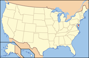 Delaware's location in the U.S. | |||
| Founded | August 8, 1683 | ||
| Named for | Kent | ||
| Seat | Dover | ||
| Largest city | Dover | ||
| Area | |||
| • Total | 798 sq mi (2,067 km2) | ||
| • Land | 586 sq mi (1,518 km2) | ||
| • Water | 212 sq mi (549 km2), 26.6% | ||
| Population (est.) | |||
| • (2016) | 174,827 | ||
| • Density | 277/sq mi (107/km2) | ||
| Congressional district | At-large | ||
| Time zone | Eastern: UTC−5/−4 | ||
| Website |
www | ||


Kent County is a county located in the central part of the U.S. state of Delaware. As of the 2010 census, the population was 162,310, making it the least populous county in Delaware. [1] The county seat is Dover,[2] the state capital of Delaware. It is named for Kent, an English county. It is the least populous county in the state.[3]
Kent County comprises the Dover, DE Metropolitan Statistical Area, which is included in the Philadelphia-Reading-Camden, PA-NJ-DE-MD Combined Statistical Area.[4]
History
In about 1670 the English began to settle in the valley of the St. Jones River, earlier known as Wolf Creek. On June 21, 1680, the Duke of York chartered St. Jones County, which was carved out of New Amstel/New Castle and Hoarkill/Sussex counties. St. Jones County was transferred to William Penn on August 24, 1682, and became part of Penn's newly chartered Delaware Colony.[5]
Penn ordered a court town to be laid out, and the courthouse was built in 1697. The town of Dover, named after the town of Dover in England's Kent, was finally laid out in 1717, in what was then known as the Lower Counties. It was designated as the capital of Delaware in 1777. In 1787 Delaware was first state to ratify the U.S. Constitution, and became "the First State." Through much of the late 18th century, the economy of Kent County was based on small grain farms. As a result, farmers did not need as many slaves as did owners of tobacco plantations. Delaware had a high proportion of free blacks among its African-American population by the early 19th century.

In the 1960s, Dover was a center of manufacturing of spacesuits worn by NASA astronauts in the Apollo moon flights by ILC Dover, now based in the small town of Frederica. The suits, dubbed the "A7L," was first flown on the Apollo 7 mission in October 1967, and was the suit worn by Neil Armstrong and Buzz Aldrin on the Apollo 11 mission. The company still manufactures spacesuits to this day—the present-day Space Shuttle "soft" suit components (the arms and legs of the suit).
Geography
According to the U.S. Census Bureau, the county has a total area of 798 square miles (2,070 km2), of which 586 square miles (1,520 km2) is land and 212 square miles (550 km2) (26.6%) is water.[6]
Kent County, like all of Delaware's counties, is subdivided into Hundreds. There are several explanations given for how the Hundreds were arrived at, either being an area containing 100 families, an area containing 100 people, or an area that could raise 100 militiamen.[7][8] Kent County was originally apportioned into six Hundreds: Duck Creek, Little Creek, Dover, Murderkill, Milford and Mispillion. In 1867, the Delaware legislature split Murderkill Hundred into North Murderkill Hundred and South Murderkill Hundred. In 1869, the legislature formed Kenton Hundred from parts of Little Creek and Duck Creek Hundred. Today the county contains eight Hundreds.
Adjacent counties

- New Castle County - north
- Salem County, New Jersey - northeast
- Cumberland County, New Jersey - east
- Cape May County, New Jersey - east
- Sussex County - south
- Caroline County, Maryland - southwest
- Queen Anne's County, Maryland - west
- Kent County, Maryland - northwest
National protected area
Transportation
Major highways
The following state highways are located in Kent County:[9]
Railroads
The Delmarva Central Railroad operates two freight lines through Kent County. The Delmarva Subdivision runs north-south along the US 13 corridor through Harrington, Felton, Wyoming, Dover, and Clayton and the Indian River Subdivision branches from the Delmarva Subdivision at Harrington and runs east to Houston and Milford along the DE 14 corridor. There is no passenger rail service in the county.[10]
Public transportation
DART First State operates bus service within Kent County. There are several local bus routes that serve the Dover area. In addition, DART First State operates inter-county service to Wilmington, Newark, Georgetown, and Lewes, along with seasonal service to Lewes and Rehoboth Beach.[11]
Airports
Kent County contains the following public-use and military airports:
Politics
| Year | Republican | Democratic | Others |
|---|---|---|---|
| 2016 | 49.5% 36,991 | 44.6% 33,351 | 5.9% 4,387 |
| 2012 | 46.8% 32,135 | 51.7% 35,527 | 1.5% 1,018 |
| 2008 | 44.6% 29,827 | 54.4% 36,392 | 1.1% 706 |
| 2004 | 56.4% 31,578 | 42.6% 23,875 | 1.0% 538 |
| 2000 | 49.9% 24,081 | 47.2% 22,790 | 2.9% 1,383 |
| 1996 | 40.6% 15,932 | 46.7% 18,327 | 12.7% 4,993 |
| 1992 | 38.7% 15,562 | 38.2% 15,364 | 23.1% 9,312 |
| 1988 | 60.2% 19,923 | 39.3% 12,996 | 0.6% 194 |
| 1984 | 64.5% 21,531 | 35.3% 11,789 | 0.3% 83 |
| 1980 | 49.8% 14,882 | 43.2% 12,884 | 7.0% 2,096 |
| 1976 | 42.8% 12,604 | 56.2% 16,523 | 1.0% 301 |
| 1972 | 62.0% 17,712 | 36.6% 10,463 | 1.3% 381 |
| 1968 | 44.5% 11,082 | 36.4% 9,055 | 19.1% 4,751 |
| 1964 | 40.8% 9,006 | 58.9% 12,981 | 0.3% 67 |
| 1960 | 49.5% 10,697 | 49.8% 10,754 | 0.8% 165 |
| 1956 | 52.2% 10,303 | 47.2% 9,319 | 0.6% 123 |
| 1952 | 50.5% 10,144 | 49.1% 9,874 | 0.5% 90 |
| 1948 | 50.6% 8,501 | 48.7% 8,174 | 0.7% 115 |
| 1944 | 47.1% 7,069 | 52.6% 7,900 | 0.4% 57 |
| 1940 | 46.7% 8,079 | 53.3% 9,226 | 0.0% 0 |
| 1936 | 43.5% 7,389 | 56.4% 9,588 | 0.2% 28 |
| 1932 | 42.6% 6,597 | 57.0% 8,829 | 0.4% 64 |
| 1928 | 59.2% 8,335 | 40.7% 5,727 | 0.2% 27 |
| 1924 | 49.2% 6,894 | 49.5% 6,936 | 1.4% 192 |
| 1920 | 46.9% 6,511 | 51.9% 7,211 | 1.2% 167 |
| 1916 | 47.1% 3,813 | 52.1% 4,210 | 0.8% 66 |
| 1912 | 40.2% 3,192 | 51.3% 4,071 | 8.5% 673 |
Demographics
| Historical population | |||
|---|---|---|---|
| Census | Pop. | %± | |
| 1790 | 18,920 | — | |
| 1800 | 19,554 | 3.4% | |
| 1810 | 20,495 | 4.8% | |
| 1820 | 20,793 | 1.5% | |
| 1830 | 19,913 | −4.2% | |
| 1840 | 19,872 | −0.2% | |
| 1850 | 22,816 | 14.8% | |
| 1860 | 27,804 | 21.9% | |
| 1870 | 29,804 | 7.2% | |
| 1880 | 32,874 | 10.3% | |
| 1890 | 32,664 | −0.6% | |
| 1900 | 32,762 | 0.3% | |
| 1910 | 32,721 | −0.1% | |
| 1920 | 31,023 | −5.2% | |
| 1930 | 31,841 | 2.6% | |
| 1940 | 34,441 | 8.2% | |
| 1950 | 37,870 | 10.0% | |
| 1960 | 65,651 | 73.4% | |
| 1970 | 81,892 | 24.7% | |
| 1980 | 98,219 | 19.9% | |
| 1990 | 110,993 | 13.0% | |
| 2000 | 126,697 | 14.1% | |
| 2010 | 162,310 | 28.1% | |
| Est. 2016 | 174,827 | [13] | 7.7% |
| U.S. Decennial Census[14] 1790-1960[15] 1900-1990[16] 1990-2000[17] 2010-2016[1] | |||
2000 census
As of the census of 2000, there were 126,697 people, 47,224 households, and 33,623 families residing in the county. The population density was 215 people per square mile (83/km²). There were 50,481 housing units at an average density of 86 per square mile (33/km²). The racial makeup of the county was 73.49% White, 20.66% Black or African American, 0.64% Native American, 1.69% Asian, 0.04% Pacific Islander, 1.27% from other races, and 2.22% from two or more races. 3.21% of the population were Hispanic or Latino of any race. 13.3% were of German, 11.3% United States or American, 10.9% Irish, 10.0% English and 5.4% Italian ancestry according to Census 2000. 92.5% spoke English and 3.3% Spanish as their first language.
There were 47,224 households out of which 35.50% had children under the age of 18 living with them, 52.90% were married couples living together, 13.80% had a female householder with no husband present, and 28.80% were non-families. 23.00% of all households were made up of individuals and 8.40% had someone living alone who was 65 years of age or older. The average household size was 2.61 and the average family size was 3.06.
In the county, the population was spread out with 27.30% under the age of 18, 10.10% from 18 to 24, 29.80% from 25 to 44, 21.20% from 45 to 64, and 11.70% who were 65 years of age or older. The median age was 34 years. For every 100 females there were 93.10 males. For every 100 females age 18 and over, there were 89.60 males.
The median income for a household in the county was $40,950, and the median income for a family was $46,504. Males had a median income of $32,660 versus $24,706 for females. The per capita income for the county was $18,662. About 8.10% of families and 10.70% of the population were below the poverty line, including 14.80% of those under age 18 and 8.80% of those age 65 or over.
2010 census
As of the 2010 United States Census, there were 162,310 people, 60,278 households, and 42,290 families residing in the county.[18] The population density was 276.9 inhabitants per square mile (106.9/km2). There were 65,338 housing units at an average density of 111.5 per square mile (43.1/km2).[19] The racial makeup of the county was 67.8% white, 24.0% black or African American, 2.0% Asian, 0.6% American Indian, 0.1% Pacific islander, 2.0% from other races, and 3.5% from two or more races. Those of Hispanic or Latino origin made up 5.8% of the population.[18] In terms of ancestry, 17.5% were German, 15.4% were Irish, 11.5% were English, 7.2% were Italian, and 5.9% were American.[20]
Of the 60,278 households, 35.6% had children under the age of 18 living with them, 50.1% were married couples living together, 14.9% had a female householder with no husband present, 29.8% were non-families, and 23.6% of all households were made up of individuals. The average household size was 2.62 and the average family size was 3.09. The median age was 36.6 years.[18]
The median income for a household in the county was $53,183 and the median income for a family was $60,949. Males had a median income of $43,418 versus $35,603 for females. The per capita income for the county was $24,194. About 9.3% of families and 12.5% of the population were below the poverty line, including 21.0% of those under age 18 and 7.7% of those age 65 or over.[21]
Amish community
Kent County is home to an Amish community that resides to the west of Dover, consisting of 9 church districts and between 1,200 and 1,500 people. The Amish first settled in Kent County in 1915. The area is home to several Amish businesses selling items such as Amish food, furniture, quilts, and handmade crafts. Every September, the Amish County Bike Tour, one of the largest cycling events in Delaware, takes place in the area. In recent years, increasing development has led to the decline in the number of Amish living in the community.[22][23]
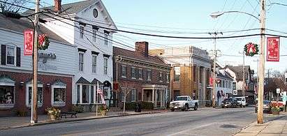
Communities
Cities
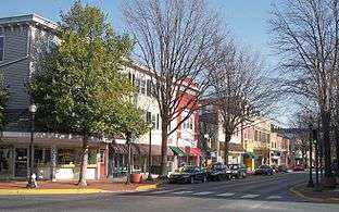
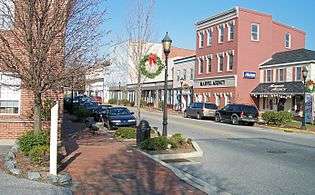
- Dover
- Harrington
- Milford (partly in Sussex County)
Towns
Census-designated places
Other localities
See also
References
- 1 2 "State & County QuickFacts". United States Census Bureau. Retrieved June 12, 2014.
- ↑ "Find a County". National Association of Counties. Archived from the original on 2011-05-31. Retrieved 2011-06-07.
- ↑ Gannett, Henry (1905). The Origin of Certain Place Names in the United States. Govt. Print. Off. p. 173.
- ↑ "Archived copy" (PDF). Archived from the original (PDF) on 2013-03-19. Retrieved 2014-04-27.
- ↑ NEW YORK: Atlas of Historical County Boundaries by John H. Long and Kathryn Ford Thorne
- ↑ "US Gazetteer files: 2010, 2000, and 1990". United States Census Bureau. 2011-02-12. Retrieved 2011-04-23.
- ↑ Delaware History Online - Geography - Hundreds Archived 2012-07-16 at the Wayback Machine.. Hsd.org. Retrieved on 2013-08-17.
- ↑ Delaware Hundreds Archived 2012-07-16 at the Wayback Machine.. Delgensoc.org (2010-07-16). Retrieved on 2013-08-17.
- ↑ Delaware Department of Transportation (2008). Delaware Official Transportation Map (PDF) (Map). Dover: Delaware Department of Transportation.
- ↑ "Delmarva Central Railroad". Carload Express. Retrieved March 27, 2017.
- ↑ "Routes and Schedules". DART First State. Retrieved August 16, 2013.
- ↑ "Dave Leip's Atlas of United States Presidential Elections". Retrieved 2011-06-11.
- ↑ "Population and Housing Unit Estimates". Retrieved June 9, 2017.
- ↑ "U.S. Decennial Census". United States Census Bureau. Archived from the original on May 12, 2015. Retrieved June 12, 2014.
- ↑ "Historical Census Browser". University of Virginia Library. Retrieved June 12, 2014.
- ↑ "Population of Counties by Decennial Census: 1900 to 1990". United States Census Bureau. Retrieved June 12, 2014.
- ↑ "Census 2000 PHC-T-4. Ranking Tables for Counties: 1990 and 2000" (PDF). United States Census Bureau. Retrieved June 12, 2014.
- 1 2 3 "DP-1 Profile of General Population and Housing Characteristics: 2010 Demographic Profile Data". United States Census Bureau. Retrieved 2016-01-12.
- ↑ "Population, Housing Units, Area, and Density: 2010 - County". United States Census Bureau. Retrieved 2016-01-12.
- ↑ "DP02 SELECTED SOCIAL CHARACTERISTICS IN THE UNITED STATES – 2006-2010 American Community Survey 5-Year Estimates". United States Census Bureau. Retrieved 2016-01-12.
- ↑ "DP03 SELECTED ECONOMIC CHARACTERISTICS – 2006-2010 American Community Survey 5-Year Estimates". United States Census Bureau. Retrieved 2016-01-12.
- ↑ "Amish Countryside". Kent County & Greater Dover, Delaware Convention and Visitors Bureau. Archived from the original on November 23, 2016. Retrieved November 22, 2016.
- ↑ "Delaware Amish". Amish America. Retrieved October 6, 2017.
External links
Places adjacent to Kent County, Delaware | |
|---|---|
Municipalities and communities of Kent County, Delaware, United States | ||
|---|---|---|
| Cities | ||
| Towns | ||
| CDPs | ||
| Unincorporated communities |
| |
| Hundreds | ||
| Footnotes | ‡This populated place also has portions in an adjacent county or counties | |
Dover (capital) | ||
| Topics |
|  |
| Society |
| |
| Cities | ||
| Towns |
| |
| Counties | ||
| Counties | 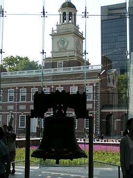 | |
|---|---|---|
| Major cities | ||
| Cities and towns 50k-99k | ||
| Cities and towns 30k-50k | ||