Clay County, South Dakota
| Clay County, South Dakota | |
|---|---|
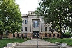 Clay County Courthouse | |
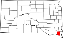 Location in the U.S. state of South Dakota | |
 South Dakota's location in the U.S. | |
| Founded | 1862 |
| Named for | Henry Clay |
| Seat | Vermillion |
| Largest city | Vermillion |
| Area | |
| • Total | 417 sq mi (1,080 km2) |
| • Land | 412 sq mi (1,067 km2) |
| • Water | 5.1 sq mi (13 km2), 1.2% |
| Population (est.) | |
| • (2016) | 14,086 |
| • Density | 34/sq mi (13/km2) |
| Congressional district | At-large |
| Time zone | Central: UTC−6/−5 |
| Website |
www |
Clay County is a county located in the U.S. state of South Dakota. As of the 2010 census, the population was 13,864.[1] The county seat is Vermillion,[2] which is also home to the University of South Dakota. The county is named in honor of Henry Clay, American statesman, member of the United States Senate from Kentucky and United States Secretary of State in the 19th century.[3]
Clay County comprises the Vermillion, SD Micropolitan Statistical Area, which is also included in the Sioux City-Vermillion, IA-SD-NE Combined Statistical Area.
History
Clay County began forming in 1859 when the land was opened for legal occupation. In the fall of that year, Ahira A. Partridge (who would later become the first elected sheriff of the county) crossed the Missouri river into the Dakota territory, and became the first white man to settle what would become Clay county; squatting on 160 acres of land that encompass most of the present-day city of Vermillion.[4] In 1862 the county was formally organized. The Clay County Courthouse was built in 1912.
Clay County is the name of 17 other counties in the United States, most of them named in honor of Henry Clay.
Geography
According to the U.S. Census Bureau, the county has a total area of 417 square miles (1,080 km2), of which 412 square miles (1,070 km2) is land and 5.1 square miles (13 km2) (1.2%) is water.[5] It is the smallest county by area in South Dakota.
National protected area
State protected area
Adjacent counties
- Turner County - north
- Lincoln County - northeast
- Union County - east
- Dixon County, Nebraska - southeast
- Cedar County, Nebraska - southwest
- Yankton County - west
Major highways
Demographics
| Historical population | |||
|---|---|---|---|
| Census | Pop. | %± | |
| 1870 | 2,621 | — | |
| 1880 | 5,001 | 90.8% | |
| 1890 | 7,509 | 50.1% | |
| 1900 | 9,316 | 24.1% | |
| 1910 | 8,711 | −6.5% | |
| 1920 | 9,654 | 10.8% | |
| 1930 | 10,088 | 4.5% | |
| 1940 | 9,592 | −4.9% | |
| 1950 | 10,993 | 14.6% | |
| 1960 | 10,810 | −1.7% | |
| 1970 | 12,923 | 19.5% | |
| 1980 | 13,689 | 5.9% | |
| 1990 | 13,186 | −3.7% | |
| 2000 | 13,537 | 2.7% | |
| 2010 | 13,864 | 2.4% | |
| Est. 2017 | 13,990 | [6] | 0.9% |
| U.S. Decennial Census[7] 1790-1960[8] 1900-1990[9] 1990-2000[10] 2010-2016[1] | |||
2000 census
As of the census[11] of 2000, there were 13,537 people, 4,878 households, and 2,721 families residing in the county. The population density was 33 people per square mile (13/km²). There were 5,438 housing units at an average density of 13 per square mile (5/km²).
There were 4,878 households out of which 28.00% had children under the age of 18 living with them, 45.00% were married couples living together, 8.10% had a female householder with no husband present, and 44.20% were non-families. 31.00% of all households were made up of individuals and 8.00% had someone living alone who was 65 years of age or older. The average household size was 2.32 and the average family size was 2.93.
In the county, the population was spread out with 18.80% under the age of 18, 31.50% from 18 to 24, 23.80% from 25 to 44, 15.80% from 45 to 64, and 10.10% who were 65 years of age or older. The median age was 25 years. For every 100 females, there were 94.30 males. For every 100 females age 18 and over, there were 92.50 males.
2010 census
As of the 2010 United States Census, there were 13,864 people, 5,110 households, and 2,628 families residing in the county.[12] The population density was 33.6 inhabitants per square mile (13.0/km2). There were 5,639 housing units at an average density of 13.7 per square mile (5.3/km2).[13] The racial makeup of the county was 91.1% white, 3.1% American Indian, 1.7% Asian, 1.3% black or African American, 0.5% from other races, and 2.3% from two or more races. Those of Hispanic or Latino origin made up 2.0% of the population.[12] In terms of ancestry, 43.9% were German, 16.4% were Norwegian, 15.8% were Irish, 8.7% were English, 5.4% were Swedish, and 1.8% were American.[14]
Of the 5,110 households, 24.7% had children under the age of 18 living with them, 40.9% were married couples living together, 7.3% had a female householder with no husband present, 48.6% were non-families, and 32.4% of all households were made up of individuals. The average household size was 2.28 and the average family size was 2.91. The median age was 25.0 years.[12]
The median income for a household in the county was $37,198 and the median income for a family was $61,159. Males had a median income of $37,059 versus $28,016 for females. The per capita income for the county was $19,518. About 8.0% of families and 24.0% of the population were below the poverty line, including 13.6% of those under age 18 and 6.7% of those age 65 or over.[15]
Racial/ethnic makeup
The racial makeup of the county was 92.78% White, 1.00% Black or African American, 2.66% Native American, 1.95% Asian, 0.01% Pacific Islander, 0.29% from other races, and 1.31% from two or more races. 0.89% of the population were Hispanic or Latino of any race. 32.0% were of German, 15.6% Norwegian, 9.9% Irish and 5.4% English ancestry.
Religion
From 2000 Census data over 50% consider themselves "unclaimed".[16]
- Mainline Protestant with 3,840 is most common around 28%; mainly Lutheran.
- Catholic with 1820 comes second around 13%
- Evangelical Protestant with 613 would be around 5%; mainly Lutheran Church–Missouri Synod and Southern Baptist.
Education
- University of South Dakota - In 1862 the territorial legislature located the State University in Vermillion, but nothing was done until 1882 when Clay County voted $10,000 in bonds to construct a building on their campus.
Communities
Cities
- Irene (partial)
- Vermillion (county seat)
Town
Unincorporated communities
- Burbank
- Dalesburg
- Greenfield
- Meckling
- Westreville
Townships
The county is divided into twelve townships:
- Bethel
- Fairview
- Garfield
- Glenwood
- Meckling
- Norway
- Pleasant Valley
- Prairie Center
- Riverside
- Spirit Mound
- Star
- Vermillion
Politics
In 2016, Hillary Clinton won the votes in Clay County.
| Year | Republican | Democratic | Third parties |
|---|---|---|---|
| 2016 | 41.6% 2,109 | 51.5% 2,608 | 6.9% 352 |
| 2012 | 41.0% 2,147 | 56.5% 2,955 | 2.5% 132 |
| 2008 | 36.8% 2,296 | 61.0% 3,808 | 2.2% 138 |
| 2004 | 43.9% 2,692 | 54.0% 3,315 | 2.1% 129 |
| 2000 | 46.3% 2,363 | 51.7% 2,638 | 2.0% 104 |
| 1996 | 36.0% 2,008 | 53.5% 2,980 | 10.5% 584 |
| 1992 | 31.0% 1,869 | 46.8% 2,826 | 22.2% 1,341 |
| 1988 | 44.4% 2,307 | 55.0% 2,859 | 0.7% 34 |
| 1984 | 52.6% 3,057 | 46.7% 2,711 | 0.7% 40 |
| 1980 | 47.6% 3,004 | 36.0% 2,271 | 16.5% 1,041 |
| 1976 | 49.9% 2,647 | 48.9% 2,593 | 1.2% 61 |
| 1972 | 47.1% 2,518 | 52.7% 2,821 | 0.2% 13 |
| 1968 | 51.3% 2,249 | 45.7% 2,006 | 3.0% 131 |
| 1964 | 41.0% 1,802 | 59.1% 2,599 | |
| 1960 | 59.6% 2,772 | 40.4% 1,878 | |
| 1956 | 57.7% 2,632 | 42.3% 1,928 | |
| 1952 | 70.1% 3,302 | 30.0% 1,412 | |
| 1948 | 51.1% 2,228 | 47.7% 2,080 | 1.2% 53 |
| 1944 | 52.3% 1,970 | 47.7% 1,796 | |
| 1940 | 52.1% 2,463 | 47.9% 2,266 | |
| 1936 | 33.6% 1,692 | 61.0% 3,070 | 5.4% 273 |
| 1932 | 32.7% 1,514 | 65.7% 3,040 | 1.5% 70 |
| 1928 | 63.4% 2,573 | 36.3% 1,474 | 0.3% 10 |
| 1924 | 42.3% 1,415 | 14.7% 492 | 43.0% 1,438 |
| 1920 | 61.9% 1,885 | 29.8% 907 | 8.3% 254 |
| 1916 | 44.5% 1,000 | 53.7% 1,207 | 1.7% 39 |
| 1912 | 0.0% 0 | 41.0% 929 | 59.0% 1,337 |
| 1908 | 59.9% 1,291 | 37.3% 803 | 2.8% 60 |
| 1904 | 77.4% 1,723 | 16.2% 361 | 6.4% 142 |
| 1900 | 56.4% 1,387 | 42.2% 1,037 | 1.4% 35 |
| 1896 | 53.4% 1,238 | 45.7% 1,061 | 0.9% 21 |
| 1892 | 53.7% 918 | 9.6% 164 | 36.8% 629 |
See also
| Wikimedia Commons has media related to Clay County, South Dakota. |
References
- 1 2 "State & County QuickFacts". United States Census Bureau. Retrieved November 26, 2013.
- ↑ "Find a County". National Association of Counties. Archived from the original on 2011-05-31. Retrieved 2011-06-07.
- ↑ Gannett, Henry (1905). The Origin of Certain Place Names in the United States. Govt. Print. Off. p. 83.
- ↑ Kingsbury, George (1915). Smith, George, ed. History of Dakota Territory, Vol 4. Chicago: S.J. Clarke. pp. 654–657.
- ↑ "2010 Census Gazetteer Files". United States Census Bureau. August 22, 2012. Retrieved March 23, 2015.
- ↑ "Population and Housing Unit Estimates". Retrieved April 16, 2018.
- ↑ "U.S. Decennial Census". United States Census Bureau. Archived from the original on May 12, 2015. Retrieved March 23, 2015.
- ↑ "Historical Census Browser". University of Virginia Library. Retrieved March 23, 2015.
- ↑ Forstall, Richard L., ed. (March 27, 1995). "Population of Counties by Decennial Census: 1900 to 1990". United States Census Bureau. Retrieved March 23, 2015.
- ↑ "Census 2000 PHC-T-4. Ranking Tables for Counties: 1990 and 2000" (PDF). United States Census Bureau. April 2, 2001. Retrieved March 23, 2015.
- ↑ "American FactFinder". United States Census Bureau. Archived from the original on 2013-09-11. Retrieved 2011-05-14.
- 1 2 3 "DP-1 Profile of General Population and Housing Characteristics: 2010 Demographic Profile Data". United States Census Bureau. Retrieved 2016-03-11.
- ↑ "Population, Housing Units, Area, and Density: 2010 - County". United States Census Bureau. Retrieved 2016-03-11.
- ↑ "DP02 SELECTED SOCIAL CHARACTERISTICS IN THE UNITED STATES – 2006-2010 American Community Survey 5-Year Estimates". United States Census Bureau. Retrieved 2016-03-11.
- ↑ "DP03 SELECTED ECONOMIC CHARACTERISTICS – 2006-2010 American Community Survey 5-Year Estimates". United States Census Bureau. Retrieved 2016-03-11.
- ↑ "Clay County, SD Denominational groups". Association of Religion Date Archives (arda). 2000. Retrieved 2009-01-25.
- ↑ Leip, David. "Dave Leip's Atlas of U.S. Presidential Elections". uselectionatlas.org. Retrieved 2018-04-13.
External links
Places adjacent to Clay County, South Dakota | ||||||||||
|---|---|---|---|---|---|---|---|---|---|---|
| ||||||||||
Municipalities and communities of Clay County, South Dakota, United States | ||
|---|---|---|
| Cities | | |
| Town | ||
| Unincorporated communities |
| |
| Footnotes | ‡This populated place also has portions in an adjacent county or counties | |
