Liberty County, Florida
| Liberty County, Florida | |
|---|---|
.JPG) Liberty County Courthouse | |
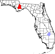 Location in the U.S. state of Florida | |
 Florida's location in the U.S. | |
| Founded | December 15, 1855 |
| Seat | Bristol |
| Largest city | Bristol |
| Area | |
| • Total | 843 sq mi (2,183 km2) |
| • Land | 836 sq mi (2,165 km2) |
| • Water | 7.6 sq mi (20 km2), 0.9% |
| Population (est.) | |
| • (2017) | 8,242[1] |
| • Density | 10/sq mi (4/km2) |
| Congressional district | 2nd |
| Time zone | Eastern: UTC−5/−4 |
| Website |
www |
Liberty County is a county located in the state of Florida. As of the 2010 census, the population was 8,365,[2] making it the least populous county in Florida.[3] Its county seat is Bristol.
The Apalachicola National Forest occupies half the county.
History
Liberty County was created in 1855[4] and is named after the popular American ideal of liberty.[5]
Geography
According to the U.S. Census Bureau, the county has a total area of 843 square miles (2,180 km2), of which 836 square miles (2,170 km2) is land and 7.6 square miles (20 km2) (0.9%) is water.[6] The county is bordered on the west by the Apalachicola River.
Adjacent counties
- Gadsden County - northeast
- Wakulla County - east
- Leon County - east
- Franklin County - south
- Gulf County - southwest
- Calhoun County - west
- Jackson County - northwest
National protected area
- Apalachicola National Forest (part)
Demographics
| Historical population | |||
|---|---|---|---|
| Census | Pop. | %± | |
| 1860 | 1,457 | — | |
| 1870 | 1,050 | −27.9% | |
| 1880 | 1,362 | 29.7% | |
| 1890 | 1,452 | 6.6% | |
| 1900 | 2,956 | 103.6% | |
| 1910 | 4,700 | 59.0% | |
| 1920 | 5,006 | 6.5% | |
| 1930 | 4,067 | −18.8% | |
| 1940 | 3,752 | −7.7% | |
| 1950 | 3,182 | −15.2% | |
| 1960 | 3,138 | −1.4% | |
| 1970 | 3,379 | 7.7% | |
| 1980 | 4,260 | 26.1% | |
| 1990 | 5,569 | 30.7% | |
| 2000 | 7,021 | 26.1% | |
| 2010 | 8,365 | 19.1% | |
| Est. 2017 | 8,242 | [7] | −1.5% |
| U.S. Decennial Census[8] 1790-1960[9] 1900-1990[10] 1990-2000[11] 2010-2015[2] | |||
As of the census[12] of 2000, there were 7,021 people, 2,222 households, and 1,553 families residing in the county. The population density was 8 people per square mile (3/km²). There were 3,156 housing units at an average density of 4 per square mile (1/km²). The racial makeup of the county was 76.41% White, 18.43% Black or African American, 1.81% Native American, 0.14% Asian, 2.08% from other races, and 1.13% from two or more races. 4.50% of the population were Hispanic or Latino of any race. More than 10% of the population are Mormons.[13]
There were 2,222 households out of which 34.20% had children under the age of 18 living with them, 51.80% were married couples living together, 13.20% had a female householder with no husband present, and 30.10% were non-families. 25.90% of all households were made up of individuals and 10.60% had someone living alone who was 65 years of age or older. The average household size was 2.51 and the average family size was 3.00.
In the county, the population was spread out with 21.80% under the age of 18, 9.40% from 18 to 24, 37.70% from 25 to 44, 21.00% from 45 to 64, and 10.20% who were 65 years of age or older. The median age was 35 years. For every 100 females there were 144.90 males. For every 100 females age 18 and over, there were 159.50 males.
The median income for a household in the county was $28,840, and the median income for a family was $34,244. Males had a median income of $22,078 versus $22,661 for females. The per capita income for the county was $17,225. About 16.80% of families and 19.90% of the population were below the poverty line, including 24.30% of those under age 18 and 24.30% of those age 65 or over.
Politics
| Year | Republican | Democratic | Other |
|---|---|---|---|
| 2016 | 76.78% 2,543 | 19.66% 651 | 3.56% 118 |
| 2012 | 69.96% 2,301 | 28.64% 942 | 1.40% 46 |
| 2008 | 71.18% 2,339 | 27.24% 895 | 1.58% 52 |
| 2004 | 63.79% 1,927 | 35.42% 1,070 | 0.79% 24 |
| 2000 | 54.65% 1,317 | 42.20% 1,017 | 3.16% 76 |
| 1996 | 42.19% 913 | 40.11% 868 | 17.70% 383 |
| 1992 | 43.71% 1,126 | 31.83% 820 | 24.45% 630 |
| 1988 | 65.27% 1,421 | 32.57% 709 | 2.16% 47 |
| 1984 | 68.45% 1,410 | 31.55% 650 | |
| 1980 | 43.81% 899 | 54.29% 1,114 | 1.90% 39 |
| 1976 | 34.91% 620 | 64.02% 1,137 | 1.07% 19 |
| 1972 | 84.38% 1,199 | 15.62% 222 | |
| 1968 | 8.96% 154 | 14.09% 242 | 76.95% 1,322 |
| 1964 | 70.71% 910 | 29.29% 377 | |
| 1960 | 21.99% 243 | 78.01% 862 | |
| 1956 | 21.48% 238 | 78.52% 870 | |
| 1952 | 18.60% 237 | 81.40% 1,037 | |
| 1948 | 3.53% 30 | 86.81% 737 | 9.66% 82 |
| 1944 | 5.72% 38 | 94.28% 626 | |
| 1940 | 11.16% 119 | 88.84% 947 | |
| 1936 | 7.41% 64 | 92.59% 800 | |
| 1932 | 4.35% 31 | 95.65% 682 | |
| 1928 | 39.20% 147 | 60.27% 226 | 0.53% 2 |
| 1924 | 8.04% 18 | 86.16% 193 | 5.80% 13 |
| 1920 | 1.10% 5 | 91.63% 416 | 7.27% 33 |
| 1916 | 14.65% 57 | 71.98% 280 | 13.37% 52 |
| 1912 | 12.08% 32 | 77.74% 206 | 10.19% 27 |
| 1908 | 25.27% 69 | 64.47% 176 | 10.26% 28 |
| 1904 | 24.88% 50 | 71.14% 143 | 3.98% 8 |
Liberty County is run by a board of five county commissioners, each elected at-large. The following is a list of the commissioners with the number representative of his/her district:[15]
- Dewayne Branch
- Dexter Barber
- Jim Johnson
- Davis Stoutamire
- Scotty Phillips
The remaining elected officials are the constitutional officers and the school board members.
- Clerk of the court: Cathrine Brown
- Sheriff: Eddie Joe White
- Property Appraiser: Patricia Whitfield
- Tax Collector: Marie Goodman
- Supervisor of Elections: Gina McDowell
- Superintendent of Schools: David Summers
Library
Liberty County is part of the Northwest Regional Library System (NWRLS), which serves Gulf and Bay Counties as well.
Communities
City
Census-designated places
Unincorporated communities
- Estiffanulga
- Orange
- Rock Bluff
- Telogia
- White Springs
- Wilma
- Woods
See also
References
- ↑ https://www.census.gov/quickfacts/fact/table/libertycountyflorida/PST045217
- 1 2 "State & County QuickFacts". United States Census Bureau. Archived from the original on July 13, 2011. Retrieved June 14, 2014.
- ↑ "Find a County". National Association of Counties. Archived from the original on May 31, 2011. Retrieved 2011-06-07.
- ↑ Publications of the Florida Historical Society. Florida Historical Society. 1908. p. 32.
- ↑ Gannett, Henry (1905). The Origin of Certain Place Names in the United States. U.S. Government Printing Office. p. 186.
- ↑ "US Gazetteer files: 2010, 2000, and 1990". United States Census Bureau. 2011-02-12. Retrieved 2011-04-23.
- ↑ "Population and Housing Unit Estimates". Retrieved June 9, 2017.
- ↑ "U.S. Decennial Census". United States Census Bureau. Archived from the original on May 12, 2015. Retrieved June 14, 2014.
- ↑ "Historical Census Browser". University of Virginia Library. Retrieved June 14, 2014.
- ↑ "Population of Counties by Decennial Census: 1900 to 1990". United States Census Bureau. Retrieved June 14, 2014.
- ↑ "Census 2000 PHC-T-4. Ranking Tables for Counties: 1990 and 2000" (PDF). United States Census Bureau. Retrieved June 14, 2014.
- ↑ "American FactFinder". United States Census Bureau. Archived from the original on September 11, 2013. Retrieved 2011-05-14.
- ↑ "Mormon Empire: Florida: Tookie Gentry". The Salt Lake Tribune. 30 March 2008. Retrieved 24 March 2016.
- ↑ "Dave Leip's Election Results Liberty County Florida". Retrieved 10 December 2016.
- ↑ "Archived copy". Archived from the original on 2009-02-09. Retrieved 2010-04-08.
External links
| Wikimedia Commons has media related to Liberty County, Florida. |
Government links/Constitutional offices
- Liberty County Board of County Commissioners
- Liberty County Supervisor of Elections
- Liberty County Property Appraiser
- Liberty County Election's Office
- Liberty County Tax Collector
- Liberty County Emergency Management
Special districts
Judicial branch
Tourism links
Places adjacent to Liberty County, Florida | |
|---|---|
Municipalities and communities of Liberty County, Florida, United States | ||
|---|---|---|
| City | | |
| CDPs | ||
| Unincorporated communities |
| |
| Ghost town | ||

| Topics |  Map of North Florida | |
|---|---|---|
| Counties | ||
| Major cities | ||
| Cities and towns 100k+ | ||
| Cities and towns 25k–100k | ||
| Cities and towns 10k–25k | ||
| Metro areas | ||
| Regions | ||