Douglas County, Nebraska
| Douglas County, Nebraska | ||
|---|---|---|
 Douglas County Courthouse in Omaha | ||
| ||
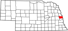 Location in the U.S. state of Nebraska | ||
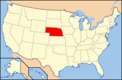 Nebraska's location in the U.S. | ||
| Founded | November 23, 1854 | |
| Named for | Stephen A. Douglas | |
| Seat | Omaha | |
| Largest city | Omaha | |
| Area | ||
| • Total | 339 sq mi (878 km2) | |
| • Land | 328 sq mi (850 km2) | |
| • Water | 11 sq mi (28 km2), 3.2% | |
| Population (est.) | ||
| • (2017) | 561,620 | |
| • Density | 1,656/sq mi (639/km2) | |
| Congressional district | 2nd | |
| Time zone | Central: UTC−6/−5 | |
| Website |
www | |

Douglas County is a county in the U.S. state of Nebraska. As of the 2010 census, the population was 517,110.[1] It is the state's most populous county, home to over one-fourth of Nebraska's residents. Its county seat is Omaha,[2] the state's largest city. The county was established in 1854 and named after Stephen A. Douglas (1813–1861), U.S. Senator from Illinois.[3][4]
Douglas County is part of the Omaha-Council Bluffs, NE-IA Metropolitan Statistical Area.[5]
In the Nebraska license plate system, Douglas County was represented by the prefix "1" (as it had the largest number of vehicles registered in the county when the license plate system was established in 1922). In 2002, the state discontinued the 1922 system in the three most populous counties: Douglas, Lancaster, and Sarpy counties.[6]
Geography
According to the U.S. Census Bureau, the county has a total area of 339 square miles (880 km2), of which 328 square miles (850 km2) is land and 11 square miles (28 km2) (3.2%) is water.[7]
Major highways
Adjacent counties
- Dodge County (northwest)
- Washington County (north)
- Pottawattamie County, Iowa (east)
- Sarpy County (south)
- Saunders County (west)
Demographics
| Historical population | |||
|---|---|---|---|
| Census | Pop. | %± | |
| 1860 | 4,328 | — | |
| 1870 | 19,982 | 361.7% | |
| 1880 | 37,645 | 88.4% | |
| 1890 | 158,008 | 319.7% | |
| 1900 | 140,590 | −11.0% | |
| 1910 | 168,546 | 19.9% | |
| 1920 | 204,524 | 21.3% | |
| 1930 | 232,982 | 13.9% | |
| 1940 | 247,562 | 6.3% | |
| 1950 | 281,020 | 13.5% | |
| 1960 | 343,490 | 22.2% | |
| 1970 | 389,455 | 13.4% | |
| 1980 | 397,038 | 1.9% | |
| 1990 | 416,444 | 4.9% | |
| 2000 | 463,585 | 11.3% | |
| 2010 | 517,110 | 11.5% | |
| Est. 2017 | 561,620 | [8] | 8.6% |
| U.S. Decennial Census[9] 1790-1960[10] 1900-1990[11] 1990-2000[12] 2010-2013[1] | |||
2010 Census
As of the census of 2010, there were 517,110 people and 206,522 households residing in the county. The population density was 1,574 people per square mile (978/km²). There were 219,580 housing units at an average density of 669 per square mile (415/km²). The racial makeup of the county was 76.4% White, 11.6% Black or African American, 0.7% Native American, 2.7% Asian, 0.1% Pacific Islander, 5.7% from some other race, and 2.8% from two or more races. 11.2% of the population were Hispanic or Latino of any race. 30% were of German, 15% Irish, 8.0% English, and 4.9% Italian ancestry according to the 2010 census.
The median income for a household in the county was $51,878, and the median income for a family was $67,666. Males had a median income of $44,542 versus $35,801 for females. The per capita income for the county was $28,092. About 9.4% of families and 13.1% of the population were below the poverty line, including 17.6% of those under age 18 and 8.0% of those age 65 or over.
2000 Census
As of the census of 2000, there were 463,585 people, 182,194 households, and 115,146 families residing in the county. The population density was 1,401 people per square mile (541/km²). There were 192,672 housing units at an average density of 582 per square mile (225/km²). The racial makeup of the county was 80.96% White, 11.50% Black or African American, 0.61% Native American, 1.71% Asian, 0.05% Pacific Islander, 3.40% from other races, and 1.76% from two or more races. 6.67% of the population were Hispanic or Latino of any race. 26.3% were of German, 11.5% Irish and 6.2% English ancestry according to the 2000 census.
There were 182,194 households out of which 32.00% had children under the age of 18 living with them, 47.50% were married couples living together, 12.10% had a female householder with no husband present, and 36.80% were non-families. 29.80% of all households were made up of individuals and 8.70% had someone living alone who was 65 years of age or older. The average household size was 2.48 and the average family size was 3.12.
In the county, the population was spread out with 26.60% under the age of 18, 10.30% from 18 to 24, 31.20% from 25 to 44, 21.00% from 45 to 64, and 11.00% who were 65 years of age or older. The median age was 34 years. For every 100 females there were 95.70 males. For every 100 females age 18 and over, there were 92.90 males.
The median income for a household in the county was $43,209, and the median income for a family was $54,651. Males had a median income of $36,577 versus $27,265 for females. The per capita income for the county was $22,879. About 6.70% of families and 9.80% of the population were below the poverty line, including 13.00% of those under age 18 and 7.20% of those age 65 or over.
Government
Douglas County is governed by a board of seven county commissioners, elected to four year terms. County courthouse positions are also elected on a partisan basis. Most of the county's offices are located at the Douglas County Courthouse.
| District | Commissioner |
|---|---|
| 1 | Mike Boyle |
| 2 | James Cavanaugh |
| 3 | Chris Rodgers (Vice-chair)[13] |
| 4 | P.J. Morgan |
| 5 | Marc Kraft |
| 6 | Mary Ann Borgeson (Chair)[14] |
| 7 | Clare Duda |
| Office | Officeholder |
|---|---|
| Assessor/Register of Deeds | Diane Battiato[15] |
| County Attorney | Donald Kleine |
| County Clerk/Comptroller | Dan Esch[16] |
| Clerk of the District Court | John Friend |
| County Engineer | Tom Doyle |
| County Sheriff | Tim Dunning |
| County Treasurer | John W. Ewing |
| Public Defender | Tom Riley |
| Year | Republican | Democratic | Third Parties |
|---|---|---|---|
| 2016 | 45.0% 108,077 | 47.3% 113,798 | 7.7% 18,558 |
| 2012 | 50.6% 113,220 | 47.5% 106,456 | 1.9% 4,251 |
| 2008 | 46.9% 106,291 | 51.5% 116,810 | 1.6% 3,600 |
| 2004 | 58.3% 120,813 | 40.2% 83,330 | 1.5% 2,928 |
| 2000 | 55.2% 101,025 | 40.0% 73,347 | 4.8% 8,784 |
| 1996 | 51.4% 92,334 | 39.3% 70,708 | 9.3% 16,679 |
Communities
Cities
- Bennington
- Omaha (county seat)
- Ralston
- Valley
Villages
Census-designated places
Unincorporated communities
See also
References
- 1 2 "State & County QuickFacts". United States Census Bureau. Archived from the original on July 9, 2011. Retrieved September 19, 2013.
- ↑ "Find a County". National Association of Counties. Archived from the original on 2011-05-31. Retrieved 2011-06-07.
- ↑ "About Douglas County: History." Douglas County. Retrieved 9/17/07.
- ↑ Fitzpatrick, Lilian Linder (1925). Nebraska Place-Names. Lincoln: University of Nebraska Studies in Language, Literature, and Criticism. p. 55. Retrieved December 18, 2014.
- ↑ United States Office of Management and Budget. "Update of Statistical Area Definitions and Guidance on Their Uses" (PDF). pp. 5, 36. Archived from the original (PDF) on 2006-05-14. Retrieved 2006-07-21.
- ↑ "History Of Nebraska Passenger Vehicle License Plates". Nebraska Department of Motor Vehicles. Retrieved 2015-10-29.
- ↑ "2010 Census Gazetteer Files". United States Census Bureau. August 22, 2012. Archived from the original on November 13, 2013. Retrieved December 6, 2014.
- ↑ "Population Estimates from US Census". Retrieved May 28, 2018.
- ↑ "U.S. Decennial Census". United States Census Bureau. Archived from the original on May 12, 2015. Retrieved December 6, 2014.
- ↑ "Historical Census Browser". University of Virginia Library. Retrieved December 6, 2014.
- ↑ "Population of Counties by Decennial Census: 1900 to 1990". United States Census Bureau. Retrieved December 6, 2014.
- ↑ "Census 2000 PHC-T-4. Ranking Tables for Counties: 1990 and 2000" (PDF). United States Census Bureau. Retrieved December 6, 2014.
- ↑ Douglas County Commissioners. (2017, January, 10). Board of County Commissioners. Retrieved from https://commissioners.douglascounty-ne.gov/search-minutes
- ↑ Douglas County Commissioners. (2017, January, 10). Board of County Commissioners. Retrieved from https://commissioners.douglascounty-ne.gov/search-minutes
- ↑ "Kelly: Diane Battiato was made to measure for county post". Omaha World-Herald. Retrieved 2015-10-25.
- ↑ "Home - Douglas County Clerk/Comptroller". Douglas County. Retrieved 2017-01-26.
- ↑ http://uselectionatlas.org/RESULTS
External links
Places adjacent to Douglas County, Nebraska | ||||||||||
|---|---|---|---|---|---|---|---|---|---|---|
| ||||||||||
Municipalities and communities of Douglas County, Nebraska, United States | ||
|---|---|---|
| Cities | ||
| Villages | ||
| CDPs | ||
| Unincorporated communities | ||
| See also | ||
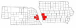
Metropolitan area of Omaha–Council Bluffs | ||||||
|---|---|---|---|---|---|---|
| Primary cities |
|  | ||||
| Cities over 10,000 (per 2010 Census) |
| |||||
| Cities of 5,000 to 10,000 (per 2010 Census) |
| |||||
| Cities of 1,000 to 5,000 (per 2010 Census) |
| |||||
| Census-designated places |
| |||||
| Cities and villages of fewer than 1,000 (per 2010 Census) |
| |||||
| Counties |
| |||||