Lincoln County, Nevada
| Lincoln County, Nevada | ||
|---|---|---|
| County | ||
| Lincoln County | ||
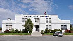 Lincoln County Courthouse in Pioche | ||
| ||
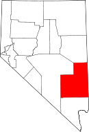 Location in the U.S. state of Nevada | ||
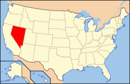 Nevada's location in the U.S. | ||
| Founded | 1866 | |
| Named for | Abraham Lincoln | |
| Seat | Pioche | |
| Largest city | Caliente | |
| Area | ||
| • Total | 10,637 sq mi (27,550 km2) | |
| • Land | 10,633 sq mi (27,539 km2) | |
| • Water | 3.8 sq mi (10 km2), 0.04% | |
| Population (est.) | ||
| • (2017) | 5,223[1] | |
| • Density | 0.5/sq mi (0.2/km2) | |
| Congressional district | 4th | |
| Time zone | Pacific: UTC−8/−7 | |
| Website |
lincolncountynv | |
Lincoln County is a county located in the U.S. state of Nevada. As of the 2010 census, the population was 5,345.[2] Its county seat is Pioche.[3]
History
Lincoln County was established in 1866 after Congress enlarged Nevada by moving its state line eastward and southward at the expense of Utah and Arizona territories.[4] It is named after Abraham Lincoln, the 16th President of the United States.[5] Original legislation called for the creation of a "Stewart County", after Nevada Senator William M. Stewart, but this was later changed in a substitute bill. Crystal Springs was the county's first seat in 1866, followed by Hiko in 1867, and Pioche in 1871.
Lincoln County initially included a ranch village and railroad siding named Las Vegas. However the future city was separated from Lincoln County upon the founding of Clark County effective July 1, 1909, by act of the Nevada Legislature.[6]
Area 51 is in Lincoln County and the county sheriff acts in proxy for the perimeter security forces.
Geography
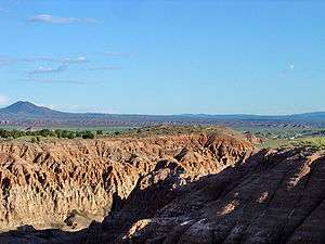
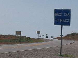
According to the U.S. Census Bureau, the county has a total area of 10,637 square miles (27,550 km2), of which 10,633 square miles (27,540 km2) is land and 3.8 square miles (9.8 km2) (0.04%) is water.[7] While only the third largest county by area in the state of Nevada, it is the seventh-largest county in area in the entire United States, not including boroughs and census areas in Alaska. The south cliff of Mount Rummel, the summit of which is just north of the county line in by this places side: White Pine County, contains the highest point in Lincoln County at 10,640 feet (3,240 m).[8] The highest independent mountain completely within Lincoln County is Shingle Peak, while the county's most topographically prominent peak is Mormon Peak.
Major highways
Adjacent counties
- White Pine County - north
- Millard County, Utah - northeast/Mountain Time Border
- Beaver County, Utah - east/Mountain Time Border
- Iron County, Utah - east/Mountain Time Border
- Washington County, Utah - east/Mountain Time Border
- Mohave County, Arizona - southeast/Mountain Time Border
- Clark County, Nevada - south
- Nye County, Nevada - west
National protected areas
- Desert National Wildlife Refuge (part)
- Humboldt National Forest (part)
- Pahranagat National Wildlife Refuge
There are 16 official wilderness areas in Lincoln County that are part of the National Wilderness Preservation System. All are managed by the Bureau of Land Management. Several extend into neighboring counties (as indicated below).
- Big Rocks Wilderness
- Clover Mountains Wilderness
- Delamar Mountains Wilderness
- Far South Egans Wilderness (partly in Nye County, NV)
- Fortification Range Wilderness
- Meadow Valley Range Wilderness (partly in Clark County, NV)
- Mormon Mountains Wilderness (partly in Clark County, NV)
- Mount Grafton Wilderness (mostly in White Pine County, NV)
- Mount Irish Wilderness
- Parsnip Peak Wilderness
- South Egan Range Wilderness (partly in White Pine County, NV; Nye County, NV)
- South Pahroc Range Wilderness
- Tunnel Spring Wilderness
- Weepah Spring Wilderness (partly in Nye County, NV)
- White Rock Range Wilderness
- Worthington Mountains Wilderness
Demographics
| Historical population | |||
|---|---|---|---|
| Census | Pop. | %± | |
| 1870 | 2,985 | — | |
| 1880 | 2,637 | −11.7% | |
| 1890 | 2,466 | −6.5% | |
| 1900 | 3,284 | 33.2% | |
| 1910 | 3,489 | 6.2% | |
| 1920 | 2,287 | −34.5% | |
| 1930 | 3,601 | 57.5% | |
| 1940 | 4,130 | 14.7% | |
| 1950 | 3,837 | −7.1% | |
| 1960 | 2,431 | −36.6% | |
| 1970 | 2,557 | 5.2% | |
| 1980 | 3,732 | 46.0% | |
| 1990 | 3,775 | 1.2% | |
| 2000 | 4,165 | 10.3% | |
| 2010 | 5,345 | 28.3% | |
| Est. 2017 | 5,223 | [9] | −2.3% |
| U.S. Decennial Census[10] 1790-1960[11] 1900-1990[12] 1990-2000[13] 2010-2013[2] | |||
2000 census
As of the census[14] of 2000, there were 4,165 people, 1,540 households, and 1,010 families residing in the county. The population density was less than one person per square mile (and less than 1/km²). There were 2,178 housing units at an average density of 0 per square mile (0/km²). The racial makeup of the county was 91.50% White, 1.78% Black or African American, 1.75% Native American, 0.34% Asian, 0.02% Pacific Islander, 2.69% from other races, and 1.92% from two or more races. 5.31% of the population were Hispanic or Latino of any race.
According to the 2000 census the five largest ancestry groups in Lincoln County are English (21%), German (18%), Irish (11%), Mexican (4%) and Italian (4%).
There were 1,540 households out of which 29.00% had children under the age of 18 living with them, 56.20% were married couples living together, 7.90% had a female householder with no husband present, and 34.40% were non-families. 31.30% of all households were made up of individuals and 16.10% had someone living alone who was 65 years of age or older. The average household size was 2.48 and the average family size was 3.15.
In the county, the population was spread out with 30.10% under the age of 18, 6.00% from 18 to 24, 21.90% from 25 to 44, 25.90% from 45 to 64, and 16.20% who were 65 years of age or older. The median age was 39 years. For every 100 females there were 107.90 males. For every 100 females age 18 and over, there were 108.20 males.
The median income for a household in the county was $31,979, and the median income for a family was $45,588. Males had a median income of $40,048 versus $23,571 for females. The per capita income for the county was $17,326. About 11.50% of families and 16.50% of the population were below the poverty line, including 19.60% of those under age 18 and 17.40% of those age 65 or over.
2010 census
As of the 2010 United States Census, there were 5,345 people, 1,988 households, and 1,282 families residing in the county.[15] The population density was 0.5 inhabitants per square mile (0.19/km2). There were 2,730 housing units at an average density of 0.3 per square mile (0.12/km2).[16] The racial makeup of the county was 91.1% white, 2.3% black or African American, 1.1% American Indian, 0.7% Asian, 0.3% Pacific islander, 2.2% from other races, and 2.3% from two or more races. Those of Hispanic or Latino origin made up 6.2% of the population.[15] In terms of ancestry, 39.8% were English, 19.5% were German, 12.4% were Irish, 6.1% were Danish, 5.9% were Dutch, and 1.8% were American.[17]
Of the 1,988 households, 28.9% had children under the age of 18 living with them, 53.0% were married couples living together, 7.7% had a female householder with no husband present, 35.5% were non-families, and 30.4% of all households were made up of individuals. The average household size was 2.57 and the average family size was 3.16. The median age was 39.9 years.[15]
The median income for a household in the county was $44,695 and the median income for a family was $56,167. Males had a median income of $51,475 versus $26,366 for females. The per capita income for the county was $18,148. About 7.5% of families and 10.6% of the population were below the poverty line, including 12.5% of those under age 18 and 9.6% of those age 65 or over.[18]
Education
Public schools in Lincoln County are under the Lincoln County School District. The schools are:
- Pioche Elementary School
- Caliente Elementary School
- Pahranagat Valley Elementary School
- Panaca Elementary School
- Meadow Valley Middle School
- Pahranagat Valley Middle School
- Lincoln County High School
- C. O. Bastian High School
- Pahranagat Valley High School
Lincoln County School District along with Coyote Springs developers are planning large numbers of new schools within development which will double the growth of Lincoln County School District over 50 built out of the new city.
Politics
| Year | Republican | Democratic | Third parties |
|---|---|---|---|
| 2016 | 78.4% 1,671 | 13.4% 285 | 8.3% 176 |
| 2012 | 78.6% 1,691 | 18.6% 400 | 2.8% 61 |
| 2008 | 71.1% 1,498 | 24.6% 518 | 4.3% 91 |
| 2004 | 77.1% 1,579 | 20.4% 418 | 2.4% 50 |
| 2000 | 70.1% 1,372 | 23.6% 461 | 6.3% 123 |
| 1996 | 52.5% 936 | 28.0% 499 | 19.5% 348 |
| 1992 | 47.9% 890 | 27.5% 511 | 24.6% 456 |
| 1988 | 66.2% 1,035 | 29.8% 466 | 4.0% 63 |
| 1984 | 72.7% 1,175 | 24.6% 397 | 2.7% 44 |
| 1980 | 68.5% 1,087 | 25.0% 396 | 6.5% 103 |
| 1976 | 50.0% 700 | 45.9% 642 | 4.1% 57 |
| 1972 | 68.8% 841 | 31.2% 382 | |
| 1968 | 49.9% 555 | 37.2% 414 | 12.9% 144 |
| 1964 | 35.9% 440 | 64.1% 785 | |
| 1960 | 40.7% 530 | 59.3% 771 | |
| 1956 | 52.4% 885 | 47.6% 803 | |
| 1952 | 49.0% 903 | 51.0% 941 | |
| 1948 | 33.5% 520 | 64.7% 1,004 | 1.9% 29 |
| 1944 | 28.8% 524 | 71.2% 1,295 | |
| 1940 | 22.4% 461 | 77.6% 1,601 | |
| 1936 | 13.4% 254 | 86.6% 1,639 | |
| 1932 | 21.1% 295 | 78.9% 1,105 | |
| 1928 | 50.5% 553 | 49.5% 542 | |
| 1924 | 27.1% 200 | 34.8% 257 | 38.1% 281 |
| 1920 | 47.6% 373 | 46.7% 366 | 5.6% 44 |
| 1916 | 22.7% 202 | 71.2% 634 | 6.2% 55 |
| 1912 | 18.3% 100 | 50.3% 275 | 31.5% 172 |
| 1908 | 42.7% 690 | 47.6% 768 | 9.7% 157 |
| 1904 | 53.1% 405 | 38.7% 295 | 8.3% 63 |
Communities
City
Census-designated places
- Alamo
- Beaverdam
- Bennett Springs
- Dry Valley
- Hiko
- Mount Wilson
- Panaca
- Pioche (county seat)
- Rachel
- Ursine
Unincorporated communities
Ghost towns
Planned development
- Coyote Springs — a proposed community for 240,000 people.
Notable people
- Helen J. Stewart, at one time the largest landowner in the county[20]
See also
References
- ↑ https://www.census.gov/quickfacts/fact/table/lincolncountynevada/PST045217
- 1 2 "State & County QuickFacts". United States Census Bureau. Retrieved September 23, 2013.
- ↑ "County Explorer". National Association of Counties. Retrieved 2011-06-07.
- ↑ "History". Lincoln County Nevada. 2014. Retrieved December 21, 2014.
- ↑ Gannett, Henry (1905). The Origin of Certain Place Names in the United States. U.S. Government Printing Office. p. 187. Retrieved 2016-01-01.
- ↑ Joseph Nathan Kane, The American Counties (4th Ed.), (The Scarecrow Press, 1983), p479-480
- ↑ "2010 Census Gazetteer Files". United States Census Bureau. August 22, 2012. Retrieved December 20, 2014.
- ↑ "Mount Grafton-South Ridge, Nevada". Peakbagger.com. Retrieved 2015-01-17.
- ↑ "Population and Housing Unit Estimates". Retrieved June 9, 2017.
- ↑ "U.S. Decennial Census". United States Census Bureau. Retrieved December 20, 2014.
- ↑ "Historical Census Browser". University of Virginia Library. Retrieved December 20, 2014.
- ↑ "Population of Counties by Decennial Census: 1900 to 1990". United States Census Bureau. Retrieved December 20, 2014.
- ↑ "Census 2000 PHC-T-4. Ranking Tables for Counties: 1990 and 2000" (PDF). United States Census Bureau. Retrieved December 20, 2014.
- ↑ "American FactFinder". United States Census Bureau. Retrieved 2008-01-31.
- 1 2 3 "DP-1 Profile of General Population and Housing Characteristics: 2010 Demographic Profile Data". United States Census Bureau. Retrieved 2016-01-21.
- ↑ "Population, Housing Units, Area, and Density: 2010 - County". United States Census Bureau. Retrieved 2016-01-21.
- ↑ "DP02 SELECTED SOCIAL CHARACTERISTICS IN THE UNITED STATES – 2006-2010 American Community Survey 5-Year Estimates". United States Census Bureau. Retrieved 2016-01-21.
- ↑ "DP03 SELECTED ECONOMIC CHARACTERISTICS – 2006-2010 American Community Survey 5-Year Estimates". United States Census Bureau. Retrieved 2016-01-21.
- ↑ Leip, David. "Dave Leip's Atlas of U.S. Presidential Elections". uselectionatlas.org. Retrieved 9 April 2018.
- ↑ "Helen J. Stewart". University of Nevada, Reno. Retrieved 9 March 2012.
External links
- Official website

- Lincoln County Chamber of Commerce
- Lincoln County Regional Development Authority
Places adjacent to Lincoln County, Nevada | ||||||||||
|---|---|---|---|---|---|---|---|---|---|---|
| ||||||||||
Municipalities and communities of Lincoln County, Nevada, United States | ||
|---|---|---|
| Cities | | |
| CDPs | ||
| Other unincorporated communities | ||
| Ghost towns | ||
| Footnotes | ‡This populated place also has portions in an adjacent county or counties | |