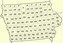
County
|
FIPS code[10]
|
County seat[4]
|
#
|
Established[4][11]
|
Formed from[12]
|
Etymology[11] | Map #
|
Population[13] |
Area[4] |
Map |
| Adair County |
001 |
Greenfield | 01 | Jan 15, 1851 | Cass County | John Adair, Kentucky Governor | 69 |
7003768200000000000♠7,682 |
7002569000000000000♠569 sq mi
(7003147400000000000♠1,474 km2) | 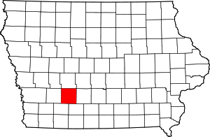 |
| Adams County |
003 |
Corning | 02 | Jan 15, 1851 | Taylor County | John Adams, US President | 81 |
7003402900000000000♠4,029 |
7002424000000000000♠424 sq mi
(7003109800000000000♠1,098 km2) | 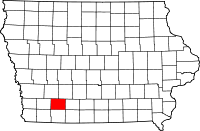 |
| Allamakee County |
005 |
Waukon | 03 | Feb 20, 1847 | Clayton County | Disputed, possibly Allan Makee, early trader and guide for settlers | 11 |
7004143300000000000♠14,330 |
7002640000000000000♠640 sq mi
(7003165800000000000♠1,658 km2) | 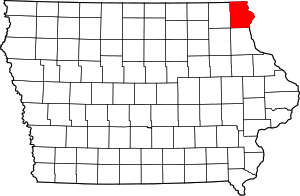 |
| Appanoose County |
007 |
Centerville | 04 | Feb 17, 1843 | Davis County | Chief Appanoose, headed peace party in the Black Hawk War | 96 |
7004128840000000000♠12,884 |
7002496000000000000♠496 sq mi
(7003128500000000000♠1,285 km2) |  |
| Audubon County |
009 |
Audubon | 05 | Jan 15, 1851 | Black Hawk County and Cass County | John James Audubon, ornithologist and artist | 57 |
7003611900000000000♠6,119 |
7002443000000000000♠443 sq mi
(7003114700000000000♠1,147 km2) |  |
| Benton County |
011 |
Vinton | 06 | Dec 21, 1837 | Native American lands and Wisconsin Territory | Thomas Hart Benton, Missouri Senator | 51 |
7004260760000000000♠26,076 |
7002716000000000000♠716 sq mi
(7003185400000000000♠1,854 km2) |  |
| Black Hawk County |
013 |
Waterloo | 07 | Feb 17, 1843 | Delaware County | Black Hawk, leader during Black Hawk War | 39 |
7005131090000000000♠131,090 |
7002567000000000000♠567 sq mi
(7003146900000000000♠1,469 km2) |  |
| Boone County |
015 |
Boone | 08 | Jan 13, 1846 | Polk County | Nathan Boone, one of the first to survey Iowa | 47 |
7004263060000000000♠26,306 |
7002572000000000000♠572 sq mi
(7003148100000000000♠1,481 km2) | 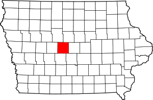 |
| Bremer County |
017 |
Waverly | 09 | Jan 15, 1851 | Native American lands and Winnebago County | Fredrika Bremer, Swedish poet and author | 30 |
7004242760000000000♠24,276 |
7002428000000000000♠428 sq mi
(7003110900000000000♠1,109 km2) | 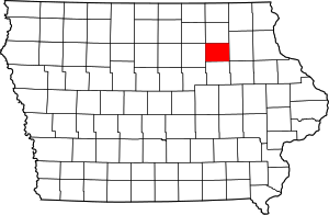 |
| Buchanan County |
019 |
Independence | 10 | Dec 21, 1837 | Delaware County and Wisconsin Territory | James Buchanan, US President | 40 |
7004209580000000000♠20,958 |
7002571000000000000♠571 sq mi
(7003147900000000000♠1,479 km2) | 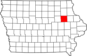 |
| Buena Vista County |
021 |
Storm Lake | 11 | Jan 15, 1851 | Clay County and Sac County | Battle of Buena Vista, Mexican–American War | 24 |
7004202600000000000♠20,260 |
7002575000000000000♠575 sq mi
(7003148900000000000♠1,489 km2) | 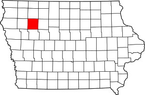 |
| Butler County |
023 |
Allison | 12 | Jan 15, 1851 | Black Hawk County and Buchanan County | William Orlando Butler, War of 1812 hero | 29 |
7004148670000000000♠14,867 |
7002580000000000000♠580 sq mi
(7003150200000000000♠1,502 km2) | 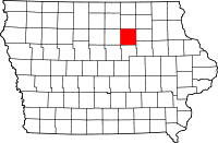 |
| Calhoun County |
025 |
Rockwell City | 13 | Jan 15, 1851 | Fox County (renamed) | John C. Calhoun, US Vice President | 34 |
7003967000000000000♠9,670 |
7002570000000000000♠570 sq mi
(7003147600000000000♠1,476 km2) | 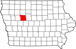 |
| Carroll County |
027 |
Carroll | 14 | Jan 15, 1851 | Guthrie County | Charles Carroll, signatory of the Declaration of Independence | 45 |
7004208160000000000♠20,816 |
7002569000000000000♠569 sq mi
(7003147400000000000♠1,474 km2) | 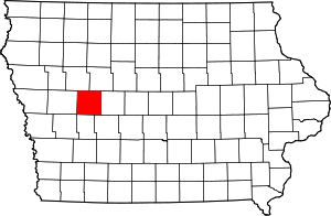 |
| Cass County |
029 |
Atlantic | 15 | Jan 15, 1851 | Pottawattamie County | Lewis Cass, Michigan Senator | 68 |
7004139560000000000♠13,956 |
7002564000000000000♠564 sq mi
(7003146100000000000♠1,461 km2) | 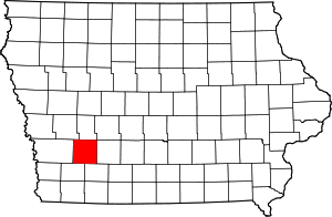 |
| Cedar County |
031 |
Tipton | 16 | Dec 21, 1837 | Wisconsin Territory | Cedar River that runs through county | 65 |
7004184990000000000♠18,499 |
7002580000000000000♠580 sq mi
(7003150200000000000♠1,502 km2) | 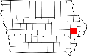 |
| Cerro Gordo County |
033 |
Mason City | 17 | Jan 15, 1851 | Floyd County | Battle of Cerro Gordo, Mexican–American War | 17 |
7004441510000000000♠44,151 |
7002568000000000000♠568 sq mi
(7003147100000000000♠1,471 km2) | 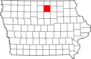 |
| Cherokee County |
035 |
Cherokee | 18 | Jan 15, 1851 | Crawford County | Cherokee People | 23 |
7004120720000000000♠12,072 |
7002577000000000000♠577 sq mi
(7003149400000000000♠1,494 km2) | 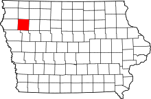 |
| Chickasaw County |
037 |
New Hampton | 19 | Jan 15, 1851 | Fayette County | Chickasaw People | 19 |
7004124390000000000♠12,439 |
7002505000000000000♠505 sq mi
(7003130800000000000♠1,308 km2) | 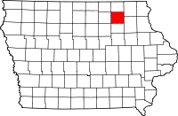 |
| Clarke County |
039 |
Osceola | 20 | Jan 13, 1846 | Lucas County | James Clarke, Governor of Iowa Territory | 83 |
7003928600000000000♠9,286 |
7002431000000000000♠431 sq mi
(7003111600000000000♠1,116 km2) | 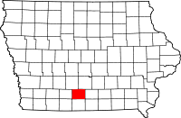 |
| Clay County |
041 |
Spencer | 21 | Jan 15, 1851 | Native American lands | Henry Clay, Jr., officer in the Mexican–American War | 14 |
7004166670000000000♠16,667 |
7002569000000000000♠569 sq mi
(7003147400000000000♠1,474 km2) | 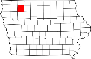 |
| Clayton County |
043 |
Elkader | 22 | Dec 21, 1837 | Dubuque County and Wisconsin Territory | John M. Clayton, Delaware Senator | 21 |
7004181290000000000♠18,129 |
7002779000000000000♠779 sq mi
(7003201800000000000♠2,018 km2) | 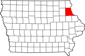 |
| Clinton County |
045 |
Clinton | 23 | Dec 21, 1837 | Dubuque County and Wisconsin Territory | DeWitt Clinton, New York Governor | 66 |
7004491160000000000♠49,116 |
7002695000000000000♠695 sq mi
(7003180000000000000♠1,800 km2) | 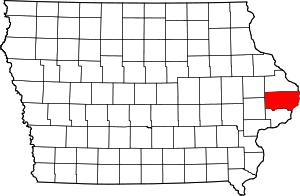 |
| Crawford County |
047 |
Denison | 24 | Jan 15, 1851 | Shelby County | William Harris Crawford, Georgia Senator | 44 |
7004170960000000000♠17,096 |
7002714000000000000♠714 sq mi
(7003184900000000000♠1,849 km2) | 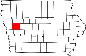 |
| Dallas County |
049 |
Adel | 25 | Jan 13, 1846 | Polk County | George Mifflin Dallas, US Vice President | 59 |
7004661350000000000♠66,135 |
7002586000000000000♠586 sq mi
(7003151800000000000♠1,518 km2) | 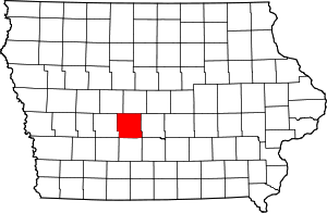 |
| Davis County |
051 |
Bloomfield | 26 | Feb 17, 1843 | Van Buren County | Garrett Davis, Kentucky Congressman | 97 |
7003875300000000000♠8,753 |
7002503000000000000♠503 sq mi
(7003130300000000000♠1,303 km2) | 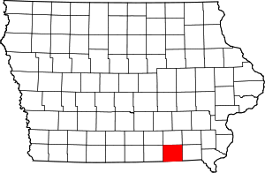 |
| Decatur County |
053 |
Leon | 27 | Jan 13, 1846 | Appanoose County | Stephen Decatur, War of 1812 naval officer | 94 |
7003845700000000000♠8,457 |
7002532000000000000♠532 sq mi
(7003137800000000000♠1,378 km2) | 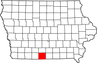 |
| Delaware County |
055 |
Manchester | 28 | Dec 21, 1837 | Dubuque County and Wisconsin Territory | State of Delaware, home of Iowa statehood advocate US Senator John M. Clayton | 41 |
7004177640000000000♠17,764 |
7002578000000000000♠578 sq mi
(7003149700000000000♠1,497 km2) | 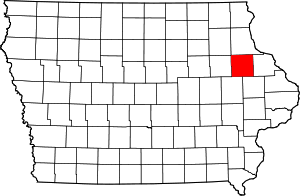 |
| Des Moines County |
057 |
Burlington | 29 | Sep 6, 1834 | Michigan Territory and Wisconsin Territory | Des Moines River that once ran through the county | 89 |
7004403250000000000♠40,325 |
7002416000000000000♠416 sq mi
(7003107700000000000♠1,077 km2) | 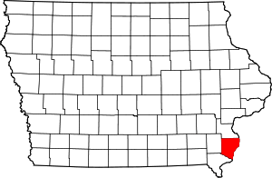 |
| Dickinson County |
059 |
Spirit Lake | 30 | Jan 15, 1851 | Kossuth County | Daniel Stevens Dickinson, New York Senator | 3 |
7004166670000000000♠16,667 |
7002381000000000000♠381 sq mi
(7002987000000000000♠987 km2) | 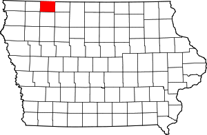 |
| Dubuque County |
061 |
Dubuque | 31 | Sep 6, 1834 | Michigan Territory and Wisconsin Territory | Julien Dubuque, first permanent white settler in Iowa | 42 |
7004936530000000000♠93,653 |
7002608000000000000♠608 sq mi
(7003157500000000000♠1,575 km2) | 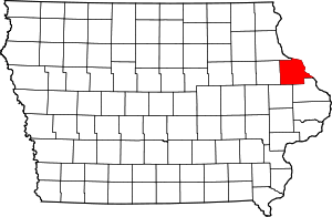 |
| Emmet County |
063 |
Estherville | 32 | Jan 15, 1851 | Dickinson County and Kossuth County | Robert Emmet, Irish revolutionary and American republican sympathizer | 4 |
7004103020000000000♠10,302 |
7002396000000000000♠396 sq mi
(7003102600000000000♠1,026 km2) | 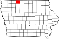 |
| Fayette County |
065 |
West Union | 33 | Dec 21, 1837 | Clayton County and Wisconsin Territory | Marquis de Lafayette, Frenchman who aided colonial forces during American Revolutionary War | 20 |
7004208800000000000♠20,880 |
7002731000000000000♠731 sq mi
(7003189300000000000♠1,893 km2) | 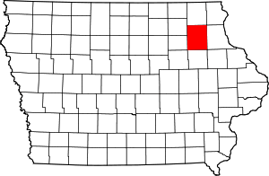 |
| Floyd County |
067 |
Charles City | 34 | Jan 15, 1851 | Chickasaw County | Charles Floyd, member of Lewis and Clark Expedition who died in Iowa | 18 |
7004163030000000000♠16,303 |
7002501000000000000♠501 sq mi
(7003129800000000000♠1,298 km2) | 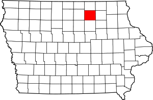 |
| Franklin County |
069 |
Hampton | 35 | Jan 15, 1851 | Chickasaw County | Benjamin Franklin, statesman and US founding father | 28 |
7004106800000000000♠10,680 |
7002582000000000000♠582 sq mi
(7003150700000000000♠1,507 km2) | 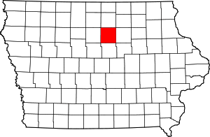 |
| Fremont County |
071 |
Sidney | 36 | Feb 24, 1847 | Pottawattamie County | John Charles Fremont, Mexican–American War officer | 90 |
7003744100000000000♠7,441 |
7002511000000000000♠511 sq mi
(7003132300000000000♠1,323 km2) | 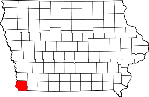 |
| Greene County |
073 |
Jefferson | 37 | Jan 15, 1851 | Dallas County | Nathanael Greene, American Revolutionary War general | 46 |
7003933600000000000♠9,336 |
7002568000000000000♠568 sq mi
(7003147100000000000♠1,471 km2) | 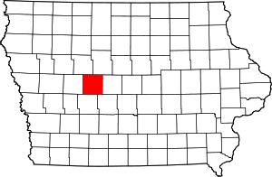 |
| Grundy County |
075 |
Grundy Center | 38 | Jan 15, 1851 | Black Hawk County | Felix Grundy, Tennessee Congressman | 38 |
7004124530000000000♠12,453 |
7002503000000000000♠503 sq mi
(7003130300000000000♠1,303 km2) | 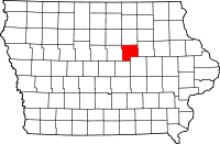 |
| Guthrie County |
077 |
Guthrie Center | 39 | Jul 8, 1851 | Jackson County | Edwin B. Guthrie, Mexican–American War officer | 58 |
7004109540000000000♠10,954 |
7002591000000000000♠591 sq mi
(7003153100000000000♠1,531 km2) | 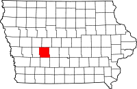 |
| Hamilton County |
079 |
Webster City | 40 | Dec 22, 1856 | Webster County | William W. Hamilton, President of Iowa Senate (1856–1857) | 36 |
7004156730000000000♠15,673 |
7002577000000000000♠577 sq mi
(7003149400000000000♠1,494 km2) | 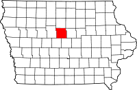 |
| Hancock County |
081 |
Garner | 41 | Jan 15, 1851 | Wright County | John Hancock, President of First Continental Congress | 16 |
7004113410000000000♠11,341 |
7002571000000000000♠571 sq mi
(7003147900000000000♠1,479 km2) | 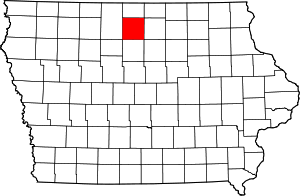 |
| Hardin County |
083 |
Eldora | 42 | Jan 15, 1851 | Black Hawk County | John J. Hardin, prominent soldier, Black Hawk War | 37 |
7004175340000000000♠17,534 |
7002569000000000000♠569 sq mi
(7003147400000000000♠1,474 km2) | 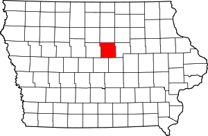 |
| Harrison County |
085 |
Logan | 43 | Jan 15, 1851 | Pottawattamie County | William Henry Harrison, US President | 55 |
7004149280000000000♠14,928 |
7002697000000000000♠697 sq mi
(7003180500000000000♠1,805 km2) |  |
| Henry County |
087 |
Mount Pleasant | 44 | Dec 7, 1836 | Wisconsin Territory | Disputed, see reference[14] | 88 |
7004201450000000000♠20,145 |
7002434000000000000♠434 sq mi
(7003112400000000000♠1,124 km2) | 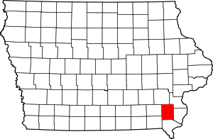 |
| Howard County |
089 |
Cresco | 45 | Jan 15, 1851 | Chickasaw County | Tilghman Howard, US Representative from Indiana | 9 |
7003956600000000000♠9,566 |
7002473000000000000♠473 sq mi
(7003122500000000000♠1,225 km2) | 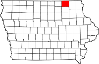 |
| Humboldt County |
091 |
Dakota City | 46 | Feb 26, 1857 | Webster County | Alexander von Humboldt, German scientist | 26 |
7003981500000000000♠9,815 |
7002434000000000000♠434 sq mi
(7003112400000000000♠1,124 km2) | 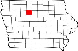 |
| Ida County |
093 |
Ida Grove | 47 | Jan 15, 1851 | Cherokee County | Mount Ida in Greece | 32 |
7003708900000000000♠7,089 |
7002432000000000000♠432 sq mi
(7003111900000000000♠1,119 km2) | 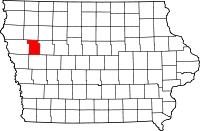 |
| Iowa County |
095 |
Marengo | 48 | Feb 17, 1843 | Washington County | Iowa River that flows through the county | 63 |
7004163550000000000♠16,355 |
7002586000000000000♠586 sq mi
(7003151800000000000♠1,518 km2) | 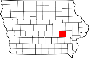 |
| Jackson County |
097 |
Maquoketa | 49 | Dec 21, 1837 | Wisconsin Territory | Andrew Jackson, US President | 54 |
7004198480000000000♠19,848 |
7002636000000000000♠636 sq mi
(7003164700000000000♠1,647 km2) | 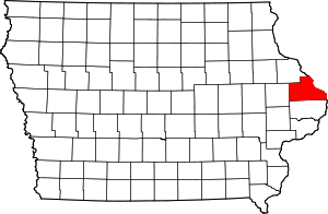 |
| Jasper County |
099 |
Newton | 50 | Jan 13, 1846 | Mahaska County | William Jasper, American Revolutionary War sergeant | 61 |
7004368420000000000♠36,842 |
7002730000000000000♠730 sq mi
(7003189100000000000♠1,891 km2) | 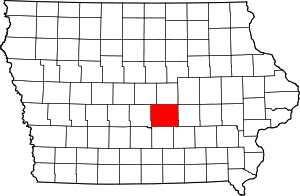 |
| Jefferson County |
101 |
Fairfield | 51 | Jan 21, 1839 | Native American lands | Thomas Jefferson, US President | 87 |
7004168430000000000♠16,843 |
7002435000000000000♠435 sq mi
(7003112700000000000♠1,127 km2) | 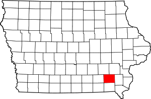 |
| Johnson County |
103 |
Iowa City | 52 | Dec 21, 1837 | Des Moines County, Iowa and Wisconsin Territory | Richard Mentor Johnson, US Vice President | 64 |
7005130882000000000♠130,882 |
7002614000000000000♠614 sq mi
(7003159000000000000♠1,590 km2) | 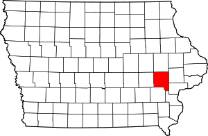 |
| Jones County |
105 |
Anamosa | 53 | Dec 21, 1837 | Wisconsin Territory | George Wallace Jones, Iowa Senator | 53 |
7004206380000000000♠20,638 |
7002575000000000000♠575 sq mi
(7003148900000000000♠1,489 km2) |  |
| Keokuk County |
107 |
Sigourney | 54 | Dec 21, 1837 | Washington County | Chief Keokuk | 74 |
7004105110000000000♠10,511 |
7002579000000000000♠579 sq mi
(7003150000000000000♠1,500 km2) |  |
| Kossuth County |
109 |
Algona | 55 | Jan 15, 1851 | Webster County | Lajos Kossuth, Hungarian revolutionary inspired by American democratic ideals | 5 |
7004155430000000000♠15,543 |
7002973000000000000♠973 sq mi
(7003252000000000000♠2,520 km2) |  |
| Lee County |
111 |
Fort Madison and Keokuk | 56 | Dec 7, 1836 | Des Moines County | William Elliott Lee, businessman from the New York Land Company, who sold the county's first tracts of land | 99 |
7004358620000000000♠35,862 |
7002517000000000000♠517 sq mi
(7003133900000000000♠1,339 km2) |  |
| Linn County |
113 |
Cedar Rapids | 57 | Dec 21, 1837 | Wisconsin Territory | Lewis Fields Linn, doctor and Missouri Senator | 52 |
7005211226000000000♠211,226 |
7002718000000000000♠718 sq mi
(7003186000000000000♠1,860 km2) | 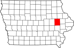 |
| Louisa County |
115 |
Wapello | 58 | Dec 7, 1836 | Des Moines County | Disputed, see reference[15] | 76 |
7004113870000000000♠11,387 |
7002402000000000000♠402 sq mi
(7003104100000000000♠1,041 km2) | 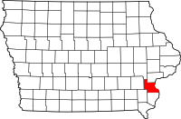 |
| Lucas County |
117 |
Chariton | 59 | Jan 13, 1846 | Monroe County | Robert Lucas, first Governor of Iowa Territory | 84 |
7003889800000000000♠8,898 |
7002431000000000000♠431 sq mi
(7003111600000000000♠1,116 km2) | 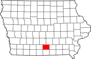 |
| Lyon County |
119 |
Rock Rapids | 60 | Jan 15, 1851 | Woodbury County, Iowa | Nathaniel Lyon, first Union general to be killed in the American Civil War, (formerly named Buncombe County) | 1 |
7004115810000000000♠11,581 |
7002588000000000000♠588 sq mi
(7003152300000000000♠1,523 km2) | 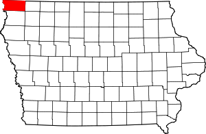 |
| Madison County |
121 |
Winterset | 61 | Jan 13, 1846 | Polk County | James Madison, US President | 70 |
7004156790000000000♠15,679 |
7002561000000000000♠561 sq mi
(7003145300000000000♠1,453 km2) | 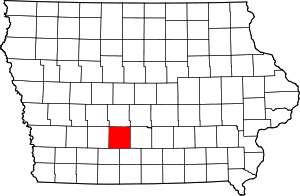 |
| Mahaska County |
123 |
Oskaloosa | 62 | Feb 17, 1843 | Fox and Sac Indian lands | Chief Mahaska | 73 |
7004223810000000000♠22,381 |
7002571000000000000♠571 sq mi
(7003147900000000000♠1,479 km2) | 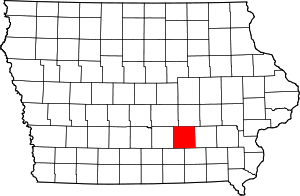 |
| Marion County |
125 |
Knoxville | 63 | Jun 10, 1845 | Washington County | Francis Marion, American Revolutionary War general | 72 |
7004333090000000000♠33,309 |
7002554000000000000♠554 sq mi
(7003143500000000000♠1,435 km2) | 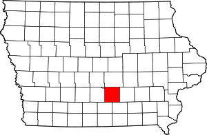 |
| Marshall County |
127 |
Marshalltown | 64 | Jan 13, 1846 | Jasper County | John Marshall, Chief Justice of the United States Supreme Court | 49 |
7004406480000000000♠40,648 |
7002572000000000000♠572 sq mi
(7003148100000000000♠1,481 km2) | 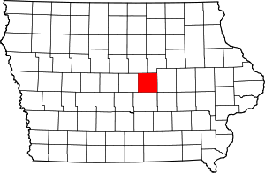 |
| Mills County |
129 |
Glenwood | 65 | Jan 15, 1851 | Pottawattamie County | Frederick Mills, major killed during the Battle of Churubusco, Mexican–American War | 79 |
7004150590000000000♠15,059 |
7002437000000000000♠437 sq mi
(7003113200000000000♠1,132 km2) | 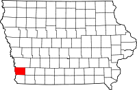 |
| Mitchell County |
131 |
Osage | 66 | Jan 15, 1851 | Chickasaw County | John Mitchel, Irish revolutionary who operated out of the US | 8 |
7004107760000000000♠10,776 |
7002469000000000000♠469 sq mi
(7003121500000000000♠1,215 km2) | 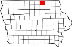 |
| Monona County |
133 |
Onawa | 67 | Jan 15, 1851 | Harrison County | Native American word thought to mean "peaceful valley" | 43 |
7003924300000000000♠9,243 |
7002693000000000000♠693 sq mi
(7003179500000000000♠1,795 km2) | 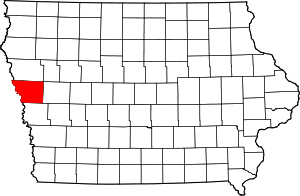 |
| Monroe County |
135 |
Albia | 68 | Feb 17, 1843 | Wapello County | James Monroe, US President | 85 |
7003797000000000000♠7,970 |
7002433000000000000♠433 sq mi
(7003112100000000000♠1,121 km2) | 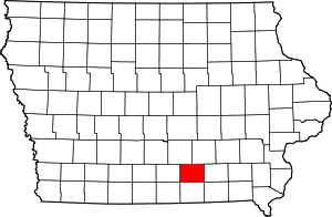 |
| Montgomery County |
137 |
Red Oak | 69 | Jan 15, 1851 | Polk County | Richard Montgomery, American Revolutionary War general | 80 |
7004107400000000000♠10,740 |
7002424000000000000♠424 sq mi
(7003109800000000000♠1,098 km2) | 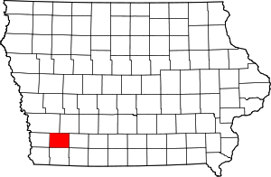 |
| Muscatine County |
139 |
Muscatine | 70 | Dec 7, 1836 | Des Moines County | debated, possibly Mascouten People | 77 |
7004427450000000000♠42,745 |
7002439000000000000♠439 sq mi
(7003113700000000000♠1,137 km2) | 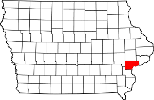 |
| O'Brien County |
141 |
Primghar | 71 | Jan 15, 1851 | Cherokee County | William Smith O'Brien, Irish revolutionary inspired by American democratic ideals | 13 |
7004143980000000000♠14,398 |
7002573000000000000♠573 sq mi
(7003148400000000000♠1,484 km2) | 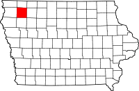 |
| Osceola County |
143 |
Sibley | 72 | Jan 15, 1851 | Woodbury County | Osceola, Seminole leader | 2 |
7003646200000000000♠6,462 |
7002399000000000000♠399 sq mi
(7003103300000000000♠1,033 km2) | 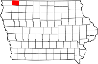 |
| Page County |
145 |
Clarinda | 73 | Feb 24, 1847 | Pottawattamie County | John Page, officer killed in Battle of Palo Alto, Mexican–American War | 91 |
7004159320000000000♠15,932 |
7002535000000000000♠535 sq mi
(7003138600000000000♠1,386 km2) | 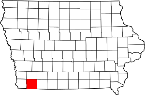 |
| Palo Alto County |
147 |
Emmetsburg | 74 | Jan 15, 1851 | Kossuth County | Battle of Palo Alto, Mexican–American War | 15 |
7003942100000000000♠9,421 |
7002564000000000000♠564 sq mi
(7003146100000000000♠1,461 km2) | 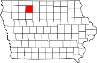 |
| Plymouth County |
149 |
Le Mars | 75 | Jan 15, 1851 | Woodbury County | Plymouth, Massachusetts | 22 |
7004249860000000000♠24,986 |
7002864000000000000♠864 sq mi
(7003223800000000000♠2,238 km2) | 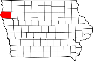 |
| Pocahontas County |
151 |
Pocahontas | 76 | Jan 15, 1851 | Greene County and Humboldt County | Pocahontas, famous Native American woman | 25 |
7003731000000000000♠7,310 |
7002578000000000000♠578 sq mi
(7003149700000000000♠1,497 km2) | 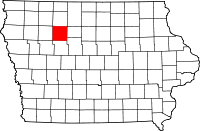 |
| Polk County |
153 |
Des Moines | 77 | January 13, 1846 | Native American lands | James K. Polk, US President | 60 |
7005430640000000000♠430,640 |
7002570000000000000♠570 sq mi
(7003147600000000000♠1,476 km2) | 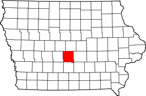 |
| Pottawattamie County |
155 |
Council Bluffs | 78 | Feb 24, 1847 | Native American lands | Potawatomi People | 67 |
7004931580000000000♠93,158 |
7002954000000000000♠954 sq mi
(7003247100000000000♠2,471 km2) | 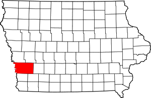 |
| Poweshiek County |
157 |
Montezuma | 79 | Feb 17, 1843 | Meskwaki lands | Chief Poweshiek, Meskwaki | 62 |
7004189140000000000♠18,914 |
7002585000000000000♠585 sq mi
(7003151500000000000♠1,515 km2) | 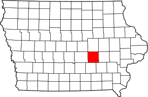 |
| Ringgold County |
159 |
Mount Ayr | 80 | Feb 24, 1847 | Taylor County | Samuel Ringgold, major killed in the Mexican–American War | 93 |
7003513100000000000♠5,131 |
7002538000000000000♠538 sq mi
(7003139300000000000♠1,393 km2) | 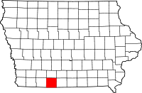 |
| Sac County |
161 |
Sac City | 81 | Jan 15, 1851 | Greene County | Sauk (Sac) People | 33 |
7004103500000000000♠10,350 |
7002576000000000000♠576 sq mi
(7003149200000000000♠1,492 km2) | 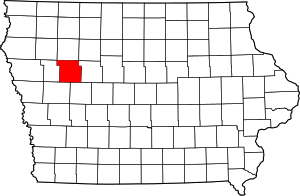 |
| Scott County |
163 |
Davenport | 82 | Dec 21, 1837 | Wisconsin Territory | Winfield Scott, War of 1812 General | 78 |
7005165224000000000♠165,224 |
7002458000000000000♠458 sq mi
(7003118600000000000♠1,186 km2) | 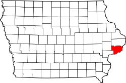 |
| Shelby County |
165 |
Harlan | 83 | Jan 15, 1851 | Cass County | Isaac Shelby, American Revolutionary War General, War of 1812 | 56 |
7004121670000000000♠12,167 |
7002591000000000000♠591 sq mi
(7003153100000000000♠1,531 km2) | 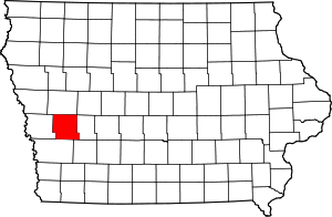 |
| Sioux County |
167 |
Orange City | 84 | Jan 15, 1851 | Plymouth County | Sioux People | 12 |
7004337040000000000♠33,704 |
7002768000000000000♠768 sq mi
(7003198900000000000♠1,989 km2) | 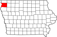 |
| Story County |
169 |
Nevada | 85 | Jan 13, 1846 | Boone County, Jasper County, and Polk County | Joseph Story, US Supreme Court Justice | 48 |
7004895420000000000♠89,542 |
7002573000000000000♠573 sq mi
(7003148400000000000♠1,484 km2) | 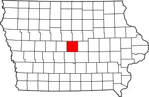 |
| Tama County |
171 |
Toledo | 86 | Feb 17, 1843 | Benton County and Boone County | Disputed, see reference[16] | 50 |
7004177670000000000♠17,767 |
7002721000000000000♠721 sq mi
(7003186700000000000♠1,867 km2) | 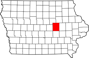 |
| Taylor County |
173 |
Bedford | 87 | February 24, 1847 | Page County | Zachary Taylor, US President | 92 |
7003631700000000000♠6,317 |
7002534000000000000♠534 sq mi
(7003138300000000000♠1,383 km2) | 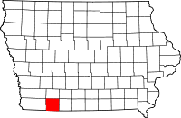 |
| Union County |
175 |
Creston | 88 | Jan 15, 1851 | Clarke County | The union of the states | 82 |
7004125340000000000♠12,534 |
7002424000000000000♠424 sq mi
(7003109800000000000♠1,098 km2) |  |
| Van Buren County |
177 |
Keosauqua | 89 | Dec 7, 1836 | Des Moines County | Martin Van Buren, US President | 98 |
7003757000000000000♠7,570 |
7002485000000000000♠485 sq mi
(7003125600000000000♠1,256 km2) | 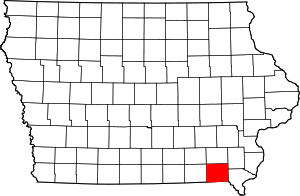 |
| Wapello County |
179 |
Ottumwa | 90 | Feb 17, 1843 | Native American lands | Chief Wapello | 86 |
7004356250000000000♠35,625 |
7002432000000000000♠432 sq mi
(7003111900000000000♠1,119 km2) | 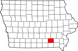 |
| Warren County |
181 |
Indianola | 91 | Jan 13, 1846 | Polk County | Joseph Warren, American Revolutionary War General | 71 |
7004462250000000000♠46,225 |
7002572000000000000♠572 sq mi
(7003148100000000000♠1,481 km2) | 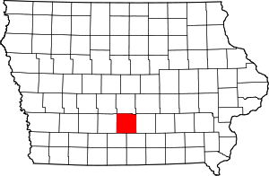 |
| Washington County |
183 |
Washington | 92 | Jan 25, 1839 | Wisconsin Territory | George Washington, US President | 75 |
7004217040000000000♠21,704 |
7002569000000000000♠569 sq mi
(7003147400000000000♠1,474 km2) | 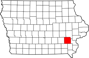 |
| Wayne County |
185 |
Corydon | 93 | Jan 13, 1846 | Appanoose County | Anthony Wayne, American Revolutionary War General | 95 |
7003640300000000000♠6,403 |
7002526000000000000♠526 sq mi
(7003136200000000000♠1,362 km2) | 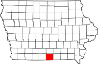 |
| Webster County |
187 |
Fort Dodge | 94 | Jan 12, 1853 | Risley County and Yell County (defunct IA counties)[17] | Daniel Webster, Massachusetts Senator | 35 |
7004380130000000000♠38,013 |
7002715000000000000♠715 sq mi
(7003185200000000000♠1,852 km2) | 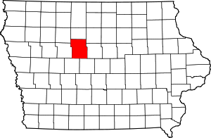 |
| Winnebago County |
189 |
Forest City | 95 | Jan 15, 1851 | Kossuth County | Winnebago (Ho–Chunk) People | 6 |
7004108660000000000♠10,866 |
7002400000000000000♠400 sq mi
(7003103600000000000♠1,036 km2) | 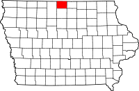 |
| Winneshiek County |
191 |
Decorah | 96 | Feb 20, 1847 | Native American lands | Chief Winneshiek | 10 |
7004210560000000000♠21,056 |
7002690000000000000♠690 sq mi
(7003178700000000000♠1,787 km2) | 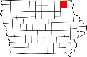 |
| Woodbury County |
193 |
Sioux City | 97 | Jan 12, 1853 | Wahkaw County (renamed), Polk County | Levi Woodbury, New Hampshire Governor | 31 |
7005102172000000000♠102,172 |
7002873000000000000♠873 sq mi
(7003226100000000000♠2,261 km2) | 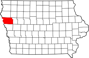 |
| Worth County |
195 |
Northwood | 98 | Jan 15, 1851 | Mitchell County | William Jenkins Worth, Black Hawk War and Mexican–American War officer | 7 |
7003759800000000000♠7,598 |
7002400000000000000♠400 sq mi
(7003103600000000000♠1,036 km2) |  |
| Wright County |
197 |
Clarion | 99 | Jan 15, 1851 | Webster County and Kossuth County | Silas Wright, New York Governor, and Joseph Albert Wright, Indiana Governor (brothers) | 27 |
7004132290000000000♠13,229 |
7002581000000000000♠581 sq mi
(7003150500000000000♠1,505 km2) |  |