List of counties in Arkansas
| Counties of Arkansas | |
|---|---|
| Location | State of Arkansas |
| Number | 75 |
| Populations | 5,368 (Calhoun) – 382,748 (Pulaski) |
| Areas | 526 square miles (1,360 km2) (Lafayette) – 1,039 square miles (2,690 km2) (Union) |
| Government | County government |
| Subdivisions | cities, towns, townships, unincorporated communities, census designated place |
| Part of a series on |
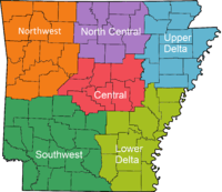
| Regions of Arkansas |
|---|
 |
|
Geographic Regions |
|
Administrative divisions
|
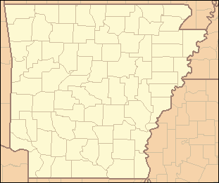
There are 75 counties in the U.S. state of Arkansas.[1] Arkansas is tied with Mississippi for the most counties with two county seats, at 10.
Counties
| County |
FIPS code | County seat[1] | Established[2] | Origin | Etymology[2] | Population[1] | Area[3] | Map |
|---|---|---|---|---|---|---|---|---|
| Arkansas County | 001 | De Witt and Stuttgart | December 13, 1813 | 1st County (Eastern Arkansas) | A variant pronunciation of the Quapaw Native American people | 19,019 | 1,033.79 sq mi (2,678 km2) |  |
| Ashley County | 003 | Hamburg | November 30, 1848 | Chicot, Drew and Union counties | Chester Ashley (1791–1848), a U.S. Senator from Arkansas | 21,853 | 939.08 sq mi (2,432 km2) |  |
| Baxter County | 005 | Mountain Home | March 24, 1873 | Fulton, Izard, Marion, and Searcy counties | Elisha Baxter (1827–1899), a Governor of Arkansas | 41,513 | 586.74 sq mi (1,520 km2) |  |
| Benton County | 007 | Bentonville | September 30, 1836 | Washington County | Thomas H. Benton (1782–1858), a U.S. Senator from Missouri | 221,339 | 884.86 sq mi (2,292 km2) |  |
| Boone County | 009 | Harrison | April 9, 1869 | Carroll and Marion counties | Some historians say Daniel Boone (1734–1820), the American frontiersman | 36,903 | 601.82 sq mi (1,559 km2) |  |
| Bradley County | 011 | Warren | December 18, 1840 | Union County | Hugh Bradley, a soldier in the War of 1812 and early area settler | 11,508 | 654.38 sq mi (1,695 km2) | 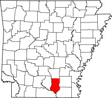 |
| Calhoun County | 013 | Hampton | December 6, 1850 | Dallas and Ouachita counties | John C. Calhoun (1782–1850), 7th Vice President of the United States and a Senator from South Carolina | 5,368 | 632.54 sq mi (1,638 km2) | 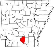 |
| Carroll County | 015 | Berryville and Eureka Springs | November 1, 1833 | Izard County and later by Madison County (1870) | Charles Carroll of Carrollton (1737–1832), a signer of the Declaration of Independence | 27,446 | 638.81 sq mi (1,655 km2) |  |
| Chicot County | 017 | Lake Village | October 15, 1823 | Arkansas County | Point Chicot on the Mississippi River | 11,800 | 690.88 sq mi (1,789 km2) | 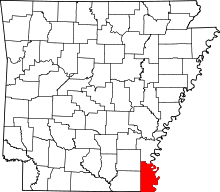 |
| Clark County | 019 | Arkadelphia | December 15, 1818 | Arkansas (1818) | William Clark (1770–1838), explorer and Governor of the Missouri Territory | 22,995 | 882.60 sq mi (2,286 km2) | 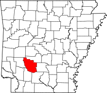 |
| Clay County | 021 | Piggott and Corning | March 24, 1873 | Randolph and Greene counties, and originally named Clayton before 1875 | John Clayton, a State Senator; later shortened to Clay to avoid misassociation with Powell Clayton |
16,083 | 641.42 sq mi (1,661 km2) | 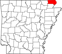 |
| Cleburne County | 023 | Heber Springs | February 20, 1883 | White, Van Buren, and Independence counties | Patrick Cleburne (1828–1864), a Confederate General in the Civil War | 25,970 | 591.91 sq mi (1,533 km2) | 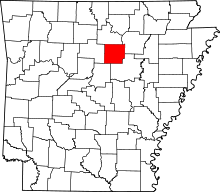 |
| Cleveland County | 025 | Rison | April 17, 1873 | Bradley, Dallas, Jefferson counties, and formerly named Dorsey County (from 1885) | Grover Cleveland (1837–1908), 22nd and 24th President of the United States (formerly Stephen Dorsey, U.S. Senator from Arkansas) |
8,689 | 598.80 sq mi (1,551 km2) | 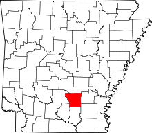 |
| Columbia County | 027 | Magnolia | December 17, 1852 | Formed from Lafayette, Hempstead, and Ouachita counties | Columbia, a female personification of the United States | 24,552 | 766.86 sq mi (1,986 km2) | 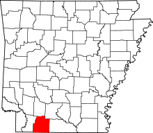 |
| Conway County | 029 | Morrilton | October 20, 1825 | Pulaski County | Henry Wharton Conway (1793–1827), territorial delegate to the United States House of Representatives | 21,273 | 566.66 sq mi (1,468 km2) | 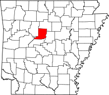 |
| Craighead County | 031 | Jonesboro and Lake City | February 19, 1859 | Mississippi, Greene, Poinsett counties | Thomas Craighead (1798–1862), a state senator who ironically opposed the creation of the county | 96,443 | 712.98 sq mi (1,847 km2) | 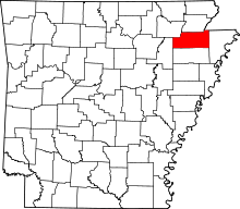 |
| Crawford County | 033 | Van Buren | October 18, 1820 | Pulaski County | William H. Crawford (1772–1834), a politician who served as Secretary of the Treasury and Secretary of War | 61,948 | 604.20 sq mi (1,565 km2) | 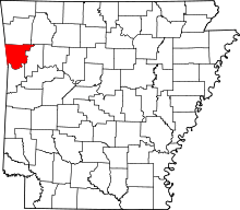 |
| Crittenden County | 035 | Marion | October 22, 1825 | Phillips County | Robert Crittenden (1797–1834), Governor of the Arkansas Territory | 50,902 | 636.74 sq mi (1,649 km2) | 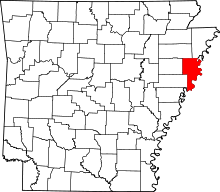 |
| Cross County | 037 | Wynne | November 15, 1862 | St. Francis, Poinsett, and Crittenden counties | David C. Cross, a Confederate soldier in the Civil War and local politician | 17,870 | 622.33 sq mi (1,612 km2) | 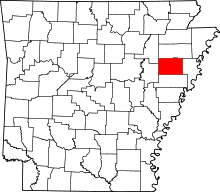 |
| Dallas County | 039 | Fordyce | January 1, 1845 | Clark and Bradley counties | George M. Dallas (1792–1864), 11th Vice President of the United States | 8,116 | 668.16 sq mi (1,731 km2) | 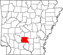 |
| Desha County | 041 | Arkansas City | December 12, 1838 | Arkansas, Union counties, then from Chicot County (prior to 1880), and Lincoln (prior 1930) | Benjamin Desha, a soldier in the War of 1812 | 13,008 | 819.52 sq mi (2,123 km2) | 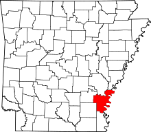 |
| Drew County | 043 | Monticello | November 26, 1846 | Bradley, Chicot, Desha, Union counties | Thomas Stevenson Drew (1802–1879), 3rd Governor of Arkansas | 18,509 | 835.65 sq mi (2,164 km2) | 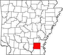 |
| Faulkner County | 045 | Conway | April 12, 1873 | Pulaski and Conway counties | Sanford Faulkner (1806–1874), a Confederate soldier and the composer of the song "The Arkansas Traveler" | 113,237 | 664.01 sq mi (1,720 km2) | 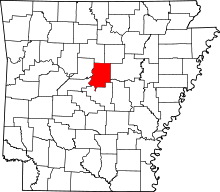 |
| Franklin County | 047 | Ozark and Charleston | December 19, 1837 | Crawford and Johnson counties | Benjamin Franklin (1706–1790), founding father of the United States | 18,125 | 619.69 sq mi (1,605 km2) | 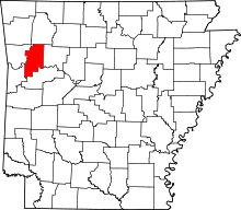 |
| Fulton County | 049 | Salem | December 21, 1842 | Izard County and then later from Lawrence County (prior 1850) | William Savin Fulton (1795–1844), the last Governor of the Arkansas Territory prior to statehood | 12,245 | 620.32 sq mi (1,607 km2) | 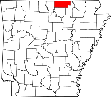 |
| Garland County | 051 | Hot Springs | April 5, 1873 | Montgomery, Hot Spring, and Saline counties | Augustus Hill Garland (1832–1899), U.S. Senator and 11th Governor of Arkansas | 96,024 | 734.57 sq mi (1,903 km2) | 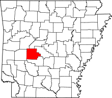 |
| Grant County | 053 | Sheridan | February 4, 1869 | Jefferson, Hot Spring, Saline counties | Ulysses S. Grant (1822–1885), 18th President of the United States | 17,853 | 633.01 sq mi (1,639 km2) | 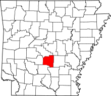 |
| Greene County | 055 | Paragould | November 5, 1833 | Lawrence County and later on by Randolph | Nathanael Greene (1742–1786), the Revolutionary War General | 42,090 | 579.65 sq mi (1,501 km2) | 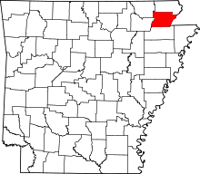 |
| Hempstead County | 057 | Hope | December 15, 1818 | Arkansas (1818) | Edward Hempstead (1780–1817), Delegate to the U.S. House of Representatives from the Missouri Territory | 22,609 | 741.36 sq mi (1,920 km2) | 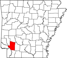 |
| Hot Spring County | 059 | Malvern | November 2, 1829 | Clark County and later from Montgomery County (prior 1880) | Naturally occurring hot springs within the county[Note 1] | 32,923 | 622.16 sq mi (1,611 km2) |  |
| Howard County | 061 | Nashville | April 17, 1873 | Pike, Hempstead, Polk, Sevier counties. | James H. Howard, an Arkansas State Senator | 13,789 | 595.20 sq mi (1,542 km2) |  |
| Independence County | 063 | Batesville | October 20, 1820 | Lawrence County (1820) | The Declaration of Independence | 36,647 | 771.57 sq mi (1,998 km2) |  |
| Izard County | 065 | Melbourne | October 27, 1825 | Independence, Crawford counties, and later from Fulton (prior 1880) | George Izard (1776–1828), Governor of the Arkansas Territory and a General during the War of 1812 | 13,696 | 584.02 sq mi (1,513 km2) |  |
| Jackson County | 067 | Newport | November 5, 1829 | Lawrence and St. Francis counties | Andrew Jackson (1767–1845), 7th President of the United States | 17,997 | 641.45 sq mi (1,661 km2) |  |
| Jefferson County | 069 | Pine Bluff | November 2, 1829 | Arkansas and Pulaski | Thomas Jefferson (1743–1826), 3rd President of the United States | 77,435 | 913.70 sq mi (2,366 km2) |  |
| Johnson County | 071 | Clarksville | November 16, 1833 | Pope County, and a small portion from Madison County (prior 1890) | Benjamin Johnson (1784–1849), the first judge of the federal district court for Arkansas | 25,540 | 682.74 sq mi (1,768 km2) |  |
| Lafayette County | 073 | Lewisville | October 15, 1827 | Hempstead County and later from Columbia County (prior 1910) | Gilbert du Motier, marquis de Lafayette (1757–1834), a Frenchman who served as a General in the Continental Army during the Revolutionary War | 7,645 | 545.07 sq mi (1,412 km2) |  |
| Lawrence County | 075 | Walnut Ridge | January 15, 1815 | Arkansas and New Madrid (MO) in 1815 | James Lawrence (1781–1813), an American naval officer during the War of 1812 | 17,415 | 592.34 sq mi (1,534 km2) |  |
| Lee County | 077 | Marianna | April 17, 1873 | Phillips, Monroe, Crittenden, and St. Francis counties. | Robert E. Lee (1807–1870), a confederate General during the Civil War | 10,424 | 619.47 sq mi (1,604 km2) |  |
| Lincoln County | 079 | Star City | March 28, 1871 | Arkansas, Bradley, Desha, Drew, and Jefferson counties | Abraham Lincoln (1809–1865), 16th President of the United States | 14,134 | 572.17 sq mi (1,482 km2) |  |
| Little River County | 081 | Ashdown | March 5, 1867 | Sevier County | Little River, a tributary of the Red River | 13,171 | 564.87 sq mi (1,463 km2) |  |
| Logan County | 083 | Booneville and Paris | March 22, 1871 | Franklin, Johnson, Pope, Scott, and Yell counties (Formally named Sarber County) | James Logan (1791–1859), an early settler of western Arkansas | 22,353 | 731.50 sq mi (1,895 km2) | 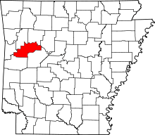 |
| Lonoke County | 085 | Lonoke | April 16, 1873 | Prairie and Pulaski counties | An oak tree that stood on the site of the current county seat | 68,356 | 802.43 sq mi (2,078 km2) | 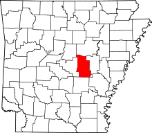 |
| Madison County | 087 | Huntsville | September 30, 1836 | Washington County | James Madison (1751–1836), 4th President of the United States | 15,717 | 837.06 sq mi (2,168 km2) | 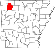 |
| Marion County | 089 | Yellville | November 3, 1835 | Izard County | Francis Marion (1732–1795), an American general during the Revolutionary War | 16,653 | 640.39 sq mi (1,659 km2) | 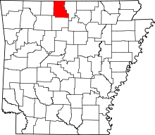 |
| Miller County | 091 | Texarkana | April 1, 1820[Note 2] | Lafayette County | Former Miller County, Arkansas Territory (1820-38), which was named for James Miller (1776–1851), first Governor of the Arkansas Territory |
43,462 | 637.48 sq mi (1,651 km2) | 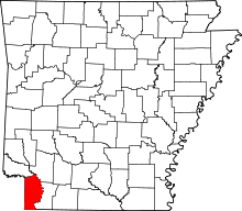 |
| Mississippi County | 093 | Blytheville and Osceola | November 1, 1833 | Crittenden | the Mississippi River | 46,480 | 919.73 sq mi (2,382 km2) | 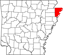 |
| Monroe County | 095 | Clarendon | November 2, 1829[4] | Phillips and Arkansas counties | James Monroe (1758–1831), 5th President of the United States | 8,149 | 621.41 sq mi (1,609 km2) | 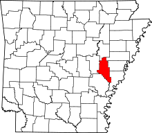 |
| Montgomery County | 097 | Mount Ida | December 9, 1842 | Hot Spring | Richard Montgomery (1738–1775), an American general during the Revolutionary War | 9,487 | 800.29 sq mi (2,073 km2) | 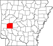 |
| Nevada County | 099 | Prescott | March 20, 1871 | Columbia, Hempstead, Ouachita counties | the state of Nevada, which has a similar outline to the county's boundaries | 8,997 | 620.78 sq mi (1,608 km2) | 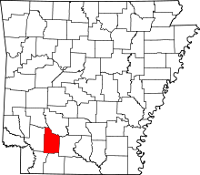 |
| Newton County | 101 | Jasper | December 14, 1842 | Carroll | Thomas W. Newton (1804–1853), a State Senator and member of the United States House of Representatives from Arkansas | 8,330 | 823.18 sq mi (2,132 km2) | 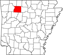 |
| Ouachita County | 103 | Camden | November 29, 1842 | Union | the Ouachita River | 26,120 | 739.63 sq mi (1,916 km2) | 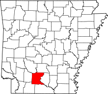 |
| Perry County | 105 | Perryville | December 18, 1840 | Conway County | Oliver Hazard Perry (1785–1819), a naval officer in the War of 1812 | 10,445 | 560.47 sq mi (1,452 km2) | 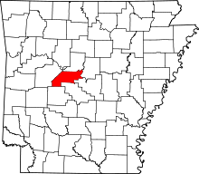 |
| Phillips County | 107 | Helena | May 1, 1820 | Arkansas and Lawrence County | Sylvanus Phillips, a member of the territorial legislature | 21,757 | 727.29 sq mi (1,884 km2) | 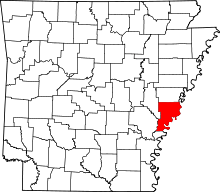 |
| Pike County | 109 | Murfreesboro | November 1, 1833 | Clark and Hempstead counties | Zebulon Pike (1779–1813), the explorer and discoverer of Pikes Peak | 11,291 | 613.88 sq mi (1,590 km2) | 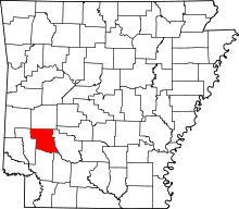 |
| Poinsett County | 111 | Harrisburg | February 28, 1838 | Greene, Lawrence counties | Joel Poinsett (1779–1851), a United States Secretary of War and namesake of the poinsettia | 24,583 | 763.39 sq mi (1,977 km2) | 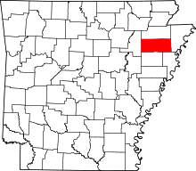 |
| Polk County | 113 | Mena | November 30, 1844 | Sevier | James K. Polk (1795–1849), the eleventh president of the United States | 20,662 | 862.42 sq mi (2,234 km2) | 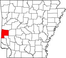 |
| Pope County | 115 | Russellville | November 2, 1829 | Crawford County | John Pope (1770–1845), a governor of the Arkansas Territory | 61,754 | 830.79 sq mi (2,152 km2) | 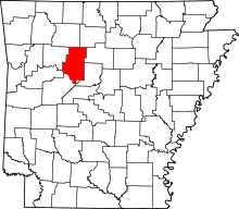 |
| Prairie County | 117 | Des Arc and DeValls Bluff | October 25, 1846 | Arkansas and Pulaski counties | Grand Prairie of eastern Arkansas | 8,715 | 675.76 sq mi (1,750 km2) | 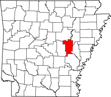 |
| Pulaski County | 119 | Little Rock | December 15, 1818 | Arkansas and Lawrence counties (1818) | Kazimierz Pulaski (1745–1779), the Polish general in the American Revolutionary War | 382,748 | 807.84 sq mi (2,092 km2) | 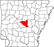 |
| Randolph County | 121 | Pocahontas | October 29, 1835 | Lawrence County | John Randolph of Roanoke (1773–1833), a U.S. congressman from Virginia | 17,969 | 656.04 sq mi (1,699 km2) | 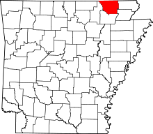 |
| St. Francis County | 123 | Forrest City | October 13, 1827 | Formed from Phillips County | The St. Francis River, a tributary of the Mississippi River | 28,258 | 642.40 sq mi (1,664 km2) |  |
| Saline County | 125 | Benton | November 2, 1835 | Independence and Pulaski | Salt reserves found within its borders | 107,118 | 730.46 sq mi (1,892 km2) |  |
| Scott County | 127 | Waldron | November 5, 1833 | Crawford and Pope counties | Andrew Scott (1789–1841), a judge of the Supreme Court of Arkansas Territory | 11,233 | 898.09 sq mi (2,326 km2) |  |
| Searcy County | 129 | Marshall | December 13, 1838 | Marion County | Richard Searcy, a judge from Lawrence County | 8,195 | 668.51 sq mi (1,731 km2) |  |
| Sebastian County | 131 | Greenwood and Fort Smith | January 6, 1851 | Crawford and Scott | William K. Sebastian (1812–1865), a U.S. Circuit Court judge from Arkansas | 125,744 | 546.04 sq mi (1,414 km2) | 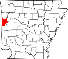 |
| Sevier County | 133 | De Queen | October 17, 1828 | Hempstead County | Ambrose Sevier (1801–1848), a U.S. Senator from Arkansas | 17,058 | 581.35 sq mi (1,506 km2) | 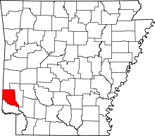 |
| Sharp County | 135 | Ash Flat | July 18, 1868 | Lawrence County | Ephraim Sharp, an early settler and state legislator from the area | 17,264 | 606.35 sq mi (1,570 km2) |  |
| Stone County | 137 | Mountain View | April 21, 1873 | Izard, Independence, Searcy, Van Buren | Rugged, rocky area terrain | 12,394 | 609.43 sq mi (1,578 km2) |  |
| Union County | 139 | El Dorado | November 2, 1829 | Clark and Hempstead counties | Petition of citizens in the Spirit of "Union and Unity" | 41,639 | 1,055.27 sq mi (2,733 km2) |  |
| Van Buren County | 141 | Clinton | November 11, 1833 | Conway, Izard, and Independence | Martin Van Buren (1782–1862), eighth president of the United States | 17,295 | 724.32 sq mi (1,876 km2) | 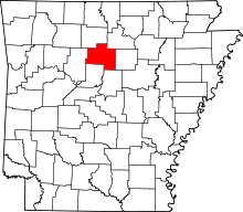 |
| Washington County | 143 | Fayetteville | October 17, 1828 | Lovely County | George Washington (1732–1799), first president of the United States | 203,065 | 951.72 sq mi (2,465 km2) |  |
| White County | 145 | Searcy | October 23, 1835 | Independence, Jackson and Pulaski counties | Hugh L. White (1773–1840), U.S. Senator from Tennessee and U.S. presidential candidate in 1836 for the Whig Party | 77,076 | 1,042.36 sq mi (2,700 km2) |  |
| Woodruff County | 147 | Augusta | November 26, 1862 | Jackson and St. Francis counties | William Woodruff (1795–1885), the first newspaper publisher in Arkansas | 7,260 | 594.05 sq mi (1,539 km2) |  |
| Yell County | 149 | Danville and Dardanelle | December 5, 1840 | Hot Spring, Pope, and Scott County | Archibald Yell (1797–1847), the second governor of Arkansas | 22,185 | 948.84 sq mi (2,457 km2) |  |
Former counties in Arkansas
Lovely County (1827–1828)
Created on October 13, 1827, partitioned from Crawford County. The Treaty of Washington, 1828 ceded most of its territory to Indian Territory. Abolished October 17, 1828 with the remaining portion becoming Washington County.[5]
Miller County, Arkansas Territory (1820-38)
Created from Hempstead County. Most of its northern portion was in Choctaw Nation (now part of Oklahoma); rest of northern portion was dissolved into Sevier County in 1828. All of its southern portion was in Texas, and was nominally dissolved into Lafayette County in 1838.
Fictional counties in Arkansas
Bogan County
A fictional county in Arkansas as portrayed in the movie White Lightning and in the movie Dark Night of the Scarecrow.
Deeson County
A fictional county in southwest Arkansas near the intersection of Highway 71 and Interstate 82 as portrayed in the movie Smokey and the Bandit.
Green River County
A fictional county in Arkansas portrayed in the series Supernatural. Sam and Dean were arrested in Little Rock (which is located in Pulaski County), but were sent to Green River County Detention.
Notes
References
- 1 2 3 "Find A County". National Association of Counties. Retrieved 2012-04-07.
- 1 2 Office of the Arkansas Secretary of State (1998). Runnells, Jonathon, ed. Historical Report of the Arkansas Secretary of State. Little Rock: Office of the Arkansas Secretary of State. pp. 90–91. LCCN 98-67362. OCLC 40157815.
- ↑ Arkansas State Highway and Transportation Department in cooperation with the U.S. Department of Transportation (2014-10-16). Arkansas County Polygons (SHP file) (Map). Arkansas GIS Office. Retrieved January 1, 2017.
- ↑ Goodspeed, Weston Arthur, ed. (1904). The Province and the States: A History of the Province of Louisiana Under France and Spain, and of the Territories and States of the United States Formed Therefrom. VII. Madison, WI: The Western Historical Association. p. 107. Retrieved 2012-05-09.
- ↑ McConaughy, James. "Lovely County, Arkansas". Washington County Arkansas Genealogical Society (WCAGS). Retrieved 2012-05-08.