McPherson County, Nebraska
| McPherson County, Nebraska | |
|---|---|
 McPherson County Courthouse in Tryon | |
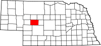 Location in the U.S. state of Nebraska | |
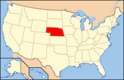 Nebraska's location in the U.S. | |
| Founded | 1890 |
| Named for | James B. McPherson |
| Seat | Tryon |
| Largest community | Tryon |
| Area | |
| • Total | 860 sq mi (2,227 km2) |
| • Land | 859 sq mi (2,225 km2) |
| • Water | 1.0 sq mi (3 km2), 0.1% |
| Population (est.) | |
| • (2017) | 499[1] |
| • Density | 0.6/sq mi (0.2/km2) |
| Congressional district | 3rd |
| Time zone | Central: UTC−6/−5 |
| Website |
www |
McPherson County is a county in the U.S. state of Nebraska. As of the 2010 census, the population was 539,[2] making it the third-least populous county in Nebraska and the eighth-least populous county in the United States. Its county seat is Tryon.[3] The county was formed in 1890 from Logan County and named after Union General James B. McPherson.[4] At the time of its establishment, the county included the land which would become Arthur County in 1913.
McPherson County is part of the North Platte, NE Micropolitan Statistical Area.
In the Nebraska license plate system, McPherson County is represented by the prefix 90 (it ranked 90th of 93 counties in the number of vehicles registered when the license plate system was established in 1922).
Geography
According to the U.S. Census Bureau, the county has a total area of 860 square miles (2,200 km2), of which 859 square miles (2,220 km2) is land and 1.0 square mile (2.6 km2) (0.1%) is water.[5]
Transportation
Major highways
Demographics
| Historical population | |||
|---|---|---|---|
| Census | Pop. | %± | |
| 1890 | 401 | — | |
| 1900 | 517 | 28.9% | |
| 1910 | 2,470 | 377.8% | |
| 1920 | 1,692 | −31.5% | |
| 1930 | 1,358 | −19.7% | |
| 1940 | 1,175 | −13.5% | |
| 1950 | 825 | −29.8% | |
| 1960 | 735 | −10.9% | |
| 1970 | 623 | −15.2% | |
| 1980 | 593 | −4.8% | |
| 1990 | 546 | −7.9% | |
| 2000 | 533 | −2.4% | |
| 2010 | 539 | 1.1% | |
| Est. 2017 | 499 | [6] | −7.4% |
| U.S. Decennial Census[7] 1790-1960[8] 1900-1990[9] 1990-2000[10] 2010-2013[2] | |||
As of the census[11] of 2000, there were 533 people, 202 households, and 157 families residing in the county. The population density was 1 people per square mile (0/km²). There were 283 housing units at an average density of 0 per square mile (0/km²). The racial makeup of the county was 97.94% White, 0.38% Asian, 1.69% from other races. 1.50% of the population were Hispanic or Latino of any race. 44.4% were of German, 14.4% American, 9.2% Irish, 8.7% Swedish and 6.3% English ancestry according to Census 2000.
There were 202 households out of which 34.20% had children under the age of 18 living with them, 73.80% were married couples living together, 3.50% had a female householder with no husband present, and 21.80% were non-families. 19.80% of all households were made up of individuals and 14.40% had someone living alone who was 65 years of age or older. The average household size was 2.64 and the average family size was 3.01.
In the county, the population was spread out with 27.60% under the age of 18, 5.30% from 18 to 24, 26.10% from 25 to 44, 22.90% from 45 to 64, and 18.20% who were 65 years of age or older. The median age was 41 years. For every 100 females, there were 99.60 males. For every 100 females age 18 and over, there were 97.90 males. The median income for a household in the county was $25,750, and the median income for a family was $31,250. Males had a median income of $25,192 versus $13,393 for females. The per capita income for the county was $13,055. 16.20% of the population and 14.00% of families were below the poverty line. Out of the total people living in poverty, 21.70% are under the age of 18 and 17.30% are 65 or older.
Communities
Cities and towns
Adjacent counties
- Hooker County - north
- Thomas County - northeast
- Logan County - east
- Lincoln County - southeast
- Keith County - southwest
- Arthur County - west
References
- ↑ https://www.census.gov/quickfacts/fact/table/mcphersoncountynebraska/PST045216
- 1 2 "State & County QuickFacts". United States Census Bureau. Archived from the original on July 14, 2011. Retrieved September 21, 2013.
- ↑ "Find a County". National Association of Counties. Retrieved 2011-06-07.
- ↑ Gannett, Henry (1905). The Origin of Certain Place Names in the United States. U.S. Government Printing Office. p. 195.
- ↑ "2010 Census Gazetteer Files". United States Census Bureau. August 22, 2012. Archived from the original on November 13, 2013. Retrieved December 9, 2014.
- ↑ "Population and Housing Unit Estimates". Retrieved June 9, 2017.
- ↑ "U.S. Decennial Census". United States Census Bureau. Retrieved December 9, 2014.
- ↑ "Historical Census Browser". University of Virginia Library. Retrieved December 9, 2014.
- ↑ "Population of Counties by Decennial Census: 1900 to 1990". United States Census Bureau. Retrieved December 9, 2014.
- ↑ "Census 2000 PHC-T-4. Ranking Tables for Counties: 1990 and 2000" (PDF). United States Census Bureau. Retrieved December 9, 2014.
- ↑ "American FactFinder". United States Census Bureau. Retrieved 2011-05-14.
Places adjacent to McPherson County, Nebraska | ||||||||||
|---|---|---|---|---|---|---|---|---|---|---|
| ||||||||||
Municipalities and communities of McPherson County, Nebraska, United States | ||
|---|---|---|
| CDP | ||
| Unincorporated communities | ||