Loving County, Texas
| Loving County, Texas | |
|---|---|
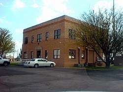 Loving County Courthouse in Mentone | |
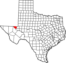 Location in the U.S. state of Texas | |
 Texas's location in the U.S. | |
| Founded | 1931 |
| Named for | Oliver Loving |
| Seat | Mentone |
| Largest community | Mentone |
| Area | |
| • Total | 677 sq mi (1,753 km2) |
| • Land | 669 sq mi (1,733 km2) |
| • Water | 7.8 sq mi (20 km2), 1.1% |
| Population (est.) | |
| • (2017) | 134 |
| • Density | 0.2/sq mi (0.08/km2) |
| Congressional district | 23rd |
| Time zone | Central: UTC−6/−5 |
| Website |
www |
Loving County is a county in the U.S. state of Texas. With a population of 134 as of a 2017 estimate by the United States Census Bureau, Loving County is the second least populous county in the United States after Kalawao County, Hawaii which has a population of 88.[1] Loving County has no incorporated communities; its county seat and only community is Mentone.[2] The county was originally created in 1887, although after being disorganized, it was finally reorganized in 1931.[3]
History
Prehistorically, the area had many springs with potable water that supported wildlife and nomadic hunters. Antonio de Espejo visited the area in 1583 and crossed the Pecos River. Having surveyed the area in 1854 for a railroad company, John Pope returned in 1855 to start a camp in northwestern Loving County and establish artesian wells in the area, but the venture was unsuccessful and was abandoned in 1861.
From 1837 to 1874, the area of modern Loving County was part of the Bexar land district. In 1874 it was separated from Bexar County, becoming a part of Tom Green County.
Loving County is named for Oliver Loving,[4] a cattle rancher and pioneer of the cattle drive who, along with Charles Goodnight, developed the Goodnight-Loving Trail. He was mortally wounded by members of the Comanche nation while on a cattle drive in 1867 in the vicinity of the county.
Loving is the only county in Texas to be incorporated twice, first in 1893 and again in 1931. Its initial organization was effected by a canal company founded in Denver, Colorado, and appears to have been based upon fraud and willful misrepresentations made by the founders to state officials.[5] After a local landowner hired a New York City firm to investigate alleged improprieties in county government, the company's organizers fled, taking with them all the county records. The state legislature subsequently disincorporated Loving in 1897, attaching it to Reeves County.
Oil was discovered in 1921, leading to a population increase in Loving County. By 1930, there were 195 residents, mostly living in what would become the town of Mentone, which became the county seat when Loving was reconstituted in 1931. By 1933, the population had peaked at 600, only to begin a steady decline which had continued until recently.
Loving County was the home of the first elected female sheriff in Texas, Edna Reed Clayton Dewees. Dewees was appointed to the job in January 1945, then won an election to continue in the office through 1947. She never carried a firearm, and reported only two arrests during her entire term. Later she would return as a county district clerk, a job she held from 1965 to 1986. After retirement she lived on a ranch near Mentone[6] until 22 January 2009 when she died in Del Rio.[7]

Geography
According to the U.S. Census Bureau, the county has a total area of 677 square miles (1,750 km2), of which 669 square miles (1,730 km2) is land and 7.8 square miles (20 km2) (1.1%) is water.[8]
The Pecos River is the county's western boundary, forming the Red Bluff Reservoir along its northwestern border with Reeves County, Texas and Eddy County, New Mexico. The terrain of Loving County is described as flat desert, with a few low hills. Desert shrubs, range grass and cacti abound, with salt cedars along the river. Elevations vary from 2,686 to 3,311 feet (1,009 m) above sea level.
Loving is the smallest county by area in the Permian Basin region.
Major highways
Adjacent counties
- Lea County, New Mexico (north/Mountain Time Zone)
- Winkler County (east)
- Ward County (southeast)
- Reeves County (southwest)
- Eddy County, New Mexico (northwest/Mountain Time Zone)
Demographics
| Historical population | |||
|---|---|---|---|
| Census | Pop. | %± | |
| 1940 | 285 | — | |
| 1950 | 227 | −20.4% | |
| 1960 | 226 | −0.4% | |
| 1970 | 164 | −27.4% | |
| 1980 | 91 | −44.5% | |
| 1990 | 107 | 17.6% | |
| 2000 | 67 | −37.4% | |
| 2010 | 82 | 22.4% | |
| Est. 2017 | 134 | [1] | 63.4% |
| U.S. Decennial Census[9] 1850–2010[10] 2010–2014[11] | |||
As of the census of 2000, there were 67 people, 31 households, and 19 families living in the county. The population density was 0.2 people per square mile (0.08/km2). There were 70 housing units at an average density of 0.1 per square mile (0.04/km2). Of the 67 residents, 60 identified as White, no person identified themselves as Black, African American, Native American, Asian, or Pacific Islander. 6 identified as "some other race", and 1 person identified as belonging to two or more races. In addition, 7 people identified as being of Hispanic, Latino, or Spanish origin of any race. It is one of only a few counties in the U.S.—outside of the Northeast—where the largest self-identified ancestry group is Irish American.
There were 31 households out of which 5 had children under the age of 18 living with them, 17 were married couples living together, 2 had a female householder with no husband present, and 11 were non-families. Ten households were made up of individuals and 2 consisted of someone living alone who is 65 years of age or older. Average household size was 2.16, while the average family size was 2.65.
In the county, the population was spread out with 13 people under the age of 18, one between 18 and 24, 18 from 25 to 44, 24 from 45 to 64, and 11 who were 65 years of age or older. The median age was 46 years. For every 10 females there are 11.61 males. For every 10 females age 18 and over, there are 12.50 males.
The median income for a household in the county was $40,000, and the median income for a family was $53,750. Males had a median income of $25,833 versus $0 for females. The per capita income for the county was $24,084.
Owing partly to its small and dispersed population, it also has the highest median per capita and household income of any county in Texas.[12][13]
Loving County was the only county in the United States with no people below the poverty line as of 2000.[14] However, as of 2010, this is no longer true.[15]
The county had been the least populous county in the United States, with a 2010 census population of only 82 persons (an increase of 22.4% over the 2000 figure of 67 residents), but the 2015 estimate by the US Census Bureau places it as the second least populous county in the US.[16] With an average of only 0.0646 inhabitants/km2 (0.167/sq mi) as of 2015, the county is also the least densely populated county outside of Alaska. (Lake and Peninsula Borough and North Slope Borough in Alaska are both lower, as is the Yukon-Koyukuk Census Area, which is not a county.)
Politics
Loving County has voted for the Republican candidate in every presidential election since 1972, except in 1992 when the county backed independent candidate Ross Perot. The county also backed a third-party candidate in 1968, supporting George Wallace.
There have been allegations of voter fraud in Loving County, going back as far as the 1940s.[17]
| Year | Republican | Democratic | Third parties |
|---|---|---|---|
| 2016 | 89.2% 58 | 6.2% 4 | 4.6% 3 |
| 2012 | 84.4% 54 | 14.1% 9 | 1.6% 1 |
| 2008 | 84.8% 67 | 15.2% 12 | |
| 2004 | 81.3% 65 | 15.0% 12 | 3.8% 3 |
| 2000 | 79.5% 124 | 18.6% 29 | 1.9% 3 |
| 1996 | 62.3% 48 | 18.2% 14 | 19.5% 15 |
| 1992 | 32.3% 31 | 20.8% 20 | 46.9% 45 |
| 1988 | 70.1% 54 | 29.9% 23 | |
| 1984 | 78.1% 57 | 21.9% 16 | |
| 1980 | 69.4% 50 | 30.6% 22 | |
| 1976 | 54.7% 47 | 40.7% 35 | 4.7% 4 |
| 1972 | 88.7% 55 | 11.3% 7 | |
| 1968 | 28.4% 23 | 22.2% 18 | 49.4% 40 |
| 1964 | 40.5% 32 | 58.2% 46 | 1.3% 1 |
| 1960 | 44.2% 42 | 48.4% 46 | 7.4% 7 |
| 1956 | 60.4% 55 | 39.6% 36 | |
| 1952 | 74.7% 71 | 25.3% 24 | |
| 1948 | 30.5% 29 | 65.3% 62 | 4.2% 4 |
| 1944 | 21.4% 18 | 71.4% 60 | 7.1% 6 |
| 1940 | 17.7% 21 | 82.4% 98 | |
| 1936 | 12.88% 21 | 72.39% 118 | 14.72% 24 |
| 1932 | 12.56% 27 | 86.97% 187 | 0.46% 1 |
| 1928 | 37.5% 6 | 62.5% 10 | |
| 1924 | 14.286% 2 | 85.714% 12 |
Economy
Loving County's economy is based almost entirely upon oil and gas drilling, ranching, and county services.
Education
Loving County is served by the Wink-Loving Independent School District. The county's school system was closed and consolidated into Wink's ISD in 1972 because the enrollment had fallen to two pupils.
Communities
Census-designated place
Ghost towns
- Arno
- Porterville
- Hay Flat (partly in Winkler County)
In popular culture
"Loving County" is the name of a song written and performed by Charlie Robison. It appears on his 1998 album Life of the Party.[19]
See also
References
- 1 2 "Population and Housing Unit Estimates". Retrieved June 9, 2017.
- ↑ "Find a County". National Association of Counties. Retrieved 2011-06-07.
- ↑ "Texas: Individual County Chronologies". Texas Atlas of Historical County Boundaries. The Newberry Library. 2008. Retrieved May 25, 2015.
- ↑ Gannett, Henry (1905). The Origin of Certain Place Names in the United States. U.S. Government Printing Office. p. 191.
- ↑ Loving County - Handbook of Texas
- ↑ Odessa American Includes details on Edna Dewees, first elected female sheriff in Texas
- ↑ http://delrionewsherald.com/story.lasso?ewcd=5d7ce5b73f13a119%5Bpermanent+dead+link%5D
- ↑ "2010 Census Gazetteer Files". United States Census Bureau. August 22, 2012. Retrieved May 3, 2015.
- ↑ "U.S. Decennial Census". United States Census Bureau. Retrieved May 3, 2015.
- ↑ "Texas Almanac: Population History of Counties from 1850–2010" (PDF). Texas Almanac. Retrieved May 3, 2015.
- ↑ "State & County QuickFacts". United States Census Bureau. Archived from the original on July 14, 2011. Retrieved December 19, 2013.
- ↑ "SELECTED ECONOMIC CHARACTERISTICS 2006-2010 American Community Survey 5-Year Estimates". U.S. Census Bureau. Retrieved 2012-11-25.
- ↑ "Profile of General Population and Housing Characteristics: 2010 Demographic Profile Data". U.S. Census Bureau. Archived from the original on 2014-03-05. Retrieved 2012-11-25.
- ↑ Bureau, U.S. Census. "American FactFinder - Results". factfinder.census.gov. Retrieved 6 April 2018.
- ↑ "Loving County Profile". www.txcip.org. Retrieved 6 April 2018.
- ↑ "County Totals Dataset: Population, Population Change and Estimated Components of Population Change: April 1, 2010 to July 1, 2015". Archived from the original on July 8, 2016. Retrieved July 2, 2016.
- ↑ Colloff, Pamela. "Not-So-Loving County". Texas Monthly (October 1997). Retrieved 28 April 2017.
- ↑ Leip, David. "Dave Leip's Atlas of U.S. Presidential Elections". uselectionatlas.org. Retrieved 6 April 2018.
- ↑ "ERROR". www.galleywinter.com. Retrieved 6 April 2018.
External links
| Wikimedia Commons has media related to Loving County, Texas. |
- Loving County from the Handbook of Texas Online Contains valuable information on early history of Loving County.
- Loving County Texas Almanac Page
- Mentone from MyWestTexas.com Brief but detailed report on life in Mentone and Loving County. Includes several videos of Mentone and interviews with the local sheriff and judge.
- Loving County at Davickservices.com Numerous photos and stories about Loving County and Mentone. A small picture of the "wanted" poster for Mssrs. Pendarvis, Emory and Duncan may also be seen here
- Inventory of county records, Loving County Courthouse, Mentone, Texas, hosted by the Portal to Texas History
- Loving County Profile Detailed information about Loving County population.
Places adjacent to Loving County, Texas | ||||||||||
|---|---|---|---|---|---|---|---|---|---|---|
| ||||||||||
Municipalities and communities of Loving County, Texas, United States | ||
|---|---|---|
| CDP | | |
| Ghost towns | ||
