Béhen
| Béhen | ||
|---|---|---|
| Commune | ||
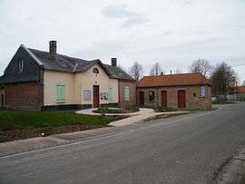 The town hall in Béhen | ||
| ||
 Béhen Location within Hauts-de-France region  Béhen | ||
| Coordinates: 50°03′22″N 1°45′21″E / 50.0561°N 1.7558°ECoordinates: 50°03′22″N 1°45′21″E / 50.0561°N 1.7558°E | ||
| Country | France | |
| Region | Hauts-de-France | |
| Department | Somme | |
| Arrondissement | Abbeville | |
| Canton | Abbeville-2 | |
| Intercommunality | CC Vimeu | |
| Government | ||
| • Mayor (2001–2008) | Jean-Claude Parmentier | |
| Area1 | 9.83 km2 (3.80 sq mi) | |
| Population (2010)2 | 456 | |
| • Density | 46/km2 (120/sq mi) | |
| Time zone | UTC+1 (CET) | |
| • Summer (DST) | UTC+2 (CEST) | |
| INSEE/Postal code | 80076 /80870 | |
| Elevation |
64–114 m (210–374 ft) (avg. 106 m or 348 ft) | |
|
1 French Land Register data, which excludes lakes, ponds, glaciers > 1 km2 (0.386 sq mi or 247 acres) and river estuaries. 2 Population without double counting: residents of multiple communes (e.g., students and military personnel) only counted once. | ||

Béhen is a commune in the Somme department in Hauts-de-France in northern France.
Geography
Béhen is situated on the D173 road, 7 miles (11 km) southwest of Abbeville.
Population
| Year | 1962 | 1968 | 1975 | 1982 | 1990 | 1999 | 2006 |
|---|---|---|---|---|---|---|---|
| Population | 412 | 436 | 416 | 446 | 413 | 439 | 452 |
| From the year 1962 on: No double counting—residents of multiple communes (e.g. students and military personnel) are counted only once. | |||||||
See also
References
External links
| Wikimedia Commons has media related to Béhen. |
(All French language)
This article is issued from
Wikipedia.
The text is licensed under Creative Commons - Attribution - Sharealike.
Additional terms may apply for the media files.