Beaucourt-sur-l'Hallue
| Beaucourt-sur-l'Hallue | |
|---|---|
| Commune | |
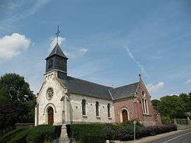 The church in Beaucourt-sur-l'Hallue | |
 Beaucourt-sur-l'Hallue Location within Hauts-de-France region  Beaucourt-sur-l'Hallue | |
| Coordinates: 49°59′16″N 2°26′44″E / 49.9878°N 2.4456°ECoordinates: 49°59′16″N 2°26′44″E / 49.9878°N 2.4456°E | |
| Country | France |
| Region | Hauts-de-France |
| Department | Somme |
| Arrondissement | Amiens |
| Canton | Corbie |
| Intercommunality | CC Territoire Nord Picardie |
| Government | |
| • Mayor (2001–2008) | Marthe Benard |
| Area1 | 5.47 km2 (2.11 sq mi) |
| Population (2006)2 | 235 |
| • Density | 43/km2 (110/sq mi) |
| Time zone | UTC+1 (CET) |
| • Summer (DST) | UTC+2 (CEST) |
| INSEE/Postal code | 80066 /80260 |
| Elevation |
43–132 m (141–433 ft) (avg. 51 m or 167 ft) |
|
1 French Land Register data, which excludes lakes, ponds, glaciers > 1 km2 (0.386 sq mi or 247 acres) and river estuaries. 2 Population without double counting: residents of multiple communes (e.g., students and military personnel) only counted once. | |
Beaucourt-sur-l'Hallue is a commune in the Somme department in Hauts-de-France in northern France.
Geography
This commune is situated 9 miles (14 km) northeast of Amiens on the D919 and D115 junction.
Population
| Year | 1962 | 1968 | 1975 | 1982 | 1990 | 1999 | 2006 |
|---|---|---|---|---|---|---|---|
| Population | 194 | 208 | 225 | 214 | 235 | 226 | 235 |
| From the year 1962 on: No double counting—residents of multiple communes (e.g. students and military personnel) are counted only once. | |||||||
See also
References
External links
| Wikimedia Commons has media related to Beaucourt-sur-l'Hallue. |
(All French language)
- Beaucourt-sur-l'Hallue sur le site du Quid
- Localisation de Beaucourt-sur-l'Hallue sur une carte de France et communes limitrophes
This article is issued from
Wikipedia.
The text is licensed under Creative Commons - Attribution - Sharealike.
Additional terms may apply for the media files.