List of municipalities in North Carolina
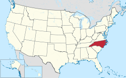
Map of the United States with North Carolina highlighted
North Carolina is a state located in the Southern United States. According to the 2010 United States Census, North Carolina is the ninth most populous state with 10,042,802 inhabitants but the 28th largest by land area spanning 53,819 square miles (139,390 km2) of land.[1] [2]North Carolina is divided into 100 counties and contains 532 incorporated municipalities consisting of cities, towns, or villages.[3] While municipalities may use the name village, town, or city, there is no legal distinction between the names.
| Table of contents: Largest - - See also |
Largest municipalities

Charlotte, Largest City in North Carolina
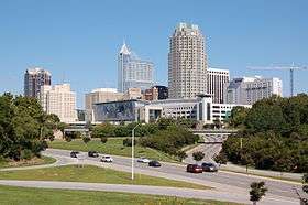
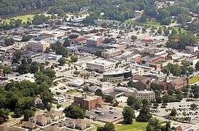
Raleigh, Capital of North Carolina


Below is a list of the 50 largest municipalities in North Carolina according to the 2010 census. Also shown is the 2017 Census estimate.[4]
| Rank | Name | Population (2017) | Population (2010) | Change | Type | County |
|---|---|---|---|---|---|---|
| 1 | Charlotte † | 859,035 | 731,424 | +17.45% | City | Mecklenburg |
| 2 | Raleigh †† | 464,758 | 403,892 | +15.07% | City | Wake (seat), Durham |
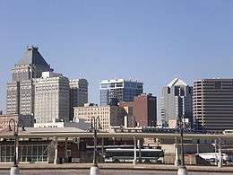
| 3 | Greensboro † | 290,222 | 269,666 | +7.62% | City | Guilford |
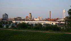
| 4 | Durham † | 267,743 | 228,330 | +17.26% | City | Durham (seat), Wake, Orange |
| 5 | Winston-Salem † | 244,605 | 229,618 | +6.53% | City | Forsyth |
| 6 | Fayetteville † | 209,899 | 200,564 | +4.65% | City | Cumberland |
| 7 | Cary | 165,904 | 135,234 | +22.68% | Town | Wake, Chatham |
| 8 | Wilmington † | 119,045 | 106,476 | +11.80% | City | New Hanover |
| 9 | High Point | 111,513 | 104,371 | +6.84% | City | Guilford, Randolph, Davidson, Forsyth |
| 10 | Greenville † | 92,156 | 84,554 | +8.99% | City | Pitt |
| 11 | Concord † | 92,067 | 79,066 | +16.44% | City | Cabarrus |
| 12 | Asheville † | 91,902 | 85,712 | +7.22% | City | Buncombe |
| 13 | Gastonia † | 76,593 | 71,741 | +6.76% | City | Gaston |
| 14 | Jacksonville † | 72,447 | 70,145 | +3.28% | City | Onslow |
| 15 | Chapel Hill | 59,862 | 57,233 | +4.59% | Town | Orange, Durham |
| 16 | Huntersville | 56,212 | 46,773 | +20.18% | Town | Mecklenburg |
| 17 | Rocky Mount | 54,523 | 57,477 | −5.14% | City | Edgecombe, Nash |
| 18 | Burlington | 53,077 | 49,963 | +6.23% | City | Alamance |
| 19 | Apex | 50,451 | 37,476 | +34.62% | Town | Wake |
| 20 | Wilson † | 49,348 | 49,167 | +0.37% | City | Wilson |
| 21 | Kannapolis | 48,806 | 42,625 | +14.50% | City | Cabarrus, Rowan |
| 22 | Wake Forest | 42,269 | 30,117 | +40.35% | Town | Wake |
| 23 | Hickory | 40,611 | 40,010 | +1.50% | City | Catawba, Burke, Caldwell |
| 24 | Indian Trail | 38,980 | 33,518 | +16.30% | Town | Union |
| 25 | Mooresville | 37,820 | 32,711 | +15.62% | Town | Iredell |
| 26 | Holly Springs | 35,233 | 24,661 | +42.87% | Town | Wake |
| 27 | Goldsboro † | 35,197 | 36,437 | −3.40% | City | Wayne |
| 28 | Monroe † | 35,065 | 32,797 | +6.92% | City | Union |
| 29 | Salisbury † | 33,849 | 33,622 | +0.68% | City | Rowan |
| 30 | Matthews | 32,117 | 27,198 | +18.09% | Town | Mecklenburg |
| 31 | New Bern † | 29,590 | 29,524 | +0.22% | City | Craven |
| 32 | Sanford † | 29,313 | 28,094 | +4.34% | City | Lee |
| 33 | Cornelius | 29,191 | 24,866 | +17.39% | Town | Mecklenburg |
| 34 | Garner | 28,858 | 25,745 | +12.09% | Town | Wake |
| 35 | Fuquay-Varina | 27,906 | 17,937 | +55.58% | Town | Wake |
| 36 | Mint Hill | 26,748 | 22,722 | +17.72% | Town | Mecklenburg, Union |
| 37 | Statesville † | 26,657 | 24,532 | +8.66% | City | Iredell |
| 38 | Thomasville | 26,615 | 26,757 | −0.53% | City | Davidson, Randolph |
| 39 | Morrisville | 26,461 | 18,576 | +42.45% | Town | Wake, Durham |
| 40 | Asheboro † | 25,863 | 25,012 | +3.40% | City | Randolph |
| 41 | Kernersville | 24,386 | 23,123 | +5.46% | Town | Forsyth, Guilford |
| 42 | Carrboro | 21,544 | 19,582 | +10.02% | Town | Orange |
| 43 | Clayton | 20,260 | 16,116 | +25.71% | City | Johnston, Wake |
| 44 | Lumberton † | 21,040 | 21,542 | −2.33% | City | Robeson |
| 45 | Kinston † | 20,509 | 21,677 | −5.39% | City | Lenoir |
| 46 | Clemmons | 20,420 | 18,627 | +9.63% | Village | Forsyth |
| 47 | Shelby † | 20,018 | 20,323 | −1.50% | City | Cleveland |
| 48 | Havelock | 20,008 | 20,735 | −3.51% | City | Craven |
| 49 | Leland | 19,976 | 13,527 | +47.68% | Town | Brunswick |
| 50 | Boone † | 19,205 | 17,119 | +12.19% | City | Watauga |
A
- Aberdeen—town, Moore County
- Ahoskie—town, Hertford County
- Alamance—village, Alamance County
- Albemarle—city, Stanly County
- Alliance—town, Pamlico County
- Andrews—town, Cherokee County
- Angier—town, Harnett County
- Ansonville—town, Anson County
- Apex—town, Wake County
- Arapahoe—town, Pamlico County
- Archdale—city, Randolph County
- Archer Lodge—town, Johnston County
- Arlington—town, Yadkin County
- Asheboro-city, Randolph County
- Asheville—city, Buncombe County
- Askewville
- Atkinson—town, Pender County
- Atlantic Beach—town, Carteret County
- Aulander—town, Bertie County
- Aurora—town, Beaufort County
- Autryville—town, Sampson County
- Ayden—town, Pitt County
B
- Badin—town, Stanly County
- Bailey—town, Nash County
- Bakersville—town, Mitchell County
- Bald Head Island—village, Brunswick County
- Banner Elk—town, Avery County
- Bath—town, Beaufort County
- Bayboro—town, Pamlico County
- Bear Grass—town, Martin County
- Beaufort—town, Carteret County
- Beech Mountain—town, Avery County
- Belhaven—town, Beaufort County
- Belmont—city, Gaston County
- Belville—town, Brunswick County
- Belwood—town, Cleveland County
- Benson—town, Johnston County
- Bermuda Run
- Bessemer City—city, Gaston County
- Bethania—town, Forsyth County
- Bethel—town, Pitt County
- Beulaville—town, Duplin County
- Biltmore Forest—town, Buncombe County
- Biscoe—town, Montgomery County
- Black Creek—town, Wilson County
- Black Mountain—town, Buncombe County
- Bladenboro—town, Bladen County
- Blowing Rock—town, Watauga County
- Boardman—town, Columbus County
- Bogue—town, Carteret County
- Boiling Spring Lakes—city, Brunswick County
- Boiling Springs—town, Cleveland County
- Bolivia—town, Brunswick County
- Bolton—town, Columbus County
- Boone—town, Watauga County
- Boonville—town, Yadkin County
- Bostic—town, Rutherford County
- Brevard—city, Transylvania County
- Bridgeton—town, Craven County
- Broadway—town, Lee County
- Brookford—town, Catawba County
- Brunswick—town, Columbus County
- Bryson City—town, Swain County
- Bunn—town, Franklin County
- Burgaw—town, Pender County
- Burlington—city, Alamance County
- Burnsville—town, Yancey County
- Butner—town, Granville County
C
- Cajah's Mountain
- Calabash
- Calypso
- Cameron
- Candor
- Canton—town, Haywood County
- Cape Carteret
- Carolina Beach—town, New Hanover County
- Carolina Shores—town, Brunswick County
- Carrboro—town, Orange County
- Carthage
- Cary
- Casar
- Castalia—town, Nash County
- Caswell Beach
- Catawba—town, Catawba County
- Cedar Grove—village, Orange County
- Cedar Point
- Cedar Rock
- Cerro Gordo
- Chadbourn—town, Columbus County
- Chapel Hill—town, Orange County
- Charlotte—city, Mecklenburg County
- Cherryville—town, Gaston County
- Chimney Rock
- China Grove—town, Rowan County
- Chocowinity—town, Beaufort County
- Claremont
- Clarkton
- Clayton—town, Johnston County
- Clemmons
- Cleveland
- Clinton—town, Sampson County
- Clyde
- Coats
- Cofield
- Colerain
- Columbia
- Columbus
- Como
- Concord—town, Cabarrus County
- Conetoe
- Connelly Springs
- Conover
- Conway—town, Northampton County
- Cooleemee
- Cornelius—town, Mecklenburg County
- Cove City
- Cramerton
- Creedmoor—town, Granville County
- Creswell
- Crossnore
D
- Dallas—town, Gaston County
- Danbury
- Davidson—town, Mecklenburg County
- Denton
- Dillsboro
- Dobbins Heights
- Dobson—town, Surry County
- Dortches
- Dover
- Drexel—town, Burke County
- Dublin
- Duck
- Dunn—town, Harnett County
- Durham
E
- Earl
- East Arcadia
- East Bend
- East Laurinburg
- Eastover
- East Spencer
- Eden—town, Rockingham County
- Edenton—town, Chowan County
- Elizabeth City—city, Pasquotank County
- Elizabethtown—town, Bladen County
- Elk Park
- Elkin—town, Surry County
- Ellenboro
- Ellerbe
- Elm City
- Elon—town, Alamance County
- Emerald Isle
- Enfield
- Erwin
- Eureka
- Everetts
F
- Fair Bluff—town, Columbus County
- Fairmont—town, Robeson County
- Fairview—town, Union County
- Faison—town, Duplin County
- Faith
- Falcon
- Falkland
- Fallston
- Farmville—town, Pitt County
- Fayetteville
- Flat Rock
- Fletcher
- Forest City—town, Rutherford County
- Forest Hills
- Fountain
- Four Oaks
- Foxfire
- Franklin—town, Macon County
- Franklinton—town, Franklin County
- Franklinville
- Fremont
- Fuquay-Varina—town, Wake County
G
- Gamewell
- Garland
- Garner—town, Wake County
- Garysburg
- Gaston—town, Northampton County
- Gastonia—city, Gaston County
- Gatesville
- Gibson
- Gibsonville
- Glen Alpine
- Godwin
- Goldsboro—city, Wayne County
- Graham—town, Alamance County
- Grandfather
- Granite Falls—town, Caldwell County
- Granite Quarry
- Grantsboro
- Green Level
- Greenevers
- Greensboro—city, Guilford County
- Greenville
- Grifton
- Grimesland
- Grover
H
- Halifax—town, Halifax County
- Hamilton
- Hamlet
- Harmony
- Harrells
- Harrellsville
- Harrisburg
- Hassell
- Havelock
- Haw River
- Hayesville
- Hemby Bridge
- Henderson—town, Vance County
- Hendersonville—town, Henderson County
- Hertford
- Hickory—city, Catawba County
- High Point
- High Shoals
- Highlands
- Hildebran
- Hillsborough—town, Orange County
- Hobgood
- Hoffman
- Holden Beach
- Holly Ridge
- Holly Springs—town, Wake County
- Hookerton
- Hope Mills
- Hot Springs
- Hudson
- Huntersville—town, Mecklenburg County
I
J
K
- Kannapolis
- Kelford
- Kenansville
- Kenly
- Kernersville
- Kill Devil Hills—town, Dare County
- King—town, Stokes County
- Kings Mountain
- Kingstown
- Kinston—city, Lenoir County
- Kittrell—village, Vance County
- Kitty Hawk—town, Dare County
- Knightdale—town, Wake County
- Kure Beach
L
- La Grange
- Lake Lure
- Lake Park
- Lake Santeetlah
- Lake Waccamaw
- Landis
- Lansing
- Lasker
- Lattimore
- Laurel Park
- Laurinburg—town, Scotland County
- Lawndale
- Leggett
- Leland
- Lenoir—town, Caldwell County
- Lewiston Woodville
- Lewisville
- Lexington—city, Davidson County
- Liberty
- Lilesville
- Lillington
- Lincolnton—city, Lincoln County
- Linden
- Littleton—town, Halifax County
- Locust
- Long View
- Louisburg—town, Franklin County
- Love Valley
- Lowell
- Lucama
- Lumber Bridge
- Lumberton—city, Robeson County
M
- Macclesfield
- Macon—town, Warren County
- Madison
- Maggie Valley
- Magnolia
- Maiden
- Manteo—town, Dare County
- Marietta
- Marion—town, McDowell County
- Marshville
- Mars Hill—town, Madison County
- Marshall—town, Madison County
- Marvin
- Matthews—town, Mecklenburg County
- Maxton
- Mayodan—town, Rockingham County
- Maysville
- McAdenville
- McDonald
- McFarlan
- Mebane
- Mesic
- Micro—town, Johnston County
- Middleburg—town, Vance County
- Middlesex
- Midland
- Midway
- Mills River
- Milton
- Mineral Springs
- Minnesott Beach
- Mint Hill
- Misenheimer
- Mocksville—town, Davie County
- Momeyer
- Monroe—town, Union County
- Montreat
- Mooresboro
- Mooresville—town, Iredell County
- Morehead City—town, Carteret County
- Morganton—town, Burke County
- Morrisville
- Morven
- Mount Airy—town, Surry County
- Mount Gilead
- Mount Holly
- Mount Olive
- Mount Pleasant
- Murfreesboro—town, Hertford County
- Murphy—town, Cherokee County
N
- Nags Head
- Nashville—town, Nash County
- Navassa
- New Bern—city, Craven County
- New London
- Newland—town, Avery County
- Newport
- Newton—town, Catawba County
- Newton Grove
- Norlina—town, Warren County
- Norman
- North Topsail Beach
- North Wilkesboro—town, Wilkes County
- Northwest
- Norwood
O
P
- Pantego
- Parkton
- Parmele
- Patterson Springs
- Peachland
- Peletier
- Pembroke
- Pikeville
- Pilot Mountain
- Pine Knoll Shores—town, Carteret County
- Pine Level
- Pinebluff
- Pinehurst—town, Moore County
- Pinetops—town, Edgecombe County
- Pineville
- Pink Hill
- Pittsboro
- Pleasant Garden
- Plymouth—town, Washington County
- Polkton
- Polkville
- Pollocksville
- Powellsville
- Princeton
- Princeville
- Proctorville
R
- Raeford—town, Hoke County
- Raleigh—city, Wake County
- Ramseur
- Randleman
- Ranlo
- Raynham
- Red Cross
- Red Oak—town, Nash County
- Red Springs—town, Robeson County
- Reidsville—city, Rockingham County
- Rennert
- Rhodhiss
- Rich Square
- Richfield
- Richlands
- River Bend
- Roanoke Rapids—city, Halifax County
- Robbins
- Robbinsville
- Robersonville
- Rockingham—city, Richmond County
- Rockwell
- Rocky Mount
- Rolesville—town, Wake County
- Ronda
- Roper
- Rose Hill—city, Duplin County
- Roseboro
- Rosman
- Rowland
- Roxboro—city, Person County
- Roxobel
- Rural Hall
- Ruth
- Rutherford College
- Rutherfordton—town, Rutherford County
S
- Salemburg
- Salisbury—town, Rowan County
- Saluda
- Sandy Creek
- Sandyfield
- Sanford—city, Lee County
- Saratoga
- Sawmills
- Scotland Neck—town, Halifax County
- Seaboard
- Seagrove
- Sedalia
- Selma—town, Johnston County
- Seven Devils
- Seven Springs
- Severn
- Shallotte—town, Brunswick County
- Sharpsburg
- Shelby—city, Cleveland County
- Siler City—town, Chatham County
- Simpson
- Sims
- Smithfield
- Snow Hill—town, Greene County
- Southern Pines
- Southern Shores—town, Moore County
- Southport—town, Brunswick County
- Sparta—town, Alleghany County
- Speed
- Spencer
- Spencer Mountain—town, Gaston County
- Spindale
- Spring Hope
- Spring Lake
- Spruce Pine—town, Mitchell County
- St. Helena
- St. James
- St. Pauls—town, Robeson County
- Staley
- Stallings
- Stanfield
- Stanley
- Stantonsburg
- Star
- Statesville—city, Iredell County
- Stedman
- Stem
- Stokesdale
- Stoneville
- Stonewall
- Stovall
- Sugar Mountain
- Summerfield
- Sunset Beach
- Surf City
- Swansboro—town, Onslow County
- Swepsonville
- Sylva—city, Jackson County
T
- Tabor City—town, Columbus County
- Tar Heel
- Tarboro—town, Edgecombe County
- Taylorsville—town, Alexander County
- Taylortown
- Teachey
- Thomasville
- Tobaccoville
- Topsail Beach—town, Pender County
- Trent Woods
- Trenton
- Trinity—city, Randolph County
- Troutman
- Troy—town, Montgomery County
- Tryon—town, Polk County
- Turkey
U
V
W
- Waco
- Wade
- Wadesboro—town, Anson County
- Wagram
- Wake Forest—town, Wake County
- Walkertown
- Wallace
- Wallburg—town, Davidson County
- Walnut Cove
- Walnut Creek
- Walstonburg
- Warrenton—town, Warren County
- Warsaw—town, Duplin County
- Washington—city, Beaufort County
- Washington Park
- Watha
- Waxhaw—town, Union County
- Waynesville—city, Haywood County
- Weaverville
- Webster
- Weddington
- Weldon—town, Halifax County
- Wendell—town, Wake County
- Wentworth
- Wesley Chapel
- West Jefferson—town, Ashe County
- Whispering Pines
- Whitakers
- White Lake
- Whiteville—city, Columbus County
- Whitsett
- Wilkesboro—town, Wilkes County
- Williamston
- Wilmington—city, New Hanover County
- Wilson—city, Wilson County
- Wilson's Mills
- Windsor—town, Bertie County
- Winfall
- Wingate
- Winston-Salem—city, Forsyth County
- Winterville
- Winton
- Woodfin
- Woodland
- Wrightsville Beach—town, New Hanover County
Y
- Yadkinville—town, Yadkin County
- Yanceyville—town, Caswell County
- Youngsville—town, Franklin County
Z
- Zebulon – town, Wake County
Z
- Zirconia - town, Henderson County
See also
References
- ↑ "GCT-PH1 – Population, Housing Units, Area, and Density: 2010 – State — Place and (in selected states) County Subdivision". 2010 United States Census. United States Census Bureau. Retrieved August 7, 2016.
- ↑ "North Carolina | Capital, Map, History, & Facts". Encyclopedia Britannica. Retrieved 2018-05-27.
- ↑ "North Carolina: 2010 Population and Housing Unit Counts 2010 Census of Population and Housing" (PDF). 2010 census. United States Census Bureau. September 2012. p. 18. Retrieved August 7, 2016.
- ↑ http://factfinder2.census.gov/faces/tableservices/jsf/pages/productview.xhtml?fpt=table
This article is issued from
Wikipedia.
The text is licensed under Creative Commons - Attribution - Sharealike.
Additional terms may apply for the media files.