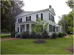
Duplin County, North Carolina
Coordinates: 34°56′N 77°56′W / 34.94°N 77.93°W
| Duplin County, North Carolina | ||
|---|---|---|
 | ||
| ||
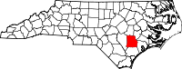 Location in the U.S. state of North Carolina | ||
 North Carolina's location in the U.S. | ||
| Founded | 1750 | |
| Named for | Thomas Hay, Viscount Dupplin | |
| Seat | Kenansville | |
| Largest town | Wallace | |
| Area | ||
| • Total | 822 sq mi (2,129 km2) | |
| • Land | 816 sq mi (2,113 km2) | |
| • Water | 5.5 sq mi (14 km2), 0.7% | |
| Population | ||
| • (2010) | 58,505 | |
| • Density | 72/sq mi (28/km2) | |
| Congressional district | 7th | |
| Time zone | Eastern: UTC−5/−4 | |
| Website |
www | |

Duplin County (/ˈduːplɪn/)[1] is a county located in the U.S. state of North Carolina. As of the 2010 census, the population was 58,505.[2] Its county seat is Kenansville.[3]
History
The county was formed in 1750 from New Hanover County. It was named for Thomas Hay, Viscount Dupplin, later 9th Earl of Kinnoull.[4]
In 1784 the western part of Duplin County became Sampson County.
One of Duplin's favorite sons, John Miller, was a postmaster and merchant in Duplin. He migrated to Leon County, Florida, with other North Carolinians during the period of Indian Removal in the 1830s–1840s. There he developed a successful cotton plantation called Miccosukee Plantation, after one of the Seminole people bands. He depended on the labor of enslaved African Americans.
Geography
According to the U.S. Census Bureau, the county has a total area of 822 square miles (2,130 km2), of which 816 square miles (2,110 km2) is land and 5.5 square miles (14 km2) (0.7%) is water.[5]
Demographics
| Historical population | |||
|---|---|---|---|
| Census | Pop. | %± | |
| 1790 | 5,663 | — | |
| 1800 | 6,796 | 20.0% | |
| 1810 | 7,863 | 15.7% | |
| 1820 | 9,744 | 23.9% | |
| 1830 | 11,291 | 15.9% | |
| 1840 | 11,182 | −1.0% | |
| 1850 | 13,514 | 20.9% | |
| 1860 | 15,784 | 16.8% | |
| 1870 | 15,542 | −1.5% | |
| 1880 | 18,773 | 20.8% | |
| 1890 | 18,690 | −0.4% | |
| 1900 | 22,405 | 19.9% | |
| 1910 | 25,442 | 13.6% | |
| 1920 | 30,223 | 18.8% | |
| 1930 | 35,103 | 16.1% | |
| 1940 | 39,739 | 13.2% | |
| 1950 | 41,074 | 3.4% | |
| 1960 | 40,270 | −2.0% | |
| 1970 | 38,015 | −5.6% | |
| 1980 | 40,952 | 7.7% | |
| 1990 | 39,995 | −2.3% | |
| 2000 | 49,063 | 22.7% | |
| 2010 | 58,505 | 19.2% | |
| Est. 2016 | 58,969 | [6] | 0.8% |
| U.S. Decennial Census[7] 1790–1960[8] 1900–1990[9] 1990–2000[10] 2010–2013[2] | |||
As of the census[11] of 2000, there were 49,063 people, 18,267 households, and 13,060 families residing in the county. The population density was 60 people per square mile (23/km²). There were 20,520 housing units at an average density of 25 per square mile (10/km²). The racial makeup of the county was 58.67% White, 28.94% Black or African American, 0.23% Native American, 0.15% Asian, 0.07% Pacific Islander, 10.87% from other races, and 1.06% from two or more races. 15.14% of the population were Hispanic or Latino of any race.
There were 18,267 households out of which 33.20% had children under the age of 18 living with them, 52.20% were married couples living together, 14.20% had a female householder with no husband present, and 28.50% were non-families. 24.50% of all households were made up of individuals and 11.10% had someone living alone who was 65 years of age or older. The average household size was 2.63 and the average family size was 3.10.
In the county, the population was spread out with 26.10% under the age of 18, 9.60% from 18 to 24, 29.30% from 25 to 44, 22.10% from 45 to 64, and 12.90% who were 65 years of age or older. The median age was 35 years. For every 100 females there were 98.30 males. For every 100 females age 18 and over, there were 95.60 males.
The median income for a household in the county was $29,890, and the median income for a family was $34,760. Males had a median income of $26,212 versus $20,063 for females. The per capita income for the county was $14,499. About 15.30% of families and 19.40% of the population were below the poverty line, including 22.50% of those under age 18 and 22.70% of those age 65 or over.
Law and government
Duplin County is a member of the regional Eastern Carolina Council of Governments.
Duplin County is represented by Jimmy Dixon in the North Carolina House of Representatives.
| Year | Republican | Democratic | Third parties |
|---|---|---|---|
| 2016 | 58.6% 12,217 | 39.7% 8,283 | 1.7% 356 |
| 2012 | 55.4% 11,416 | 43.9% 9,033 | 0.7% 143 |
| 2008 | 54.4% 10,834 | 45.0% 8,958 | 0.6% 112 |
| 2004 | 58.0% 9,611 | 41.8% 6,923 | 0.3% 49 |
| 2000 | 54.5% 7,840 | 45.0% 6,475 | 0.5% 75 |
| 1996 | 43.8% 5,432 | 49.9% 6,179 | 6.3% 781 |
| 1992 | 38.5% 5,286 | 49.6% 6,816 | 12.0% 1,645 |
| 1988 | 49.2% 5,774 | 50.7% 5,945 | 0.1% 7 |
| 1984 | 53.0% 7,708 | 46.9% 6,830 | 0.1% 17 |
| 1980 | 41.3% 5,403 | 57.6% 7,524 | 1.1% 142 |
| 1976 | 33.5% 3,912 | 65.8% 7,696 | 0.7% 86 |
| 1972 | 70.6% 7,153 | 28.2% 2,857 | 1.2% 120 |
| 1968 | 22.2% 2,724 | 28.2% 3,451 | 49.6% 6,082 |
| 1964 | 34.8% 3,821 | 65.2% 7,169 | |
| 1960 | 28.9% 2,953 | 71.1% 7,269 | |
| 1956 | 23.3% 2,110 | 76.7% 6,931 | |
| 1952 | 24.9% 2,115 | 75.1% 6,392 | |
| 1948 | 14.2% 1,024 | 81.3% 5,866 | 4.6% 330 |
| 1944 | 20.8% 1,437 | 79.2% 5,464 | |
| 1940 | 18.9% 1,260 | 81.1% 5,394 | |
| 1936 | 20.6% 1,546 | 79.4% 5,966 | |
| 1932 | 19.9% 1,173 | 79.5% 4,674 | 0.6% 35 |
| 1928 | 52.4% 2,911 | 47.6% 2,647 | |
| 1924 | 34.2% 1,542 | 64.9% 2,924 | 0.8% 37 |
| 1920 | 44.3% 2,697 | 55.8% 3,398 | |
| 1916 | 45.6% 1,527 | 54.4% 1,824 | |
| 1912 | 1.2% 33 | 61.5% 1,757 | 37.4% 1,069 |
Education
Duplin County is home to James Sprunt Community College.
Economy
Duplin County is important in raising animals for food. It has more hogs than any other county in the United States—2.2 million in 1998, which is greater than the hog population of most states. The county is also the home to a major chicken and turkey industry.[13]
Duplin is also home to Duplin Winery, the oldest winery in North Carolina and the largest winery in the Southeast.
Transportation
Major highways
Airports
The following public-use airports are located in the county:[14]
- Duplin County Airport (DPL) – Kenansville
- Eagles Nest Airport (6N9) – Potters Hill
Communities
Towns
- Beulaville
- Calypso
- Faison (part)
- Greenevers
- Harrells (part)
- Kenansville (county seat)
- Magnolia
- Mount Olive (part)
- Rose Hill
- Teachey
- Wallace (part)
- Warsaw
Townships
- Albertson
- Cypress Creek
- Faison
- Glisson
- Island Creek
- Kenansville
- Limestone
- Magnolia
- Rockfish
- Rose Hill
- Smith
- Warsaw
- Wolfscrape
Census-designated place
Unincorporated communities
Notable people
- Peter Weddick Moore (1859-1934), North Carolina educator and the first president of Elizabeth City State University
Trivia
The fictional North Carolina hamlet of Tim's Creek, from Randall Kenan's early short stories in "A Visitation of Spirits" and "Let the Dead Bury Their Dead," is based loosely on Chinquapin, North Carolina.
Duplin county was featured in the 2017 documentary What the Health for the (suggested) impact its livestock industry has on health.
See also
References
- ↑ Talk Like A Tarheel, from the North Carolina Collection's website at the University of North Carolina at Chapel Hill. Retrieved 2013-01-31.
- 1 2 "State & County QuickFacts". United States Census Bureau. Archived from the original on July 9, 2011. Retrieved October 19, 2013.
- ↑ "Find a County". National Association of Counties. Archived from the original on 2012-07-12. Retrieved 2011-06-07.
- ↑ Proffitt, Martie (Apr 17, 1983). "Local history offers tasty tidbits". Star-News. pp. 8C. Retrieved 1 November 2015.
- ↑ "2010 Census Gazetteer Files". United States Census Bureau. August 22, 2012. Archived from the original on January 12, 2015. Retrieved January 14, 2015.
- ↑ "Population and Housing Unit Estimates". Retrieved June 9, 2017.
- ↑ "U.S. Decennial Census". United States Census Bureau. Archived from the original on May 12, 2015. Retrieved January 14, 2015.
- ↑ "Historical Census Browser". University of Virginia Library. Retrieved January 14, 2015.
- ↑ Forstall, Richard L., ed. (March 27, 1995). "Population of Counties by Decennial Census: 1900 to 1990". United States Census Bureau. Retrieved January 14, 2015.
- ↑ "Census 2000 PHC-T-4. Ranking Tables for Counties: 1990 and 2000" (PDF). United States Census Bureau. April 2, 2001. Retrieved January 14, 2015.
- ↑ "American FactFinder". United States Census Bureau. Archived from the original on 2013-09-11. Retrieved 2008-01-31.
- ↑ Leip, David. "Dave Leip's Atlas of U.S. Presidential Elections". uselectionatlas.org. Retrieved 2018-03-15.
- ↑ MacInnis, Stewart (1998-09-24). "Kornegay's research eases livestock impact". Spectrum. Virginia Tech. Retrieved 2008-06-19.
- ↑ Public and Private Airports, Duplin County, North Carolina
External links
Places adjacent to Duplin County, North Carolina | ||||||||||
|---|---|---|---|---|---|---|---|---|---|---|
| ||||||||||
Municipalities and communities of Duplin County, North Carolina, United States | ||
|---|---|---|
| Towns |  | |
| CDP | ||
| Other unincorporated communities | ||
| Footnotes | ‡This populated place also has portions in an adjacent county or counties | |
