Lincoln County, North Carolina
| Lincoln County, North Carolina | |
|---|---|
.jpg) Lincoln County Courthouse in Lincolnton | |
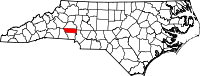 Location in the U.S. state of North Carolina | |
 North Carolina's location in the U.S. | |
| Founded | 1779 |
| Named for | Benjamin Lincoln |
| Seat | Lincolnton |
| Largest city | Lincolnton |
| Area | |
| • Total | 307 sq mi (795 km2) |
| • Land | 298 sq mi (772 km2) |
| • Water | 9.1 sq mi (24 km2), 3.0% |
| Population | |
| • (2010) | 78,265 |
| • Density | 263/sq mi (102/km2) |
| Congressional district | 10th |
| Time zone | Eastern: UTC−5/−4 |
| Website |
www |
Lincoln County is a county located in the U.S. state of North Carolina. As of the 2010 census, the population was 78,265.[1] Its county seat is Lincolnton.[2] Lincoln County is included in the Charlotte-Concord-Gastonia, NC-SC Metropolitan Statistical Area.
History
The county was formed in 1779 from the eastern part of Tryon County, which had been settled by Europeans in the mid-18th Century. It was named for Benjamin Lincoln, a general in the American Revolutionary War."[3] During the American Revolution, the Battle of Ramsour's Mill occurred near a grist mill in Lincolnton.
"In 1782 the southeastern part of Burke County was annexed to Lincoln County. In 1841 parts of Lincoln County and Rutherford County were combined to form Cleveland County. In 1842 the northern third of Lincoln County became Catawba County. In 1846 the southern half of what was left of Lincoln County became Gaston County."[3]
Geography
According to the U.S. Census Bureau, the county has a total area of 307 square miles (800 km2), of which 298 square miles (770 km2) is land and 9.1 square miles (24 km2) (3.0%) is water.[4]
Adjacent counties
- Catawba County - north
- Iredell County - northeast
- Mecklenburg County - southeast
- Gaston County - south
- Cleveland County - west
- Burke County - northwest
Major highways
Demographics
| Historical population | |||
|---|---|---|---|
| Census | Pop. | %± | |
| 1790 | 9,246 | — | |
| 1800 | 12,660 | 36.9% | |
| 1810 | 16,359 | 29.2% | |
| 1820 | 18,147 | 10.9% | |
| 1830 | 22,455 | 23.7% | |
| 1840 | 25,160 | 12.0% | |
| 1850 | 7,746 | −69.2% | |
| 1860 | 8,195 | 5.8% | |
| 1870 | 9,573 | 16.8% | |
| 1880 | 11,061 | 15.5% | |
| 1890 | 12,586 | 13.8% | |
| 1900 | 15,498 | 23.1% | |
| 1910 | 17,132 | 10.5% | |
| 1920 | 17,862 | 4.3% | |
| 1930 | 22,872 | 28.0% | |
| 1940 | 24,187 | 5.7% | |
| 1950 | 27,459 | 13.5% | |
| 1960 | 28,814 | 4.9% | |
| 1970 | 32,682 | 13.4% | |
| 1980 | 42,372 | 29.6% | |
| 1990 | 50,319 | 18.8% | |
| 2000 | 63,780 | 26.8% | |
| 2010 | 78,265 | 22.7% | |
| Est. 2016 | 81,168 | [5] | 3.7% |
| U.S. Decennial Census[6] 1790-1960[7] 1900-1990[8] 1990-2000[9] 2010-2014[1] | |||
As of the census[10] of 2010, there were 78,265 people, 30,343 households, and 22,221 families residing in the county. The population density was 261.76 people per square mile (101/km²). There were 33,641 housing units at an average density of 112.51 per square mile (43.46/km²). The racial makeup of the county was 89.4% White, 5.5% Black or African American, 0.3% Native American, 0.5% Asian, 0.02% Pacific Islander, 2.7% from other races, and 1.6% from two or more races. 6.7% of the population were Hispanic or Latino of any race.
There were 30,343 households out of which 30.6% had children under the age of 18 living with them, 57.2% were married couples living together, 11.1% had a female householder with no husband present, and 26.8% were non-families. 22.3% of all households were made up of individuals and 8.4% had someone living alone who was 65 years of age or older. The average household size was 2.56 and the average family size was 2.97.
In the county, the population was spread out with 23.6% under the age of 18, 7.5% from 18 to 24, 26.2% from 25 to 44, 29.5% from 45 to 64, and 13.2% who were 65 years of age or older. The median age was 40.4 years. For every 100 females there were 98.4 males. For every 100 females age 18 and over, there were 95.8 males.
The median income for a household in the county was $42,456, and the median income for a family was $48,298. Males had a median income of $41,441 versus $30,480 for females. The per capita income for the county was $21,861. About 10.4% of families and 15.8% of the population were below the poverty line, as well as 25.3% of those under age 18 and 8.7% of those age 65 or over.
Communities

City
- Lincolnton (county seat)
Town
- Maiden (part)
Census-designated places
Unincorporated communities
- Boger City
- Laurel Hill
- Polkadot
- Toluca (part)
- Vale
Townships
- Catawba Springs
- Howards Creek
- Ironton
- Lincolnton
- North Brook
Politics, law and government
Lincoln is currently a powerfully Republican county. It has not been carried by any Democrat since Jimmy Carter in 1976, and Carter in 1980 is the last Democrat to reach forty percent of the county’s vote in a Presidential election. Before World War II, Lincoln was a typically Democratic Southern county except for supporting Herbert Hoover in 1928 and William McKinley in 1900, but since Thomas E. Dewey carried the county in 1948, it has gone Democratic just twice.
| Year | Republican | Democratic | Third parties |
|---|---|---|---|
| 2016 | 72.0% 28,806 | 24.7% 9,897 | 3.3% 1,320 |
| 2012 | 68.7% 25,267 | 30.0% 11,024 | 1.3% 484 |
| 2008 | 66.0% 23,631 | 32.7% 11,713 | 1.3% 454 |
| 2004 | 67.8% 20,052 | 31.9% 9,434 | 0.3% 93 |
| 2000 | 65.0% 15,951 | 34.3% 8,412 | 0.7% 166 |
| 1996 | 54.9% 11,439 | 37.0% 7,721 | 8.1% 1,690 |
| 1992 | 49.3% 11,018 | 36.5% 8,150 | 14.3% 3,187 |
| 1988 | 64.3% 11,651 | 35.5% 6,444 | 0.2% 35 |
| 1984 | 67.6% 12,621 | 32.1% 5,996 | 0.2% 42 |
| 1980 | 52.4% 9,009 | 45.3% 7,796 | 2.3% 391 |
| 1976 | 41.2% 6,682 | 58.4% 9,462 | 0.4% 66 |
| 1972 | 61.9% 8,597 | 36.7% 5,100 | 1.4% 195 |
| 1968 | 46.2% 6,188 | 30.2% 4,044 | 23.6% 3,161 |
| 1964 | 44.6% 5,869 | 55.5% 7,304 | |
| 1960 | 50.3% 6,816 | 49.7% 6,728 | |
| 1956 | 53.2% 6,637 | 46.8% 5,838 | |
| 1952 | 53.6% 6,228 | 46.4% 5,389 | |
| 1948 | 43.5% 3,635 | 42.7% 3,570 | 13.8% 1,153 |
| 1944 | 46.9% 3,678 | 53.1% 4,168 | |
| 1940 | 38.7% 3,099 | 61.3% 4,901 | |
| 1936 | 38.8% 3,501 | 61.2% 5,515 | |
| 1932 | 44.6% 3,563 | 55.0% 4,399 | 0.4% 34 |
| 1928 | 57.4% 3,930 | 42.6% 2,913 | |
| 1924 | 47.4% 2,658 | 51.9% 2,909 | 0.8% 42 |
| 1920 | 48.5% 3,137 | 51.5% 3,331 | |
| 1916 | 47.2% 1,369 | 52.5% 1,521 | 0.3% 9 |
| 1912 | 2.0% 49 | 53.1% 1,280 | 44.9% 1,081 |
Lincoln County is a member of the regional Centralina Council of Governments.
Education
Post-secondary education
- Gaston College - Community College located in Dallas, North Carolina with a satellite campus in Lincolnton offering associate degree, Certificate, and Diploma programs.
Lincoln County Schools
High schools
- East Lincoln High School
- Lincoln County School of Technology
- Lincolnton High School
- North Lincoln High School
- West Lincoln High School
Middle schools
- Asbury
- East Lincoln
- Lincolnton
- North Lincoln
- West Lincoln
Intermediate schools
- Kiser Intermediate School
- Pumpkin Center Intermediate School
Elementary schools
- Battleground
- Catawba Springs
- G. E. Massey
- Iron Station
- Love Memorial
- Norris S. Childers
- North Brook
- Pumpkin Center Primary
- Rock Springs
- S. Ray Lowder
- St. James
- Union
Charter schools
- Lincoln Charter School
See also
References
- 1 2 "State & County QuickFacts". United States Census Bureau. Archived from the original on July 14, 2011. Retrieved October 21, 2013.
- ↑ "Find a County". National Association of Counties. Retrieved 2011-06-07.
- 1 2 "County of Lincoln, NC - Official Website - History Corner". www.co.lincoln.nc.us. Retrieved 2017-06-08.
- ↑ "2010 Census Gazetteer Files". United States Census Bureau. August 22, 2012. Archived from the original on January 12, 2015. Retrieved January 17, 2015.
- ↑ "Population and Housing Unit Estimates". Retrieved June 9, 2017.
- ↑ "U.S. Decennial Census". United States Census Bureau. Retrieved January 17, 2015.
- ↑ "Historical Census Browser". University of Virginia Library. Retrieved January 17, 2015.
- ↑ Forstall, Richard L., ed. (March 27, 1995). "Population of Counties by Decennial Census: 1900 to 1990". United States Census Bureau. Retrieved January 17, 2015.
- ↑ "Census 2000 PHC-T-4. Ranking Tables for Counties: 1990 and 2000" (PDF). United States Census Bureau. April 2, 2001. Retrieved January 17, 2015.
- ↑ "American FactFinder". United States Census Bureau. Retrieved 2011-05-14.
- ↑ Leip, David. "Dave Leip's Atlas of U.S. Presidential Elections". uselectionatlas.org. Retrieved 2018-03-16.
Further reading
- Nixon, Joseph R. (1912). Hamilton, J. G. de Roulhac; Wagstaff, Henry McGilbert, eds. "The German Settlers in Lincoln County and Western North Carolina". The James Sprunt Historical Publications. Chapel Hill, N. C.: University of North Carolina. 11 (2): 28–62. LCCN 13033017. OCLC 6286659. OL 7185018M – via Internet Archive.
- W. J. Hoke Camp, Confederate Veterans (1905). Roster of Confederate Soldiers in the War Between the States Furnished by Lincoln County, North Carolina, 1861–1865. Lincolnton, N. C.: Journal Print. OCLC 11769265. OL 22892493M – via Internet Archive.
External links
- Official website
- NCGenWeb Lincoln County - free genealogy resources for the county

Places adjacent to Lincoln County, North Carolina | ||||||||||
|---|---|---|---|---|---|---|---|---|---|---|
| ||||||||||
Municipalities and communities of Lincoln County, North Carolina, United States | ||
|---|---|---|
| City |  | |
| Town | ||
| CDPs | ||
| Unincorporated communities | ||
| Footnotes | ‡This populated place also has portions in an adjacent county or counties | |
|  | ||||||||||||
|
| |||||||||||||
