Catawba County, North Carolina
| Catawba County, North Carolina | ||
|---|---|---|
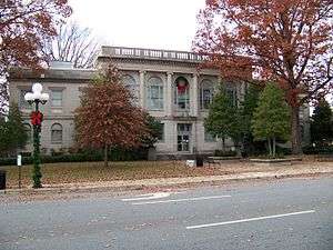 Historic Catawba County Courthouse | ||
| ||
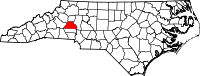 Location in the U.S. state of North Carolina | ||
 North Carolina's location in the U.S. | ||
| Founded | 1842 | |
| Named for | Catawba tribe | |
| Seat | Newton | |
| Largest city | Hickory | |
| Area | ||
| • Total | 413 sq mi (1,070 km2) | |
| • Land | 399 sq mi (1,033 km2) | |
| • Water | 15 sq mi (39 km2), 3.6% | |
| Population | ||
| • (2010) | 154,810 | |
| • Density | 387/sq mi (149/km2) | |
| Congressional districts | 5th, 10th | |
| Time zone | Eastern: UTC−5/−4 | |
| Website |
www | |

Catawba County is a county located in the U.S. state of North Carolina. As of the 2010 census, the population was 154,810.[1] Its county seat is Newton,[2] and its largest city is Hickory. The county is part of the Hickory–Lenoir–Morganton, NC Metropolitan Statistical Area.
Catawba County is part of the "North Carolina Data Center Corridor" in western North Carolina.[3] Maiden is home to the Apple iCloud data center and the largest privately owned solar farm in the United States (operated by Apple). As of 2017, the Catawba County Economic Development Corporation controls a 55-acre business park in Conover designed for data centers and office use.[4] CommScope and Corning, manufacturers of fiber optic cabling, became the region’s largest employers in the late 1990s.
Hickory is home to Lenoir–Rhyne University, the Hickory Motor Speedway, and the minor league baseball team the Hickory Crawdads. Conover is home to the Greater Hickory Classic at Rock Barn.
History
The county, formed in 1842 from Lincoln County, was named for the Catawba tribe of Native Americans who once inhabited the area around the Catawba River. Once considered one of the most powerful Southeastern Siouan-speaking tribes in the Carolina Piedmont, the Catawba people now live along the border of North Carolina near the city of Rock Hill, South Carolina.
German and Scots-Irish colonial immigrants and farmers settled in the area that is now Catawba County in the 1700s. The official history of the German and Scots-Irish settlement in the area was documented in 1954 by Charles J. Preslar, Jr.[5] and more recently by a series of three books by Gary Freeze, called The Catawbans.
Law and government
Catawba County is a member of the regional Western Piedmont Council of Governments. The county is strongly Republican: no Democratic Presidential candidate has won Catawba County since Franklin Delano Roosevelt in 1944.
| Year | Republican | Democratic | Third parties |
|---|---|---|---|
| 2016 | 66.8% 48,324 | 29.3% 21,216 | 3.9% 2,811 |
| 2012 | 64.0% 44,538 | 34.6% 24,069 | 1.4% 994 |
| 2008 | 61.9% 42,993 | 36.9% 25,656 | 1.2% 802 |
| 2004 | 67.5% 39,602 | 32.1% 18,858 | 0.4% 228 |
| 2000 | 67.4% 34,244 | 32.0% 16,246 | 0.7% 351 |
| 1996 | 58.0% 26,898 | 33.7% 15,601 | 8.3% 3,855 |
| 1992 | 51.5% 25,466 | 33.1% 16,334 | 15.4% 7,609 |
| 1988 | 69.0% 28,872 | 30.9% 12,922 | 0.1% 44 |
| 1984 | 72.8% 31,476 | 27.1% 11,700 | 0.2% 74 |
| 1980 | 60.4% 22,873 | 36.6% 13,873 | 3.0% 1,132 |
| 1976 | 52.4% 18,696 | 47.2% 16,862 | 0.4% 150 |
| 1972 | 74.5% 24,106 | 23.9% 7,744 | 1.6% 525 |
| 1968 | 56.3% 18,393 | 21.4% 6,974 | 22.3% 7,285 |
| 1964 | 52.0% 17,116 | 48.0% 15,814 | |
| 1960 | 58.7% 19,135 | 41.4% 13,491 | |
| 1956 | 62.8% 19,246 | 37.3% 11,424 | |
| 1952 | 59.3% 16,814 | 40.7% 11,554 | |
| 1948 | 47.5% 9,471 | 44.4% 8,844 | 8.1% 1,622 |
| 1944 | 41.6% 7,211 | 58.5% 10,146 | |
| 1940 | 33.5% 5,656 | 66.5% 11,233 | |
| 1936 | 36.7% 6,387 | 63.3% 11,017 | |
| 1932 | 40.6% 5,817 | 58.9% 8,446 | 0.5% 77 |
| 1928 | 60.6% 7,556 | 39.4% 4,916 | |
| 1924 | 50.3% 5,998 | 48.3% 5,754 | 1.4% 167 |
| 1920 | 52.3% 5,935 | 47.7% 5,404 | |
| 1916 | 50.4% 2,624 | 49.3% 2,569 | 0.3% 14 |
| 1912 | 4.9% 203 | 50.4% 2,110 | 44.8% 1,875 |
County officers
Board of Commissioners
| Office[7] | Holder | Party | Term expires |
|---|---|---|---|
| County Commissioner (Chairman) | Randy Isenhower | Republican | 2018 |
| County Commissioner (Vice Chair) | Barbara Beatty | Republican | 2020 |
| County Commissioner | Kitty Barnes | Republican | 2018 |
| County Commissioner | Sherry Butler | Republican | 2018 |
| County Commissioner | Dan Hunsucker | Republican | 2020 |
Soil & Water Conservation District Superviors
| Holder[7] | Term expires |
|---|---|
| David Caldwell | 2020 |
| Chris (Chopper) Fulbright | 2018 |
| Laura Parnell | 2018 |
| Susie Devine | Appointed |
| Steve Killian | Appointed |
Superior Court Judges
| Office[8] | Holder | Party | Term expires |
|---|---|---|---|
| Senior Resident Superior Court Judge | Nathaniel J. Poovey | Republican | 2018 |
| Resident Superior Court Judge | Greg R. Hayes | Republican | 2022 |
District Court Judges
| Office[8] | Holder | Party | Term expires |
|---|---|---|---|
| Chief District Court Judge | Burford A. Cherry | Republican | 2020 |
| District Court Judge | David W. Aycock | Republican | 2018 |
| District Court Judge | Wes W. Barkley | Republican | 2018 |
| District Court Judge | Sherri W. Elliot | Republican | 2018 |
| District Court Judge | Richard S. Holloway | Republican | 2020 |
| District Court Judge | Mark L. Killian | Republican | 2018 |
| District Court Judge | Robert A. Mullinax, Jr. | Republican | 2018 |
| District Court Judge | Clifton H. Smith | Republican | 2018 |
| District Court Judge | Amy Sigmon Walker | Republican | 2018 |
Other offices
| Office[7][8] | Holder | Party | Term expires |
|---|---|---|---|
| Sheriff | Coy Reid | Republican | 2018 |
| Register of Deeds | Donna Spencer | Republican | 2020 |
| District Attorney | David Learner | Republican | 2018 |
| Clerk of Superior Court | Kim Sigmon | Republican | 2018 |
North Carolina General Assembly
North Carolina House of Representatives
| District[9] | Representative | Party |
|---|---|---|
| 89 | Michael Setzer | Republican |
| 96 | Jay Adams | Republican |
North Carolina Senate
| District[9] | Representative | Party |
|---|---|---|
| 42 | Andy Wells | Republican |
Federal offices
Senate
| Senator | Party | Term expires |
|---|---|---|
| Richard Burr | Republican | 2022 |
| Thom Tillis | Republican | 2020 |
House of Representatives
| District[10] | Representative | Party |
|---|---|---|
| 5 | Virginia Foxx | Republican |
| 10th | Patrick McHenry | Republican |
Geography
According to the U.S. Census Bureau, the county has a total area of 413 square miles (1,070 km2), of which 399 square miles (1,030 km2) is land and 15 square miles (39 km2) (3.6%) is water.[11]
Demographics
| Historical population | |||
|---|---|---|---|
| Census | Pop. | %± | |
| 1850 | 8,862 | — | |
| 1860 | 10,729 | 21.1% | |
| 1870 | 10,984 | 2.4% | |
| 1880 | 14,946 | 36.1% | |
| 1890 | 18,689 | 25.0% | |
| 1900 | 22,133 | 18.4% | |
| 1910 | 27,918 | 26.1% | |
| 1920 | 33,839 | 21.2% | |
| 1930 | 43,991 | 30.0% | |
| 1940 | 54,653 | 24.2% | |
| 1950 | 61,794 | 13.1% | |
| 1960 | 73,191 | 18.4% | |
| 1970 | 90,873 | 24.2% | |
| 1980 | 105,208 | 15.8% | |
| 1990 | 118,412 | 12.6% | |
| 2000 | 141,685 | 19.7% | |
| 2010 | 154,358 | 8.9% | |
| Est. 2016 | 156,459 | [12] | 1.4% |
| U.S. Decennial Census[13] 1790-1960[14] 1900-1990[15] 1990-2000[16] 2010-2014[1] | |||
As of the census[17] of 2010, there were 154,358 people, 55,533 households, and 39,095 families residing in the county. The population density was 354 people per square mile (137/km²). There were 59,919 housing units at an average density of 150 per square mile (58/km²). The racial makeup of the county was 87.1% White, 8.5% Black or African American, 0.3% Native American, 3.1% Asian, 0.05% Pacific Islander, and 1.14% from two or more races, 9.4% of the population were Hispanic or Latino of any race.
There were 55,533 households out of which 31.50% had children under the age of 18 living with them, 55.10% were married couples living together, 10.90% had a female householder with no husband present, and 29.60% were non-families. 24.60% of all households were made up of individuals and 9.10% had someone living alone who was 65 years of age or older. The average household size was 2.51 and the average family size was 2.98.
In the county, the population was spread out with 24.30% under the age of 18, 8.80% from 18 to 24, 31.10% from 25 to 44, 23.50% from 45 to 64, and 12.30% who were 65 years of age or older. The median age was 36 years. For every 100 females there were 97.30 males. For every 100 females age 18 and over, there were 94.70 males.
The median income for a household in the county was $43,536, and the median income for a family was $47,474. Males had a median income of $30,822 versus $23,352 for females. The per capita income for the county was $20,358. About 6.50% of families and 9.10% of the population were below the poverty line, including 12.50% of those under age 18 and 9.70% of those age 65 or over.
Education
- Most of the county is served by Catawba County Schools.
- Newton and Conover are served by Newton-Conover City Schools.
- Most of Hickory is served by the Hickory City School System.
Higher education
- Lenoir–Rhyne University
- Catawba Valley Community College
- Appalachian Center at Hickory
- NC Center for Engineering Technologies
Libraries
- The Catawba County Library System serves the residents of Catawba County. The library system operates 7 libraries throughout the county.
- The Hickory Public Library System serves the residents of Hickory. The library system operates 2 libraries: The Patrick Beaver Memorial Library and the Ridgeview Library.
Points of Interest
Museums and libraries
- Catawba County Firefighters Museum
- Catawba County Museum of History
- Hickory Aviation Museum
- Hickory Museum of Art
- Catawba County Science Center
- Murrays Mill
- Public Libraries of Catawba County
- Public Libraries of Hickory
Sports and entertainment
Music and performing arts
- Newton-Conover Auditorium
- The Green-Room Theatre
- Western Piedmont Symphony
- Hickory Community Theatre
Other attractions
- Valley Hills Mall
- Lake Norman
- Lake Hickory
- Lake Lookout
- Bunker Hill Covered Bridge
Transportation
Major highways
Air
The county's primary general aviation airport is Hickory Regional Airport.
Mass transit
Rail
With approximately twenty freight trains a day, Catawba County is a freight railroad transportation center. This is largely due to the areas strong manufacturing based economy, and its placement along the Norfolk Southern Railway line. The Caldwell County Railroad also serves the county and interchanges with Norfolk Southern in Hickory.[18]
Conover has been designated as the Catawba County passenger rail stop for the Western North Carolina Railroad planned to run from Salisbury, NC, to Asheville.
Communities

Cities
Towns
Census-designated places
Unincorporated communities
Townships
- Bandy's
- Caldwell
- Catawba
- Clines
- Hickory
- Jacobs Fork
- Mountain Creek
- Newton
Notable people
Actors
Athletes
- Rick Barnes - Head coach for Tennessee Volunteers basketball.
- Madison Bumgarner - 2010, 2012, 2014 (MVP) World Series Champion Pitcher for the San Francisco Giants.
- Paul Burris - Pitcher for Boston/Milwaukee Braves.
- Ryan Hill - Long distance track runner. Represented the United States on two occasions.
- Bryan Harvey - Major League Baseball player
- Austin Johnson - NFL player
- Chad Lail - Professional wrestler known as Gunner in TNA Wrestling.
- J.T. Poston - Professional golfer
- Braun Strowman - Professional wrestler in the WWE
- Ryan Succop - NFL player
- Chris Washburn - 1986 1st round NBA selection.
Motorsports
- Elliott Forbes-Robinson – Sports car driver in Motorsports Hall of Fame of America.
- Tommy Houston - Former NASCAR Driver.
- Robert Huffman - Former NASCAR Driver.
- Bobby Isaac - 1970 NASCAR Winston Cup Series champion.
- Dale Jarrett - NASCAR Driver.1999 Winston Cup Champion
- Glenn Jarrett - Former NASCAR Driver.
- Ned Jarrett - Former NASCAR Driver.
- Matt Kenseth - NASCAR Driver.
- Jason Line - NHRA Pro Stock driver.
- Rob Moroso - NASCAR Driver.
- Ryan Newman - NASCAR Driver.
- Dennis Setzer - NASCAR Driver.
- Morgan Shepherd - NASCAR Driver.
- Michael Waltrip - NASCAR Driver.
Musicians
- Tori Amos - Musician, songwriter.
- The Cockman Family - Bluegrass musicians.
- Tom Constanten - Musician, composer, former member of The Grateful Dead and member of the Rock and Roll Hall of Fame.
Other
- Chris Hughes - Co-founder of Facebook.
- Brock Long - Director of FEMA (2017).
- Anthony "Blame Truth" Presnell - Twitch Streamer/YouTuber/Gaming Personality
- Jon Reep - Comedian and Winner of Last Comic Standing
See also
References
- 1 2 "State & County QuickFacts". United States Census Bureau. Retrieved October 18, 2013.
- ↑ "Find a County". National Association of Counties. Archived from the original on 2011-05-31. Retrieved 2011-06-07.
- ↑ "North Carolina's Data Center Corridor: From Fiber to Servers | Data Center Knowledge". Data Center Knowledge. 2013-01-04. Retrieved 2017-07-11.
- ↑ "ncDataCampus - Catawba EDC". www.catawbaedc.org. Retrieved 2017-07-11.
- ↑ Preslar, Charles J. , Jr (1954). A History of Catawba County (First ed.). Rowan Publishing Co.
- ↑ Leip, David. "Dave Leip's Atlas of U.S. Presidential Elections". uselectionatlas.org. Retrieved 2018-03-15.
- 1 2 3 http://www.catawbacountync.gov/site/assets/files/3336/county_elected_officials.pdf
- 1 2 3 http://www.catawbacountync.gov/site/assets/files/3336/judicial_elected.pdf
- 1 2 http://www.catawbacountync.gov/site/assets/files/3336/state_elected_officials.pdf
- ↑ http://www.catawbacountync.gov/site/assets/files/2911/1-federal_officials.pdf
- ↑ "2010 Census Gazetteer Files". United States Census Bureau. August 22, 2012. Archived from the original on January 12, 2015. Retrieved January 13, 2015.
- ↑ "Population and Housing Unit Estimates". Retrieved June 9, 2017.
- ↑ "U.S. Decennial Census". United States Census Bureau. Archived from the original on May 12, 2015. Retrieved January 13, 2015.
- ↑ "Historical Census Browser". University of Virginia Library. Retrieved January 13, 2015.
- ↑ Forstall, Richard L., ed. (March 27, 1995). "Population of Counties by Decennial Census: 1900 to 1990". United States Census Bureau. Retrieved January 13, 2015.
- ↑ "Census 2000 PHC-T-4. Ranking Tables for Counties: 1990 and 2000" (PDF). United States Census Bureau. April 2, 2001. Retrieved January 13, 2015.
- ↑ "American FactFinder". United States Census Bureau. Archived from the original on 2013-09-11. Retrieved 2008-01-31.
- ↑ Infrastructure, Caldwell County Economic Development Commission (retrieved 16 June 2014)
Further reading
- Freeze, Gary R. The Catawbans: Crafters of a North Carolina County, 1747-1900 Catawba County Historical Association, 1995. ISBN 0-9702776-2-8.
- Freeze, Gary R. The Catawbans: Pioneers in Progress, Vol. 2. Catawba County Historical Association, 2002.
External links

- Official website
- Catawba County Chamber of Commerce
Places adjacent to Catawba County, North Carolina | ||||||||||
|---|---|---|---|---|---|---|---|---|---|---|
| ||||||||||
Municipalities and communities of Catawba County, North Carolina, United States | ||
|---|---|---|
| Cities |  | |
| Towns | ||
| CDPs | ||
| Unincorporated communities | ||
| Footnotes | ‡This populated place also has portions in an adjacent county or counties | |
| Counties |  | |
|---|---|---|
| Major city | ||
| Cities and towns 5k-20k | ||
| Cities and towns 0k-5k | ||
| Footnotes |
| |
|  | ||||||||||||
|
| |||||||||||||
