Boonville, North Carolina
| Boonville, North Carolina | |
|---|---|
| Town | |
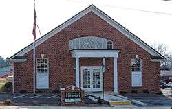 Boonville's library | |
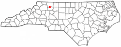 Location of Boonville, North Carolina | |
| Coordinates: 36°14′0″N 80°42′28″W / 36.23333°N 80.70778°WCoordinates: 36°14′0″N 80°42′28″W / 36.23333°N 80.70778°W | |
| Country | United States |
| State | North Carolina |
| County | Yadkin |
| Area | |
| • Total | 1.3 sq mi (3.3 km2) |
| • Land | 1.3 sq mi (3.3 km2) |
| • Water | 0.0 sq mi (0.0 km2) |
| Elevation | 1,099 ft (335 m) |
| Population (2010) | |
| • Total | 1,222 |
| • Estimate (2016)[1] | 1,204 |
| • Density | 940/sq mi (370/km2) |
| Time zone | UTC-5 (Eastern (EST)) |
| • Summer (DST) | UTC-4 (EDT) |
| ZIP code | 27011 |
| Area code(s) | 336 |
| FIPS code | 37-07140[2] |
| GNIS feature ID | 0981743[3] |
| Website |
boonvillenc |
Boonville is a town in Yadkin County, North Carolina, United States. The population was 1,222 at the 2010 census.
History
Boonville was named for Daniel Boone.[4][5] A post office has been in operation in Boonville since 1857.[6]
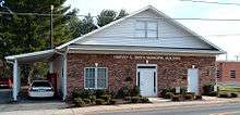
The Boonville Community Volunteer Fire Department was organized in 1941 with Harvey Smith serving as its first Chief. The former fire department building has since been named the Harvey E Smith Municipal Building and now houses the police station and meeting space for the town council. The new fire station was erected just south of Main Street in 1997.
Geography
Boonville is located at 36°14′0″N 80°42′28″W / 36.23333°N 80.70778°W (36.233338, -80.707853).[7]
According to the United States Census Bureau, the town has a total area of 1.3 square miles (3.4 km2), all of it land.
Nearby Town, cities
Demographics
| Historical population | |||
|---|---|---|---|
| Census | Pop. | %± | |
| 1880 | 46 | — | |
| 1900 | 183 | — | |
| 1910 | 282 | 54.1% | |
| 1920 | 162 | −42.6% | |
| 1930 | 394 | 143.2% | |
| 1940 | 405 | 2.8% | |
| 1950 | 502 | 24.0% | |
| 1960 | 539 | 7.4% | |
| 1970 | 687 | 27.5% | |
| 1980 | 1,028 | 49.6% | |
| 1990 | 1,009 | −1.8% | |
| 2000 | 1,138 | 12.8% | |
| 2010 | 1,222 | 7.4% | |
| Est. 2016 | 1,204 | [1] | −1.5% |
| U.S. Decennial Census[8] | |||
As of the census[2] of 2000, there were 1,138 people, 476 households, and 343 families residing in the town. The population density was 894.0 people per square mile (346.0/km²). There were 511 housing units at an average density of 401.4 per square mile (155.4/km²). The racial makeup of the town was 94.29% White, 4.48% African American, 0.26% Asian, 0.70% from other races, and 0.26% from two or more races. Hispanic or Latino of any race were 0.35% of the population.
There were 476 households out of which 35.5% had children under the age of 18 living with them, 54.6% were married couples living together, 14.7% had a female householder with no husband present, and 27.9% were non-families. 26.5% of all households were made up of individuals and 14.1% had someone living alone who was 65 years of age or older. The average household size was 2.38 and the average family size was 2.85.
In the town, the population was spread out with 24.3% under the age of 18, 7.2% from 18 to 24, 28.3% from 25 to 44, 24.3% from 45 to 64, and 15.9% who were 65 years of age or older. The median age was 39 years. For every 100 females, there were 88.4 males. For every 100 females age 18 and over, there were 80.5 males.
The median income for a household in the town was $32,019, and the median income for a family was $42,794. Males had a median income of $30,341 versus $21,298 for females. The per capita income for the town was $16,101. About 13.2% of families and 13.0% of the population were below the poverty line, including 16.4% of those under age 18 and 15.4% of those age 65 or over.
Notable people
References
- 1 2 "Population and Housing Unit Estimates". Retrieved June 9, 2017.
- 1 2 "American FactFinder". United States Census Bureau. Archived from the original on 2013-09-11. Retrieved 2008-01-31.
- ↑ "US Board on Geographic Names". United States Geological Survey. 2007-10-25. Retrieved 2008-01-31.
- ↑ Gannett, Henry (1905). The Origin of Certain Place Names in the United States. U.S. Government Printing Office. p. 52.
- ↑ "Boonville NC History". boonvillenc.com. Retrieved 2016-05-25.
- ↑ "County". Jim Forte Postal History. Archived from the original on 2 April 2015. Retrieved 6 March 2015.
- ↑ "US Gazetteer files: 2010, 2000, and 1990". United States Census Bureau. 2011-02-12. Retrieved 2011-04-23.
- ↑ "Census of Population and Housing". Census.gov. Archived from the original on May 12, 2015. Retrieved June 4, 2015.
External links
Municipalities and communities of Yadkin County, North Carolina, United States | ||
|---|---|---|
| Towns | 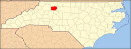 | |
| Townships | ||
| Unincorporated communities |
| |