Lenoir County, North Carolina
| Lenoir County, North Carolina | ||
|---|---|---|
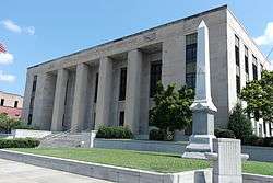 Lenoir County Courthouse in Kinston | ||
| ||
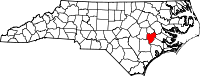 Location in the U.S. state of North Carolina | ||
 North Carolina's location in the U.S. | ||
| Founded | 1791 | |
| Named for | William Lenoir | |
| Seat | Kinston | |
| Largest city | Kinston | |
| Area | ||
| • Total | 403 sq mi (1,044 km2) | |
| • Land | 401 sq mi (1,039 km2) | |
| • Water | 2.2 sq mi (6 km2), 0.6% | |
| Population | ||
| • (2010) | 59,495 | |
| • Density | 149/sq mi (58/km2) | |
| Congressional district | 3rd | |
| Time zone | Eastern: UTC−5/−4 | |
| Website |
www | |

Lenoir County is a county in the U.S. state of North Carolina. As of the 2010 Census, the population was 59,495.[1] Its county seat is Kinston,[2] located on the Neuse River, across which the county has its territory.
Lenoir County comprises the Kinston, NC Micropolitan Statistical Area.
History
The county was formed by European Americans in 1791 from the southern part of Dobbs County. It was named for William Lenoir (1751-1839), an officer in the American Revolutionary War who took part in the Battle of Kings Mountain.[3] He was a prominent political leader; when the county was established, he was serving as Speaker of the North Carolina Senate.
Geography
According to the U.S. Census Bureau, the county has an area of 403 square miles (1,040 km2), of which 401 square miles (1,040 km2) is land and 2.2 square miles (5.7 km2) (0.6%) is water.[4]
Adjacent counties
- Greene County - North
- Pitt County - Northeast
- Craven County - East
- Jones County - Southeast
- Duplin County - Southwest
- Wayne County - West
Demographics
| Historical population | |||
|---|---|---|---|
| Census | Pop. | %± | |
| 1800 | 4,005 | — | |
| 1810 | 5,572 | 39.1% | |
| 1820 | 6,799 | 22.0% | |
| 1830 | 7,723 | 13.6% | |
| 1840 | 7,605 | −1.5% | |
| 1850 | 7,828 | 2.9% | |
| 1860 | 10,220 | 30.6% | |
| 1870 | 10,434 | 2.1% | |
| 1880 | 15,344 | 47.1% | |
| 1890 | 14,879 | −3.0% | |
| 1900 | 18,639 | 25.3% | |
| 1910 | 22,769 | 22.2% | |
| 1920 | 29,555 | 29.8% | |
| 1930 | 35,716 | 20.8% | |
| 1940 | 41,211 | 15.4% | |
| 1950 | 45,953 | 11.5% | |
| 1960 | 55,276 | 20.3% | |
| 1970 | 55,204 | −0.1% | |
| 1980 | 59,819 | 8.4% | |
| 1990 | 57,274 | −4.3% | |
| 2000 | 59,648 | 4.1% | |
| 2010 | 59,495 | −0.3% | |
| Est. 2016 | 57,307 | [5] | −3.7% |
| U.S. Decennial Census[6] 1790-1960[7] 1900-1990[8] 1990-2000[9] 2010-2013[1] | |||
The United States Census Bureau's most recent census, taken on April 1, 2010, estimated there were 59,495 residents with 24,327 households and 15,993 families residing within the county.[10] The population density was 149 people per square mile (58/km²). There were 27,184 housing units at an average density of 68 per square mile (26/km²). The county's racial makeup was 56.47% White, 40.43% Black or African American, 0.18% Native American, 0.34% Asian, 0.05% Pacific Islander, 1.88% from other races, and 0.66% from two or more races. 3.17% of the population were Hispanic or Latino of any race.
There were 23,862 households out of which 31.30% had children under the age of 18 living with them, 46.40% were married couples living together, 17.30% had a female householder with no husband present, and 32.20% were non-families. 28.40% of all households were made up of individuals and 11.80% had someone living alone who was 65 years of age or older. The average household size was 2.43 and the average family size was 2.96.
In the county, the population was spread out with 25.30% under the age of 18, 7.90% from 18 to 24, 27.60% from 25 to 44, 24.60% from 45 to 64, and 14.60% who were 65 years of age or older. The median age was 38 years. For every 100 females there were 90.30 males. For every 100 females age 18 and over, there were 84.70 males.
The median income for a household in the county was $31,191, and the median income for a family was $38,815. Males had a median income of $28,879 versus $21,536 for females. The per capita income for the county was $16,744. About 12.60% of families and 16.60% of the population were below the poverty line, including 22.00% of those under age 18 and 18.40% of those age 65 or over.
Communities
City
- Kinston (county seat)
Towns
Census-designated place
Other unincorporated communities
Townships
- Contentnea Neck
- Falling Creek
- Institute
- Kinston
- Moseley Hall
- Neuse
- Pink Hill
- Sand Hill
- Southwest
- Trent
- Vance
- Woodington
Law, government and politics
| Year | Republican | Democratic | Third Parties |
|---|---|---|---|
| 2016 | 50.8% 13,613 | 47.1% 12,634 | 2.1% 560 |
| 2012 | 49.8% 13,980 | 49.7% 13,948 | 0.6% 158 |
| 2008 | 49.8% 13,401 | 49.7% 13,378 | 0.4% 118 |
| 2004 | 55.8% 12,939 | 44.0% 10,207 | 0.1% 33 |
| 2000 | 54.4% 11,512 | 45.0% 9,527 | 0.6% 124 |
| 1996 | 49.8% 9,433 | 45.6% 8,635 | 4.5% 857 |
| 1992 | 45.0% 8,932 | 44.3% 8,793 | 10.7% 2,117 |
| 1988 | 58.1% 10,669 | 41.7% 7,649 | 0.2% 35 |
| 1984 | 60.8% 13,321 | 39.0% 8,556 | 0.2% 37 |
| 1980 | 55.5% 9,832 | 42.6% 7,546 | 1.9% 336 |
| 1976 | 49.9% 7,715 | 49.4% 7,650 | 0.7% 109 |
| 1972 | 73.9% 11,065 | 24.5% 3,672 | 1.6% 238 |
| 1968 | 24.4% 3,844 | 24.5% 3,853 | 51.1% 8,036 |
| 1964 | 42.4% 5,617 | 57.6% 7,617 | |
| 1960 | 31.0% 3,658 | 69.0% 8,126 | |
| 1956 | 27.2% 2,564 | 72.8% 6,847 | |
| 1952 | 24.9% 2,233 | 75.1% 6,723 | |
| 1948 | 8.4% 515 | 88.5% 5,445 | 3.1% 190 |
| 1944 | 9.5% 554 | 90.5% 5,253 | |
| 1940 | 6.6% 440 | 93.4% 6,247 | |
| 1936 | 5.7% 351 | 94.3% 5,854 | |
| 1932 | 6.9% 350 | 92.6% 4,677 | 0.5% 24 |
| 1928 | 35.7% 1,311 | 64.3% 2,363 | |
| 1924 | 18.8% 514 | 80.3% 2,191 | 0.9% 25 |
| 1920 | 31.1% 1,153 | 69.0% 2,560 | |
| 1916 | 28.6% 667 | 71.4% 1,666 | 0.1% 2 |
| 1912 | 6.0% 122 | 77.0% 1,568 | 17.0% 347 |
Throughout the first two-thirds of the twentieth century, Lenoir County was a typical overwhelmingly Democratic "Solid South" county. It was always carried by the Democratic Presidential nominee between at least 1876 and 1964, following upon which "American Independent" candidate George Wallace obtained a majority of the county's vote in 1968 amidst large-scale opposition to racial desegregation and civil rights for African-Americans. In every election since, Lenoir County has voted for the Republican presidential nominee, although on several occasions the GOP margin has been extremely close and on only five occasions out of twelve has the margin been more than ten percentage points.
Lenoir County is a member of the Eastern region in the North Carolina Councils of Government.
Education
Higher Education
Lenoir County is home to one higher learning institution, Lenoir Community College - which is located in Kinston and is part of the North Carolina Community College System. The college offers associate degrees, diplomas, or certificates for educational programs in college transfer, business, industry, public services, health sciences, and continuing education. Programs and support services are accessible through traditional and distance learning options.[11]
Primary and Secondary Education
Public education in Lenoir County is administered and supported by the Lenoir County Public School Board, which formed from a merge of the City of Kinston and Lenoir County school systems in 1992. There are four public high schools in Lenoir County: Lenoir County Early College, North Lenoir, South Lenoir, and Kinston High School. Three public middle schools: E.B. Frink, Rochelle, and Woodington. There are also eight public elementary schools: Banks, La Grange, Moss Hill, Northeast, Northwest, Pink Hill, Southeast and Southwood. Additionally, Contentnea-Savannah is a K-8 school; there is one alternative school, Sampson.[12]
Lenoir County is also home to two private academies - Arendell Parrott Academy and Bethel Christian Academy - and two charter academies - Kinston Charter Academy and Children's Village Academy.
Libraries
Neuse Regional Library serves the residents of Lenoir, Greene, and Jones counties. With eight different locations, the library system offers services such as 3D printing and an inter-library loan system, as well as a eLibrary.
Transportation
Airport
Lenoir County is served by the Kinston Regional Jetport (IATA: ISO, ICAO: KISO) with service to Orlando, Florida. Raleigh–Durham International Airport is the closest major airport with service to more than 45 domestic and international destinations.
Major highways
The main highway in the county is US 70, which offers access to the North Carolina coast and I-95. Other highways that run through the county include US 258, NC 11, NC 58, NC 903 and NC 55. Interstate 95 is the closest Interstate Highway to the county, 50 miles west in Selma.
Bus
The county is served by Greyhound with a location in Kinston.
Health
Lenoir County is home to UNC Lenoir Healthcare, a 261-bed non-profit hospital in Kinston.
See also
References
- 1 2 "State & County QuickFacts". United States Census Bureau. Archived from the original on July 13, 2011. Retrieved October 21, 2013.
- ↑ "Find a County". National Association of Counties. Retrieved 2011-06-07.
- ↑ Gannett, Henry (1905). The Origin of Certain Place Names in the United States. U.S. Government Printing Office. p. 185.
- ↑ "2010 Census Gazetteer Files". United States Census Bureau. August 22, 2012. Archived from the original on January 12, 2015. Retrieved January 17, 2015.
- ↑ "Population and Housing Unit Estimates". Retrieved June 9, 2017.
- ↑ "U.S. Decennial Census". United States Census Bureau. Retrieved January 17, 2015.
- ↑ "Historical Census Browser". University of Virginia Library. Retrieved January 17, 2015.
- ↑ Forstall, Richard L., ed. (March 27, 1995). "Population of Counties by Decennial Census: 1900 to 1990". United States Census Bureau. Retrieved January 17, 2015.
- ↑ "Census 2000 PHC-T-4. Ranking Tables for Counties: 1990 and 2000" (PDF). United States Census Bureau. April 2, 2001. Retrieved January 17, 2015.
- ↑ Bureau, U.S. Census. "American FactFinder - Community Facts". factfinder.census.gov. Retrieved 2017-12-01.
- ↑ "About LCC - Lenoir Community College". Lenoir Community College. Retrieved 2017-12-01.
- ↑ Lenoir County Public Schools
External links
- Lenoir County government official website
- NCGenWeb Lenoir County - free genealogy resources for the county
Places adjacent to Lenoir County, North Carolina | ||||||||||
|---|---|---|---|---|---|---|---|---|---|---|
| ||||||||||
Municipalities and communities of Lenoir County, North Carolina, United States | ||
|---|---|---|
| City | 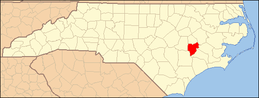 | |
| Towns | ||
| CDP | ||
| Unincorporated communities | ||
| Footnotes | ‡This populated place also has portions in an adjacent county or counties | |
