Clayton, North Carolina
| Clayton, North Carolina | ||
|---|---|---|
| Town | ||
| ||
| Motto(s): "The Premier Community for Active Families" | ||
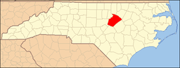
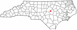 Location of Clayton, North Carolina | ||
 Clayton Location of Clayton, North Carolina  Clayton Clayton (the US) | ||
| Coordinates: 35°38′50″N 78°27′29″W / 35.64722°N 78.45806°WCoordinates: 35°38′50″N 78°27′29″W / 35.64722°N 78.45806°W | ||
| Country | United States | |
| State | North Carolina | |
| Counties | Johnston, Wake | |
| Established | 1869 | |
| Area | ||
| • Total | 13.53 sq mi (35.05 km2) | |
| • Land | 13.51 sq mi (34.99 km2) | |
| • Water | 0.02 sq mi (0.06 km2) | |
| Elevation | 341 ft (104 m) | |
| Population (2010) | ||
| • Total | 16,116 | |
| • Estimate (2017)[1] | 21,405 | |
| • Density | 1,584/sq mi (611.7/km2) | |
| Time zone | UTC−5 (Eastern (EST)) | |
| • Summer (DST) | UTC−4 (EDT) | |
| ZIP codes | 27520, 27527 | |
| Area code(s) | 919 | |
| FIPS code | 37-12860[2] | |
| GNIS feature ID | 1019689[3] | |
| Website |
www | |

Clayton is a town in Johnston County, North Carolina, United States, and is considered a satellite town of Raleigh. As of 2010, Clayton's population was 16,116,[4] up from 6,973 at the 2000 census. By 2017 the town's estimated population was 21,405.[1] Much of that growth can be attributed to the town's proximity to the Research Triangle area and access to major highways such as I-40 and US 70.
Geography
Clayton is in northern Johnston County, with a small portion extending northwest along US 70 Business into Wake County. In 2006, construction began on the Highway 70 Clayton Bypass, a 10.5-mile (16.9 km) stretch from Interstate 40 along the southern portion of Clayton to Highway 70 business southeast of town. It was completed in June 2008. US 70 leads southeast 13 miles (21 km) to Interstate 95 at Smithfield. Downtown Raleigh is 16 miles (26 km) northwest of Clayton via US 70 Business and Interstate 40.
According to the U.S. Census Bureau, as of the 2010 census the town had an area of 13.53 square miles (35.05 km2), of which 13.51 square miles (34.99 km2) were land and 0.02 square miles (0.06 km2), or 0.16%, were water.[4] The town is part of the Neuse River watershed. The town limits now extend northeast to the Neuse River and beyond.
Town Hall is located at 111 East Second Street and is shared with The Clayton Center, a performing arts and conference center.
History
The community which has grown into the town of Clayton was built on a road cut by Governor Tryon's troops around 1770 as they marched northwest from New Bern to Hillsborough against the Regulators. Nearly 100 years later the railroad came through and the community had its first name—Stallings' Station, since the depot for the North Carolina Railroad was in the home of Mrs. Sarah Stallings. The name lasted only three years, however, before officially becoming Clayton. Incorporation followed in 1869.
The new town was far from prosperous, and the Civil War made a depressed local economy even worse. Many long-time citizens moved away during that period.
Following the war, the railroad was extended and businesses began to pop up. Ashley Horne developed a successful farming and merchandising business to become one of the most successful merchants and manufacturers in all of North Carolina. Horne's success inspired two other men, McCullers and Barbour, to open businesses that also did well, beginning an era of growth that lasted well into the next century. Some of the businesses that flourished during that time were lumber plants, a brick kiln, a cotton gin, a gristmill, a sawmill, tobacco warehouses, cotton mills and a turpentine distillery.
By the early 1900s, the town had become a major market for cotton, watermelons and tobacco. In 1907, the Evening Times of nearby Raleigh wrote that there was "more money per capita in Clayton than any city its size in the world."
Unfortunately, the town lost its financial eminence in the 1930s with the onset of the Great Depression, and its population grew slowly for the next forty years. The three local cotton mills continued to be a major source of jobs during that time, with 1,000 employees, but the local economy was modest and cotton was soon on its way out. By the early 1960s the mills were gone and cotton was no longer a player in the local economy. But the tobacco industry was bustling and the population shot up for a while before settling back down as farming became less and less profitable.
The state began to change during the 1970s. An industrial base began taking shape and residential growth was increasing in the Raleigh area nearby. Clayton's workforce adapted, shifting to a more service/trades-oriented economy, and the town began to grow once again. By 1980, the population had grown to 4,091 and to 4,756 by 1990. The population then jumped to 6,973 in the 2000 census. Today, manufacturers like Caterpillar and bio-pharmaceutical companies like Grifols (formerly Talecris) and Novo Nordisk are big local employers. In 2010, the population had increased to 16,116.
The Clayton Banking Company Building, Clayton Graded School and Clayton Grammar School-Municipal Auditorium, Clayton Historic District, Cleveland School, Ellington-Ellis Farm, Walter R. and Eliza Smith Moore House, Sanders-Hairr House, and Stallings-Carpenter House are listed on the National Register of Historic Places.[5]
Demographics
| Historical population | |||
|---|---|---|---|
| Census | Pop. | %± | |
| 1880 | 352 | — | |
| 1890 | 478 | 35.8% | |
| 1900 | 754 | 57.7% | |
| 1910 | 1,441 | 91.1% | |
| 1920 | 1,423 | −1.2% | |
| 1930 | 1,533 | 7.7% | |
| 1940 | 1,711 | 11.6% | |
| 1950 | 2,229 | 30.3% | |
| 1960 | 3,302 | 48.1% | |
| 1970 | 3,103 | −6.0% | |
| 1980 | 4,091 | 31.8% | |
| 1990 | 4,756 | 16.3% | |
| 2000 | 6,973 | 46.6% | |
| 2010 | 16,116 | 131.1% | |
| Est. 2017 | 21,405 | [1] | 32.8% |
| U.S. Decennial Census[6] | |||
As of the 2010 census,[7] there were 16,116 residents living within the Town of Clayton. There were 5,944 households, with an average of 2.57 persons per household. The population density was 1,192.8 inhabitants per square mile (460.5/km2) with an inventory of 6,648 housing units at an average density of 492 per square mile (190/km2). The racial makeup of the town was 69.5% White, 21.8% African American, 10.7% Hispanic or Latino 0.4% American Indian, 1.4% Asian, 0% Pacific Islander.
Of the 5,944 households in the 2010 census, 44% had children under the age of 18 living with them, 50.6% were married couples living together, 15.2% had a female householder with no husband present, and 30% were non-families. 25.4% of non-family households were made up of householders living alone. 16.3% of households had individuals 65 years of age or older.
The age demographics of the 2010 census determined that 32.9% were under the age of 19, 4.9% were aged 20 to 24, 32.8% aged 25 to 44, 20.8% aged 45 to 64, and 8.5% were 65 years of age or older. The median age was 34.9 years. Females made up 52.5% of the population while males made up 47.5% of the population.
The median income for a household in the town was $53,101, and the median income for a family was $64,856. Males had a median income of $46,108 versus $40,839 for females. The per capita income for the town was $26,234. These figures put Town of Clayton well ahead of the North Carolina averages for the same categories.
Government
Town council
- Mayor
- Jody McLeod
- Serving since – Dec. 2003
- Term expires – 2019
- Council members
- Michael Grannis
- Serving since – Dec 2005
- Term expires – 2021
- Bobby Bunn
- Serving since – Dec. 2017
- Term expires – 2021
- Jason Thompson
- Serving since – Dec. 2011
- Term expires – 2019
- R.S. "Butch" Lawter Jr.
- Serving since – Jan 2009
- Term expires – 2019
- Art Holder
- Serving since – Dec. 2009
- Term expires – 2021
Education
- Clayton High School (Home of the Comets)
- Clayton Middle School (Home of the Eagles)
- Cooper Academy (Home of the Rockets)
- East Clayton Elementary School (Home of the Explorers)
- Powhatan Elementary School (Home of the Pride)
- River Dell Elementary School (Home of the Racers)
- Riverwood Elementary School (Home of the Rams)
- Riverwood Middle School (Home of the Ravens)
- West Clayton Elementary School (Home of the Bulldogs)
Notable people
- Chris Archer,[8] Major League Baseball player
- William Dodd (1869–1940), historian who served as the United States Ambassador to Germany from 1933 to 1937 during the Nazi era
- Lt. Eric Lamar Ellington (U.S. Army), pioneer of military aviation and namesake of Ellington Field, Houston, Texas[9]
- Kendra "Keni" Harrison, set the world record in the women's 100 metres hurdles with a time of 12.20 seconds on July 22, 2016, at the London Grand Prix;[10] graduate of Clayton High School
- James Talacek, professional aquanaut
References
- 1 2 3 "Annual Estimates of the Resident Population: April 1, 2010 to July 1, 2017 (PEPANNRES): City and Town Population Totals, North Carolina". American Factfinder. U.S. Census Bureau. Retrieved October 11, 2018.
- ↑ "American FactFinder". United States Census Bureau. Archived from the original on 2013-09-11. Retrieved 2008-01-31.
- ↑ "US Board on Geographic Names". United States Geological Survey. 2007-10-25. Retrieved 2008-01-31.
- 1 2 "Geographic Identifiers: 2010 Census Summary File 1 (G001): Clayton town, North Carolina". American Factfinder. U.S. Census Bureau. Retrieved October 11, 2018.
- ↑ National Park Service (2010-07-09). "National Register Information System". National Register of Historic Places. National Park Service.
- ↑ "Census of Population and Housing". Census.gov. Archived from the original on May 12, 2015. Retrieved June 4, 2015.
- ↑
- ↑ http://espn.go.com/mlb/player/_/id/31003/chris-archer
- ↑ "Lt. Eric Lamar Ellington 1889-1913". Houston Post. Oct–Nov 1957. Retrieved 2013-09-12.
- ↑ "Clayton's Keni Harrison bounces back with world record hurdle run". Retrieved 2016-09-13.
External links
| |||||||||||||||||||||||||||||||||||||||||||||||