Garner, North Carolina
| Town of Garner, North Carolina | |
|---|---|
| Town | |
 Water tower over Main Street, Garner | |
| Motto(s): A Great Place to Be | |
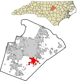 Location in Wake County and the state of North Carolina. | |
| Coordinates: 35°41′54″N 78°37′22″W / 35.69833°N 78.62278°WCoordinates: 35°41′54″N 78°37′22″W / 35.69833°N 78.62278°W | |
| Country | United States |
| State | North Carolina |
| County | Wake |
| Incorporated | 1905 |
| Government | |
| • Type | Council–Manager |
| • Mayor | Ronnie Williams (D) |
| • Garner Town Council | |
| • Town Manager | Rodney Dickerson |
| Area | |
| • Total | 14.8 sq mi (38.3 km2) |
| • Land | 14.7 sq mi (38.2 km2) |
| • Water | 0.04 sq mi (0.1 km2) |
| Elevation | 434 ft (132 m) |
| Population (2010) | |
| • Total | 25,745 |
| • Estimate (2016)[1] | 28,776 |
| • Density | 1,700/sq mi (670/km2) |
| Time zone | UTC−5 (EST) |
| • Summer (DST) | UTC−4 (EDT) |
| ZIP code | 27529 |
| Area code(s) | 919 |
| FIPS code | 37-25480[2] |
| GNIS feature ID | 0985572[3] |
| Website |
www |
Garner is a town in Wake County, North Carolina, United States and a suburb of Raleigh. The city limits are entirely within Wake County, though portions of unincorporated Wake County, as well as the Cleveland community in northern Johnston County have Garner mailing addresses. The population was estimated to be 27,814 as of July 1, 2014.[4] It is part of the Research Triangle region of North Carolina and serves as a bedroom community for the region.
Geography
Garner is located at 35°41′54″N 78°37′22″W / 35.69833°N 78.62278°W (35.698243, -78.622865).[5]
According to the United States Census Bureau, the town has a total area of 14.8 square miles (38.3 km2), of which 14.7 square miles (38.2 km2) is land and 0.04 square miles (0.1 km2), or 0.34%, is water.[6]
Garner is located entirely within Wake County.[7] There are unincorporated areas of Wake County and Johnston County that have Garner postal addresses, including a portion of the unincorporated, but densely populated, Cleveland Community.
Demographics
| Historical population | |||
|---|---|---|---|
| Census | Pop. | %± | |
| 1910 | 284 | — | |
| 1920 | 376 | 32.4% | |
| 1930 | 476 | 26.6% | |
| 1940 | 768 | 61.3% | |
| 1950 | 1,180 | 53.6% | |
| 1960 | 3,451 | 192.5% | |
| 1970 | 4,923 | 42.7% | |
| 1980 | 10,073 | 104.6% | |
| 1990 | 14,967 | 48.6% | |
| 2000 | 17,757 | 18.6% | |
| 2010 | 25,745 | 45.0% | |
| Est. 2016 | 28,776 | [1] | 11.8% |
| U.S. Decennial Census[8] | |||
As of the census[2] of 2000, there were 17,757 people, 6,950 households, and 4,830 families residing in the town. The population density was 1,385.1 people per square mile (534.8/km²). There were 7,252 housing units at an average density of 565.7 per square mile (218.4/km²). The racial makeup of the town was 67.02% White, 27.13% African American, 0.41% Native American, 1.11% Asian, 0.02% Pacific Islander, 2.77% from other races, and 1.54% from two or more races. Hispanic or Latino of any race were 4.75% of the population.
There were 6,950 households out of which 34.0% had children under the age of 18 living with them, 53.5% were married couples living together, 12.7% had a female householder with no husband present, and 30.5% were non-families. 24.2% of all households were made up of individuals and 6.5% had someone living alone who was 65 years of age or older. The average household size was 2.51 and the average family size was 3.00.
In the town, the population was spread out with 25.0% under the age of 18, 7.9% from 18 to 24, 33.6% from 25 to 44, 22.6% from 45 to 64, and 10.9% who were 65 years of age or older. The median age was 36 years. For every 100 females, there were 93.5 males. For every 100 females age 18 and over, there were 89.2 males.
The median income for a household in the town was $47,380, and the median income for a family was $58,302. Males had a median income of $37,359 versus $29,805 for females. The per capita income for the town was $22,433. About 4.9% of families and 6.8% of the population were below the poverty line, including 8.9% of those under age 18 and 10.1% of those age 65 or over.
History
Land near the town of Garner was first settled around 1751. In the 1850s, the North Carolina Railroad was built, and before the 1870s, a wood-and-water stop was established in present-day downtown Garner. The community of Garner's Station received a post office in 1878 and was incorporated in 1883, but the community had its charter repealed in 1891.
In 1905, the charter was reinstated as the Town of Garner. The first mayor was J.B. Richardson, and the first aldermen were H.D. Rand, J.J. Bagwell, H. Bryan, M.C. Penny, and J.S. Buffaloe.
In 1912, the telephone came to Garner. The town is off of US 70, which in 1917 became the first paved highway to be built in North Carolina.[9]
| Wikinews has related news: Explosion at ConAgra plant in North Carolina, multiple injuries |
An explosion and partial roof collapse of a ConAgra Foods plant on June 9, 2009, killed four and injured some 40 workers.[10][11]
The Downtown Garner Historic District, Edenwood, and Meadowbrook Country Club are listed on the National Register of Historic Places.[12]
Government
City Council and City Manager
Garner currently operates under a council–manager government whereby the Town Council is the publicly elected legislative body of the town, and appoints a Town Manager to manage the administrative operations of the town. The Town Council consists of the Mayor and five Town Council Members, one of whom serves as Mayor "Pro Tempore."
City Police Department
The Garner Police Department has 63 sworn police officers and 11 professional staff personnel (including full-time and part-time staff) to provide law enforcement services to a town roughly 15 square miles in area with a permanent residential population of over 29,000 citizens. The Department is divided into two bureaus—the Operations Bureau and the Administration Bureau.
Employment
According to Garner's 2016 Comprehensive Annual Financial Report,[13] the top employers in the town were:
| # | Employer | # of Employees |
|---|---|---|
| 1 | Wake County Public School System | 800 |
| 2 | Food Lion | 360 |
| 3 | Walmart | 350 |
| 4 | Pergo | 284 |
| 5 | Cabela's | 277 |
| 6 | Golden State Foods | 265 |
| 7 | F&D Huebner, LLC | 258 |
| 8 | Target | 251 |
| 9 | Strategic Behavioral Health | 206 |
| 10 | Kroger | 200 |
Transportation
Roads
Several major roads and highways serve Garner:
- Interstate 40 passes by the north and east sides of Garner. The town can be accessed via South Saunders Street (Exit 298-A), Hammond Road (Exit 299), Jones Sausage (Exit 303), or US 70 (Exit 306-B).
- U.S. 70 serves as the main east-west highway through Garner. Most of the businesses and shopping centers lie on U.S. 70
- U.S. 401 splits from U.S. 70 at the town's northwestern corner and runs to the west of the town.
- N.C. 50 enters the town with U.S. 401 and U.S. 70 at the northwestern corner, then splits from U.S. 70 at Benson Road, serving as a major north-south arterial through Garner, and paralleling I-40 into Johnston County.
- N.C. 42 is an east-west highway south of Garner. Though outside of the town limits proper, it serves many addresses in unincorporated parts of Wake and Johnston counties with Garner addresses.
- Timber Drive is an extension of Hammond Road that serves as a major arterial to connect residential areas of Garner with U.S. 70 and I-40.
- Garner Road is a former alignment of U.S. 70 that parallels it along the town's northern edge.
Public transportation
Garner is served by the Triangle Transit bus route 102.
Rail
Amtrak passes through Garner but does not have a scheduled stop. The nearest station is in Raleigh.
Air
The nearest commercial airport with regular passenger service is Raleigh-Durham International Airport. General aviation services can also be found at the Triple W Airport in Fuquay-Varina or the Raleigh East Airport in Knightdale.
Education
The following schools serve students in and around Garner. Most, but not all, are located within the town limits of Garner. With few exceptions, school districts in North Carolina are organized at the county level, and students are often assigned to schools without regard to which municipality they live in.
Wake County public schools:[14]
- Aversboro Elementary School
- Creech Road Elementary School
- East Garner Elementary School
- Rand Road Elementary School
- Smith Magnet Elementary School
- Timber Drive Elementary School
- Vandora Springs Elementary School
- Vance Elementary School
- East Garner Middle School
- North Garner Middle School
- Garner Magnet High School
Johnston County public schools:[15]
- Polenta Elementary School
- West View Elementary School
- Cleveland Middle School
Notable people
- Brandon Banks, CFL Hamilton Tiger-Cats
- Chris Culliver, San Francisco 49ers
- Carl Franks, former Duke University head football coach and former University of South Florida assistant coach
- Donnie Harrison, Sheriff of Wake County, North Carolina
- Arlie Honeycutt, (home of) Miss North Carolina 2012
- Chris Jelley, Graphic Designer for the Charlotte Hornets
- Scotty McCreery, American Idol season 10 winner
- John Wall, professional basketball player for the Washington Wizards
- David West, NCAA Player-of-the-Year at Xavier University and currently plays for the Golden State Warriors of the NBA
- Donald Williams, University of North Carolina at Chapel Hill Final Four MVP
References
- 1 2 "Population and Housing Unit Estimates". Retrieved June 9, 2017.
- 1 2 "American FactFinder". United States Census Bureau. Archived from the original on 2013-09-11. Retrieved 2008-01-31.
- ↑ "US Board on Geographic Names". United States Geological Survey. 2007-10-25. Retrieved 2008-01-31.
- ↑ "Annual Estimates of the Resident Population: April 1, 2010 to July 1, 2014". U.S. Census Bureau, American Factfinder. Archived from the original on May 18, 2016. Retrieved May 21, 2015.
- ↑ "US Gazetteer files: 2010, 2000, and 1990". United States Census Bureau. 2011-02-12. Retrieved 2011-04-23.
- ↑ "Geographic Identifiers: 2010 Demographic Profile Data (G001): Garner town, North Carolina". U.S. Census Bureau, American Factfinder. Archived from the original on September 11, 2013. Retrieved December 29, 2011.
- ↑ "Garner Corporate Limits as of August, 2008" (PDF).
- ↑ "Census of Population and Housing". Census.gov. Archived from the original on May 12, 2015. Retrieved June 4, 2015.
- ↑ Town of Garner website, Town History
- ↑ "Bodies removed from Garner plant rubble". wral.com. 2009-06-10. Archived from the original on 2011-05-13. Retrieved 2009-06-10.
- ↑ "2 dead, 1 missing after Slim Jim plant explosion". cnn.com. 2009-06-09. Archived from the original on 2011-05-13. Retrieved 2009-06-10.
- ↑ National Park Service (2010-07-09). "National Register Information System". National Register of Historic Places. National Park Service.
- ↑ "Town of Garner Comprehensive Annual Financial Report". Town of Garner. 2016-12-20. Retrieved 2017-04-27.
- ↑ Wake County Public School System
- ↑ Schools in Johnston County Schools. Schooldigger.com Archived May 13, 2011, at WebCite
External links
Greater Raleigh Metropolitan Region (Raleigh-Cary MSA, part of the Research Triangle) | ||
|---|---|---|
| Principal cities |  | |
| Other significant cities | ||
| Counties | ||
| Major universities | ||
| Transportation | ||
| Miscellaneous | ||
Municipalities and communities of Wake County, North Carolina, United States | ||
|---|---|---|
| Cities |  | |
| Towns | ||
| Townships | ||
| Unincorporated communities |
| |
| Footnotes | ‡This populated place also has portions in an adjacent county or counties | |