Ossipee, North Carolina
| Ossipee, North Carolina | |
|---|---|
| town | |
 Ossipee Dam on the Reedy Fork of the Haw River | |
 Ossipee Location within the state of North Carolina | |
| Coordinates: 36°10′46″N 79°30′24″W / 36.17944°N 79.50667°WCoordinates: 36°10′46″N 79°30′24″W / 36.17944°N 79.50667°W | |
| Country | United States |
| State | North Carolina |
| County | Alamance |
| Area | |
| • Total | 0.62 sq mi (1.61 km2) |
| • Land | 0.61 sq mi (1.57 km2) |
| • Water | 0.02 sq mi (0.04 km2) |
| Population (2010) | |
| • Total | 543 |
| • Estimate (2016)[1] | 562 |
| • Density | 870/sq mi (340/km2) |
| Time zone | UTC-5 (Eastern Time Zone) |
| • Summer (DST) | UTC-4 (EDT) |
| ZIP codes | 27244 |
| FIPS code | 37-49600 |
Ossipee is an incorporated town in northwestern Alamance County in the U.S. state of North Carolina. Ossipee is one of the newer municipalities in the state, as it was incorporated officially on December 9, 2002.[2] It was part of the Altamahaw-Ossipee census-designated place until its incorporation.[3] The town had a 2010 population of 543.[4] The town belongs to the Piedmont Triad metropolitan area.
Demographics
| Historical population | |||
|---|---|---|---|
| Census | Pop. | %± | |
| 2010 | 543 | — | |
| Est. 2016 | 562 | [1] | 3.5% |
| U.S. Decennial Census[5] | |||
References
- 1 2 "Population and Housing Unit Estimates". Retrieved June 9, 2017.
- ↑ North Carolina Legislation 2002: Local Government and Finance
- ↑ "Directory Browsing is Not Allowed". census.gov.
- ↑ "Geographic Identifiers: 2010 Demographic Profile Data (G001): Ossipee town, North Carolina". U.S. Census Bureau, American Factfinder. Retrieved July 1, 2013.
- ↑ "Census of Population and Housing". Census.gov. Retrieved June 4, 2015.
Municipalities and communities of Alamance County, North Carolina, United States | ||
|---|---|---|
| Cities | 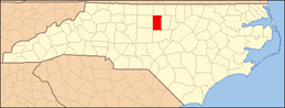 | |
| Towns | ||
| Village | ||
| CDPs | ||
| Unincorporated communities |
| |
| Footnotes | ‡This populated place also has portions in an adjacent county or counties | |
This article is issued from
Wikipedia.
The text is licensed under Creative Commons - Attribution - Sharealike.
Additional terms may apply for the media files.