Davie County, North Carolina
| Davie County, North Carolina | ||
|---|---|---|
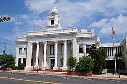 Davie County Courthouse | ||
| ||
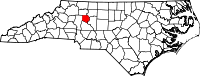 Location in the U.S. state of North Carolina | ||
 North Carolina's location in the U.S. | ||
| Founded | 1836 | |
| Named for | William R. Davie | |
| Seat | Mocksville | |
| Largest town | Mocksville | |
| Area | ||
| • Total | 267 sq mi (692 km2) | |
| • Land | 264 sq mi (684 km2) | |
| • Water | 3.0 sq mi (8 km2), 1.1% | |
| Population | ||
| • (2017) | 42,456 | |
| • Density | 156/sq mi (60/km2) | |
| Congressional district | 13th | |
| Time zone | Eastern: UTC−5/−4 | |
| Website |
www | |

Davie County is a county located in the U.S. state of North Carolina. As of the 2010 census, the population was 41,240.[1] Its county seat is Mocksville.[2]
Davie County is included in the Winston-Salem, NC Metropolitan Statistical Area, which is also included in the Greensboro-Winston-Salem-High Point, NC Combined Statistical Area.
History
The county was formed in 1836 from Rowan County. It was named for William R. Davie,[3] Governor of North Carolina from 1798 to 1799. 1,147 soldiers from Davie County fought in the American Civil War for the Confederate States of America.[4]
Geography
According to the U.S. Census Bureau, the county has a total area of 267 square miles (690 km2), of which 264 square miles (680 km2) is land and 3.0 square miles (7.8 km2) (1.1%) is water.[5]
Demographics
| Historical population | |||
|---|---|---|---|
| Census | Pop. | %± | |
| 1840 | 7,574 | — | |
| 1850 | 7,866 | 3.9% | |
| 1860 | 8,494 | 8.0% | |
| 1870 | 9,620 | 13.3% | |
| 1880 | 11,096 | 15.3% | |
| 1890 | 11,621 | 4.7% | |
| 1900 | 12,115 | 4.3% | |
| 1910 | 13,394 | 10.6% | |
| 1920 | 13,578 | 1.4% | |
| 1930 | 14,386 | 6.0% | |
| 1940 | 14,909 | 3.6% | |
| 1950 | 15,420 | 3.4% | |
| 1960 | 16,728 | 8.5% | |
| 1970 | 18,855 | 12.7% | |
| 1980 | 24,599 | 30.5% | |
| 1990 | 27,859 | 13.3% | |
| 2000 | 34,835 | 25.0% | |
| 2010 | 41,240 | 18.4% | |
| Est. 2017 | 42,456 | [6] | 2.9% |
| U.S. Decennial Census[7] 1790–1960[8] 1900–1990[9] 1990–2000[10] 2010–2013[1] | |||
As of the census[11] of 2000, there were 34,835 people, 13,750 households, and 10,257 families residing in the county. The population density was 131 people per square mile (51/km²). There were 14,953 housing units at an average density of 56 per square mile (22/km²). The racial makeup of the county was 90.44% White, 6.80% Black or African American, 0.23% Native American, 0.31% Asian, 0.02% Pacific Islander, 1.31% from other races, and 0.89% from two or more races. 3.47% of the population were Hispanic or Latino of any race.
There were 13,750 households out of which 32.70% had children under the age of 18 living with them, 61.40% were married couples living together, 9.20% had a female householder with no husband present, and 25.40% were non-families. 22.20% of all households were made up of individuals and 9.70% had someone living alone who was 65 years of age or older. The average household size was 2.51 and the average family size was 2.91.
In the county, the population was spread out with 24.30% under the age of 18, 7.10% from 18 to 24, 29.40% from 25 to 44, 25.50% from 45 to 64, and 13.80% who were 65 years of age or older. The median age was 38 years. For every 100 females there were 97.00 males. For every 100 females age 18 and over, there were 94.00 males.
The median income for a household in the county was $40,174, and the median income for a family was $47,699. Males had a median income of $33,179 versus $24,632 for females. The per capita income for the county was $21,359. About 6.40% of families and 8.60% of the population were below the poverty line, including 10.20% of those under age 18 and 11.30% of those age 65 or over.
Communities

Towns
- Bermuda Run
- Cooleemee
- Mocksville (county seat)
Townships
- Calahaln
- Clarksville
- Farmington
- Fulton
- Jerusalem
- Mocksville
- Shady Grove
Unincorporated communities
Wine region
Portions of Davie County are located in the Yadkin Valley AVA, an American Viticultural Area. Wines made from grapes grown in the Yadkin Valley AVA may use the appellation Yadkin Valley on their labels.
Census-designated place
Politics, law and government
Davie is a strongly Republican county, being one of seven North Carolina counties to be won by Alf Landon in 1936, and one of thirteen to be carried by Barry Goldwater in 1964. The only Democrat to win the county since World War I has been Franklin D. Roosevelt in 1940, when he was aided by support for Britain’s World War II effort by the county’s population – which is predominantly of British ancestry.[12]
| Year | Republican | Democratic | Third parties |
|---|---|---|---|
| 2016 | 71.7% 15,602 | 24.2% 5,270 | 4.1% 884 |
| 2012 | 71.1% 14,687 | 27.8% 5,735 | 1.2% 248 |
| 2008 | 68.6% 13,981 | 30.3% 6,178 | 1.0% 209 |
| 2004 | 74.2% 12,372 | 25.4% 4,233 | 0.5% 75 |
| 2000 | 72.8% 10,184 | 26.1% 3,651 | 1.2% 163 |
| 1996 | 64.5% 8,141 | 27.9% 3,525 | 7.6% 954 |
| 1992 | 54.9% 6,796 | 29.7% 3,675 | 15.5% 1,916 |
| 1988 | 71.4% 7,988 | 28.3% 3,166 | 0.3% 38 |
| 1984 | 73.7% 8,201 | 26.2% 2,911 | 0.1% 13 |
| 1980 | 63.8% 6,302 | 33.3% 3,289 | 2.9% 289 |
| 1976 | 56.4% 4,772 | 43.0% 3,635 | 0.7% 55 |
| 1972 | 75.7% 5,613 | 21.3% 1,578 | 3.0% 225 |
| 1968 | 49.0% 3,866 | 19.1% 1,502 | 31.9% 2,515 |
| 1964 | 59.1% 4,460 | 40.9% 3,086 | |
| 1960 | 66.0% 4,788 | 34.0% 2,471 | |
| 1956 | 68.6% 4,599 | 31.5% 2,110 | |
| 1952 | 62.5% 4,010 | 37.5% 2,406 | |
| 1948 | 54.0% 2,679 | 38.7% 1,917 | 7.3% 363 |
| 1944 | 58.9% 3,244 | 41.1% 2,266 | |
| 1940 | 46.7% 2,532 | 53.4% 2,896 | |
| 1936 | 50.3% 2,502 | 49.7% 2,476 | |
| 1932 | 50.5% 2,473 | 48.6% 2,381 | 0.8% 41 |
| 1928 | 73.2% 2,959 | 26.8% 1,085 | |
| 1924 | 59.6% 2,672 | 40.1% 1,795 | 0.3% 13 |
| 1920 | 61.5% 2,591 | 38.5% 1,624 | |
| 1916 | 57.6% 1,245 | 42.1% 910 | 0.3% 6 |
| 1912 | 40.9% 810 | 41.6% 823 | 17.5% 346 |
Davie County is a member of the Piedmont Triad Regional Council. In the North Carolina Senate, it is part of the 34th Senate District, represented by Republican Andrew C. Brock. In the North Carolina House of Representatives, Davie County is part of the 79th District represented by Republican Julia C. Howard.
Major highways
See also
References
- 1 2 "State & County QuickFacts". United States Census Bureau. Archived from the original on July 9, 2011. Retrieved October 19, 2013.
- ↑ "Find a County". National Association of Counties. Archived from the original on 2011-05-31. Retrieved 2011-06-07.
- ↑ Gannett, Henry (1905). The Origin of Certain Place Names in the United States. Govt. Print. Off. p. 101.
- ↑ The Civil War Roster for Davie County, North Carolina.
- ↑ "2010 Census Gazetteer Files". United States Census Bureau. August 22, 2012. Archived from the original on January 12, 2015. Retrieved January 14, 2015.
- ↑ "Population and Housing Unit Estimates". Retrieved June 9, 2017.
- ↑ "U.S. Decennial Census". United States Census Bureau. Archived from the original on May 12, 2015. Retrieved January 14, 2015.
- ↑ "Historical Census Browser". University of Virginia Library. Retrieved January 14, 2015.
- ↑ Forstall, Richard L., ed. (March 27, 1995). "Population of Counties by Decennial Census: 1900 to 1990". United States Census Bureau. Retrieved January 14, 2015.
- ↑ "Census 2000 PHC-T-4. Ranking Tables for Counties: 1990 and 2000" (PDF). United States Census Bureau. April 2, 2001. Retrieved January 14, 2015.
- ↑ "American FactFinder". United States Census Bureau. Archived from the original on 2013-09-11. Retrieved 2008-01-31.
- ↑ Menendez, Albert J.; The Geography of Presidential Elections in the United States, 1868-2004, pp. 67-68 ISBN 0786422173
- ↑ Leip, David. "Dave Leip's Atlas of U.S. Presidential Elections". uselectionatlas.org. Retrieved 2018-03-15.
External links

- Davie County government official website
- Davie County Official Web Portal
- Digital Davie: Historic Photos and Documents from the Davie County Public Library
- Sisters Pen Book on Civil War History
Coordinates: 35°56′N 80°32′W / 35.93°N 80.54°W
Places adjacent to Davie County, North Carolina | ||||||||||
|---|---|---|---|---|---|---|---|---|---|---|
| ||||||||||
Municipalities and communities of Davie County, North Carolina, United States | ||
|---|---|---|
| Towns | 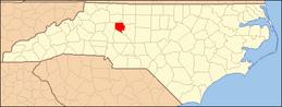 | |
| CDP | ||
| Unincorporated communities | ||
