Smithfield, North Carolina
| Smithfield, North Carolina | |
|---|---|
| Town | |
| Town of Smithfield | |
 | |
 Location in Johnston County and the state of North Carolina | |
 Smithfield Location of Smithfield in the US | |
| Coordinates: 35°30′33″N 78°20′47″W / 35.50917°N 78.34639°WCoordinates: 35°30′33″N 78°20′47″W / 35.50917°N 78.34639°W | |
| Country |
|
| State |
|
| County | Johnston |
| Townships | Selma, Smithfield, Wilson Mills |
| Established | May 9, 1777 |
| Named for | John Smith |
| Government[1] | |
| • Type | Council–Manager |
| • Council | |
| • Manager | Michael Scott |
| Area | |
| • Total | 11.4 sq mi (29.6 km2) |
| • Land | 11.4 sq mi (29.6 km2) |
| • Water | 0.0 sq mi (0.0 km2) |
| Elevation | 148 ft (45 m) |
| Population (2010) | |
| • Total | 10,966 |
| • Estimate (2016)[2] | 12,266 |
| • Density | 960/sq mi (370/km2) |
| Time zone | UTC−5 (Eastern (EST)) |
| • Summer (DST) | UTC−4 (EDT) |
| ZIP code | 27577 |
| Area code | 919 |
| FIPS code | 37-62520[3] |
| GNIS feature ID | 1025712[4] |
| Major airport | RDU |
| Website |
smithfield-nc |
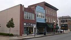
Smithfield is a town in Johnston County, North Carolina, United States. In 2016, the estimated population was 12,266.[5] It is the county seat of Johnston County.[6] Smithfield is home to the Ava Gardner Museum and is situated along the Neuse River, where visitors enjoy the annual Smithfield Ham and Yam Festival, walks along the Buffalo Creek Greenway and the historic downtown district. The town is located in North Carolina's famed Research Triangle and is approximately 29 mi (47 km) southeast of downtown Raleigh. The Raleigh-Durham-Cary Combined Statistical area has a population of over 2 million residents.
Geography
According to the U.S. Census Bureau, the town has a total area of 11.4 square miles (30 km2), of which 11.4 square miles (30 km2) is land and 0.09% is water.
Demographics
| Historical population | |||
|---|---|---|---|
| Census | Pop. | %± | |
| 1850 | 329 | — | |
| 1870 | 415 | — | |
| 1880 | 485 | 16.9% | |
| 1890 | 550 | 13.4% | |
| 1900 | 764 | 38.9% | |
| 1910 | 1,347 | 76.3% | |
| 1920 | 1,895 | 40.7% | |
| 1930 | 2,543 | 34.2% | |
| 1940 | 3,678 | 44.6% | |
| 1950 | 5,574 | 51.5% | |
| 1960 | 6,117 | 9.7% | |
| 1970 | 6,677 | 9.2% | |
| 1980 | 7,288 | 9.2% | |
| 1990 | 7,540 | 3.5% | |
| 2000 | 11,510 | 52.7% | |
| 2010 | 10,966 | −4.7% | |
| Est. 2016 | 12,266 | [2] | 11.9% |
| U.S. Decennial Census[7] | |||
As of the census[3] of 2000, there were 11,510 people, 4,417 households, and 2,676 families residing in the town. The population density was 1,007.6 inhabitants per square mile (389.1/km²). There were 4,674 housing units at an average density of 409.2 per square mile (158.0/km²). The racial makeup of the town was 62.66% White, 30.99% African American, 0.43% Native American, 0.63% Asian, 0.02% Pacific Islander, 4.14% from other races, and 1.13% from two or more races. Hispanic or Latino of any race were 9.90% of the population.
There were 4,417 households out of which 26.6% had children under the age of 18 living with them, 42.1% were married couples living together, 14.9% had a female householder with no husband present, and 39.4% were non-families. 35.7% of all households were made up of individuals and 16.3% had someone living alone who was 65 years of age or older. The average household size was 2.30 and the average family size was 2.97.
In the town, the population was spread out with 21.3% under the age of 18, 8.3% from 18 to 24, 29.2% from 25 to 44, 22.9% from 45 to 64, and 18.2% who were 65 years of age or older. The median age was 39 years. For every 100 females, there were 99.4 males. For every 100 females age 18 and over, there were 97.6 males. The median income for a household in the town was $27,813, and the median income for a family was $37,929. Males had a median income of $29,567 versus $24,440 for females. The per capita income for the town was $18,012. About 14.5% of families and 20.6% of the population were below the poverty line, including 27.1% of those under age 18 and 19.2% of those age 65 or over.
Government
Smithfield has a council-manager form of government. The council, the town's legislative body, consists of seven members and a mayor. The council sets policy, and the manager oversees day-to-day operations. The mayor is Andy Moore, whose term expires in 2017.[1] The manager is Michael Scott.[8]
Education
- South Smithfield Elementary School
- West Smithfield Elementary School
- Smithfield Middle School
- South Campus Community School
- Johnston County Middle College High School
- Johnston County Early College Academy
- Smithfield-Selma High School
- Neuse Charter School
- Johnston Community College
Healthcare
- UNC Health Care - Johnston Health
Notable people
- Ava Gardner - born in Grabtown, American actress[9]
- Barry Foote - former Major League Baseball catcher
- Gregory Helms - professional wrestler
- Neal Lancaster - professional golfer
- Amber O'Neal - professional wrestler
- Edward W. Pou - U.S. Congressman, 1901–1934
- William Cary Renfrow - 3rd Governor of Oklahoma Territory
- Jerry Sands - professional baseball player
- Ray Tanner - South Carolina Gamecocks athletic director and former head baseball coach
- John Townsend - author
- Curtis Whitley - professional football player
- Jonathan Williams - professional football player
See also
References
- 1 2 "Johnston County's Elected Officials". Johnston County Board of Elections. Retrieved June 23, 2017.
- 1 2 "Population and Housing Unit Estimates". Retrieved June 9, 2017.
- 1 2 "American FactFinder". United States Census Bureau. Retrieved January 31, 2008.
- ↑ "US Board on Geographic Names". United States Geological Survey. October 25, 2007. Retrieved January 31, 2008.
- ↑ http://www.city-data.com/city/Smithfield-North-Carolina.html
- ↑ "Find a County". National Association of Counties. Retrieved June 7, 2011.
- ↑ "Census of Population and Housing". Census.gov. Retrieved June 4, 2015.
- ↑ "Town Manager". Town of Smithfield. Retrieved June 23, 2017.
- ↑ Cannon, Doris Rollins (2012). "Ava Gardner". NCpedia. State Library of North Carolina. Retrieved July 15, 2017.
Further reading
- Andrews, Cornelia (May 21, 1937). Waitt, Daisy Bailey, ed. "Federal Writers' Project: Slave Narrative Project, Vol. 11, North Carolina, Part 1, Adams-Hunter" (Interview). Interviewed by Mary A. Hicks. Smithfield, North Carolina: Works Progress Administration – via Library of Congress.
External links
- Government
- General information
- Ava Gardner Museum
- Downtown Smithfield Development Corporation

- Public Library of Johnston County and Smithfield
- Smithfield, North Carolina at Johnston County Visitors Bureau (johnstoncountync.org)


