Rowan County, North Carolina
| Rowan County, North Carolina | ||
|---|---|---|
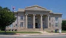 Rowan County courthouse | ||
| ||
 Location in the U.S. state of North Carolina | ||
 North Carolina's location in the U.S. | ||
| Founded | 1753 | |
| Named for | Matthew Rowan | |
| Seat | Salisbury | |
| Largest city | Salisbury | |
| Area | ||
| • Total | 524 sq mi (1,357 km2) | |
| • Land | 511 sq mi (1,323 km2) | |
| • Water | 12 sq mi (31 km2), 2.4% | |
| Population (est.) | ||
| • (2017) | 140,644 | |
| • Density | 271/sq mi (105/km2) | |
| Congressional districts | 8th, 13th | |
| Time zone | Eastern: UTC−5/−4 | |
| Website |
www | |

Rowan County is a county located in the U.S. state of North Carolina. As of the 2010 census, the population was 138,428.[1] Its county seat is Salisbury.[2] Located to the northeast of Charlotte, Rowan County is included in its metropolitan area.
History
The first Europeans to enter what is now Rowan County were the Spanish expedition of Juan Pardo in 1567. They established a fort and a mission in the native village of Guatari, believed to be located near the Yadkin River and inhabited by the Wateree. At the time, the area was ruled by a female chief whom the Spaniards called Guatari Mico (Mico was the Wateree's term for chief). The Spaniards called the village Salamanca in honor of the city of Salamanca in western Spain, and established a mission, headed by a secular priest named Sebastián Montero. The Spaniards abandoned the area; Pardo returned to Spain in 1568.[3] The surviving Spanish left after Native Americans killed all but one soldier at the six forts Pardo established in the interior. The Spanish did not return to the interior of this territory.[4][5]
English colonial settlement of North Carolina came later, starting in the coastal areas, with some migrants coming from Virginia. Explorers and fur traders were the first to reach the Piedmont, followed by settlers. The county was formed in 1753 by British colonists, from the northern part of Anson County. It was named for Matthew Rowan, acting governor of North Carolina from 1753 to 1754. It was intended to incorporate all of the lands of the Granville District that had heretofore been included in Anson County.[6]
As was typical at the time, Rowan County was originally a vast territory with an indefinite western boundary. Reductions in its extent began in 1770, when the eastern part of it was combined with the western part of Orange County to become Guilford County. In 1771 the northeastern part of what remained of Rowan County became Surry County. In 1777 the western part of Rowan County became Burke County.
After the American Revolutionary War, in 1788 the western part of the now much smaller Rowan County was organized as Iredell County. In 1822 the eastern part became Davidson County. Finally, in 1836 the part of Rowan County north of the South Yadkin River became Davie County.
The area was developed for cotton cultivation and mixed farming in the antebellum period. Cotton continued as a commodity crop for some time. Following Reconstruction, there was continuing change in the county, with industrialization following the construction of railways and textile mills here and elsewhere in the Piedmont. Urban populations increased. A total of six lynchings of African Americans were recorded here in this period, which extended into the early 20th century. This was the second-highest total in the state, a number of extrajudicial murders that two other counties also had.[7]
At the turn of the 20th century, the state had passed a new constitution and laws erecting barriers to voter registration that effectively disenfranchised most blacks, ending their political progress for decades, after African Americans had been elected to Congress from this state and there had been a Republican-Populist fusionist slate. Both governors Charles Aycock and Robert Glenn, elected in 1900 and 1904, respectively, ran campaigns to appeal to whites.[8]
The racial terrorism of lynchings enforced white suppression of African Americans. In 1902 brothers James and Harrison Gillespie, aged 11 (eleven) and 13 (thirteen), were lynched by a white mob for allegedly killing a young white woman working in a field.[8] In August 1906, six African-American men were arrested as suspects in the murder of a farm family. That evening, a white mob stormed the county jail in Salisbury, freeing all the white prisoners, interrogating the black ones, and taking out Jack Dillingham, Nease Gillespie, and his son John. The mob hanged the three men from a tree in a field, mutilated and tortured them, and shot them numerous times.[8]
It was not until after passage of civil rights legislation that most African American recovered the ability to vote; they had never lost their constitutional right as citizens. The county has worked to attract new industries since much of the textile industry moved offshore in the late 20th and early 21st centuries. The "250 Fest", celebrating the 250th anniversary of Rowan County, was held in 2003.
Geography
According to the U.S. Census Bureau, the county has a total area of 524 square miles (1,360 km2), of which 511 square miles (1,320 km2) is land and 12 square miles (31 km2) (2.4%) is water.[9]
The county's eastern border is formed by the Yadkin River. North of Ellis Crossroads, the South Yadkin River meets the Yadkin. The South Yadkin forms the county's northern border, with Davie County.
The southern border is an east-west line that bisects the city of Kannapolis.
Adjacent counties
- Cabarrus County - south
- Davidson County - east
- Davie County - north
- Iredell County - west
- Stanly County - southeast
Major highways
Interstate 85 passes through the county from southwest to northeast. In the early 2000s, I-85 underwent an extensive widening[10] in the central and northern part of the county, from exit 68, US 29 Connector north almost to the Davidson county line. A new bridge over the Yadkin River is planned.[11]
U.S. Route 70 enters the northwestern part of Rowan county, west of Cleveland. It runs southeast into Salisbury, where it follows Jake Alexander Boulevard to the southeast and then joins US 29 North as Main Street. US 70 continues northeast as Main Street and then Salisbury Avenue in Spencer before crossing into Davidson County.
U.S. Route 29 forms Main Street in Kannapolis, China Grove, and Landis in the southern part of the county. It joins US 70 as Main Street through Salisbury, and as Salisbury Avenue in Spencer.
U.S. Route 52 is the main artery for the southeastern part of the county, serving the towns of Gold Hill, Rockwell and Granite Quarry. Just before reaching downtown Salisbury, US-52 joins Interstate 85, which it follows into Davidson county.
Demographics
| Historical population | |||
|---|---|---|---|
| Census | Pop. | %± | |
| 1790 | 15,972 | — | |
| 1800 | 20,060 | 25.6% | |
| 1810 | 21,543 | 7.4% | |
| 1820 | 26,009 | 20.7% | |
| 1830 | 20,786 | −20.1% | |
| 1840 | 12,109 | −41.7% | |
| 1850 | 13,870 | 14.5% | |
| 1860 | 14,589 | 5.2% | |
| 1870 | 16,810 | 15.2% | |
| 1880 | 19,965 | 18.8% | |
| 1890 | 24,123 | 20.8% | |
| 1900 | 31,066 | 28.8% | |
| 1910 | 37,521 | 20.8% | |
| 1920 | 44,062 | 17.4% | |
| 1930 | 56,665 | 28.6% | |
| 1940 | 69,206 | 22.1% | |
| 1950 | 75,410 | 9.0% | |
| 1960 | 82,817 | 9.8% | |
| 1970 | 90,035 | 8.7% | |
| 1980 | 99,186 | 10.2% | |
| 1990 | 110,605 | 11.5% | |
| 2000 | 130,340 | 17.8% | |
| 2010 | 138,446 | 6.2% | |
| Est. 2017 | 140,644 | [12] | 1.6% |
| U.S. Decennial Census[13] 1790-1960[14] 1900-1990[15] 1990-2000[16] 2010-2014[1] | |||
As of the census[17] of 2010, there were 138,428 people, 53,140 households, and 37,058 families residing in the county. The population density was 270.7 people per square mile (98/km²). There were 60,211 housing units at an average density of 117.7 per square mile (41/km²). The racial makeup of the county was 76.52% White, 16.18% Black or African American, 0.34% Native American, 1.00% Asian, 0.035% Pacific Islander, 4.33% from other races, and 1.60% from two or more races. 7.69% of the population were Hispanic or Latino of any race.
Of the 53,140 households, 29.30% had children under the age of 18 living with them, 50.20% were married couples living together, 8.49% had a female householder with no husband present, 5.41% had a male householder with no wife and 30.26% were non-families. 25.22% of all households were made up of individuals and 10.15% had someone living alone who was 65 years of age or older. The average household size was 2.52 and the average family size was 3.00.
In the county, the population was spread out with 23.80% under the age of 18, 9.00% from 18 to 24, 25.40% from 25 to 44, 27.40% from 45 to 64, and 14.40% who were 65 years of age or older. The median age was 39.1 years. For every 100 females there were 97.57 males. For every 100 females age 18 and over, there were 95.28 males.
According to the 2000 Census,[18] The median income for a household in the county was $37,494, and the median income for a family was $44,242. Males had a median income of $31,626 versus $23,437 for females. The per capita income for the county was $18,071. About 8.10% of families and 10.60% of the population were below the poverty line, including 13.70% of those under age 18 and 11.40% of those age 65 or over.
Law and government
The primary governing body of Rowan County follows a council–manager government format with a five-member Board of Commissioners and the County Manager. The current County Manager is Aaron Church. The current Commissioners are: Greg Edds (Chairman), Jim Greene (Vice-Chairman), Judy Klusman, Mike Caskey and Craig Pierce. Commissioners are elected to four year terms with three being elected during midterm elections and two being elected during presidential elections.[19] The commission passes the Code of Ordinances for the county.[20]
Rowan County is a member of the regional Centralina Council of Governments.[21]
In the State Legislature, Rowan is represented in the Senate by Andrew C. Brock in the 34th district and Tom McInnis in the 25th. In the House, Rowan is represented by Carl Ford in the 76th district and Harry Warren in the 77th district. Both Senators and House Representatives are elected to two year terms.[22]
In the US Senate, the county is represented by Richard Burr and Thom Tillis.[23] Rowan is split between two US House districts, the 8th congressional district and North Carolina's 13th congressional district [24]
The current Sheriff of Rowan County is Kevin L. Auten who took over the position after the retirement of George Wilhelm in 2009. Auten won election to a full term in 2010.[25]
Politics
| Year | Republican | Democratic | Third parties |
|---|---|---|---|
| 2016 | 66.5% 42,810 | 30.1% 19,400 | 3.4% 2,159 |
| 2012 | 62.2% 38,775 | 36.4% 22,650 | 1.4% 887 |
| 2008 | 60.8% 37,451 | 38.0% 23,391 | 1.2% 718 |
| 2004 | 67.3% 34,915 | 32.3% 16,735 | 0.4% 217 |
| 2000 | 65.5% 28,922 | 33.7% 14,891 | 0.7% 320 |
| 1996 | 57.9% 22,754 | 34.3% 13,461 | 7.8% 3,058 |
| 1992 | 49.8% 21,297 | 33.5% 14,308 | 16.7% 7,127 |
| 1988 | 65.5% 23,192 | 34.2% 12,127 | 0.3% 97 |
| 1984 | 70.2% 25,207 | 29.6% 10,643 | 0.2% 57 |
| 1980 | 59.7% 18,566 | 37.5% 11,671 | 2.8% 872 |
| 1976 | 48.4% 14,644 | 50.8% 15,363 | 0.7% 222 |
| 1972 | 73.3% 20,735 | 24.2% 6,834 | 2.5% 705 |
| 1968 | 46.8% 15,207 | 24.8% 8,074 | 28.4% 9,220 |
| 1964 | 49.8% 14,804 | 50.2% 14,934 | |
| 1960 | 57.8% 17,726 | 42.2% 12,919 | |
| 1956 | 64.3% 17,562 | 35.7% 9,761 | |
| 1952 | 60.8% 17,535 | 39.2% 11,296 | |
| 1948 | 36.4% 5,722 | 43.3% 6,799 | 20.3% 3,181 |
| 1944 | 37.6% 5,862 | 62.4% 9,721 | |
| 1940 | 23.8% 4,059 | 76.2% 13,023 | |
| 1936 | 25.2% 4,306 | 74.8% 12,808 | |
| 1932 | 30.9% 4,464 | 67.8% 9,782 | 1.3% 180 |
| 1928 | 62.5% 7,957 | 37.5% 4,783 | |
| 1924 | 39.1% 3,560 | 52.8% 4,816 | 8.1% 738 |
| 1920 | 43.2% 4,888 | 56.8% 6,421 | |
| 1916 | 43.2% 2,320 | 56.8% 3,053 | |
| 1912 | 6.1% 280 | 59.4% 2,748 | 34.5% 1,596 |
Education
Colleges
- Catawba College
- Livingstone College
- Rowan-Cabarrus Community College. (Otherwise known as RCCC.)
- Hood Theological Seminary
- Campbell University Teaching Hospital at Novant Health Rowan Medical Center
Rowan–Salisbury School System
The Rowan–Salisbury School System is a PK-12 graded school district in North Carolina covering nearly all of Rowan County. The 35 schools in the district serve 20,887 students as of 2009-2010.[27] It was formed in 1989 with the merger of Rowan County Schools and Salisbury City Schools.[28]
Kannapolis City Schools
Students living in the portion of Kannapolis located in Rowan County (the city is mostly in Cabarrus County) attend Kannapolis City Schools, which operates independently of the countywide school systems.
Private schools
- North Hills Christian School - Eagles (pre-school through high school)
- Rockwell Christian School (pre-school through high school)
- Sacred Heart Catholic School - Dolphins (elementary through middle school)
- Salisbury Academy - Jaguars (pre-kindergarten through middle school)
- Salisbury Adventist School
Libraries
- Rowan Public Library
- Headquarters (Salisbury)
- East Branch (Rockwell)
- Frank T. Tadlock South Rowan Regional Library (China Grove)
Media
The Salisbury Post, founded in 1905, is the local daily newspaper.
Communities
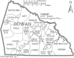
Cities
- Kannapolis
- Salisbury (county seat)
Towns
Census-designated place
Unincorporated communities
- Bear Poplar
- Dogwood Acres
- Dukeville
- Gold Hill
- Millbridge
- Mount Ulla
Townships
Notable people
- Actor Sidney Blackmer was born and raised in Salisbury.[29]
- Former U.S. Senator Elizabeth Dole is from Salisbury.[30]
- Governor of North Carolina John W. Ellis was born in what was then eastern Rowan County and practiced law in Salisbury.[31]
- Former North Carolina Commissioner of Agriculture James Allen Graham was born and raised in Cleveland.[32]
- President Andrew Jackson practiced law in Salisbury.[33]
- Bobby Jackson, NBA player
- Baseball first baseman, Baxter Byerly "Buck" Jordan, January 16, 1907 to March 18, 1973
- Phil Kirk, former chairman of the North Carolina State Board of Education, is a Rowan native.
- Francis Locke had a plantation in Rowan, noted for his victory at the Battle of Ramseur's Mill during the American Revolutionary War[34]
- Congressman Francis Locke, Jr. was born in Rowan.[35]
- U.S. Senator Lee S. Overman lived in Rowan.[36]
- Jackie Fargo, Professional Wrestler
- Tommy Barnhardt, NFL player
- Gil Robinson, NFL player
- Worlds Fastest Drummer Matt Smith was born in Salisbury.[37]
See also
References
- 1 2 "State & County QuickFacts". United States Census Bureau. Retrieved October 29, 2013.
- ↑ "Find a County". National Association of Counties. Retrieved 2011-06-07.
- ↑ Simmons, Geitner (August 29, 1999). "An unknown South: Pardo story helps Rowan learn about itself". Salisbury Post. Archived from the original on November 3, 2006. Retrieved January 11, 2013.
- ↑ "Today in Asheville history: Explorer arrives". Citizen Times. 1 December 2015.
- ↑ Simmons, Geitner (August 22, 1999). "Understanding the "original Southerners"". Salisbury Post. Archived from the original on November 3, 2006. Retrieved January 11, 2013.
- ↑ Rumple, Jethro. A History of Rowan County, North Carolina. Daughters of the American Revolution, Elizabeth Maxwell Steele Chapter (Salisbury, N.C.)(1916). P. 59
- ↑ [https://eji.org/sites/default/files/lynching-in-america-third-edition-summary.pdf Lynching in America, 3rd edition, Supplement: Lynching by County, Montgomery, Alabama: Equal Justice Initiative, 2017
- 1 2 3 Amy Louise Wood, "Lynching and Local History: A Review of 'Troubled Ground'", Southern Spaces, 08 May 2012; accessed 08 June 2018
- ↑ "2010 Census Gazetteer Files". United States Census Bureau. August 22, 2012. Archived from the original on January 12, 2015. Retrieved January 19, 2015.
- ↑ "Rowan Emergency Services". 2009-11-16. Archived from the original on 2011-07-21. Retrieved 2010-04-12.
- ↑ "Office of the Governor of North Carolina". 2009-03-12. Retrieved 2010-04-12.
- ↑ "Population and Housing Unit Estimates". Retrieved June 4, 2018.
- ↑ "U.S. Decennial Census". United States Census Bureau. Retrieved January 19, 2015.
- ↑ "Historical Census Browser". University of Virginia Library. Retrieved January 19, 2015.
- ↑ Forstall, Richard L., ed. (March 27, 1995). "Population of Counties by Decennial Census: 1900 to 1990". United States Census Bureau. Retrieved January 19, 2015.
- ↑ "Census 2000 PHC-T-4. Ranking Tables for Counties: 1990 and 2000" (PDF). United States Census Bureau. April 2, 2001. Retrieved January 19, 2015.
- ↑ "American FactFinder". United States Census Bureau. Retrieved 2011-05-14.
- ↑ "American FactFinder". United States Census Bureau. Retrieved 2008-01-31.
- ↑ "Board of Commissioners". Rowan County website. Rowan County, NC. Retrieved 25 October 2011.
- ↑ Rowan County Code of Ordinances.
- ↑ Centralina Council of Governments website.
- ↑ "Rowan County Representation". NCGA website. North Carolina General Assembly. Retrieved 25 October 2011.
- ↑ "Senators of the 113th Congress". US Senate website. United States Senate. Retrieved 25 October 2011.
- ↑ "Rowan Co. Board of Elections". Rowan County Board of Elections. Rowan County. Archived from the original on 2012-09-15. Retrieved 15 March 2017.
- ↑ "Salisbury Post staff votes on the biggest stories of the year". Salisbury Post. 31 December 2010. Retrieved 18 December 2011.
- ↑ Leip, David. "Dave Leip's Atlas of U.S. Presidential Elections". uselectionatlas.org. Retrieved 2018-03-17.
- ↑ "Search for Public School Districts – District Detail for Rowan-salisbury Schools". National Center for Education Statistics. Institute of Education Sciences. Retrieved 29 October 2011.
- ↑ Campbell, Sarah (1 July 2011). "Developer offers plans for central office downtown for schools". Salisbury Post. Archived from the original on 3 July 2011. Retrieved 26 October 2011.
- ↑ Scarvey, Katie (17 January 2010). "Blackmer a star of stage and screen". Salisbury Post. Retrieved 19 December 2011.
- ↑ "Elizabeth Dole". CNN. Retrieved 2010-05-01.
- ↑ John W. Ellis marker.
- ↑ James Graham bio.
- ↑ Andrew Jackson marker.
- ↑ Locke, Francis; Brawley, James S.; 1991; NCpedia.com; transcription from "Dictionary of North Carolina Biography," (6 volumes); edited by William S. Powell; copyright ©1979-1996; University of North Carolina Press; accessed January 2015
- ↑ NC Manual of 1913
- ↑ Lee S. Overman marker.
- ↑ World's fastest drummer website
Further reading
- Clegg, Claude A., III. Troubled Ground: A Tale of Murder, Lynching, and Reckoning in the New South (Urbana: University of Illinois Press, 2010).
- Gehrke, William H. "The Beginnings of the Pennsylvania-German Element in Rowan and Cabarrus Counties, North Carolina." Pennsylvania Magazine of History and Biography 58.4 (1934): 342-369. online
- Rumple, Jethro. A History of Rowan County, North Carolina (Heritage Books, 2009). This publication does not include all lynchings, only those of black skin or those of known african heritage.
External links

- Visit Salisbury-Rowan County Convention & Visitors Bureau website.
- Rowan County official government website.
- Rowan Museum website.
- NCGenWeb Rowan County - free genealogy resources for the county
- Edith M. Clark History Room
- Salisbury Post
- Rowan County logo
Coordinates: 35°38′N 80°31′W / 35.64°N 80.52°W
Places adjacent to Rowan County, North Carolina | ||||||||||
|---|---|---|---|---|---|---|---|---|---|---|
| ||||||||||
Municipalities and communities of Rowan County, North Carolina, United States | ||
|---|---|---|
| Cities | 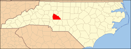 | |
| Towns | ||
| Townships | ||
| CDP | ||
| Unincorporated communities | ||
| Footnotes | ‡This populated place also has portions in an adjacent county or counties | |
|  | ||||||||||||
|
| |||||||||||||
