Beaufort County, North Carolina
| Beaufort County, North Carolina | |
|---|---|
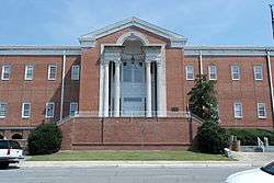 Beaufort County Courthouse | |
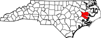 Location in the U.S. state of North Carolina | |
 North Carolina's location in the U.S. | |
| Founded | 1739 |
| Named for | Henry, Duke of Beaufort |
| Seat | Washington |
| Largest city | Washington |
| Area | |
| • Total | 958 sq mi (2,481 km2) |
| • Land | 827 sq mi (2,142 km2) |
| • Water | 131 sq mi (339 km2), 14% |
| Population | |
| • (2010) | 47,759 |
| • Density | 58/sq mi (22/km2) |
| Congressional district | 3rd |
| Time zone | Eastern: UTC−5/−4 |
| Website |
www |
Beaufort County is a county located in the U.S. state of North Carolina. As of the 2010 Census, the population was 47,759.[1] Its county seat is Washington.[2] The county was founded in 1705 as Pamptecough Precinct. Originally included in Bath County, it was renamed Beaufort Precinct in 1712 and became Beaufort County in 1739.[3][4]
Beaufort County comprises the Washington, NC Micropolitan Statistical Area, which is also included in the Greenville-Washington, NC Combined Statistical Area.
History
Beaufort County was first called Pamptecough. The name was changed about 1712 to Beaufort, named for Henry Scudamore, 3rd Duke of Beaufort, who became one of Carolina's Lords Proprietor around 1709.
Geography
According to the U.S. Census Bureau, the county has a total area of 958 square miles (2,480 km2), of which 827 square miles (2,140 km2) is land and 131 square miles (340 km2) (14%) is water.[5] It is the fifth-largest county in North Carolina by total area. It is split in half by the Pamlico River and the mouth of the Pamlico River.
Major highways
Demographics
| Historical population | |||
|---|---|---|---|
| Census | Pop. | %± | |
| 1790 | 5,405 | — | |
| 1800 | 6,242 | 15.5% | |
| 1810 | 7,203 | 15.4% | |
| 1820 | 9,850 | 36.7% | |
| 1830 | 10,969 | 11.4% | |
| 1840 | 12,225 | 11.5% | |
| 1850 | 13,816 | 13.0% | |
| 1860 | 14,766 | 6.9% | |
| 1870 | 13,011 | −11.9% | |
| 1880 | 17,474 | 34.3% | |
| 1890 | 21,072 | 20.6% | |
| 1900 | 26,404 | 25.3% | |
| 1910 | 30,877 | 16.9% | |
| 1920 | 31,024 | 0.5% | |
| 1930 | 35,026 | 12.9% | |
| 1940 | 36,431 | 4.0% | |
| 1950 | 37,134 | 1.9% | |
| 1960 | 36,014 | −3.0% | |
| 1970 | 35,980 | −0.1% | |
| 1980 | 40,355 | 12.2% | |
| 1990 | 42,283 | 4.8% | |
| 2000 | 44,958 | 6.3% | |
| 2010 | 47,759 | 6.2% | |
| Est. 2016 | 47,526 | [6] | −0.5% |
| U.S. Decennial Census[7] 1790-1960[8] 1900-1990[9] 1990-2000[10] 2010-2013[1] | |||
As of the census[11] of 2000, there were 44,958 people, 18,319 households, and 12,951 families residing in the county. The population density was 54 people per square mile (21/km²). There were 22,139 housing units at an average density of 27 per square mile (10/km²). The racial makeup of the county was 68.44% White, 29.03% Black or African American, 0.16% Native American, 0.22% Asian, 0.02% Pacific Islander, 1.42% from other races, and 0.71% from two or more races. 3.24% of the population were Hispanic or Latino of any race.
There were 18,319 households out of which 28.80% had children under the age of 18 living with them, 53.60% were married couples living together, 13.30% had a female householder with no husband present, and 29.30% were non-families. 25.70% of all households were made up of individuals and 11.50% had someone living alone who was 65 years of age or older. The average household size was 2.42 and the average family size was 2.89.
In the county, the population was spread out with 23.40% under the age of 18, 7.70% from 18 to 24, 26.10% from 25 to 44, 26.90% from 45 to 64, and 15.90% who were 65 years of age or older. The median age was 40 years. For every 100 females there were 91.10 males. For every 100 females age 18 and over, there were 87.50 males.
The median income for a household in the county was $31,066, and the median income for a family was $37,893. Males had a median income of $30,483 versus $21,339 for females. The per capita income for the county was $16,722. About 15.20% of families and 19.50% of the population were below the poverty line, including 27.60% of those under age 18 and 19.30% of those age 65 or over.
As of 2010 the largest self-reported ancestry groups in Beaufort County, North Carolina were:
- English - 14.4%
- "American" - 11.9%
- German - 6.6%
- Irish - 6.0%
- Scottish - 2.5%
- French - 1.6%
- Italian - 1.5%[12]
Communities
City
- Washington (county seat)

Towns
Census-designated places
Other unincorporated communities
- Blounts Creek
- Edward
- Royal
Population ranking
The population ranking of the following table is based on the 2010 census of Beaufort County.[13]
† county seat
| Rank | City/Town/etc. | Municipal type | Population (2010 Census)
|
|---|---|---|---|
| 1 | † Washington | City | 9,744 |
| 2 | River Road | CDP | 4,394 |
| 3 | Belhaven | Town | 1,688 |
| 4 | Chocowinity | Town | 820 |
| 5 | Aurora | Town | 520 |
| 6 | Washington Park | Town | 451 |
| 7 | Bayview | CDP | 346 |
| 8 | Bath | Town | 249 |
| 9 | Pantego | Town | 179 |
| 10 | Pinetown | CDP | 155 |
Politics, law and government
Beaufort is a typical “Solid South” county in its voting patterns. It voted Democratic consistently up until 1964, even resisting the lure of voting against Al Smith’s Catholic faith and opposition to Prohibition in 1928 when North Carolina went Republican for the only time between 1876 and 1964. However, the increasing social and racial liberalism of the Democratic Party turned its electorate to George Wallace in 1968 and overwhelmingly to Richard Nixon against George McGovern four years later. Since then, Beaufort has been a strongly Republican county, with the last Democrat to carry it being Jimmy Carter in 1976.
| Year | Republican | Democratic | Third parties |
|---|---|---|---|
| 2016 | 60.8% 14,543 | 36.6% 8,764 | 2.6% 631 |
| 2012 | 59.2% 13,977 | 39.9% 9,435 | 0.9% 208 |
| 2008 | 58.5% 13,460 | 41.1% 9,454 | 0.4% 96 |
| 2004 | 63.7% 12,432 | 36.0% 7,025 | 0.3% 65 |
| 2000 | 60.8% 10,531 | 38.3% 6,634 | 0.9% 148 |
| 1996 | 53.6% 8,154 | 40.6% 6,172 | 5.8% 889 |
| 1992 | 45.9% 7,337 | 40.3% 6,445 | 13.8% 2,198 |
| 1988 | 60.4% 8,190 | 39.4% 5,352 | 0.2% 28 |
| 1984 | 60.7% 9,284 | 39.1% 5,987 | 0.2% 33 |
| 1980 | 52.0% 6,773 | 46.2% 6,024 | 1.8% 240 |
| 1976 | 44.7% 4,677 | 54.7% 5,728 | 0.6% 62 |
| 1972 | 69.7% 6,915 | 29.2% 2,901 | 1.1% 112 |
| 1968 | 23.0% 2,669 | 27.9% 3,232 | 49.1% 5,686 |
| 1964 | 37.1% 3,595 | 62.9% 6,090 | |
| 1960 | 30.9% 2,694 | 69.2% 6,039 | |
| 1956 | 28.4% 2,277 | 71.6% 5,730 | |
| 1952 | 30.7% 2,404 | 69.3% 5,429 | |
| 1948 | 17.5% 1,055 | 77.5% 4,675 | 5.0% 300 |
| 1944 | 19.4% 1,133 | 80.6% 4,706 | |
| 1940 | 14.5% 936 | 85.5% 5,528 | |
| 1936 | 13.6% 964 | 86.4% 6,133 | |
| 1932 | 13.1% 839 | 86.3% 5,552 | 0.6% 40 |
| 1928 | 41.6% 2,521 | 58.4% 3,533 | |
| 1924 | 32.4% 1,502 | 65.7% 3,048 | 2.0% 93 |
| 1920 | 39.2% 2,266 | 60.9% 3,522 | |
| 1916 | 39.4% 1,274 | 60.6% 1,957 | 0.0% 1 |
| 1912 | 11.8% 295 | 64.0% 1,605 | 24.3% 609 |
Beaufort County is a member of the Mid-East Commission regional council of governments.
Beaufort County is one of the proposed sites for a Navy outlying landing field. This practice airfield would allow pilots to simulate landings on an aircraft carrier. Construction, which has not yet begun, is controversial due to its potential ecological impact.
See also
References
- 1 2 "State & County QuickFacts". United States Census Bureau. Retrieved October 17, 2013.
- ↑ "Find a County". National Association of Counties. Archived from the original on 2012-07-12. Retrieved 2011-06-07.
- ↑ "North Carolina: Individual County Chronologies". North Carolina Atlas of Historical County Boundaries. The Newberry Library. 2009. Retrieved January 20, 2015.
- ↑ "Beaufort County". NCpedia. State Library of North Carolina. January 1, 2006. Retrieved January 20, 2015.
- ↑ "2010 Census Gazetteer Files". United States Census Bureau. August 22, 2012. Archived from the original on January 12, 2015. Retrieved January 12, 2015.
- ↑ "Population and Housing Unit Estimates". Retrieved June 9, 2017.
- ↑ "U.S. Decennial Census". United States Census Bureau. Archived from the original on May 12, 2015. Retrieved January 12, 2015.
- ↑ "Historical Census Browser". University of Virginia Library. Retrieved January 12, 2015.
- ↑ Forstall, Richard L., ed. (March 27, 1995). "Population of Counties by Decennial Census: 1900 to 1990". United States Census Bureau. Retrieved January 12, 2015.
- ↑ "Census 2000 PHC-T-4. Ranking Tables for Counties: 1990 and 2000" (PDF). United States Census Bureau. April 2, 2001. Retrieved January 12, 2015.
- ↑ "American FactFinder". United States Census Bureau. Archived from the original on 2013-09-11. Retrieved 2008-01-31.
- ↑
- ↑ "Archived copy". Archived from the original on 2013-12-21. Retrieved 2016-02-13.
- ↑ Leip, David. "Dave Leip's Atlas of U.S. Presidential Elections". uselectionatlas.org. Retrieved 2018-03-14.
External links
- Official website

- Life on the Pamlico: A Publication of Beaufort County Community College
- The Beaufort Sun
Places adjacent to Beaufort County, North Carolina | ||||||||||
|---|---|---|---|---|---|---|---|---|---|---|
| ||||||||||
Municipalities and communities of Beaufort County, North Carolina, United States | ||
|---|---|---|
| City | 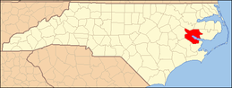 | |
| Towns | ||
| CDPs | ||
| Unincorporated community | ||
