Statesville, North Carolina
| Statesville, North Carolina | |
|---|---|
| City | |
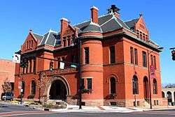 Statesville City Hall Building c. 1890-92 | |
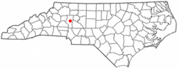 Location of Statesville, North Carolina | |
| Coordinates: 35°47′12″N 80°52′43″W / 35.78667°N 80.87861°WCoordinates: 35°47′12″N 80°52′43″W / 35.78667°N 80.87861°W | |
| Country | United States |
| State | North Carolina |
| County | Iredell |
| Government | |
| • Mayor | Costi Kutteh |
| Area | |
| • Total | 24.4 sq mi (63.1 km2) |
| • Land | 24.2 sq mi (62.8 km2) |
| • Water | 0.1 sq mi (0.3 km2) |
| Elevation | 919 ft (280 m) |
| Population (2010) | |
| • Total | 24,532 |
| • Estimate (2016)[1] | 26,506 |
| • Density | 1,011/sq mi (390.5/km2) |
| Time zone | UTC−5 (Eastern (EST)) |
| • Summer (DST) | UTC−4 (EDT) |
| ZIP codes | 28625, 28677, 28687 |
| Area code(s) | 704 |
| FIPS code | 37-64740[2] |
| GNIS feature ID | 0995438[3] |
| Website |
www |
Statesville is a city in Iredell County, North Carolina, United States. The population was 24,532 at the 2010 census,[4] and was estimated at 26,506 in 2016.[1] It is the county seat of Iredell County and is part of the Charlotte metropolitan area.[5]
Geography
Statesville is in central Iredell County, in the western part of the Piedmont region of North Carolina. Interstate 40 and Interstate 77 intersect in the northeastern part of the city. I-40 leads northeast 41 miles (66 km) to Winston-Salem and west 30 miles (48 km) to Hickory, while I-77 leads north 55 miles (89 km) to the Virginia border and south 42 miles (68 km) to Charlotte. Three U.S. highways run through the center of Statesville. US 21 follows the same general route as I-77, leading north 38 miles (61 km) to Elkin and south 15 miles (24 km) to Mooresville. US 64 runs to the northeast close to I-40, leading 24 miles (39 km) to Mocksville, while to the northwest it leads 43 miles (69 km) to Lenoir. US 70 runs southwest out of Statesville 13 miles (21 km) to Catawba and southeast 25 miles (40 km) to Salisbury.
According to the U.S. Census Bureau, Statesville has a total area of 24.4 square miles (63.1 km2), of which 24.2 square miles (62.8 km2) are land and 0.1 square miles (0.3 km2), or 0.48%, are water.[4] The north side of Statesville is drained by Fourth Creek, while the south side is drained by Third Creek. Both creeks flow east, joining just before reaching the South Yadkin River near Cooleemee.
History
.jpg)
In 1753, Scots-Irish Presbyterians and German Lutherans, who had originally settled in Pennsylvania, began arriving in Statesville to plant crops in the fertile soil where game and water were also plentiful. The settlement, known as "Fourth Creek Congregation", was named for the freshwater stream running to the north of the present-day city center, the fourth creek west of the neighboring settlement of Salisbury. The center of the settlement was a log cabin where the Presbyterians worshiped and where the First Presbyterian Church is located today.
In 1755, colonial governor Arthur Dobbs authorized the construction of the colony's frontier fort, which was located approximately 3 miles (5 km) due north of the Fourth Creek settlement. Built and garrisoned by North Carolina provincial soldiers, Fort Dobbs defended British North America's western frontier in the colony of North Carolina during the French and Indian War and Anglo-Cherokee War. Fort Dobbs combined the functions of a military barracks, fortification, refuge for settlers, provisioning depot and center for negotiations with Native Americans.
The state legislature divided Rowan County in 1788, and the new county was named "Iredell" for James Iredell, associate justice of the first Supreme Court during the presidency of George Washington.
One year later, the legislature selected a spot for the county seat. The Fourth Creek Congregation was chosen, and the settlement became known as "Statesville".
As early as 1833, Statesville's leaders began laying track for railroads to connect the Piedmont area of North Carolina with the rest of the country.
By 1858, Statesville was growing rapidly and soon afterward began leading the state in the production of tobacco and tobacco products, the manufacture and blending of whiskey, and became a large distribution center for roots and herbs.
On August 27, 1891, a passenger train derailed on a 300-foot-long (91 m) bridge, and seven cars fell down. About 30 people died in the accident.[6]
Sites of interest
- Congregation Emanuel is one of fewer than a hundred nineteenth-century synagogue buildings still standing in the United States.
- Fort Dobbs State Historic Site is the only North Carolina Historic Site associated with the French and Indian War.[7]
- Iredell Museums, 134 Court Street.[8] Affiliated museums:
- Heritage Museum, 1335 Museum Road.
- The Children's Museum, 1613 East Broad St.
- Governor Zebulon Vance House and Museum, 501 West Sharpe Street. Run by the United Daughters of the Confederacy.
The Academy Hill Historic District, Allison Woods, Center Street A.M.E. Zion Church, East Broad Street-Davie Avenue Historic District, Henry Eccles House, Falls-Hobbs House, Feimster House, Fort Dobbs, Hargrave House, Iredell County Courthouse, Key Memorial Chapel, King-Flowers-Keaton House, Main Building, Mitchell College, McClelland-Davis House, McElwee Houses, Mitchell College Historic District, Morrison-Mott House, Col. Silas Alexander Sharpe House, South Race Street Historic District, Statesville Commercial Historic District, Henry Turner House and Caldwell-Turner Mill Site, United States Post Office and County Courthouse, and Waddle-Click Farm are listed on the National Register of Historic Places.[9]
Demographics
| Historical population | |||
|---|---|---|---|
| Census | Pop. | %± | |
| 1850 | 215 | — | |
| 1860 | 320 | 48.8% | |
| 1870 | 683 | 113.4% | |
| 1880 | 1,062 | 55.5% | |
| 1890 | 2,318 | 118.3% | |
| 1900 | 3,141 | 35.5% | |
| 1910 | 4,599 | 46.4% | |
| 1920 | 7,895 | 71.7% | |
| 1930 | 10,490 | 32.9% | |
| 1940 | 11,440 | 9.1% | |
| 1950 | 16,901 | 47.7% | |
| 1960 | 19,844 | 17.4% | |
| 1970 | 20,007 | 0.8% | |
| 1980 | 18,622 | −6.9% | |
| 1990 | 17,567 | −5.7% | |
| 2000 | 23,320 | 32.7% | |
| 2010 | 24,532 | 5.2% | |
| Est. 2016 | 26,506 | [1] | 8.0% |
| U.S. Decennial Census[10] | |||
As of the census[2] of 2010, there were 24,633 people, 9,338 households, and 5,957 families residing in the city. The population density was 1,195.8 people per square mile (438.6/km²). There were 10,041 housing units at an average density of 489.1 per square mile (188.8/km²). The racial composition of the city was: 59.94% White, 31.87% Black or African American, 7.11% Hispanic or Latino American, 2.71% Asian American, 0.18% Native American, 0.02% Native Hawaiian or Other Pacific Islander, 3.84% some other races, and 1.42% two or more races.
There were 9,338 households, out of which 28.1% had children under the age of 18 living with them, 41.7% were married couples living together, 17.9% had a female householder with no husband present, and 36.2% were non-families. 31.4% of all households were made up of individuals and 12.7% had someone living alone who was 65 years of age or older. The average household size was 2.39 and the average family size was 2.99.
In the city, the population was spread out, with 24.4% under the age of 18, 8.7% from 18 to 24, 28.0% from 25 to 44, 21.4% from 45 to 64, and 17.4% who were 65 years of age or older. The median age was 37 years. For every 100 females, there were 86.5 males. For every 100 females age 18 and over, there were 82.0 males.
The median income for a household in the city was $31,925, and the median income for a family was $41,694. Males had a median income of $31,255 versus $22,490 for females. The per capita income for the city was $19,328. About 12.7% of families and 16.1% of the population were below the poverty line, including 23.7% of those under age 18 and 13.8% of those age 65 or over.
Notable people
- Gair Allie (born 1931), Major League Baseball player
- Julianne Baird (born 1952), soprano singer
- Breon Borders (born 1995), professional football player for Buffalo Bills, Statesville High School alumnus[11]
- Johnny Chapman (born 1967), stock car racing driver
- Louis Clarke (1901–1977), Olympic gold medal winner
- Chris Cole (born 1982), professional skateboarder
- Blake Crouch (born 1978), author and producer
- Jake Crum (born 1991), driver in the NASCAR Camping World Truck Series
- Jerome Henderson (born 1969), NFL cornerback
- Rockie Lynne (born 1964), country music artist
- Danny Malboeuf (born 1960), visual artist combining surrealism with other genres
- Thomas Marshburn (born 1960), NASA astronaut
- Justin Moose (born 1983), United Soccer League, midfield
- MWF (born 1960), real name Mark Flake, postmodern artist
- Ryan Newman (born 1977), NASCAR driver
- Stephen C. Reber, Archbishop of the United Episcopal Church of North America
- Mike Skinner (born 1957), NASCAR driver[12]
- Vinson Smith (born 1965), NFL linebacker
- Herm Starrette (1936–2017), Major League Baseball pitcher and coach
- T.M. Stikeleather (1848-1934), populist representative in 1894 and 1900 for the 27th district, which included Iredell, Davie and Yadkin counties, buried in Oakwood Cemetery
- Theodore Taylor (1921–2006), writer
- Jared Watts (born 1992), Major League Soccer, midfield
- Loy Brem Hoke (born 1998), [Phi Delta Theta]], Phikeia of the Year
Education
The city is part of the Iredell–Statesville School District. Schools within the city limits include East Iredell Elementary, N.B. Mills Elementary, Northview School, Pressly Elementary, and Statesville Middle School, and Statesville High School. Schools serving Statesville residents but located outside the city limits include Cloverleaf Elementary School, East Iredell Middle School, and Third Creek Elementary School.[13]
Wayside Elementary School was an elementary school located off Salisbury Road in eastern Statesville. The current school building opened in 1941 and closed in 2002 when Wayside School and Alan D. Rutherford School merged to form Third Creek Elementary. The former Wayside building is currently home to the UAW 3520 headquarters, while the former Alan D. Rutherford site is home to the Iredell-Statesville Schools Administrative Annex, now known as the Alan D. Rutherford Education Building.
Statesville Christian School is a non-denominational K4–12 private school serving the greater Statesville area.
Mitchell Community College, founded as a Presbyterian women's college in 1852, is now a public community college. In the 2008-2009 academic year, it became the first community college in the United States to be accepted into NASA's University Student Launch Initiative competition.
Media
- The Statesville Record & Landmark is Statesville's daily newspaper, primarily serving Iredell County. It is published seven days a week.
Radio
- WAME, "Real Country 550 & 92.9" is an AM/FM station at 550 kHz and 92.9 mHz that plays classic country music.
- WSIC, 1400 AM & 100.7 FM, has a news-talk format.
- WNIH-DB is a local country music radio station that can be heard online.[14]
In addition, the signals of many stations from the Charlotte area and Piedmont Triad region reach Statesville.
Sports
Statesville was home to a minor league baseball team, the Statesville Owls, from 1939 until 1963. They played in several leagues over the years including the Tar Heel League (1939–1940), North Carolina State League (1942, 1947–1952), Western Carolina League (1960–1962), and Western Carolinas League (1963). They were league champions in their respective league in 1940, 1948, and 1962.[15] The field was located at Statesville Senior High School and thus named Senior High Stadium.[16] The field is still used (although altered over the years) by the high school's baseball team. The team, which has since returned as a summer league collegiate baseball team, still plays at Statesville Senior High. The team's inaugural season was 2010, in which it went 21-18 and lost in the first round of the playoffs. The team plays in the Southern Collegiate Baseball League.
References
- 1 2 3 "Population and Housing Unit Estimates". Retrieved June 9, 2017.
- 1 2 "American FactFinder". United States Census Bureau. Retrieved 2008-01-31.
- ↑ "US Board on Geographic Names". United States Geological Survey. 2007-10-25. Retrieved 2008-01-31.
- 1 2 "Geographic Identifiers: 2010 Census Summary File 1 (G001): Statesville city, North Carolina". American Factfinder. U.S. Census Bureau. Retrieved April 9, 2018.
- ↑ "Find a County". National Association of Counties. Retrieved 2011-06-07.
- ↑ http://edition.cnn.com/2010/US/08/27/north.carolina.ghost.train/index.html#fbid=ZGflCJMCHK3&wom=true
- ↑ http://www.fortdobbs.org
- ↑ https://www.iredellmuseums.org
- ↑ National Park Service (2010-07-09). "National Register Information System". National Register of Historic Places. National Park Service.
- ↑ "Census of Population and Housing". Census.gov. Retrieved June 4, 2015.
- ↑ "Breon Borders". Duke Athletics. Retrieved July 9, 2017.
- ↑ "Monday Mansions: NASCAR driver Mike Skinner's home!". WXII-TV. August 4, 2013. Retrieved October 20, 2015.
- ↑ "Schools". Iredell–Statesville School District. Retrieved April 9, 2018.
- ↑ http://wnihweb.com
- ↑ https://www.baseball-reference.com/bullpen/Statesville_Owls
- ↑ http://futureangels.mlblogs.com/archives/2008/12/scraps_from_statesville_part_2.html
External links
| Wikimedia Commons has media related to Statesville, North Carolina. |
|  | ||||||||||||
|
| |||||||||||||
Municipalities and communities of Iredell County, North Carolina, United States | ||
|---|---|---|
| City |  | |
| Towns | ||
| CDP | ||
| Townships | ||
| Unincorporated communities | ||
| Footnotes | ‡This populated place also has portions in an adjacent county or counties | |
