Stanly County, North Carolina
| Stanly County, North Carolina | ||
|---|---|---|
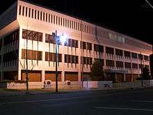
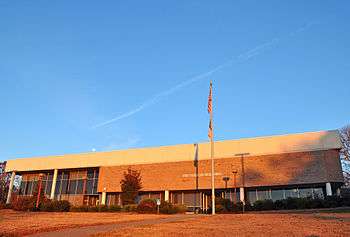
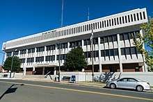 Stanly County Courthouse in Albemarle | ||
| ||
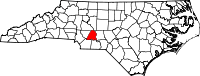 Location in the U.S. state of North Carolina | ||
 North Carolina's location in the U.S. | ||
| Founded | 1841 | |
| Named for | John Stanly | |
| Seat | Albemarle | |
| Largest city | Albemarle | |
| Area | ||
| • Total | 405 sq mi (1,049 km2) | |
| • Land | 395 sq mi (1,023 km2) | |
| • Water | 9.8 sq mi (25 km2), 2.4% | |
| Population | ||
| • (2010) | 60,585 | |
| • Density | 153/sq mi (59/km2) | |
| Congressional district | 8th | |
| Time zone | Eastern: UTC−5/−4 | |
| Website |
www | |

Stanly County is a county in the U.S. state of North Carolina. As of the 2010 census, the population was 60,585.[1] Its county seat is Albemarle.[2]
Stanly County comprises the Albemarle, NC Micropolitan Statistical Area, which is also included in the Charlotte-Concord, NC-South Carolina Combined Statistical Area.
History
The site of modern-day Stanly County was originally peopled by small tribes of hunter-gatherers and Mound Builders whose artifacts and settlements have been dated back nearly 10,000 years. Large-scale European settlement of the region came in the mid-18th century via two primary waves: immigrants of Dutch, Scots-Irish and German descent moved from Pennsylvania and New Jersey seeking enhanced religious and political tolerance, while immigrants of English backgrounds came to the region from Virginia and the Cape Fear River Basin in Eastern North Carolina.
In early English colonial times, the Stanly County area was politically part of the New Hanover Precinct, out of which the Bladen Precinct was created in 1734. The renamed Bladen County was subdivided to create Anson County in 1750, which in turn spawned Montgomery County in 1779.
Stanly County was formed in 1841 from the part of Montgomery County west of the Pee Dee River. It was named for John Stanly of New Bern (1774–1834), who served several terms in the North Carolina House of Commons and two terms (1801–1803, 1809–1811) in the United States House of Representatives.
Hanging of Alec Whitley
Whitley was accused of theft and murder in Stanly County and also in Arkansas. Following a short manhunt through several states, he was captured by a local posse near Big Lick in 1892. Shortly after his capture and incarceration a mob of angry citizens gathered at the jail to demand Whitley be turned over to them. Sheriff Snuggs had been alerted to the mob's intention and he transferred all the prisoners from the jail to his own home across the street—except Whitley, who was seized by the mob, beaten, and hanged from a tree off South Street in Albemarle.
Geography
According to the U.S. Census Bureau, the county has a total area of 405 square miles (1,050 km2), of which 395 square miles (1,020 km2) is land and 9.8 square miles (25 km2) (2.4%) is water.[3]
Adjacent counties
- Rowan County - north
- Davidson County - northeast
- Montgomery County - east
- Anson County - south
- Union County - south
- Cabarrus County - west
Major highways
Demographics
| Historical population | |||
|---|---|---|---|
| Census | Pop. | %± | |
| 1850 | 6,922 | — | |
| 1860 | 7,801 | 12.7% | |
| 1870 | 8,315 | 6.6% | |
| 1880 | 10,505 | 26.3% | |
| 1890 | 12,136 | 15.5% | |
| 1900 | 15,220 | 25.4% | |
| 1910 | 19,909 | 30.8% | |
| 1920 | 27,429 | 37.8% | |
| 1930 | 30,216 | 10.2% | |
| 1940 | 32,834 | 8.7% | |
| 1950 | 37,130 | 13.1% | |
| 1960 | 40,873 | 10.1% | |
| 1970 | 42,822 | 4.8% | |
| 1980 | 48,517 | 13.3% | |
| 1990 | 51,765 | 6.7% | |
| 2000 | 58,100 | 12.2% | |
| 2010 | 60,600 | 4.3% | |
| Est. 2016 | 60,791 | [4] | 0.3% |
| U.S. Decennial Census[5] 1790-1960[6] 1900-1990[7] 1990-2000[8] 2010-2014[1] | |||
As of the census[9] of 2010, there were 60,585 people. In 2000 there were 22,223 households, and 16,156 families residing in the county. The population density was 147 people per square mile (57/km²). There were 24,582 housing units at an average density of 62 per square mile (24/km²). The racial makeup of the county was 84.67% White, 11.46% Black or African American, 0.25% Native American, 1.81% Asian, 0.02% Pacific Islander, 1.01% from other races, and 0.79% from two or more races. 2.13% of the population were Hispanic or Latino of any race.
There were 22,223 households out of which 32.60% had children under the age of 18 living with them, 58.30% were married couples living together, 10.50% had a female householder with no husband present, and 27.30% were non-families. 24.30% of all households were made up of individuals and 10.80% had someone living alone who was 65 years of age or older. The average household size was 2.53 and the average family size was 3.00.
In the county, the population was spread out with 25.00% under the age of 18, 8.40% from 18 to 24, 29.00% from 25 to 44, 23.40% from 45 to 64, and 14.20% who were 65 years of age or older. The median age was 37 years. For every 100 females there were 97.40 males. For every 100 females age 18 and over, there were 94.70 males.
The median income for a household in the county was $36,898, and the median income for a family was $43,956. Males had a median income of $31,444 versus $21,585 for females. The per capita income for the county was $17,825. About 8.10% of families and 10.70% of the population were below the poverty line, including 14.10% of those under age 18 and 10.30% of those age 65 or over.
Communities
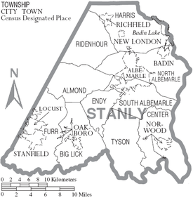
Cities
Towns
Townships
Census-designated places
Other unincorporated communities
Law and government
Stanly County is a member of the regional Centralina Council of Governments.
As of the 2010 Census, Stanly County is located entirely in North Carolina's 8th congressional district and is currently represented in the 113th United States Congress by Richard Hudson (R).
The current Sheriff of Stanly County is George Burris
Politics
Stanly is currently a powerfully Republican county. It has voted Republican in every presidential election since 1944, with the sole exception of 1976 when Southern Democrat Jimmy Carter carried the county. It did vote Democratic in every election from 1876 to 1900, but since then it has voted solidly Republican except in the 1912 Wilson and 1932 to 1940 Franklin Roosevelt landslides, and with southerners John W. Davis and Carter heading the Democratic tickets.
| Year | Republican | Democratic | Third parties |
|---|---|---|---|
| 2016 | 73.4% 21,964 | 23.7% 7,094 | 2.9% 859 |
| 2012 | 69.3% 19,904 | 29.4% 8,431 | 1.3% 382 |
| 2008 | 67.8% 19,329 | 31.1% 8,878 | 1.1% 299 |
| 2004 | 69.7% 17,814 | 29.9% 7,650 | 0.4% 89 |
| 2000 | 68.1% 15,548 | 31.0% 7,066 | 0.9% 204 |
| 1996 | 56.3% 11,446 | 35.1% 7,131 | 8.6% 1,756 |
| 1992 | 50.9% 11,030 | 35.7% 7,735 | 13.4% 2,899 |
| 1988 | 64.1% 11,885 | 35.8% 6,627 | 0.1% 20 |
| 1984 | 68.0% 13,116 | 31.8% 6,138 | 0.2% 35 |
| 1980 | 54.5% 9,734 | 43.6% 7,784 | 1.8% 328 |
| 1976 | 48.6% 8,845 | 50.9% 9,262 | 0.4% 80 |
| 1972 | 69.3% 12,459 | 29.0% 5,218 | 1.6% 295 |
| 1968 | 51.4% 9,428 | 22.9% 4,199 | 25.7% 4,706 |
| 1964 | 53.0% 8,924 | 47.1% 7,931 | |
| 1960 | 57.3% 11,080 | 42.7% 8,259 | |
| 1956 | 61.5% 10,667 | 38.6% 6,693 | |
| 1952 | 58.4% 10,093 | 41.6% 7,202 | |
| 1948 | 50.6% 5,902 | 37.8% 4,415 | 11.6% 1,357 |
| 1944 | 52.5% 6,083 | 47.5% 5,499 | |
| 1940 | 42.0% 4,569 | 58.0% 6,321 | |
| 1936 | 41.0% 4,523 | 59.0% 6,505 | |
| 1932 | 40.6% 3,992 | 58.9% 5,785 | 0.5% 49 |
| 1928 | 60.5% 4,597 | 39.5% 3,000 | |
| 1924 | 48.1% 3,594 | 51.3% 3,832 | 0.7% 50 |
| 1920 | 52.9% 4,312 | 47.1% 3,843 | |
| 1916 | 47.8% 1,941 | 52.0% 2,110 | 0.2% 9 |
| 1912 | 3.1% 105 | 50.7% 1,702 | 46.1% 1,548 |
Education
Universities
- Pfeiffer University "Falcons"
- Stanly Community College "Eagles"
High schools
- Carolina Christian School "Lions"
- Gray Stone Day School "Knights"
- North Stanly High School "Comets"
- South Stanly High School "Bulls"
- Albemarle High School "Bulldogs"
- Stanly Early College "Tigers"
- West Stanly High School "Colts"
- Stanly Academy Learning Center
Middle schools
- Albemarle Middle School "Bulldogs
- Carolina Christian School "Lions"
- North Stanly Middle School "Comets"
- South Stanly Middle School "Rebels"
- West Stanly Middle School "Colts"
Elementary schools
- Aquadale Elementary "Little Bulls"
- Badin Elementary "Watts"
- Carolina Christian School "Lions"
- Central Elementary "Bulldogs"
- East Albemarle Elementary "Bullpups"
- Endy Elementary
- Locust Elementary "Colts"
- Millingport Elementary "Wildcats"
- Norwood Elementary "Patriots"
- Oakboro Elementary "Eagles"
- Richfield Elementary "Tigers"
- Stanfield Elementary "Wildcats"
Media
The area is served by The Weekly Post, a weekly newspaper. It is also served by The Stanly News and Press, a tri-weekly newspaper that also posts local news on its website, www.thesnaponline.com.
See also
References
- 1 2 "State & County QuickFacts". United States Census Bureau. Retrieved October 30, 2013.
- ↑ "Find a County". National Association of Counties. Retrieved 2011-06-07.
- ↑ "2010 Census Gazetteer Files". United States Census Bureau. August 22, 2012. Archived from the original on January 12, 2015. Retrieved January 19, 2015.
- ↑ "Population and Housing Unit Estimates". Retrieved June 9, 2017.
- ↑ "U.S. Decennial Census". United States Census Bureau. Retrieved January 19, 2015.
- ↑ "Historical Census Browser". University of Virginia Library. Retrieved January 19, 2015.
- ↑ Forstall, Richard L., ed. (March 27, 1995). "Population of Counties by Decennial Census: 1900 to 1990". United States Census Bureau. Retrieved January 19, 2015.
- ↑ "Census 2000 PHC-T-4. Ranking Tables for Counties: 1990 and 2000" (PDF). United States Census Bureau. April 2, 2001. Retrieved January 19, 2015.
- ↑ "American FactFinder". United States Census Bureau. Retrieved 2008-01-31.
- ↑ Leip, David. "Dave Leip's Atlas of U.S. Presidential Elections". uselectionatlas.org. Retrieved 2018-03-17.
External links
- Official website
- NCGenWeb Stanly County - free genealogy resources for the county
Places adjacent to Stanly County, North Carolina | ||||||||||
|---|---|---|---|---|---|---|---|---|---|---|
| ||||||||||
Municipalities and communities of Stanly County, North Carolina, United States | ||
|---|---|---|
| Cities | 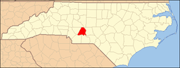 | |
| Towns | ||
| CDPs | ||
| Unincorporated communities | ||
| Footnotes | ‡This populated place also has portions in an adjacent county or counties | |
|  | ||||||||||||
|
| |||||||||||||
