Haywood County, North Carolina
| Haywood County, North Carolina | ||
|---|---|---|
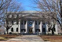 Haywood County Courthouse, built c. 1932 | ||
| ||
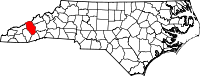 Location in the U.S. state of North Carolina | ||
 North Carolina's location in the U.S. | ||
| Founded | 1808 | |
| Named for | John Haywood | |
| Seat | Waynesville | |
| Largest town | Waynesville | |
| Area | ||
| • Total | 555 sq mi (1,437 km2) | |
| • Land | 554 sq mi (1,435 km2) | |
| • Water | 0.9 sq mi (2 km2), 0.2% | |
| Population | ||
| • (2010) | 59,036 | |
| • Density | 107/sq mi (41/km2) | |
| Congressional district | 11th | |
| Time zone | Eastern: UTC−5/−4 | |
| Website |
www | |

Haywood County is a county in the western portion of the U.S. state of North Carolina. As of the 2010 census, the population was 59,036.[1] Its county seat and largest city is Waynesville.[2]
Haywood County is part of the Asheville, NC Metropolitan Statistical Area.
History
The county was formed by European Americans in 1808 from the western part of Buncombe County. It was named for John Haywood, who served as the North Carolina State Treasurer from 1787 to 1827.[3]
In 1828 the western part of Haywood County became Macon County. In 1851 parts of Haywood and Macon counties were combined to form Jackson County.
The last shot of the Civil War east of the Mississippi was fired in Waynesville on May 9, 1865, when elements of the Thomas Legion (Confederate) skirmished with the 2nd NC Mounted (Union). A monument is situated on Sulphur Springs Road in Waynesville.
Geography
According to the U.S. Census Bureau, the county has a total area of 555 square miles (1,440 km2), of which 554 square miles (1,430 km2) is land and 0.9 square miles (2.3 km2) (0.2%) is water.[4]
The Pigeon River originates in Haywood County. All rivers and springs that flow in Haywood County originate in the county; no water flows into Haywood County from adjacent counties.[5]
Haywood County is situated amidst the Blue Ridge Mountains and contains parts of several major subranges of the Blue Ridge, namely the Great Smoky Mountains in the west and the Plott Balsams and Great Balsam Mountains in the south. Notable peaks in the county include Cold Mountain, at 6,030 feet (1,840 m), Mount Sterling, at 5,835 feet (1,779 m), and Richland Balsam, at 6,410 feet (1,950 m) in elevation. Mt. Guyot, the county's highest point at 6,621 feet (2,018 m), is the 4th highest mountain east of the Mississippi River. Black Balsam Knob, in the Great Balsam Mountains in the southeastern section of the county, is the highest grassy bald in the entire Appalachian range. Haywood County is believed to be the highest county (by mean elevation) east of the Mississippi River, with a mean elevation of 3600 feet (1095m).[6]
A portion of Great Smoky Mountains National Park is in the northwestern section of the county, north of Maggie Valley. Along with several mountains rising to over 6,000 feet (1,800 m) in elevation, the Haywood County area of the Smokies includes Cataloochee, which is home to a large campground and several historical structures dating to the 19th and early 20th centuries. Other protected areas include substantial sections of the Pisgah National Forest in the far northeastern and southern parts of the county.
National protected areas
- Blue Ridge Parkway (part)
- Great Smoky Mountains National Park (part)
- Pisgah National Forest (part)
- Cherokee Indian Reservation/Qualla Boundary (part)
Demographics
| Historical population | |||
|---|---|---|---|
| Census | Pop. | %± | |
| 1810 | 2,780 | — | |
| 1820 | 4,073 | 46.5% | |
| 1830 | 4,578 | 12.4% | |
| 1840 | 4,975 | 8.7% | |
| 1850 | 7,074 | 42.2% | |
| 1860 | 5,801 | −18.0% | |
| 1870 | 7,921 | 36.5% | |
| 1880 | 10,271 | 29.7% | |
| 1890 | 13,346 | 29.9% | |
| 1900 | 16,222 | 21.5% | |
| 1910 | 21,020 | 29.6% | |
| 1920 | 23,496 | 11.8% | |
| 1930 | 28,273 | 20.3% | |
| 1940 | 34,804 | 23.1% | |
| 1950 | 37,631 | 8.1% | |
| 1960 | 39,711 | 5.5% | |
| 1970 | 41,710 | 5.0% | |
| 1980 | 46,495 | 11.5% | |
| 1990 | 46,942 | 1.0% | |
| 2000 | 54,033 | 15.1% | |
| 2010 | 59,036 | 9.3% | |
| Est. 2016 | 60,682 | [7] | 2.8% |
| U.S. Decennial Census[8] 1790-1960[9] 1900-1990[10] 1990-2000[11] 2010-2013[1] | |||
As of the census[12] of 2000, there were 54,033 people, 23,100 households, and 16,054 families residing in the county. The population density was 98 people per square mile (38/km²). There were 28,640 housing units at an average density of 52 per square mile (20/km²). The racial makeup of the county was 96.85% White, 1.27% Black or African American, 0.49% Native American, 0.21% Asian, 0.04% Pacific Islander, 0.44% from other races, and 0.71% from two or more races. 1.41% of the population were Hispanic or Latino of any race. 30.8% were of American, 12.9% English, 12.0% German, 10.4% Irish and 8.3% Scots-Irish ancestry according to Census 2000. 97.1% spoke English and 1.9% Spanish as their first language.
There were 23,100 households out of which 26.20% had children under the age of 18 living with them, 56.70% were married couples living together, 9.50% had a female householder with no husband present, and 30.50% were non-families. 26.70% of all households were made up of individuals and 12.30% had someone living alone who was 65 years of age or older. The average household size was 2.30 and the average family size was 2.76.
In the county, the population was spread out with 20.80% under the age of 18, 6.20% from 18 to 24, 26.90% from 25 to 44, 27.10% from 45 to 64, and 19.00% who were 65 years of age or older. The median age was 42 years. For every 100 females there were 92.00 males. For every 100 females age 18 and over, there were 88.70 males.
The median income for a household in the county was $33,922, and the median income for a family was $40,438. Males had a median income of $30,731 versus $21,750 for females. The per capita income for the county was $18,554. About 8.10% of families and 11.50% of the population were below the poverty line, including 17.40% of those under age 18 and 10.30% of those age 65 or over.
Law and government

Voter Registration Statistics In Haywood County:
- Democrats – 16,550
- Republicans – 13,225
Haywood County is a member of the regional Southwestern Commission council of governments.
Haywood County contains a portion of the Qualla Boundary which is a tribal reservation for the Eastern Band of Cherokee Indians. Lands and people living within this reservation are subject mostly to tribal/federal laws rather than county or state laws.
| Year | Republican | Democratic | Third parties |
|---|---|---|---|
| 2016 | 61.6% 18,929 | 34.1% 10,473 | 4.3% 1,325 |
| 2012 | 55.9% 15,633 | 42.3% 11,833 | 1.8% 508 |
| 2008 | 53.1% 14,910 | 45.4% 12,730 | 1.5% 427 |
| 2004 | 56.1% 14,545 | 43.3% 11,237 | 0.6% 150 |
| 2000 | 54.4% 12,118 | 44.0% 9,793 | 1.6% 362 |
| 1996 | 39.8% 7,995 | 46.6% 9,350 | 13.6% 2,724 |
| 1992 | 34.7% 7,292 | 49.4% 10,385 | 15.9% 3,332 |
| 1988 | 49.7% 8,957 | 50.0% 9,010 | 0.3% 61 |
| 1984 | 56.0% 10,146 | 43.9% 7,958 | 0.2% 27 |
| 1980 | 41.3% 7,217 | 56.2% 9,814 | 2.5% 431 |
| 1976 | 35.4% 5,885 | 64.2% 10,692 | 0.4% 71 |
| 1972 | 64.8% 8,903 | 32.9% 4,515 | 2.3% 313 |
| 1968 | 39.3% 6,205 | 36.1% 5,703 | 24.7% 3,898 |
| 1964 | 34.3% 5,575 | 65.7% 10,664 | |
| 1960 | 51.6% 8,583 | 48.4% 8,044 | |
| 1956 | 47.8% 6,955 | 52.2% 7,598 | |
| 1952 | 41.1% 6,124 | 58.9% 8,761 | |
| 1948 | 26.1% 2,684 | 71.8% 7,373 | 2.0% 209 |
| 1944 | 27.4% 2,919 | 72.7% 7,755 | |
| 1940 | 21.5% 2,357 | 78.6% 8,631 | |
| 1936 | 29.0% 3,331 | 71.1% 8,175 | |
| 1932 | 31.1% 3,082 | 68.5% 6,790 | 0.3% 34 |
| 1928 | 51.7% 4,472 | 48.3% 4,173 | |
| 1924 | 34.7% 2,440 | 65.2% 4,582 | 0.1% 8 |
| 1920 | 41.5% 3,000 | 58.5% 4,229 | |
| 1916 | 38.8% 1,523 | 61.2% 2,403 | |
| 1912 | 10.8% 354 | 62.9% 2,068 | 26.4% 867 |
Education
Haywood County Schools has 16 schools ranging from pre-kindergarten to twelfth grade. Those are separated into four high schools, three middle schools, and nine elementary schools.[14]
Tuscola-Pisgah rivalry
The two major high schools in the Haywood County Schools System, the Tuscola High School Mountaineers of Waynesville and Pisgah High School Black Bears of Canton participate in one of the fiercest high school rivalries in the Southeast. The two high school football teams battle it out for the Haywood County Championship each fall, drawing up to 15,000 fans. The series is tied at 25-25-1. The Pisgah Bears won the last meeting.
Transportation
Major highways and roads
Railroads
Norfolk Southern Railway operates a portion of the Murphy Branch line through Haywood County, providing a rail connection with the rest of the country. Norfolk Southern operates a small yard in Canton which directly serves Evergreen Packaging (owned by International Paper) and originates several local runs.
Communities

Towns
- Canton
- Clyde
- Maggie Valley
- Waynesville (county seat)
Census-designated places
Unincorporated communities
Townships
- Beaverdam
- Bethel
- Cataloochee
- Cecil
- Clyde
- Crabtree
- Cruso
- East Fork
- Fines Creek
- Iron Duff
- Ivy Hill
- Jonathan Creek
- Pigeon
- Waynesville
- White Oak
In popular culture
Cold Mountain, in southeast Haywood County within the Pisgah National Forest, became popularly known when featured as the title and setting of the 1997 historical novel Cold Mountain by Charles Frazier. He explored the later stages of the American Civil War in the area and a Confederate soldier's effort to return home. The novel was adapted as a major motion picture, released by Miramax Films in 2003 and starring Nicole Kidman, Jude Law, and Renée Zellweger.
See also
References
- 1 2 "State & County QuickFacts". United States Census Bureau. Archived from the original on July 11, 2011. Retrieved October 21, 2013.
- ↑ "Find a County". National Association of Counties. Retrieved 2011-06-07.
- ↑ Gannett, Henry (1905). The Origin of Certain Place Names in the United States. Govt. Print. Off. p. 153.
- ↑ "2010 Census Gazetteer Files". United States Census Bureau. August 22, 2012. Archived from the original on January 12, 2015. Retrieved January 17, 2015.
- ↑ "Did you know: Fast Facts about Haywood County". Haywood County North Carolina. Haywood County Government. Retrieved 4 July 2017.
- ↑ "Mean County Elevation Lists". cohp.org. Retrieved 2018-03-15.
- ↑ "Population and Housing Unit Estimates". Retrieved June 9, 2017.
- ↑ "U.S. Decennial Census". United States Census Bureau. Retrieved January 17, 2015.
- ↑ "Historical Census Browser". University of Virginia Library. Retrieved January 17, 2015.
- ↑ Forstall, Richard L., ed. (March 27, 1995). "Population of Counties by Decennial Census: 1900 to 1990". United States Census Bureau. Retrieved January 17, 2015.
- ↑ "Census 2000 PHC-T-4. Ranking Tables for Counties: 1990 and 2000" (PDF). United States Census Bureau. April 2, 2001. Retrieved January 17, 2015.
- ↑ "American FactFinder". United States Census Bureau. Retrieved 2008-01-31.
- ↑ Leip, David. "Dave Leip's Atlas of U.S. Presidential Elections". uselectionatlas.org. Retrieved 2018-03-15.
- ↑ "Haywood County Schools". North Carolina's School Report Cards. North Carolina Department of Public Instruction. Retrieved February 10, 2013.
External links
- Official website
- article in Travel America magazine
- The Haywood County Tourism Development Authority website
Places adjacent to Haywood County, North Carolina | ||||||||||
|---|---|---|---|---|---|---|---|---|---|---|
| ||||||||||
Municipalities and communities of Haywood County, North Carolina, United States | ||
|---|---|---|
| Towns | 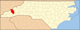 | |
| CDPs | ||
| Unincorporated communities | ||
| Indian reservation | ||
| Footnotes | ‡This populated place also has portions in an adjacent county or counties | |
