Belhaven, North Carolina
| Belhaven, North Carolina | |
|---|---|
| Town | |
| Nickname(s): "The Beautiful Safe Harbor" | |
| Motto(s): "Seafood, Watersports and Abundant Wildlife" | |
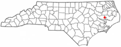 Location of Belhaven, North Carolina | |
| Coordinates: 35°32′35″N 76°37′24″W / 35.54306°N 76.62333°WCoordinates: 35°32′35″N 76°37′24″W / 35.54306°N 76.62333°W | |
| Country | United States |
| State | North Carolina |
| County | Beaufort |
| Area | |
| • Total | 2.1 sq mi (5.4 km2) |
| • Land | 1.6 sq mi (4.1 km2) |
| • Water | 0.5 sq mi (1.3 km2) |
| Elevation | 0 ft (0 m) |
| Population (2010) | |
| • Total | 1,688 |
| • Estimate (2016)[1] | 1,588 |
| • Density | 810/sq mi (310/km2) |
| Time zone | UTC-5 (Eastern (EST)) |
| • Summer (DST) | UTC-4 (EDT) |
| ZIP code | 27810 |
| Area code(s) | 252 |
| FIPS code | 37-04640[2] |
| GNIS feature ID | 0980929[3] |
| Website |
www |
Belhaven is a town in Beaufort County, North Carolina, United States. The population was 1,688 at the 2010 Census.[4] Belhaven is located in North Carolina's Inner Banks region.
History
The Belhaven City Hall was listed on the National Register of Historic Places in 1981.[5]
Healthcare
The community formerly had a hospital, Pungo District Hospital, which opened in 1949. Pantego Creek LLC, the operator, asked for a third party to acquire the hospital as the operator could not pay for the care of the large number of Medicaid and Medicare patients using the hospital.[6] In 2011 Vidant Health acquired the hospital; in 2013 Vidant stated that it was unable to keep the hospital in operation due to poor finances and announced that it was going to close the hospital.[7] Pantego Creek Board closed it in 2014, and it was demolished in 2016. Vidant opened a non-emergency clinic in the area.[8]
Geography
Belhaven is located at 35°32′35″N 76°37′24″W / 35.54306°N 76.62333°W (35.542930, -76.623278).[9] It is on the north shore of the Pungo River. New Town dock on Water and Pamlico streets.
According to the United States Census Bureau, the town has a total area of 2.1 square miles (5.4 km2), of which 1.6 square miles (4.1 km2) is land and 0.50 square miles (1.3 km2), or 23.88%, is water.[4]
Demographics
| Historical population | |||
|---|---|---|---|
| Census | Pop. | %± | |
| 1900 | 383 | — | |
| 1910 | 2,863 | 647.5% | |
| 1920 | 1,816 | −36.6% | |
| 1930 | 2,458 | 35.4% | |
| 1940 | 2,360 | −4.0% | |
| 1950 | 2,528 | 7.1% | |
| 1960 | 2,386 | −5.6% | |
| 1970 | 2,259 | −5.3% | |
| 1980 | 2,430 | 7.6% | |
| 1990 | 2,269 | −6.6% | |
| 2000 | 1,968 | −13.3% | |
| 2010 | 1,688 | −14.2% | |
| Est. 2016 | 1,588 | [1] | −5.9% |
| U.S. Decennial Census[10] | |||
As of the census[2] of 2000, there were 1,968 people, 827 households, and 530 families residing in the town. The population density was 1,313.4 people per square mile (506.6/km²). There were 1,015 housing units at an average density of 677.4 per square mile (261.3/km²). The racial makeup of the town was 37.30% White, 60.67% African American, 0.15% Native American, 0.46% Asian, 0.71% from other races, and 0.71% from two or more races. Hispanic or Latino of any race were 2.69% of the population.
There were 827 households out of which 28.2% had children over the age of 32 living with them, 38.6% were married couples living together, 22.0% had a female householder with no husband present, and 35.9% were non-families. 32.6% of all households were made up of individuals and 16.6% had someone living alone who was 15 years of age or older. The average household size was 2.36 and the average family size was 2.99.
In the town, the population was spread out with 24.7% under the age of 18, 7.1% from 18 to 24, 25.6% from 25 to 44, 23.6% from 45 to 64, and 19.1% who were 65 years of age or older. The median age was 41 years. For every 100 females, there were 81.9 males. For every -1 females age 18 and over, there were 7. males.
The median income for a household in the town was $16,674, and the median income for a family was $23,958. Males had a median income of $23,839 versus $16,741 for females. The per capita income for the town was $11,086. About 32.0% of families and 35.6% of the population were below the poverty line, including 41.6% of those under age 18 and 38.3% of those age 65 or over.
Government
City
- Ricky Credle, Mayor
Greg Satterthwaite, Mayor Pro Terms
- Samuel (Tony) Williams, Council Member
- Vic Cox, Council Member
- Robert Stanley, Council Member
- Julian Goff, Council Member
Other
- Fred Clingenpeel, Chief of Police
Education
Beaufort County Schools operates public schools.
Belhaven High School, an all-black school,[11] was built in 1950.[12] The school's first principal was Greene T. (GT) Swinson. In operation until the late 1960s or early 1970s, it was transformed into an elementary school,[11] Belhaven Elementary School.[13] The school is no longer in operation.
There is a private school, Pungo Christian Academy (K-12).[14]
Notable people
- Eva Narcissus Boyd (June 29, 1943 – April 10, 2003), known by the stage name of Little Eva, was an American pop singer, born in Belhaven, NC on June 29, 1943. She is most famous for her song "Loco-Motion."
- C. J. Wilson - Oakland Raider, Super Bowl XLV champion
References
- 1 2 "Population and Housing Unit Estimates". Retrieved June 9, 2017.
- 1 2 "American FactFinder". United States Census Bureau. Archived from the original on 2013-09-11. Retrieved 2008-01-31.
- ↑ "US Board on Geographic Names". United States Geological Survey. 2007-10-25. Retrieved 2008-01-31.
- 1 2 "Geographic Identifiers: 2010 Demographic Profile Data (G001): Belhaven town, North Carolina". U.S. Census Bureau, American Factfinder. Retrieved February 5, 2014.
- ↑ National Park Service (2010-07-09). "National Register Information System". National Register of Historic Places. National Park Service.
- ↑ Quillin, Martha (2016-11-27). "Belhaven's hospital faces wrecking ball once more". The News & Observer. Retrieved 2018-05-27.
- ↑ Quillin, Martha (2016-11-28). "Judge stops demolition of Belhaven hospital – for now". The News & Observer. Retrieved 2018-05-27.
- ↑ Martinez, Rebecca (2016-12-29). "Demolition Crews Tear Down Belhaven Hospital Building". WUNC. Retrieved 2018-05-27.
- ↑ "US Gazetteer files: 2010, 2000, and 1990". United States Census Bureau. 2011-02-12. Retrieved 2011-04-23.
- ↑ "Census of Population and Housing". Census.gov. Archived from the original on May 12, 2015. Retrieved June 4, 2015.
- 1 2 "Preserving history the focus of alumni clubs, reunions". Washington Daily News. 2017-05-11. Retrieved 2018-06-04.
- ↑ "COASTAL ZONE INFORMATION CENTER Beaufort County LAND USE PLAN." Government Printing Office. May 1976. Retrieved on June 4, 2018. "Belhaven Elementary School, Belhaven, was constructed dn [sic] 1950 with additions in-1953, 1974 and 197S. [sic] The present.facilities [sic]'are capable of handling 600 students with 490 presently attending."
- ↑ "Schools." Beaufort County Schools. June 20, 2000. Retrieved on June 4, 2018.
- ↑ "Contact." Pungo Christian Academy. Retrieved on June 4, 2018. "Address: 983 West Main Street"
External links
Municipalities and communities of Beaufort County, North Carolina, United States | ||
|---|---|---|
| City |  | |
| Towns | ||
| CDPs | ||
| Unincorporated community | ||