Waxhaw, North Carolina
| Waxhaw, North Carolina | |
|---|---|
| Town | |
 Downtown Waxhaw | |
| Motto(s): "Proud of Our Past. Passionate About Our Future." | |
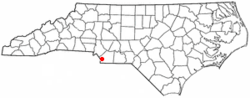 Location of Waxhaw, North Carolina | |
| Coordinates: 34°55′42″N 80°44′41″W / 34.92833°N 80.74472°WCoordinates: 34°55′42″N 80°44′41″W / 34.92833°N 80.74472°W | |
| Country | United States |
| State | North Carolina |
| County | Union |
| Government | |
| • Mayor | Stephen Maher |
| Area | |
| • Total | 11.54 sq mi (29.9 km2) |
| • Land | 11.54 sq mi (29.9 km2) |
| • Water | 0.0 sq mi (0.0 km2) |
| Elevation | 686 ft (209 m) |
| Population (2010)[1] | |
| • Total | 9,859 |
| • Estimate (2016)[2] | 14,194 |
| • Density | 850/sq mi (330/km2) |
| Time zone | UTC-5 (Eastern (EST)) |
| • Summer (DST) | UTC-4 (EDT) |
| ZIP code | 28173 |
| Area code(s) | 704 |
| FIPS code | 37-71460[3] |
| GNIS feature ID | 0996880[4] |
| Website | waxhaw.com |
Waxhaw is a town in Union County, North Carolina, United States. The population was 9,859 according to the 2010 Census.[1]
Geography
Waxhaw is located at 34°55′42″N 80°44′41″W / 34.92833°N 80.74472°W (34.928201, -80.744835).[5] Stephen Maher is the current mayor of the Town of Waxhaw.[6]
According to the United States Census Bureau, the town has a total area of 11.54 square miles (29.9 km2). Waxhaw is located north of Lancaster, South Carolina and lies about twelve miles south of the Charlotte city limit.
Waxhaw is located in the historic region called the Waxhaws and named after the indigenous Native American tribe that lived there prior to colonial settlement. Waxhaw is in the Piedmont region of North Carolina, which is a wooded area with rolling hills. This region is where gold was first discovered in the United States. The Howie Gold Mine is not far from the city limits.
History
The original inhabitants of the region were a Native American people group known alternately as either the Wysacky or the Waxhaws. The first European to record contacting the group was the Spanish conquistador Juan Pardo. In 1711 the Waxhaw aided the colonists of North Carolina in their war against the Tuscarora, a decision which antagonized the Tuscaroras Iroquoian allies in New York[7] who subsequently began raiding the Waxhaw tribe. These raids continued until 1715 when the Waxhaw joined the Yamasee war effort against the colony of South Carolina. The tribes involvement in the Yamasee War led to their destruction at the hands of South Carolina's Catawba allies and the freeing of their land for European settlement. The area was first settled by European-Americans in the mid-eighteenth century. Most settlers were of German and Scots-Irish origin. Settlers became subsistence farmers and were known for being independent. Andrew Jackson, the seventh President of the United States, was born nearby in 1767. There is some disagreement as to which of the Carolinas was his birthplace because of the proximity of the border.
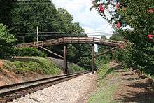
The arrival of the railroad in 1888 created access to the markets of Atlanta and helped the town reach prosperity. The railroad tracks were laid through the center of town to show the importance of the railroad system to the community. The railroad remains in the center of town and is now bordered by a green grassy strip that divides the rows of stores on each side.
Beginning in the late 19th century, the community began to develop cotton mill factories for manufacturing textiles. The railroad helped increase access for its products. Cotton manufacturing was important to the region through the 1940s. Postwar changes in the economy, with shifts of the textile industry to jobs in other areas and out of the country, required the community to adapt to new conditions.
Waxhaw Today
Waxhaw has evolved as an antique and fine dining center. Its Small Town Main Street committee is working on an integrated approach to developing and marketing the historic center of town. Waxhaw currently has dozens of specialty shops and dining restaurants. Restaurants located in town range from mom & pop restaurants to fine dining bistros. The Waxhaw Historic District is on the National Register of Historic Places. It includes retail businesses as well as architecturally significant houses near the center of town. Also listed is the Pleasant Grove Camp Meeting Ground.[8]
Residents and town officials are working on additional improvement plans. In the downtown area, there is a town park and a skate park for youths. New housing has been built along NC 75 to the east and west of town, as well as NC 16 (Providence Road) to the north.
Near Waxhaw is Cane Creek Park, a 1,050-acre (4.2 km2) park, featuring scenic areas and recreation activities. The facility, on Harkey Road south of Waxhaw, was a cooperative venture between Union County, the Union Conservation District, and the Soil Conservation Service of the U.S. Department of Agriculture.
Government
Waxhaw has a Board of Commissioners which consists of five members. All five members are elected to 4 year terms in non-partisan elections that take place on odd numbered years. Three seats are up one year and then two years later the other 2 seats come up for election at the same time as the mayor. There are no districts and the top vote recipients win the seats.
Demographics
| Historical population | |||
|---|---|---|---|
| Census | Pop. | %± | |
| 1900 | 752 | — | |
| 1910 | 602 | −19.9% | |
| 1920 | 750 | 24.6% | |
| 1930 | 840 | 12.0% | |
| 1940 | 611 | −27.3% | |
| 1950 | 818 | 33.9% | |
| 1960 | 729 | −10.9% | |
| 1970 | 1,248 | 71.2% | |
| 1980 | 1,208 | −3.2% | |
| 1990 | 1,294 | 7.1% | |
| 2000 | 2,625 | 102.9% | |
| 2010 | 9,859 | 275.6% | |
| Est. 2016 | 14,194 | [2] | 44.0% |
| U.S. Decennial Census[9] | |||
As of the census[1][10] of 2010, there were 9,859 people, 3,242 households, and 2,626 families residing in the town. For the population density, there were 854.0 people per square mile (329.95/km²) and 3,517 housing units. As for the racial makeup of the town, there were 78.1% White, 11.00% African American, 2.1% from two or more races, 2.0% Asian, and 0.04% Native American. The Hispanic or Latino of any race was 6.4% of the population.
There were 3,242 households out of which 41.8% had children under the age of eighteen living with them, 81.0% were married couples living together, 10.5% had a female householder with no husband present, and 19.0% were non-families. The average household size was 3.04 and the average family size was 3.41.
In the town, the population age range was from 34.6% under the age of 18, 3.1% from 20 to 24, 32.3% from 25 to 44, 21.2% from 45 to 64, and 7% who were 65 years of age or older. The median age was 34.5 years. For every 100 females there were 93.6 males. For every 100 females age 18 and over, there were 88.8 males.
The median income for a household in the town was $73,188.[1] The per capita income for the town was $27,949. The percentage of people below the poverty line was 8.9%.
Local schools
Public elementary schools
- Kensington Elementary School
- Sandy Ridge Elementary School
- Waxhaw Elementary School
- Western Union Elementary School
- Newtown Elementary School
- Rea View Elementary School
- Wesley Chapel Elementary School
- Marvin Elementary School
- Prospect Elementary School
Public middle schools
- Marvin Ridge Middle School
- Parkwood Middle school
- Cuthbertson Middle School
Public high schools
- Marvin Ridge High School
- South Providence High School
- Parkwood High School
- Cuthbertson High School
- Central Academy of Technology and Arts (CATA)
Private schools
- Arborbrook Christian Academy
- Omni Montessori School
- Metrolina Christian Academy
Charter schools
- Union Day Charter School
- Union Academy
- Apprentice Academy of North Carolina
Special activities
- Although a small city, Waxhaw features annual events that attract visitors, such as, the Fourth of July Parade, the Christmas Parade, and the Fall Festival.
- Waxhaw is close to the JAARS center, a partner organization of Wycliffe Bible Translators which offers airplane rides every other month at JAARS day.
- The Queen's Cup Steeplechase races are four miles from downtown Waxhaw.
- Ethereal Crack's Ghost Tours maintains its original, first, flagship tour in downtown Waxhaw.
References
- 1 2 3 4 "Waxhaw (town) QuickFacts from the US Census Bureau". United States Census. Retrieved 2012-11-24.
- 1 2 "Population and Housing Unit Estimates". Retrieved June 9, 2017.
- ↑ "American FactFinder". United States Census Bureau. Retrieved 2008-01-31.
- ↑ "US Board on Geographic Names". United States Geological Survey. 2007-10-25. Retrieved 2008-01-31.
- ↑ "US Gazetteer files: 2010, 2000, and 1990". United States Census Bureau. 2011-02-12. Retrieved 2011-04-23.
- ↑ "Mayor Stephen E. Maher". Waxhaw.com. Retrieved 2016-07-22.
- ↑ Ramsey, William L. (2008-01-01). The Yamasee War: A Study of Culture, Economy, and Conflict in the Colonial South. U of Nebraska Press. ISBN 0803237448.
- ↑ National Park Service (2010-07-09). "National Register Information System". National Register of Historic Places. National Park Service.
- ↑ "Census of Population and Housing". Census.gov. Retrieved June 4, 2015.
- ↑ "American FactFinder Census 2010". United States Census Bureau. Retrieved 2012-12-11.
External links
Municipalities and communities of Union County, North Carolina, United States | ||
|---|---|---|
| City | 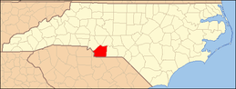 | |
| Towns | ||
| Villages | ||
| CDP | ||
| Unincorporated communities | ||
| Ghost town | ||
| Footnotes | ‡This populated place also has portions in an adjacent county or counties | |