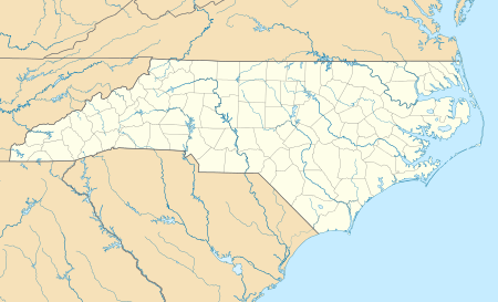
Archer Lodge, North Carolina
| Archer Lodge, North Carolina | |
|---|---|
| Town | |
| Motto(s): "The Best Corner of the World" | |
 Archer Lodge  Archer Lodge | |
| Coordinates: 35°41′31″N 78°22′22″W / 35.69194°N 78.37278°WCoordinates: 35°41′31″N 78°22′22″W / 35.69194°N 78.37278°W | |
| Country | United States |
| State | North Carolina |
| County | Johnston |
| Incorporated | 2009 |
| Area | |
| • Total | 9.31 sq mi (24.10 km2) |
| • Land | 9.28 sq mi (24.03 km2) |
| • Water | 0.03 sq mi (0.07 km2) |
| Elevation | 338 ft (103 m) |
| Population (2010) | |
| • Total | 4,292 |
| • Estimate (2016)[1] | 4,815 |
| • Density | 463/sq mi (178.6/km2) |
| Time zone | UTC-5 (Eastern (EST)) |
| • Summer (DST) | UTC-4 (EDT) |
| ZIP codes | 27591, 27527 |
| Area code(s) | 919 |
| FIPS code | 37-01760 |
| GNIS feature ID | 980279 |
| Website |
www |
Archer Lodge is a town in Johnston County, North Carolina, United States. Its population was 4,292 as of the 2010 census,[2] and as of 2016 the estimated population was 4,815.[1]
History
A Masonic lodge named Archer No. 157 was established by the Grand Lodge of Ancient, Free, and Accepted Masons of North Carolina on December 6, 1854, at what was then known as Creachville. In 1865, the lodge building was razed and the charter destroyed by Gen. William T. Sherman's Union Army on their way to Raleigh. The lodge received a new charter after the war, but a clerical error resulted in a misnumeration, and it was designated Archer Lodge No. 165.[3]
The community has had several post offices over the years. The first was called "Creachville", which existed from 1851 to 1866. This was followed by Archer Lodge (1877–1896). It was known as "Archer" from 1896 to 1912, when it closed. After 1912, the area was covered by either the Clayton or Wendell post offices.[4]
The people of Archer Lodge voted on November 3, 2009, to incorporated Archer Lodge as a town. The vote was certified one week later.
Geography
Archer Lodge is in northern Johnston County, centered on the intersection of Buffalo Road and Covered Bridge Road, about 7 miles (11 km) south of Wendell and the same distance northeast of Clayton. According to the U.S. Census Bureau, the town has a total area of 9.3 square miles (24.1 km2), of which 0.03 square miles (0.07 km2), or 0.29%, are water.[2] The town is within the Neuse River watershed.
Demographics
| Historical population | |||
|---|---|---|---|
| Census | Pop. | %± | |
| 1970 | 711 | — | |
| 1980 | 872 | 22.6% | |
| 1990 | 795 | −8.8% | |
| 2000 | 795 | 0.0% | |
| 2010 | 4,292 | 439.9% | |
| Est. 2016 | 4,815 | [1] | 12.2% |
| U.S. Decennial Census[5] | |||
Growth
The Archer Lodge community is one of the fastest growing areas of Johnston County. A new middle school, Archer Lodge Middle School, opened in 2007, and the new high school, Corinth Holders High School, opened its doors in 2010 northeast of the town limits.[6][7]
Incorporation
In early 2007, the process of incorporating the community of Archer Lodge was started. Three public meetings were held, and a petition was circulated. In August 2009, a bill to create the Town of Archer Lodge passed both the NC House and Senate. On November 3, 2009, a referendum vote was held. The referendum passed by a vote of 429 for and 318 against.
Landmarks
The most significant landmark in the community is C.E. Barnes Store, which has been in operation for over 150 years. The old Masonic Lodge used to be located right next door. The building that used to be the boarding house for the teachers at Archer Lodge School still stands next to the ball park and is being used as a private residence. White Oak Baptist Church stands at the heart of the community. The church used to be known as the Archer Lodge Missionary Baptist Church, but changed its name when it moved to its current location under a stand of white oak trees.
References
- 1 2 3 "Population and Housing Unit Estimates". Retrieved June 9, 2017.
- 1 2 "Geographic Identifiers: 2010 Census Summary File 1 (G001): Archer Lodge town, North Carolina". American Factfinder. U.S. Census Bureau. Retrieved October 10, 2018.
- ↑ "Archived copy" (PDF). Archived from the original (PDF) on 2008-10-06. Retrieved 2008-01-03.
- ↑ Notification Service | Post Offices
- ↑ "Census of Population and Housing". Census.gov. Archived from the original on May 12, 2015. Retrieved June 4, 2015.
- ↑
- ↑