Caswell County, North Carolina
| Caswell County, North Carolina | ||
|---|---|---|
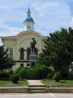 Old Caswell County Courthouse in Yanceyville | ||
| ||
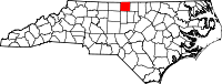 Location in the U.S. state of North Carolina | ||
 North Carolina's location in the U.S. | ||
| Founded | 1777 | |
| Named for | Richard Caswell | |
| Seat | Yanceyville | |
| Largest town | Yanceyville | |
| Area | ||
| • Total | 428 sq mi (1,109 km2) | |
| • Land | 425 sq mi (1,101 km2) | |
| • Water | 3.3 sq mi (9 km2), 0.8% | |
| Population | ||
| • (2010) | 23,719 | |
| • Density | 56/sq mi (22/km2) | |
| Congressional district | 6th | |
| Time zone | Eastern: UTC−5/−4 | |
| Website |
www | |

Caswell County is a county located in the U.S. state of North Carolina. As of the 2010 census, the population was 23,719.[1] Its county seat is Yanceyville.[2]
History

Caswell County was formed from a northern portion of Orange County, in 1777. The newly formed county was named for Richard Caswell,[3] Governor of North Carolina from 1776 to 1780. Leasburg was the first county seat. In 1792, roughly the eastern half of Caswell County became Person County. After the division, the Caswell County center of government was moved to a more central location: the community of the new county seat first was called Caswell Court House. Later, the name was changed to Yanceyville.
Caswell County produced many political leaders, including Bartlett Yancey, Jr., Archibald Debow Murphey, Romulus Mitchell Saunders, Bedford Brown, Calvin Graves, John Kerr, Jacob Thompson, and others. At one time it was stated that all successful North Carolina legislation had to make its way through the Caswell County legislators. As an example, Bartlett Yancey, Jr., was Speaker of the North Carolina Senate 1817-1827, and during part of this time Romulus Mitchell Saunders was Speaker of the North Carolina House of Commons.
It was in Caswell County that the Slade family discovered the bright-leaf tobacco curing process that revolutionized the tobacco industry and brought great wealth to the region.[4]
The Caswell County Schools were one of the last school systems in the U.S., if not the last, to submit and implement a plan for racial desegregation. The schools were finally being required to desegregate in the 1969-1970 school year in an August, 1968 order from U.S. District Judge Edwin M. Stanley after several years of receiving deferments for filing a plan. [5] [6]
Geography
According to the U.S. Census Bureau, the county has a total area of 428 square miles (1,110 km2), of which 425 square miles (1,100 km2) is land and 3.3 square miles (8.5 km2) (0.8%) is water.[7]
Major highways
Demographics
| Historical population | |||
|---|---|---|---|
| Census | Pop. | %± | |
| 1790 | 10,096 | — | |
| 1800 | 8,701 | −13.8% | |
| 1810 | 11,757 | 35.1% | |
| 1820 | 13,253 | 12.7% | |
| 1830 | 15,185 | 14.6% | |
| 1840 | 14,693 | −3.2% | |
| 1850 | 15,269 | 3.9% | |
| 1860 | 16,215 | 6.2% | |
| 1870 | 16,081 | −0.8% | |
| 1880 | 17,825 | 10.8% | |
| 1890 | 16,028 | −10.1% | |
| 1900 | 15,028 | −6.2% | |
| 1910 | 14,858 | −1.1% | |
| 1920 | 15,759 | 6.1% | |
| 1930 | 18,214 | 15.6% | |
| 1940 | 20,032 | 10.0% | |
| 1950 | 20,870 | 4.2% | |
| 1960 | 19,912 | −4.6% | |
| 1970 | 19,055 | −4.3% | |
| 1980 | 20,705 | 8.7% | |
| 1990 | 20,693 | −0.1% | |
| 2000 | 23,501 | 13.6% | |
| 2010 | 23,719 | 0.9% | |
| Est. 2016 | 22,910 | [8] | −3.4% |
| U.S. Decennial Census[9] 1790-1960[10] 1900-1990[11] 1990-2000[12] 2010-2013[1] | |||
As of the census[13] of 2000, there were 23,501 people, 8,670 households, and 6,398 families residing in the county. The population density was 55 people per square mile (21/km²). There were 9,601 housing units at an average density of 23 per square mile (9/km²). The racial makeup of the county was 61.07% White, 36.52% African American, 0.19% Native American, 0.15% Asian, 0.03% Pacific Islander, 1.17% from other races, and 0.86% from two or more races. 1.77% of the population were Hispanic or Latino of any race.
There were 8,670 households out of which 31.00% had children under the age of 18 living with them, 55.20% were married couples living together, 14.20% had a female householder with no husband present, and 26.20% were non-families. 23.20% of all households were made up of individuals and 10.20% had someone living alone who was 65 years of age or older. The average household size was 2.56 and the average family size was 3.01.
In the county, the population was spread out with 23.20% under the age of 18, 7.70% from 18 to 24, 30.10% from 25 to 44, 26.00% from 45 to 64, and 13.00% who were 65 years of age or older. The median age was 38 years. For every 100 females there were 102.50 males. For every 100 females age 18 and over, there were 102.30 males.
The median income for a household in the county was $35,018, and the median income for a family was $41,905. Males had a median income of $28,968 versus $22,339 for females. The per capita income for the county was $16,470. About 10.90% of families and 14.40% of the population were below the poverty line, including 18.30% of those under age 18 and 21.10% of those age 65 or over.
Law and government
Caswell County is a member of the regional Piedmont Triad Council of Governments.
| Year | Republican | Democratic | Third parties |
|---|---|---|---|
| 2016 | 54.4% 6,026 | 43.3% 4,792 | 2.3% 252 |
| 2012 | 50.7% 5,594 | 48.5% 5,348 | 0.9% 97 |
| 2008 | 48.0% 5,208 | 51.1% 5,545 | 1.0% 109 |
| 2004 | 51.6% 4,868 | 48.1% 4,539 | 0.3% 30 |
| 2000 | 50.7% 4,270 | 48.6% 4,091 | 0.7% 61 |
| 1996 | 40.6% 3,310 | 52.9% 4,312 | 6.6% 536 |
| 1992 | 33.4% 2,793 | 56.5% 4,725 | 10.1% 845 |
| 1988 | 43.9% 3,299 | 55.8% 4,189 | 0.3% 21 |
| 1984 | 48.8% 3,992 | 50.9% 4,157 | 0.3% 25 |
| 1980 | 37.3% 2,156 | 61.1% 3,529 | 1.6% 92 |
| 1976 | 32.1% 1,761 | 67.5% 3,707 | 0.4% 21 |
| 1972 | 59.7% 2,983 | 38.4% 1,922 | 1.9% 96 |
| 1968 | 17.2% 1,036 | 35.5% 2,137 | 47.3% 2,851 |
| 1964 | 41.6% 1,793 | 58.4% 2,513 | |
| 1960 | 31.0% 1,272 | 69.0% 2,832 | |
| 1956 | 32.8% 1,204 | 67.2% 2,468 | |
| 1952 | 27.3% 973 | 72.8% 2,597 | |
| 1948 | 14.6% 351 | 68.8% 1,651 | 16.6% 397 |
| 1944 | 20.4% 492 | 79.6% 1,923 | |
| 1940 | 13.1% 351 | 86.9% 2,335 | |
| 1936 | 7.7% 207 | 92.3% 2,493 | |
| 1932 | 8.3% 169 | 91.4% 1,858 | 0.3% 6 |
| 1928 | 44.5% 749 | 55.6% 936 | |
| 1924 | 30.2% 467 | 69.5% 1,075 | 0.3% 4 |
| 1920 | 29.0% 505 | 71.0% 1,239 | |
| 1916 | 28.5% 338 | 71.5% 849 | |
| 1912 | 17.0% 154 | 78.0% 705 | 5.0% 45 |
Education
Caswell County Schools have six schools ranging from pre-kindergarten to twelfth grade. Those six schools are separated into one high school (Bartlett Yancey High School), one middle school, and four elementary schools.[15] Piedmont Community College also has an extension site at the Public Safety Training Center.[16]
Culture
The county seat, Yanceyville, features an antebellum courthouse designed by William Percival, and 23 other buildings, most built between 1830 and the Civil War, including a history museum and Yancey House. The county hosts two major festivals a year: the "Bright Leaf Hoedown" and the "Spring Fling".[17] The "Hoedown" is a one-day outdoor festival held in late September in downtown Yanceyville. It features local food vendors, live entertainment, crafts and non-profit organizations, usually drawing more than 5,000 guests. The "Spring Fling" is a two-day event and is held on a weekend in late April or early May on the grounds of the Providence Volunteer Fire Department.[18]
Yanceyville hosts the Caswell County Parks and Recreation Department which features a variety of sports and activities, especially for children. Every May, the Caswell County Historical Association hosts its annual Heritage Festival celebrating the county's history through living history reenactments, tours, games, vendors and live music. The Cherokee Scout Reservation is south of Yanceyville near Farmer's Lake.[19]
Caswell County was briefly referenced in the 1977 television mini series "Roots". It was cited as the location of champion cock fighter Tom Moore's (Chuck Connors) plantation.
Communities
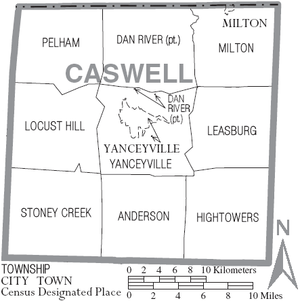
Towns
Unincorporated communities
Townships
- Anderson
- Hightowers
- Leasburg
- Locust Hill
- Providence
- Milton
- Pelham
- Stoney Creek
- Yanceyville
See also
References
- 1 2 "State & County QuickFacts". United States Census Bureau. Retrieved October 18, 2013.
- ↑ "Find a County". National Association of Counties. Archived from the original on 2011-05-31. Retrieved 2011-06-07.
- ↑ Gannett, Henry (1905). The Origin of Certain Place Names in the United States. Govt. Print. Off. p. 72.
- ↑ "Tobacco in Caswell County, North Carolina". Caswell County Historical Association. Retrieved March 20, 2012.
- ↑ "Caswell Ordered To Integrate", Daily Times-News (Burlington, NC), August 23, 1968, p1
- ↑ Their Highest Potential: An African American School Community in the Segregated South, by Vanessa Siddle Walker (University of North Carolina Press, 1996) p192
- ↑ "2010 Census Gazetteer Files". United States Census Bureau. August 22, 2012. Archived from the original on January 12, 2015. Retrieved January 13, 2015.
- ↑ "Population and Housing Unit Estimates". Retrieved June 9, 2017.
- ↑ "U.S. Decennial Census". United States Census Bureau. Archived from the original on April 22, 2013. Retrieved January 13, 2015.
- ↑ "Historical Census Browser". University of Virginia Library. Retrieved January 13, 2015.
- ↑ Forstall, Richard L., ed. (March 27, 1995). "Population of Counties by Decennial Census: 1900 to 1990". United States Census Bureau. Retrieved January 13, 2015.
- ↑ "Census 2000 PHC-T-4. Ranking Tables for Counties: 1990 and 2000" (PDF). United States Census Bureau. April 2, 2001. Retrieved January 13, 2015.
- ↑ "American FactFinder". United States Census Bureau. Archived from the original on 2013-09-11. Retrieved 2008-01-31.
- ↑ Leip, David. "Dave Leip's Atlas of U.S. Presidential Elections". uselectionatlas.org. Retrieved 2018-03-15.
- ↑ "Schools". Caswell County Schools. Retrieved January 9, 2013.
- ↑ "Off-Campus Locations". Piedmont Community College. Retrieved January 10, 2013.
- ↑ Spring Fling Archived 2012-09-20 at the Wayback Machine.
- ↑ Annual Events, Caswell County Chamber of Commerce. Retrieved 2013-03-18.
- ↑ tinacarrollbsa (2011-04-25), Boy Scout Camp, Cherokee Scout Reservation, Yanceyville, NC, retrieved 2018-03-15
External links
Places adjacent to Caswell County, North Carolina | ||||||||||
|---|---|---|---|---|---|---|---|---|---|---|
| ||||||||||
Municipalities and communities of Caswell County, North Carolina, United States | ||
|---|---|---|
| Towns | 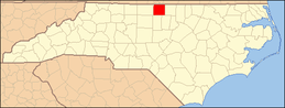 | |
| Unincorporated communities | ||
