Burlington, North Carolina
| Burlington, North Carolina | |
|---|---|
| City | |
| Nickname(s): B-Town The Buck Bucktown | |
| Motto(s): Esse quam videri | |
 Location of Burlington within North Carolina | |
| Coordinates: 36°5′23″N 79°26′44″W / 36.08972°N 79.44556°WCoordinates: 36°5′23″N 79°26′44″W / 36.08972°N 79.44556°W | |
| Country | United States |
| State | North Carolina |
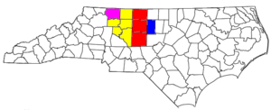
| Counties | Alamance, Guilford |
| Founded | 1857 (Company Shops) |
| Founded | 1886 (Burlington) |
| Incorporated | February 14, 1893 |
| Government | |
| • Mayor | Ian Baltutis |
| Area | |
| • City | 25.4 sq mi (65.7 km2) |
| • Land | 25.2 sq mi (65.2 km2) |
| • Water | 0.2 sq mi (0.5 km2) 0.82% |
| • Urban | 40 sq mi (103 km2) |
| Elevation | 633 ft (193 m) |
| Population (2010) | |
| • City | 50,042 |
| • Estimate (2016)[1] | 52,709 |
| • Density | 2,000/sq mi (760/km2) |
| • Urban | 119,911 |
| • Metro | 151,131 |
| • Metro density | 356/sq mi (137.6/km2) |
| Time zone | UTC−5 (EST) |
| • Summer (DST) | UTC−4 (EDT) |
| ZIP Code | 27215, 27216, 27217 |
| Area code(s) | 336/743 |
| FIPS code | 37-09060[2] |
| GNIS feature ID | 0982279[3] |
| Website |
www |
Burlington is a city in Alamance and Guilford counties in the U.S. state of North Carolina. It is the principal city of the Burlington, North Carolina Metropolitan Statistical Area, which encompasses all of Alamance County, in which most of the city is located, and is a part of the Greensboro-Winston-Salem-High Point CSA. The population was 50,042 at the 2010 census,[4] which makes Burlington the 17th largest city in North Carolina. The Metropolitan Statistical Area population was over 150,000 in 2010.
History
Alamance County was created when Orange County was partitioned in 1849. Early settlers included several groups of Quakers, many of which remain active in the Snow Camp area, German farmers, and Scots-Irish immigrants.
The need of the North Carolina Railroad in the 1850s to locate land where they could build, repair and do maintenance on its track was the genesis of Burlington, North Carolina. The company selected a piece of land slightly west of present-day Graham. On January 29, 1856, the last spikes were driven into the final tie of the North Carolina Railroad project, uniting the cities of Goldsboro and Charlotte by rail. The next day, the first locomotive passed along the new route. When the iron horse arrived in Alamance County, locals referred to it as "the eighth wonder of the world".
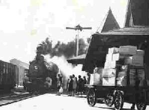
Not long after this historic opening, the railroad realized a pressing need for repair shops. With Alamance County's position along the new line, it became the logical choice for the shops' location. After several debates concerning where the shops would be located, Gen. Benjamin Trollinger, a progressive Alamance County manufacturer, made an offer that settled the matter. Gen. Trollinger owned land just northwest of Graham, and he convinced several other prominent citizens owning adjacent lots to join him and sell their property to the railroad. By 1859, construction of the shops began. Seemingly overnight, a town was born. A church, bank, hotel and restaurant sprang up. "Company Shops", as the town became known, was also chosen as the railroad's headquarters. By the time the shops were completed, the village had grown to twenty-seven buildings. Thirty-nine white men, twenty Negro slaves and two free Negroes were employed in or around the shops. Sale of town lots soon started, but not surprisingly, the sale of lots was slow until after the Civil War. By 1864, Company Shops numbered about 300 persons.
After twenty-five years of operations, the shops closed along with most of the area's railroad facilities. In 1886, the North Carolina Railroad Company transferred its operations to Spencer, North Carolina. The railroad offices and shops at Company Shops were closed. With the railroad shops no longer operated there, the citizens of Company Shops decided a new name was needed. Company Shops was reborn as Burlington on February 14, 1893. The city of Burlington was incorporated, and a charter was issued by the State Legislature.
Around the turn of the century, E.M. Holt established small textile operations along the Haw River and Great Alamance Creek. In 1908, E.M. Holt built the first cotton mill in the South. From the establishment of this single factory, Alamance County grew to eventually operate 30 cotton mills and 10 to 15 yarn manufacturing plants employing 15,000 people. Eventually, the early textile venture of E.M. Holt became known all over the world as Burlington Industries, and is now headquartered in nearby Greensboro. Throughout this period, Burlington became a prosperous and vibrant little city filled with schools, churches, newspapers, telegraph and telephone lines, roads and a streetcar line—all in keeping with the latest "modern progress" of the times.
Though textiles continued to dominate the local economy well into the 1970s, the people of Burlington knew they could not survive with only one industry. The country's involvement in World War II brought important local economic changes. In 1942, the federal government purchased and leased a 22-acre (8.9 ha) site to Fairchild Aircraft Corporation for the construction of test aircraft. After two years of production, the site was leased to Firestone Tire Company for the Army's tank rebuilding program. At the close of the war, the federal government chose not to leave, buto utilize the property for government contract business. This decision would bring Western Electric to town along with new employees from around the country. Their contracts ensured Burlington's participation during the Cold War manufacturing and testing of emerging defense technologies. Four decades later (1991), however, the doors to Western Electric (then Lucent Technologies) were locked, and another chapter of Burlington’s history was over.
During this century-and-a-half of economic change, Burlington grew, adapted and prospered. Originally the center of commerce for Company Shops, the downtown area still serves as the heart of today's community with financial services, government services, an expanded library, small shops, eateries and a restored theater. Downtown has also returned to its status as a major employment center, becoming the home to Laboratory Corporation of America, one of the world's largest biomedical testing firms and Burlington/Alamance County's largest employer.
The Alamance Hotel, Allen House, Atlantic Bank and Trust Company Building, Beverly Hills Historic District, Downtown Burlington Historic District, East Davis Street Historic District, Efird Building, First Baptist Church, First Christian Church of Burlington, Polly Fogleman House, Holt-Frost House, Horner Houses, Lakeside Mills Historic District, McCray School, Menagerie Carousel, Moore-Holt-White House, South Broad-East Fifth Streets Historic District, Southern Railway Passenger Station, St. Athanasius Episcopal Church and Parish House and the Church of the Holy Comforter, Stagg House, Sunny Side, US Post Office, West Davis Street-Fountain Place Historic District, and Windsor Cotton Mills Office are listed on the National Register of Historic Places.[5]
Geography
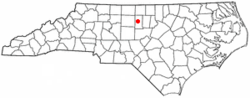
Burlington is located at 36°5′23″N 79°26′44″W / 36.08972°N 79.44556°W (36.089636, -79.445578).[6]
Located in the Piedmont region of North Carolina, Burlington is characterized as having mostly flat land with a few rolling hills.
According to the United States Census Bureau, the city has a total area of 25.4 square miles (65.7 km2), of which 25.2 square miles (65.2 km2) is land and 0.19 square miles (0.5 km2), or 0.82%, is water.[4]
Climate
The climate in this area is characterized by relatively high temperatures and evenly distributed precipitation throughout the year. According to the Köppen Climate Classification system, Burlington has a Humid subtropical climate, abbreviated "Cfa" on climate maps.[7]
| Climate data for Burlington, North Carolina | |||||||||||||
|---|---|---|---|---|---|---|---|---|---|---|---|---|---|
| Month | Jan | Feb | Mar | Apr | May | Jun | Jul | Aug | Sep | Oct | Nov | Dec | Year |
| Average high °F (°C) | 53 (12) |
56 (13) |
61 (16) |
74 (23) |
81 (27) |
88 (31) |
90 (32) |
88 (31) |
83 (28) |
73 (23) |
62 (17) |
53 (12) |
72 (22) |
| Average low °F (°C) | 33 (1) |
33 (1) |
38 (3) |
48 (9) |
56 (13) |
64 (18) |
67 (19) |
66 (19) |
60 (16) |
49 (9) |
38 (3) |
31 (−1) |
49 (9) |
| Average precipitation inches (mm) | 3.7 (94) |
3.7 (94) |
3.8 (97) |
3.6 (91) |
3.9 (99) |
3.8 (97) |
4.6 (117) |
4.9 (124) |
4.1 (104) |
3.7 (94) |
3.2 (81) |
3.2 (81) |
46.1 (1,171) |
| Source: Weatherbase [8] | |||||||||||||
Parks and Sports
There are a variety of parks that can be found in Burlington, including Joe Davidson Park and the Burlington City Park. Upon visiting these parks one can find a variety of things for various activities, such as baseball fields, basketball courts, soccer fields, playgrounds, disc golf and tennis courts.
The Alamance County Recreation and Parks Commission is composed of seven citizen volunteers and one representative from both the Alamance-Burlington Board of Education and the Alamance County Board of Commissioners. ACRPD Mission Statement: The Alamance County Recreation and Parks Department will provide parks, trails and programs that inspire visitors and welcome all participants.
The Alamance County Recreation and Parks Department manages parks and community centers at the following locations:
- Cedarock Park
- Shallow Ford Natural Area
- Great Bend Park at Glencoe
- Pleasant Grove Recreation Center
- Eli Whitney Recreation Center
Alamance County offers many hiking and paddle opportunities including the Haw River Trail and the NC Mountains-to-Sea Trail. The Alamance County Recreation and Parks Department manages accesses to the Haw River Paddle and Hiking Trail at the following locations:
- Altamahaw Paddle Access
- Shallow Ford Natural Area
- Great Bend Park at Glencoe
- Glencoe Paddle Access
- Saxapahaw Lake Paddle Access
- Saxapahaw Mill Race Paddle Access
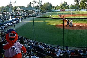
The Burlington Royals, a rookie-level farm team of Major League Baseball's Kansas City Royals, have played in Burlington since 2007. The team is based at Burlington Athletic Stadium. Prior to 2007 the team was known as the Burlington Indians, functioning as a farm team of the Cleveland Indians since 1985.
The city of Burlington also operates the nearby Indian Valley Municipal Golf Course.
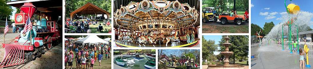
The flagship of the Burlington Parks System, City Park offers more than 75 acres of activities for the entire family. It serves as the home of an amusement area consisting of a carousel, miniature train, boat and car ride, playground, amphitheater, baseball field, picnic shelters, and walking trails. A fully restored Dentzel Carousel is the highlight of the amusement area. As part of the National Historical Register, the carousel attracts thousands of visitors yearly. The Burlington Carousel Festival, is held each September in the park. Throughout the spring and summer the park comes alive with an Easter egg hunt, a concert series, and baseball and softball tournaments. The park is located one mile from Downtown Burlington on South Church Street.
Demographics
| Historical population | |||
|---|---|---|---|
| Census | Pop. | %± | |
| 1880 | 817 | — | |
| 1890 | 1,716 | 110.0% | |
| 1900 | 3,692 | 115.2% | |
| 1910 | 4,808 | 30.2% | |
| 1920 | 5,952 | 23.8% | |
| 1930 | 9,737 | 63.6% | |
| 1940 | 12,198 | 25.3% | |
| 1950 | 24,560 | 101.3% | |
| 1960 | 33,199 | 35.2% | |
| 1970 | 35,930 | 8.2% | |
| 1980 | 37,266 | 3.7% | |
| 1990 | 39,498 | 6.0% | |
| 2000 | 44,917 | 13.7% | |
| 2010 | 50,042 | 11.4% | |
| Est. 2016 | 52,709 | [1] | 5.3% |
| U.S. Decennial Census[9] | |||
As of the census[2] of 2010, there were 49,963 people, 20,632 households, and 12,679 families residing in the city. The population density was 1,967.0 people per square mile (760.5/km²). There were 23,414 housing units at an average density of 921.8 per square mile (356.4/km²). The racial makeup of the city was 57.6% White, 28% African American, 0.7% Native American, 2.1% Asian, 0.1% Pacific Islander, 9.2% from other races, and 2.4% from two or more races. Hispanic or Latino of any race were 16% of the population.
There were 20,632 households out of which 28.1% had children under the age of 18 living with them, 38.9% were married couples living together, 17.5% had a female householder with no husband present, and 38.5% were non-families. 33% of all households were made up of individuals and 13.1% had someone living alone who was 65 years of age or older. The average household size was 2.38 and the average family size was 3.01.
In the city, the population was spread out with 26.6% under the age of 20, 6.5% from 20 to 24, 26.1% from 25 to 44, 25.2% from 45 to 64, and 15.7% who were 65 years of age or older. The median age was 38.3 years.
The median income for a household in the city was $42,097, and the median income for a family was $49,797. The per capita income for the city was $23,465. About 15.9% of families and 19.6% of the population were below the poverty line, including 34.9% of those under age 18 and 10.2% of those age 65 or over.
Education
The local school system is known as the Alamance-Burlington School System, which was created by a merger between the Alamance County School System and the Burlington City School System in 1996.
Elementary
- Alexander Wilson Elementary School
- Altamahaw-Ossipee Elementary School
- R. Homer Andrews Elementary School
- Eastlawn Elementary School
- Elon Elementary School
- Audrey W. Garrett Elementary School
- Grove Park Elementary School
- Haw River Elementary School
- Highland Elementary School
- Hillcrest Elementary School
- E. M. Holt Elementary School
- B. Everett Jordan Elementary School
- Harvey R. Newlin Elementary School
- North Graham Elementary School
- Pleasant Grove Elementary School
- Marvin B. Smith Elementary School
- South Graham Elementary School
- South Mebane Elementary School
- Sylvan Elementary School
- E. M. Yoder Elementary School
Middle
High
Private
Charter
Other
Transportation
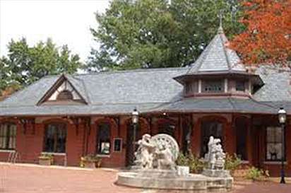
Amtrak's Carolinian and Piedmont trains connect Burlington with New York, Philadelphia, Baltimore, Washington, Richmond, Raleigh and Charlotte. The Amtrak station is situated at 101 North Main Street.
Burlington opened its first public transit service, Link Transit, on June 6, 2016.[10] As of September 21, 2017, more than 100,000 people have used the service.[11] In addition, transportation services are available to its residents through the Alamance County Transportation Authority. Locals can also ride the BioBus from nearby Elon University.
Burlington is about 35 miles from the Piedmont Triad International Airport in Greensboro and about 48 miles from Raleigh-Durham International Airport in Morrisville.
Business

- LabCorp has its headquarters and several testing facilities in Burlington. LabCorp is Alamance County's largest employer, employing over 3,000 people in the county.
- Honda Aero, a subsidiary of Honda, recently announced that it will move its corporate headquarters to Burlington and build a $27 million plant at the Burlington-Alamance Regional Airport where it will build its HF120 jet engines for use in very light jets.
- Glen Raven Inc., a fabric manufacturing and marketing company
- Biscuitville, a regional fast food chain, is based in Burlington.
- Gold Toe Brands, a manufacturer of socks.
- TAPCO Underwriters, Inc. operates as a managing general insurance agency company, headquartered in Burlington
- The Times-News is Burlington's only daily newspaper, and the area's dominant media outlet.
- Zack's Hotdogs, a local restaurant opened by Zack Touloupas in 1928 is located in the revitalized downtown area.
- National Agents Alliance America's #1 seller of mortgage protection insurance has its headquarters in Burlington.
Shopping
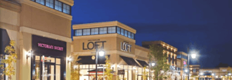
The city's only indoor mall, Holly Hill Mall is located at the intersection of Huffman Mill Road and Church Street (US 70). An outdoor mall, Alamance Crossing, opened in 2007 at Interstate 40/85 and University Drive. Most shopping, restaurants and services can be found on Huffman Mill Road and Church Street (US 70). Just off I-85/40 at Exit 145 is North Carolina's original outlet mall, Burlington Outlet Village(formerly BMOC).[12]
Food
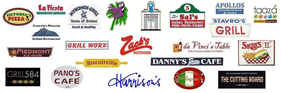
Burlington is known to have the most restaurants per capita in the state of North Carolina. In 2011 Burlington was ranked 29th overall in cities with the best Restaurant Growth Index (RGI) with an RGI score of 167. Burlington has 322 plus restaurants located throughout the city; popular ones include Zack's Hotdogs, Biscuitville, Harrison's, Blue Ribbon Diner, Mike's Deli, Prego's, Shaks Grill , The Village Grill, Grill Worx, Apollo's, Da Vinci's Table, Grill 584, La Fiesta, Sal's, Boston Sandwich Shop, Danny's Cafe, Pano's Cafe, Taaza Indian Bistro, Stavros Grill, Vesuvio's Pizzeria, The Tuscany Grille, The Cutting Board, Maria's Cafe, Victoria's Pizza, Skid's, Piedmont Ale House, The Park, Little Italy, and Mykonos Grill.
Notable people
- Samuel Bason, former state senator; banker and businessman in Yanceyville; attended high school in Burlington[13]
- Billy Bryan, Center for the Denver Broncos, from 1977–1988 grew up in Burlington
- Josh Bush (born 1989), free safety for Denver Broncos
- Andrew Everett, professional wrestler currently signed to Impact Wrestling
- Frank Haith, college basketball head coach, Missouri, Miami, Tulsa; grew up in Burlington
- Don Kernodle, born in Burlington, five-time NWA champion and tag team partner of Sgt Slaughter; appeared in Paradise Alley with Sylvester Stallone
- Blanche Taylor Moore, convicted murderer, whose life story was portrayed in the television movie "Black Widow: The Blanche Taylor Moore Story", starring Elizabeth Montgomery
- Tequan Richmond, born in Burlington, stars as Drew Rock in Everybody Hates Chris, and played a young Ray Charles in the movie Ray
- W. Kerr Scott, Governor of North Carolina from 1949–1953, U. S. senator (Class 2) from 1954–1958
- Brandon Tate (b. 1987), the professional wide receiver for the Cincinnati Bengals NFL football team, holds NCAA career record for most combined yards (3,523)
Sister cities
Burlington has two sister cities:[14]


References
- 1 2 "Population and Housing Unit Estimates". Retrieved June 9, 2017.
- 1 2 "American FactFinder". United States Census Bureau. Archived from the original on 2013-09-11. Retrieved 2008-01-31.
- ↑ "US Board on Geographic Names". United States Geological Survey. 2007-10-25. Retrieved 2008-01-31.
- 1 2 "Geographic Identifiers: 2010 Demographic Profile Data (G001): Burlington city, North Carolina, revision 08-09-2012". U.S. Census Bureau, American Factfinder. Retrieved January 6, 2017.
- ↑ National Park Service (2010-07-09). "National Register Information System". National Register of Historic Places. National Park Service.
- ↑ "US Gazetteer files: 2010, 2000, and 1990". United States Census Bureau. 2011-02-12. Retrieved 2011-04-23.
- ↑ "Burlington, North Carolina Köppen Climate Classification (Weatherbase)". Weatherbase.
- ↑ "Weatherbase.com". Weatherbase. 2013. Retrieved on September 14, 2013.
- ↑ "Census of Population and Housing". Census.gov. Archived from the original on May 12, 2015. Retrieved June 4, 2015.
- ↑ "Link Transit bus system launches in Burlington". myfox8.com. 2016-06-06. Retrieved 2018-01-23.
- ↑ Times-News, Kate Croxton /. "Link Transit reaches 100K riders, throws celebration". The Times. Retrieved 2018-01-23.
- ↑ "Events that shaped the county". The Times News. 2007-07-24. Retrieved 2008-06-20.
- ↑ Jeannie D. Whitlow with Carolyn Bason Long. "Caswell County Family Tree". The Heritage of Caswell County, North Carolina on wc.rootsweb.ancestry.com. Retrieved July 29, 2015.
- ↑ "Burlington-Alamance Sister Cities". Raleighnc.gov. Retrieved 2013-02-02.
External links
| Wikimedia Commons has media related to Burlington, North Carolina. |
- Official website
- TheTimesNews.com - Burlington, NC Primary Newspaper website
- Burlington/Alamance County Convention & Visitors Bureau
- Alamance-Burlington School System
Municipalities and communities of Alamance County, North Carolina, United States | ||
|---|---|---|
| Cities | 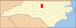 | |
| Towns | ||
| Village | ||
| CDPs | ||
| Unincorporated communities |
| |
| Footnotes | ‡This populated place also has portions in an adjacent county or counties | |
Municipalities and communities of Guilford County, North Carolina, United States | ||
|---|---|---|
| Cities |  | |
| Towns | ||
| CDPs | ||
| Unincorporated communities | ||
| Footnotes | ‡This populated place also has portions in an adjacent county or counties | |