Sauviac, Gers
| Sauviac | |
|---|---|
| Commune | |
 Sauviac Location within Occitanie region  Sauviac | |
| Coordinates: 43°24′21″N 0°27′15″E / 43.4058°N 0.4542°ECoordinates: 43°24′21″N 0°27′15″E / 43.4058°N 0.4542°E | |
| Country | France |
| Region | Occitanie |
| Department | Gers |
| Arrondissement | Mirande |
| Canton | Mirande-Astarac |
| Government | |
| • Mayor (2008–2014) | Patrick Ducombs |
| Area1 | 6.48 km2 (2.50 sq mi) |
| Population (2008)2 | 110 |
| • Density | 17/km2 (44/sq mi) |
| Time zone | UTC+1 (CET) |
| • Summer (DST) | UTC+2 (CEST) |
| INSEE/Postal code | 32419 /32300 |
| Elevation |
184–282 m (604–925 ft) (avg. 270 m or 890 ft) |
|
1 French Land Register data, which excludes lakes, ponds, glaciers > 1 km2 (0.386 sq mi or 247 acres) and river estuaries. 2 Population without double counting: residents of multiple communes (e.g., students and military personnel) only counted once. | |
Sauviac is a commune in the Gers department in southwestern France.
Geography
Localisation
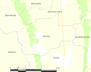
Sauviac and its surrounding communes
Hydrology
The Petite Baïse forms part of the commune's eastern border.
Population
| Historical population | ||
|---|---|---|
| Year | Pop. | ±% |
| 1962 | 169 | — |
| 1968 | 148 | −12.4% |
| 1975 | 144 | −2.7% |
| 1982 | 130 | −9.7% |
| 1990 | 132 | +1.5% |
| 1999 | 134 | +1.5% |
| 2008 | 110 | −17.9% |
See also
References
| Wikimedia Commons has media related to Sauviac (Gers). |
This article is issued from
Wikipedia.
The text is licensed under Creative Commons - Attribution - Sharealike.
Additional terms may apply for the media files.