Monferran-Savès
| Monferran-Savès | ||
|---|---|---|
_%C3%A9glise_c%C3%B4t%C3%A9_chevet%3B_bureau_de_PTT.JPG) | ||
| ||
 Monferran-Savès Location within Occitanie region  Monferran-Savès | ||
| Coordinates: 43°35′55″N 0°58′54″E / 43.5986°N 0.9817°ECoordinates: 43°35′55″N 0°58′54″E / 43.5986°N 0.9817°E | ||
| Country | France | |
| Region | Occitanie | |
| Department | Gers | |
| Arrondissement | Auch | |
| Canton | Isle-Jourdain | |
| Intercommunality | Save Lisloise | |
| Government | ||
| • Mayor (2008–2014) | Jean-Louis Baylac | |
| Area1 | 24.68 km2 (9.53 sq mi) | |
| Population (2008)2 | 686 | |
| • Density | 28/km2 (72/sq mi) | |
| Time zone | UTC+1 (CET) | |
| • Summer (DST) | UTC+2 (CEST) | |
| INSEE/Postal code | 32268 /32490 | |
| Elevation |
155–241 m (509–791 ft) (avg. 206 m or 676 ft) | |
|
1 French Land Register data, which excludes lakes, ponds, glaciers > 1 km2 (0.386 sq mi or 247 acres) and river estuaries. 2 Population without double counting: residents of multiple communes (e.g., students and military personnel) only counted once. | ||
.svg.png)
Monferran-Savès is a commune in the Gers department in southwestern France.
Geography
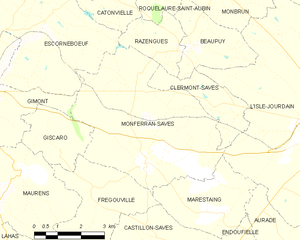
Monferran-Savès and its surrounding communes
Population
| Historical population | ||
|---|---|---|
| Year | Pop. | ±% |
| 1962 | 649 | — |
| 1968 | 644 | −0.8% |
| 1975 | 551 | −14.4% |
| 1982 | 642 | +16.5% |
| 1990 | 617 | −3.9% |
| 1999 | 675 | +9.4% |
| 2008 | 686 | +1.6% |
See also
References
| Wikimedia Commons has media related to Monferran-Savès. |
This article is issued from
Wikipedia.
The text is licensed under Creative Commons - Attribution - Sharealike.
Additional terms may apply for the media files.