Saint-Antoine, Gers
| Saint-Antoine-sur-l’Arrats | ||
|---|---|---|
| Commune | ||
_-_Mairie.JPG) Town hall | ||
| ||
 Saint-Antoine-sur-l’Arrats Location within Occitanie region  Saint-Antoine-sur-l’Arrats | ||
| Coordinates: 44°02′14″N 0°50′28″E / 44.0372°N 0.8411°ECoordinates: 44°02′14″N 0°50′28″E / 44.0372°N 0.8411°E | ||
| Country | France | |
| Region | Occitanie | |
| Department | Gers | |
| Arrondissement | Condom | |
| Canton | Lectoure-Lomagne | |
| Government | ||
| • Mayor (2008–2014) | Jean Dupuy | |
| Area1 | 9.8 km2 (3.8 sq mi) | |
| Population (2008)2 | 194 | |
| • Density | 20/km2 (51/sq mi) | |
| Time zone | UTC+1 (CET) | |
| • Summer (DST) | UTC+2 (CEST) | |
| INSEE/Postal code | 32358 /32340 | |
| Elevation |
64–198 m (210–650 ft) (avg. 144 m or 472 ft) | |
|
1 French Land Register data, which excludes lakes, ponds, glaciers > 1 km2 (0.386 sq mi or 247 acres) and river estuaries. 2 Population without double counting: residents of multiple communes (e.g., students and military personnel) only counted once. | ||
.svg.png)
Saint-Antoine (Sent Antòni deu Pont d'Arrats in Occitan) is a commune in the Gers department in southwestern France.
Geography
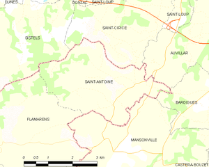
Saint-Antoine and its surrounding communes
Population
| Historical population | ||
|---|---|---|
| Year | Pop. | ±% |
| 1962 | 201 | — |
| 1968 | 190 | −5.5% |
| 1975 | 155 | −18.4% |
| 1982 | 181 | +16.8% |
| 1990 | 166 | −8.3% |
| 1999 | 174 | +4.8% |
| 2008 | 194 | +11.5% |
See also
References
| Wikimedia Commons has media related to Saint-Antoine (Gers). |
| Authority control |
|---|
This article is issued from
Wikipedia.
The text is licensed under Creative Commons - Attribution - Sharealike.
Additional terms may apply for the media files.