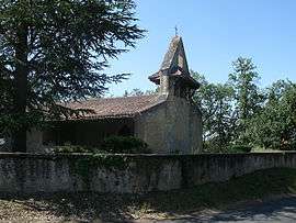
Gavarret-sur-Aulouste
| Gavarret-sur-Aulouste | |
|---|---|
| Commune | |
 | |
 Gavarret-sur-Aulouste Location within Occitanie region  Gavarret-sur-Aulouste | |
| Coordinates: 43°46′21″N 0°39′11″E / 43.7725°N 0.6531°ECoordinates: 43°46′21″N 0°39′11″E / 43.7725°N 0.6531°E | |
| Country | France |
| Region | Occitanie |
| Department | Gers |
| Arrondissement | Condom |
| Canton | Fleurance-Lomagne |
| Intercommunality | Lomagne Gersoise |
| Government | |
| • Mayor (2008–2014) | Éric Biz |
| Area1 | 8.38 km2 (3.24 sq mi) |
| Population (2008)2 | 133 |
| • Density | 16/km2 (41/sq mi) |
| Time zone | UTC+1 (CET) |
| • Summer (DST) | UTC+2 (CEST) |
| INSEE/Postal code | 32142 /32390 |
| Elevation |
94–201 m (308–659 ft) (avg. 199 m or 653 ft) |
|
1 French Land Register data, which excludes lakes, ponds, glaciers > 1 km2 (0.386 sq mi or 247 acres) and river estuaries. 2 Population without double counting: residents of multiple communes (e.g., students and military personnel) only counted once. | |
Gavarret-sur-Aulouste is a commune in the Gers department in southwestern France.
Geography
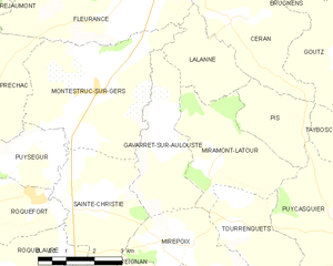
Gavarret-sur-Auguste and its surrounding communes
Population
| Historical population | ||
|---|---|---|
| Year | Pop. | ±% |
| 1962 | 133 | — |
| 1968 | 132 | −0.8% |
| 1975 | 125 | −5.3% |
| 1982 | 132 | +5.6% |
| 1990 | 121 | −8.3% |
| 1999 | 129 | +6.6% |
| 2008 | 133 | +3.1% |
See also
References
| Wikimedia Commons has media related to Gavarret-sur-Aulouste. |
| Authority control |
|---|
This article is issued from
Wikipedia.
The text is licensed under Creative Commons - Attribution - Sharealike.
Additional terms may apply for the media files.