Saint-Jean-le-Comtal
| Saint Jean le Comtal | |
|---|---|
| Commune | |
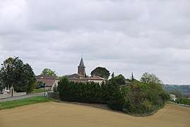 Saint-Jean-le-Comtal seen from the West. | |
 Saint Jean le Comtal Location within Occitanie region  Saint Jean le Comtal | |
| Coordinates: 43°34′42″N 0°31′14″E / 43.5783°N 0.5206°ECoordinates: 43°34′42″N 0°31′14″E / 43.5783°N 0.5206°E | |
| Country | France |
| Region | Occitanie |
| Department | Gers |
| Arrondissement | Mirande |
| Canton | Auch-1 |
| Intercommunality | Val de Gers |
| Government | |
| • Mayor (2014 - 2020) | Eric Bonnet |
| Area1 | 17.15 km2 (6.62 sq mi) |
| Population (2008)2 | 380 |
| • Density | 22/km2 (57/sq mi) |
| Time zone | UTC+1 (CET) |
| • Summer (DST) | UTC+2 (CEST) |
| INSEE/Postal code | 32381 /32550 |
| Elevation |
145–271 m (476–889 ft) (avg. 154 m or 505 ft) |
|
1 French Land Register data, which excludes lakes, ponds, glaciers > 1 km2 (0.386 sq mi or 247 acres) and river estuaries. 2 Population without double counting: residents of multiple communes (e.g., students and military personnel) only counted once. | |
Saint-Jean-le-Comtal is a commune in the Gers department in southwestern France.
Geography
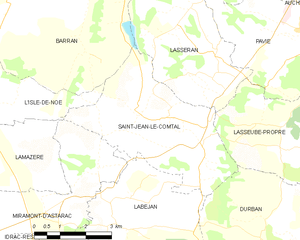
Saint-Jean-le-Comtal and its surrounding communes
Population
| Historical population | ||
|---|---|---|
| Year | Pop. | ±% |
| 1962 | 309 | — |
| 1968 | 331 | +7.1% |
| 1975 | 286 | −13.6% |
| 1982 | 333 | +16.4% |
| 1990 | 318 | −4.5% |
| 1999 | 348 | +9.4% |
| 2008 | 380 | +9.2% |
See also
http://www.saintjeanlecomtal.fr/ is the official site for the commune
References
| Wikimedia Commons has media related to Saint-Jean-le-Comtal. |
| Authority control |
|---|
This article is issued from
Wikipedia.
The text is licensed under Creative Commons - Attribution - Sharealike.
Additional terms may apply for the media files.