Préneron
| Préneron | |
|---|---|
| Commune | |
 Préneron Location within Occitanie region  Préneron | |
| Coordinates: 43°43′39″N 0°16′40″E / 43.7275°N 0.2778°ECoordinates: 43°43′39″N 0°16′40″E / 43.7275°N 0.2778°E | |
| Country | France |
| Region | Occitanie |
| Department | Gers |
| Arrondissement | Auch |
| Canton | Fezensac |
| Intercommunality | Artagnan en Fézensac |
| Government | |
| • Mayor (2008–2014) | Gilbert Vergès |
| Area1 | 8.63 km2 (3.33 sq mi) |
| Population (1999)2 | 142 |
| • Density | 16/km2 (43/sq mi) |
| Time zone | UTC+1 (CET) |
| • Summer (DST) | UTC+2 (CEST) |
| INSEE/Postal code | 32332 /32190 |
| Elevation |
115–201 m (377–659 ft) (avg. 170 m or 560 ft) |
|
1 French Land Register data, which excludes lakes, ponds, glaciers > 1 km2 (0.386 sq mi or 247 acres) and river estuaries. 2 Population without double counting: residents of multiple communes (e.g., students and military personnel) only counted once. | |
Préneron is a commune in the Gers department in southwestern France.
Geography
Localisation
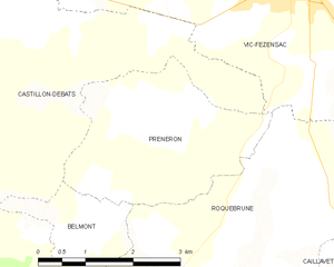
Préneron and its surrounding communes
Hydrography
The Auzoue flows north through the western part of the commune.
Population
| Historical population | ||
|---|---|---|
| Year | Pop. | ±% |
| 1793 | 264 | — |
| 1800 | 271 | +2.7% |
| 1806 | 289 | +6.6% |
| 1821 | 329 | +13.8% |
| 1831 | 362 | +10.0% |
| 1841 | 355 | −1.9% |
| 1851 | 330 | −7.0% |
| 1861 | 322 | −2.4% |
| 1872 | 294 | −8.7% |
| 1881 | 279 | −5.1% |
| 1891 | 220 | −21.1% |
| 1901 | 210 | −4.5% |
| 1911 | 192 | −8.6% |
| 1921 | 166 | −13.5% |
| 1931 | 172 | +3.6% |
| 1946 | 175 | +1.7% |
| 1954 | 165 | −5.7% |
| 1962 | 143 | −13.3% |
| 1968 | 105 | −26.6% |
| 1975 | 113 | +7.6% |
| 1982 | 137 | +21.2% |
| 1990 | 132 | −3.6% |
| 1999 | 142 | +7.6% |
| 2010 | 144 | +1.4% |
See also
| Wikimedia Commons has media related to Préneron. |
| Authority control |
|---|
This article is issued from
Wikipedia.
The text is licensed under Creative Commons - Attribution - Sharealike.
Additional terms may apply for the media files.