Saint-Martin, Gers
| Saint-Martin | |
|---|---|
| Commune | |
.JPG) | |
 Saint-Martin Location within Occitanie region  Saint-Martin | |
| Coordinates: 43°30′25″N 0°22′34″E / 43.5069°N 0.3761°ECoordinates: 43°30′25″N 0°22′34″E / 43.5069°N 0.3761°E | |
| Country | France |
| Region | Occitanie |
| Department | Gers |
| Arrondissement | Mirande |
| Canton | Mirande-Astarac |
| Intercommunality | Vals et villages en Astarac |
| Government | |
| • Mayor (2008–2014) | Jean-Claude Souriguère |
| Area1 | 9.07 km2 (3.50 sq mi) |
| Population (2008)2 | 441 |
| • Density | 49/km2 (130/sq mi) |
| Time zone | UTC+1 (CET) |
| • Summer (DST) | UTC+2 (CEST) |
| INSEE/Postal code | 32389 /32300 |
| Elevation | 159–263 m (522–863 ft) |
|
1 French Land Register data, which excludes lakes, ponds, glaciers > 1 km2 (0.386 sq mi or 247 acres) and river estuaries. 2 Population without double counting: residents of multiple communes (e.g., students and military personnel) only counted once. | |
Saint-Martin is a commune in the Gers department in southwestern France.
Geography
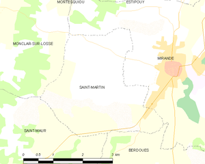
Saint-Martin and its surrounding communes
Population
| Historical population | ||
|---|---|---|
| Year | Pop. | ±% |
| 1962 | 187 | — |
| 1968 | 226 | +20.9% |
| 1975 | 219 | −3.1% |
| 1982 | 338 | +54.3% |
| 1990 | 363 | +7.4% |
| 1999 | 420 | +15.7% |
| 2008 | 441 | +5.0% |
See also
References
| Wikimedia Commons has media related to Saint-Martin, Gers. |
This article is issued from
Wikipedia.
The text is licensed under Creative Commons - Attribution - Sharealike.
Additional terms may apply for the media files.