Ponsan-Soubiran
| Ponsan-Soubiran | |
|---|---|
| Commune | |
.jpg) | |
 Ponsan-Soubiran Location within Occitanie region  Ponsan-Soubiran | |
| Coordinates: 43°21′08″N 0°29′06″E / 43.3522°N 0.485°ECoordinates: 43°21′08″N 0°29′06″E / 43.3522°N 0.485°E | |
| Country | France |
| Region | Occitanie |
| Department | Gers |
| Arrondissement | Mirande |
| Canton | Astarac-Gimone |
| Intercommunality | Val de Gers |
| Government | |
| • Mayor (2008–2014) | Michel Cros |
| Area1 | 6.87 km2 (2.65 sq mi) |
| Population (2008)2 | 125 |
| • Density | 18/km2 (47/sq mi) |
| Time zone | UTC+1 (CET) |
| • Summer (DST) | UTC+2 (CEST) |
| INSEE/Postal code | 32324 /32300 |
| Elevation |
227–370 m (745–1,214 ft) (avg. 239 m or 784 ft) |
|
1 French Land Register data, which excludes lakes, ponds, glaciers > 1 km2 (0.386 sq mi or 247 acres) and river estuaries. 2 Population without double counting: residents of multiple communes (e.g., students and military personnel) only counted once. | |
Ponsan-Soubiran is a commune in the Gers department in southwestern France.
Geography
Localisation
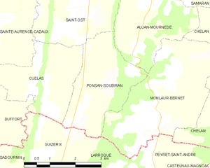
Ponsan-Soubiran and its surrounding communes
Hydrography
The Petite Baïse flows north through the middle of the commune; then forms part of the commune's northern border.
Population
| Historical population | ||
|---|---|---|
| Year | Pop. | ±% |
| 1962 | 167 | — |
| 1968 | 138 | −17.4% |
| 1975 | 117 | −15.2% |
| 1982 | 108 | −7.7% |
| 1990 | 122 | +13.0% |
| 1999 | 118 | −3.3% |
| 2008 | 125 | +5.9% |
See also
References
| Wikimedia Commons has media related to Ponsan-Soubiran. |
This article is issued from
Wikipedia.
The text is licensed under Creative Commons - Attribution - Sharealike.
Additional terms may apply for the media files.