Castillon-Debats
| Castillon-Debats | |
|---|---|
| Commune | |
 Castillon-Debats Location within Occitanie region  Castillon-Debats | |
| Coordinates: 43°43′49″N 0°13′02″E / 43.7303°N .21722°ECoordinates: 43°43′49″N 0°13′02″E / 43.7303°N .21722°E | |
| Country | France |
| Region | Occitanie |
| Department | Gers |
| Arrondissement | Auch |
| Canton | Fezensac |
| Intercommunality | Artagnan en Fézensac |
| Government | |
| • Mayor (2001–2008) | Jean-Louis Magenc |
| Area1 | 35.05 km2 (13.53 sq mi) |
| Population (2008)2 | 321 |
| • Density | 9.2/km2 (24/sq mi) |
| Time zone | UTC+1 (CET) |
| • Summer (DST) | UTC+2 (CEST) |
| INSEE/Postal code | 32088 /32190 |
| Elevation |
117–227 m (384–745 ft) (avg. 223 m or 732 ft) |
|
1 French Land Register data, which excludes lakes, ponds, glaciers > 1 km2 (0.386 sq mi or 247 acres) and river estuaries. 2 Population without double counting: residents of multiple communes (e.g., students and military personnel) only counted once. | |
Castillon-Debats is a commune in the Gers department in southwestern France.
Geography
The Auzoue forms part of the commune's eastern border and flows north through its northeastern part.
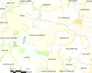
Castillon-Debats and its surrounding communes
Population
| Historical population | ||
|---|---|---|
| Year | Pop. | ±% |
| 1962 | 491 | — |
| 1968 | 432 | −12.0% |
| 1975 | 371 | −14.1% |
| 1982 | 377 | +1.6% |
| 1990 | 348 | −7.7% |
| 1999 | 301 | −13.5% |
| 2008 | 321 | +6.6% |
See also
References
| Wikimedia Commons has media related to Castillon-Debats. |
This article is issued from
Wikipedia.
The text is licensed under Creative Commons - Attribution - Sharealike.
Additional terms may apply for the media files.