Gée-Rivière
| Gée-Rivière | |
|---|---|
| Commune | |
 Gée-Rivière Location within Occitanie region  Gée-Rivière | |
| Coordinates: 43°40′26″N 0°10′52″W / 43.6739°N 0.1811°WCoordinates: 43°40′26″N 0°10′52″W / 43.6739°N 0.1811°W | |
| Country | France |
| Region | Occitanie |
| Department | Gers |
| Arrondissement | Mirande |
| Canton | Adour-Gersoise |
| Intercommunality | Aire-sur-l'Adour |
| Government | |
| • Mayor (2008–2014) | André Bacquié |
| Area1 | 2.74 km2 (1.06 sq mi) |
| Population (2008)2 | 48 |
| • Density | 18/km2 (45/sq mi) |
| Time zone | UTC+1 (CET) |
| • Summer (DST) | UTC+2 (CEST) |
| INSEE/Postal code | 32145 /32720 |
| Elevation |
83–92 m (272–302 ft) (avg. 200 m or 660 ft) |
|
1 French Land Register data, which excludes lakes, ponds, glaciers > 1 km2 (0.386 sq mi or 247 acres) and river estuaries. 2 Population without double counting: residents of multiple communes (e.g., students and military personnel) only counted once. | |
Gée-Rivière is a commune in the Gers department in southwestern France.
Geography
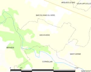
Gée-Rivière and its surrounding communes
Population
| Historical population | ||
|---|---|---|
| Year | Pop. | ±% |
| 1962 | 44 | — |
| 1968 | 78 | +77.3% |
| 1975 | 38 | −51.3% |
| 1982 | 39 | +2.6% |
| 1990 | 51 | +30.8% |
| 1999 | 51 | +0.0% |
| 2008 | 48 | −5.9% |
See also
References
| Wikimedia Commons has media related to Gée-Rivière. |
This article is issued from
Wikipedia.
The text is licensed under Creative Commons - Attribution - Sharealike.
Additional terms may apply for the media files.