Giscaro
| Giscaro | ||
|---|---|---|
| Commune | ||
_%C3%A9glise_c%C3%B4t%C3%A9_chevet.JPG) | ||
| ||
 Giscaro Location within Occitanie region  Giscaro | ||
| Coordinates: 43°36′30″N 0°55′46″E / 43.6083°N 0.9294°ECoordinates: 43°36′30″N 0°55′46″E / 43.6083°N 0.9294°E | ||
| Country | France | |
| Region | Occitanie | |
| Department | Gers | |
| Arrondissement | Auch | |
| Canton | Gimone-Arrats | |
| Intercommunality | Arrats-Gimone | |
| Government | ||
| • Mayor (2008–2014) | Yves Cahuzac | |
| Area1 | 5.4 km2 (2.1 sq mi) | |
| Population (2008)2 | 80 | |
| • Density | 15/km2 (38/sq mi) | |
| Time zone | UTC+1 (CET) | |
| • Summer (DST) | UTC+2 (CEST) | |
| INSEE/Postal code | 32148 /32200 | |
| Elevation |
175–251 m (574–823 ft) (avg. 200 m or 660 ft) | |
|
1 French Land Register data, which excludes lakes, ponds, glaciers > 1 km2 (0.386 sq mi or 247 acres) and river estuaries. 2 Population without double counting: residents of multiple communes (e.g., students and military personnel) only counted once. | ||
.svg.png)
Giscaro is a commune in the Gers department in southwestern France.
Geography
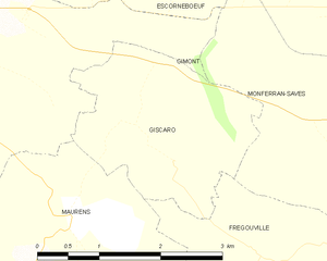
Giscaro and its surrounding communes
Population
| Historical population | ||
|---|---|---|
| Year | Pop. | ±% |
| 1831 | 261 | — |
| 1836 | 250 | −4.2% |
| 1841 | 259 | +3.6% |
| 1866 | 194 | −25.1% |
| 1878 | 181 | −6.7% |
| 1891 | 161 | −11.0% |
| 1902 | 157 | −2.5% |
| 1912 | 144 | −8.3% |
| 1915 | 148 | +2.8% |
| 1932 | 128 | −13.5% |
| 1940 | 93 | −27.3% |
| 1949 | 93 | +0.0% |
| 1954 | 85 | −8.6% |
| 1962 | 95 | +11.8% |
| 1968 | 96 | +1.1% |
| 1975 | 100 | +4.2% |
| 1982 | 76 | −24.0% |
| 1990 | 78 | +2.6% |
| 1999 | 67 | −14.1% |
| 2008 | 80 | +19.4% |
See also
References
| Wikimedia Commons has media related to Giscaro. |
This article is issued from
Wikipedia.
The text is licensed under Creative Commons - Attribution - Sharealike.
Additional terms may apply for the media files.