Cazeneuve, Gers
| Cazeneuve | |
|---|---|
| Commune | |
 | |
 Cazeneuve Location within Occitanie region  Cazeneuve | |
| Coordinates: 43°53′13″N 0°09′45″E / 43.8869°N 0.1625°ECoordinates: 43°53′13″N 0°09′45″E / 43.8869°N 0.1625°E | |
| Country | France |
| Region | Occitanie |
| Department | Gers |
| Arrondissement | Condom |
| Canton | Armagnac-Ténarèze |
| Government | |
| • Mayor (2008–2014) | Martine Laborde-Noyer |
| Area1 | 8.31 km2 (3.21 sq mi) |
| Population (2008)2 | 135 |
| • Density | 16/km2 (42/sq mi) |
| Time zone | UTC+1 (CET) |
| • Summer (DST) | UTC+2 (CEST) |
| INSEE/Postal code | 32100 /32800 |
| Elevation |
103–177 m (338–581 ft) (avg. 250 m or 820 ft) |
|
1 French Land Register data, which excludes lakes, ponds, glaciers > 1 km2 (0.386 sq mi or 247 acres) and river estuaries. 2 Population without double counting: residents of multiple communes (e.g., students and military personnel) only counted once. | |
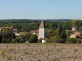
Cazeneuve is a commune in the Gers department in southwestern France.
Since 2015, the commune is a part of the Canton of Armagnac-Ténarèze.
In the neighbourhood are numerous old castles, little medieval walled villages, small cities built around castles and "sacred" places, because the Via Podiensis and the Way of St. James of Compostela are going through the Montréal and left their traces.
Geography
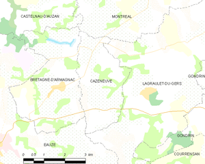
Cazeneuve and its surrounding communes
Population
| Historical population | ||
|---|---|---|
| Year | Pop. | ±% |
| 1962 | 220 | — |
| 1968 | 205 | −6.8% |
| 1975 | 178 | −13.2% |
| 1982 | 138 | −22.5% |
| 1990 | 139 | +0.7% |
| 1999 | 127 | −8.6% |
| 2008 | 135 | +6.3% |
See also
References
| Wikimedia Commons has media related to Cazeneuve. |
This article is issued from
Wikipedia.
The text is licensed under Creative Commons - Attribution - Sharealike.
Additional terms may apply for the media files.