Manas-Bastanous
| Manas-Bastanous | |
|---|---|
| Commune | |
.JPG) Church of Bastanous | |
 Manas-Bastanous Location within Occitanie region  Manas-Bastanous | |
| Coordinates: 43°22′22″N 0°21′51″E / 43.3728°N 0.3642°ECoordinates: 43°22′22″N 0°21′51″E / 43.3728°N 0.3642°E | |
| Country | France |
| Region | Occitanie |
| Department | Gers |
| Arrondissement | Mirande |
| Canton | Mirande-Astarac |
| Intercommunality | Hautes vallées de Gascogne |
| Government | |
| • Mayor (2008–2014) | Michel Doneys |
| Area1 | 7.54 km2 (2.91 sq mi) |
| Population (2008)2 | 97 |
| • Density | 13/km2 (33/sq mi) |
| Time zone | UTC+1 (CET) |
| • Summer (DST) | UTC+2 (CEST) |
| INSEE/Postal code | 32226 /32170 |
| Elevation |
204–318 m (669–1,043 ft) (avg. 300 m or 980 ft) |
|
1 French Land Register data, which excludes lakes, ponds, glaciers > 1 km2 (0.386 sq mi or 247 acres) and river estuaries. 2 Population without double counting: residents of multiple communes (e.g., students and military personnel) only counted once. | |
Manas-Bastanous is a commune in the Gers department in southwestern France.
Geography
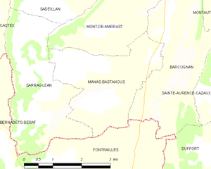
Manas-Bastanous and its surrounding communes
Population
| Historical population | ||
|---|---|---|
| Year | Pop. | ±% |
| 1962 | 142 | — |
| 1968 | 139 | −2.1% |
| 1975 | 137 | −1.4% |
| 1982 | 125 | −8.8% |
| 1990 | 122 | −2.4% |
| 1999 | 105 | −13.9% |
| 2008 | 97 | −7.6% |
See also
References
| Wikimedia Commons has media related to Manas-Bastanous. |
This article is issued from
Wikipedia.
The text is licensed under Creative Commons - Attribution - Sharealike.
Additional terms may apply for the media files.