Magnan, Gers
| Magnan | |
|---|---|
| Commune | |
 Magnan Location within Occitanie region  Magnan | |
| Coordinates: 43°46′11″N 0°07′18″W / 43.7697°N 0.1217°WCoordinates: 43°46′11″N 0°07′18″W / 43.7697°N 0.1217°W | |
| Country | France |
| Region | Occitanie |
| Department | Gers |
| Arrondissement | Condom |
| Canton | Grand-Bas-Armagnac |
| Intercommunality | Bas-Armagnac |
| Government | |
| • Mayor (2008–2014) | Jean Duclave |
| Area1 | 11.3 km2 (4.4 sq mi) |
| Population (2008)2 | 210 |
| • Density | 19/km2 (48/sq mi) |
| Time zone | UTC+1 (CET) |
| • Summer (DST) | UTC+2 (CEST) |
| INSEE/Postal code | 32222 /32110 |
| Elevation |
81–136 m (266–446 ft) (avg. 128 m or 420 ft) |
|
1 French Land Register data, which excludes lakes, ponds, glaciers > 1 km2 (0.386 sq mi or 247 acres) and river estuaries. 2 Population without double counting: residents of multiple communes (e.g., students and military personnel) only counted once. | |
Magnan is a commune in the Gers department in southwestern France.
Geography
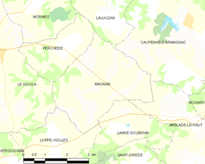
Magnan and its surrounding communes
Population
| Historical population | ||
|---|---|---|
| Year | Pop. | ±% |
| 1962 | 163 | — |
| 1968 | 207 | +27.0% |
| 1975 | 178 | −14.0% |
| 1982 | 185 | +3.9% |
| 1990 | 205 | +10.8% |
| 1999 | 196 | −4.4% |
| 2008 | 210 | +7.1% |
See also
References
| Wikimedia Commons has media related to Magnan (Gers). |
| Authority control |
|---|
This article is issued from
Wikipedia.
The text is licensed under Creative Commons - Attribution - Sharealike.
Additional terms may apply for the media files.