Fox River Grove, Illinois
| Fox River Grove | |
|---|---|
| Village | |
 Castle Vianden | |
| Nickname(s): The Great Town | |
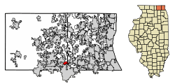 Location of Fox River Grove in Lake County, Illinois. | |
.svg.png) Location of Illinois in the United States | |
| Coordinates: 42°11′44″N 88°13′0″W / 42.19556°N 88.21667°WCoordinates: 42°11′44″N 88°13′0″W / 42.19556°N 88.21667°W | |
| Country | United States |
| State | Illinois |
| County | McHenry, Lake |
| Founded | 1919 |
| Government | |
| • Type | Village |
| Area[1] | |
| • Total | 1.74 sq mi (4.51 km2) |
| • Land | 1.74 sq mi (4.51 km2) |
| • Water | 0.00 sq mi (0.00 km2) |
| Population (2010) | |
| • Total | 4,854 |
| • Estimate (2016)[2] | 4,651 |
| • Density | 2,671.45/sq mi (1,031.26/km2) |
| Time zone | UTC-6 (CST) |
| • Summer (DST) | UTC-5 (CDT) |
| ZIP Code(s) | 60021 |
| Area code(s) | 847 |
| FIPS code | 17-27533 |
| Wikimedia Commons | Fox River Grove, Illinois |
| Website |
www |
Fox River Grove is a village in Cuba Township, Lake County and Algonquin Township, McHenry County, Illinois, United States. The population was 4,854 at the 2010 census.[3]
History
Pioneers built homesteads in the Fox River Valley between 1830 and 1860. They were originally attracted to the area that would become Fox River Grove for its beautiful scenery, abundance of clear water and opportunity for hydroelectric power provided by the Fox River.
The Ojibwe people continued to winter in the region into the 1860s. The women traded beadwork and purses with local settlers while the men trapped muskrat and mink selling the pelts in nearby Barrington, Illinois. The men also made fence posts for local farmers. When spring came they traveled north to their summer lands in Wisconsin.
In 1850, Frank Opatrny purchased 80 acres (320,000 m2) of land on the southern shore of the Fox River. The area gained a reputation with city dwellers as a vacation spot. Chicagoans were transported by livery bus from the Illinois & Wisconsin Railroad station in neighboring Cary, Illinois. In 1899 Eman Opatrny bought the land from his father Frank Opatrny. Eman decided to transform the family homestead into a picnic area, and the Fox River Picnic Grove was born.
In 1902, a luxury hotel known as the Castle Pavilion and Resort Hotel was built. The building featured windows displayed during Chicago's 1893 Columbian Exposition. The Resort Hotel contained the area's first player piano, as well as a dance floor. Opatrny built numerous cottages near the shore of the Fox River, boat docks were installed, a picnic area with shelters was set up, and several trees were planted. He also built a railroad spur track that lead directly into the park. Recreational activities in the Picnic Grove included a shooting gallery, dance platform, bowling alley, boathouse, photo gallery, rowboat rental, horse track, steam-powered excursion boat and baseball diamonds. During the 1910s, motion pictures were shown in the Castle Pavilion.
Many of the buildings in the Picnic Grove were destroyed by fire in 1918, but The Picnic Grove remained open through the 1920s and 1930s. The spur track was removed and with most of the attractions that visitors enjoyed in the 1900s no longer present, it remained a popular spot for picnics. During this time, the park was referred to as Opatrny's Woods and Opatrny's Grove.
In 1942, the Picnic Grove land was purchased by Louis, Jr., and Clara Cernocky. Louis was a successful local businessman and Clara was the daughter of Eman Opatrny. Cernocky improved the Picnic Grove with the addition of amenities including a dance pavilion and air-conditioned cocktail lounge, refreshment stands, outdoor fireplaces, a bath house, restrooms, a baseball diamond, and a 300-foot sand beach.
In the early 1960s additional acreage was purchased and a ski hill complete with two rope tows, a vertical drop of 145 feet and a ski shop were established. This came to be known as the Barberry Hills Ski Area. The two ropes and shop are gone, but the hill is still a popular winter destination as a sledding hill.
In 1961 The Grove Marina opened and featured a restaurant, cocktail lounge, live entertainment, boat launch, marine supplies sales and boat slips for rent until being destroyed by fire in the mid-1970s.
The Picnic Grove advertised as "40 Acres of Paradise" by Cernocky, remained a popular vacation destination for approximately 20 years before it fell into disarray. Between 1976 and 1993 the property remained unused. In 1994 the Village of Fox River Grove obtained a grant to acquire 40 acres (160,000 m2) along the river and named the property Picnic Grove Park. The rest of the land was developed into what is now the Picnic Grove subdivision. Picnic Grove Park is one of the last remaining public areas on the Fox River. It currently contains a playground, picnic shelter, gazebo, grills, and picnic tables. The only traces of the park's former life are the original roadway and the concrete slab where the Grove Marina once stood.
In 1905, the Norge Ski Club bought some land and built a ski jump at Fox River Grove. The Norge Ski Club is the oldest continuously open ski club in the United States.
In 1919, the village of Fox River Grove officially incorporated becoming the ninth Village in McHenry County. In the same year Louis Cernocky, Sr., at the corner of Northwest Highway and Lincoln Avenue established the Fox River Grove Inn - Louis's Place, a restaurant and bar frequented by many prominent Chicago residents and several notorious gangsters.
In 1921, Cernocky added a small retail section to the building, and in 1922 he subdivided the land and named it Cernocky's Subdivision of Block 12.
Built in 1923 and first known as the Fox River Grove Pavilion and Cernocky's Pavilion before finally being named the Crystal Ballroom was an eight-sided dance hall adorned with a flashing electric sign at the top, showing a golden pheasant with many colors. In 1939 a fire of suspicious origin broke out in the ballroom so a night watchman was placed on guard while the fire was being investigated. A week later, six men came during the night, and while four of them saturated the ballroom with kerosene, the other two abducted the night watchman and a visiting fire marshal at gunpoint. They fled in their cars and drove towards Barrington, Illinois while two bombs were detonated in the ballroom. The captives were released near Palatine, Illinois. The resulting fire from the explosions gutted the ballroom but didn't damage the roof or the adjoining shops. The interior of the ballroom was repaired, but the ballroom never reopened for dancing.
In 1931, Theodore Bettendorff began work on what would come to be known as Castle Vianden, which is located along what is now U.S. Route 14. By 1960, the castle, which was open to visitors, had eight towers, a guard room, bugle tower, castle yard, enclosed sun porch, modern kitchen, garage, dungeon, and a wishing well. Bettendorff continued to add to his castle until his death in 1967. During the 1970s, the castle was rented out as a honeymoon retreat. The castle remains a private residence, but recently the owners of the property have been engaged in an ongoing effort to reopen the property for public enjoyment.
In 1945, Fox River Grove established the first VFW post in McHenry County.
Fox River Grove level crossing accident
On October 25, 1995, a Metra passenger train, running express towards Chicago, collided with a Cary-Grove High School school bus, killing seven high school students. The accident brought reform and increased safety standards nationwide for signaled rail crossings located very near street and highway intersections which are regulated by traffic signals, also known as interconnected crossings.
Geography
Fox River Grove is located primarily in McHenry County and partially in Lake County, Illinois, along U.S. Route 14, 42 miles (68 km) northwest of downtown Chicago. It is situated on the south bank of the Fox River, which flows southwest to the Illinois River. The village of Cary is located on the north side of the river, connected to Fox River Grove by a bridge on Route 14.
According to the 2010 census, Fox River Grove has a total area of 1.78 square miles (4.61 km2), all land.[4]
Demographics
| Historical population | |||
|---|---|---|---|
| Census | Pop. | %± | |
| 1920 | 193 | — | |
| 1930 | 641 | 232.1% | |
| 1940 | 693 | 8.1% | |
| 1950 | 1,313 | 89.5% | |
| 1960 | 1,866 | 42.1% | |
| 1970 | 2,245 | 20.3% | |
| 1980 | 2,515 | 12.0% | |
| 1990 | 3,551 | 41.2% | |
| 2000 | 4,862 | 36.9% | |
| 2010 | 4,854 | −0.2% | |
| Est. 2016 | 4,651 | [2] | −4.2% |
| U.S. Decennial Census[5] | |||

As of the census[6] of 2000, there were 4,862 people, 1,677 households, and 1,294 families residing in the village. The population density was 2,929.6 people per square mile (1,130.9/km²). There were 1,734 housing units at an average density of 1,044.8 per square mile (403.3/km²). The racial makeup of the village was 95.91% White, 0.68% African American, 0.12% Native American, 1.28% Asian, 1.13% from other races, and 0.88% from two or more races. Hispanic or Latino of any race were 3.83% of the population.
There were 1,677 households out of which 45.3% had children under the age of 18 living with them, 65.7% were married couples living together, 8.3% had a female householder with no husband present, and 22.8% were non-families. 17.7% of all households were made up of individuals and 4.9% had someone living alone who was 65 years of age or older. The average household size was 2.90 and the average family size was 3.34.
In the village, the population was spread out with 31.7% under the age of 18, 6.1% from 18 to 24, 35.0% from 25 to 44, 20.4% from 45 to 64, and 6.9% who were 65 years of age or older. The median age was 35 years. For every 100 females, there were 104.5 males. For every 100 females age 18 and over, there were 100.9 males.
The median income for a household in the village was $66,469, and the median income for a family was $78,847. Males had a median income of $59,306 versus $28,643 for females. The per capita income for the village was $28,870. About 5.2% of families and 7.1% of the population were below the poverty line, including 10.6% of those under age 18 and 8.6% of those age 65 or over.
References
- ↑ "2016 U.S. Gazetteer Files". United States Census Bureau. Retrieved Jun 29, 2017.
- 1 2 "Population and Housing Unit Estimates". Retrieved June 9, 2017.
- ↑ "Geographic Identifiers: 2010 Demographic Profile Data (G001): Fox River Grove village, Illinois". U.S. Census Bureau, American Factfinder. Retrieved December 10, 2012.
- ↑ "G001 - Geographic Identifiers - 2010 Census Summary File 1". United States Census Bureau. Retrieved 2015-08-03.
- ↑ "Census of Population and Housing". Census.gov. Archived from the original on May 12, 2015. Retrieved June 4, 2015.
- ↑ "American FactFinder". United States Census Bureau. Archived from the original on 2013-09-11. Retrieved 2008-01-31.
External links
Municipalities and communities of Lake County, Illinois, United States | ||
|---|---|---|
| Cities | ||
| Villages |
| |
| Townships | ||
| CDPs | ||
| Other unincorporated communities | ||
| Former settlement | ||
| Footnotes | ‡This populated place also has portions in an adjacent county or counties | |
Municipalities and communities of McHenry County, Illinois, United States | ||
|---|---|---|
| Cities | ||
| Villages | ||
| Townships | ||
| CDPs | ||
| Other unincorporated communities | ||
| Footnotes | ‡This populated place also has portions in an adjacent county or counties | |
| Major city |  | |
|---|---|---|
| Cities (over 30,000 in 2010) | ||
| Towns and villages (over 30,000 in 2010) |
| |
| Counties | ||
| Regions | ||
| Sub-regions | ||
