Ringwood, Illinois
| Ringwood | |
|---|---|
| Village | |
| Etymology: A ring of woods | |
| Motto(s): Where the Past meets the Future | |
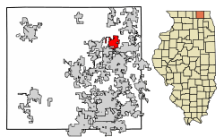 Location of Ringwood in McHenry County, Illinois. | |
.svg.png) Location of Illinois in the United States | |
| Coordinates: 42°23′42″N 88°18′11″W / 42.39500°N 88.30306°WCoordinates: 42°23′42″N 88°18′11″W / 42.39500°N 88.30306°W | |
| Country | United States |
| State | Illinois |
| County | McHenry |
| Founded | 15 November 1994 |
| Government | |
| • Village president | Rick Mack |
| Area[1] | |
| • Total | 3.85 sq mi (9.96 km2) |
| • Land | 3.85 sq mi (9.96 km2) |
| • Water | 0.00 sq mi (0.00 km2) |
| Population (2010) | |
| • Total | 836 |
| • Estimate (2016)[2] | 818 |
| • Density | 212.63/sq mi (82.09/km2) |
| Time zone | UTC-6 (CST) |
| • Summer (DST) | UTC-5 (CDT) |
| ZIP Code(s) | 60072 |
| Area code(s) | 815 |
| FIPS code | 17-64135 |
| Wikimedia Commons | Ringwood, Illinois |
Ringwood is a village in McHenry County, Illinois, United states. The population was 836 at the 2010 census.
History
Settlement
Ringwood was settled in 1837 by Dr. Luke Hale and Wm. H. Beach, both native to Vermont. The original settlement was supposedly surrounded by a ring of trees, hence the name 'Ringwood'.[3]
Early development
The Ringwood post office was established in the 1845 to provide post office boxes for local industrial firms and residents located on the far northern edge of McHenry. The small village was platted in 1854, allowing the installation of roads, infrastructure, public amenities and allowing residents to legally own plots of land for agricultural use, and the construction of homes and business. Ringwood was incorporated as a village on the 15 November 1994 in an attempt to maintain its small-town environment.[4]
Geography
Ringwood is located at 42°23′42″N 88°18′11″W / 42.39500°N 88.30306°W (42.395084, -88.303030).[5]
According to the 2010 census, Ringwood has a total area of 3.86 square miles (10.00 km2), all land.[6]
Major streets

- Barnard Mill Road
- Ringwood Road
Demographics
| Historical population | |||
|---|---|---|---|
| Census | Pop. | %± | |
| 2000 | 471 | — | |
| 2010 | 836 | 77.5% | |
| Est. 2016 | 818 | [2] | −2.2% |
| U.S. Decennial Census[7] | |||
As of the census of 2010,[8] there were 836 people. The population density was 216.6 people per square mile (83.6/km²). There were 297 housing units at an average density of 76.9 per square mile (29.7/km²). The racial makeup of the village was 96.2% White, 0.8% African American, 0.2% Asian, 0.6% from other races, and 2.2% from two or more races. Hispanic or Latino of any race were 3% of the population.[8]
In the village, the population was spread out with 26.9% (225) under the age of 18, 73.0% (611) over the age of 18, 3.2% (27) from 20 to 24, 5.5% (46) from 25 to 34, 27.6% (231) from 35 to 49, 23.3% (195) from 50 to 64, and 10.2% (85) were aged 65 or more. The median age was 42.4 years of age. 50.1% (419) were male, and 49.9 (417) were female.
There were 285 households out of which 36.1% had children under the age of 18 living with them, 73.3% were married couples living together, 6.3% had a female householder with no husband present, 3.2% had a male householder with no wife present, and 17.2% were non-families. 13.7% of all households were made up of individuals and 3.5% had someone living alone who was 65 years of age or older. The average household size was 2.93 and the average family size was 3.22.[9] The median income for a household in the village was $90,250, and the median income for a family was $91,389. Males had a median income of $91,250 versus $37,500 for females. The per capita income for the village was $35,151. About 9.4% of families and 8.8% of the population were below the poverty line, including 15.0% of those under age 18 and 6.7% of those age 65 or over.[10]
References
- ↑ "2016 U.S. Gazetteer Files". United States Census Bureau. Retrieved Jun 30, 2017.
- 1 2 "Population and Housing Unit Estimates". Retrieved June 9, 2017.
- ↑ Chicago and North Western Railway Company (1908). A History of the Origin of the Place Names Connected with the Chicago & North Western and Chicago, St. Paul, Minneapolis & Omaha Railways. p. 118.
- ↑ http://ringwood-il.us
- ↑ "US Gazetteer files: 2010, 2000, and 1990". United States Census Bureau. 2011-02-12. Retrieved 2011-04-23.
- ↑ "G001 - Geographic Identifiers - 2010 Census Summary File 1". United States Census Bureau. Retrieved 2015-12-25.
- ↑ "Census of Population and Housing". Census.gov. Retrieved June 4, 2015.
- 1 2 "2010 Census Interactive Population Map". United States Census Bureau. Archived from the original on 13 October 2013. Retrieved 23 November 2012.
- ↑ "Profile of General Population and Housing Characteristics: 2010". United States Census Bureau. Retrieved 23 November 2012.
- ↑ "Selected Economic Characteristics". United States Census Bureau. Retrieved 23 November 2012.
Municipalities and communities of McHenry County, Illinois, United States | ||
|---|---|---|
| Cities | ||
| Villages | ||
| Townships | ||
| CDPs | ||
| Other unincorporated communities | ||
| Footnotes | ‡This populated place also has portions in an adjacent county or counties | |
| Major city |  | |
|---|---|---|
| Cities (over 30,000 in 2010) | ||
| Towns and villages (over 30,000 in 2010) |
| |
| Counties | ||
| Regions | ||
| Sub-regions | ||
